

7 datasets found for "Forest Type"
-
Federal
Daily 8-Hour Maximum and Annual O3 Concentrations for the Contiguous United States, 1-km Grids, v1 (2000 - 2016)
National Aeronautics and Space Administration —
The Daily 8-Hour Maximum and Annual O3 Concentrations for the Contiguous United States, 1-km Grids, v1 (2000 - 2016) data set contains estimates of ozone... -
Federal
Millennium Ecosystem Assessment: MA Rapid Land Cover Change
National Aeronautics and Space Administration —
The Millennium Ecosystem Assessment: MA Rapid Land Cover Change provides data and information on global and regional land cover change in raster format for... -
Federal
China Dimensions Data Collection: China Maps Bibliographic Database
National Aeronautics and Space Administration —
The China Maps Bibliographic Database is an historical collection of bibliographic information for more than 400 maps of China. The information resides in a... -
Federal
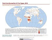
Global Fire Emissions Indicators, Country-Level Tabular Data: 1997-2015
National Aeronautics and Space Administration —
The Global Fire Emissions Indicators, Country-Level Tabular Data: 1997-2015 contains country tabulations from 1997 to 2015 for the total area burned (hectares) and... -
Federal
2015 Urban Extents from VIIRS and MODIS for the Continental U.S. Using Machine Learning Methods NGDA
National Aeronautics and Space Administration —
The 2015 Urban Extents from VIIRS and MODIS for the Continental U.S. Using Machine Learning Methods data set models urban settlements in the Continental United States... -
Federal
Daily 8-Hour Maximum and Annual O3 Concentrations for the Contiguous United States, 1-km Grids, Version 1.10 (2000-2016)
National Aeronautics and Space Administration —
The Daily 8-Hour Maximum and Annual O3 Concentrations for the Contiguous United States, 1-km Grids, Version 1.10 (2000-2016) data set contains estimates of ozone...
7 datasets found for "Forest Type"