
-
Federal
Northern and Mid-Latitude Soil Database, Version 1, R1
National Aeronautics and Space Administration —
The U.S. Department of Agriculture, Agriculture and Agri-Food Canada, the Russian Academy of Agricultural Sciences, the University of Copenhagen Institute of... -
Federal
Delta-X: AVIRIS-NG L3 Derived Herbaceous Aboveground Biomass, MRD, Louisiana, USA, V3
National Aeronautics and Space Administration —
This dataset includes high-resolution (~5 m) gridded estimates of aboveground biomass (AGB), aboveground necromass (AGN), and aboveground net primary productivity... -
Federal
Land Use and Cover Maps from Landsat, Mawas, Central Kalimantan, Indonesia, 1994-2019
National Aeronautics and Space Administration —
This dataset contains annual land use/cover (LUC) maps at 30 m resolution across Mawas, Central Kalimantan, Indonesia. There are six files, each representing a five-... -
Federal
Impacts of Wildfires on Boreal Forest Ecosystem Carbon Dynamics
National Aeronautics and Space Administration —
This dataset contains simulations of net primary production (NPP), heterotrophic respiration (RH), net ecosystem production (NEP), and soil temperature data in North... -
Federal
Methane Plumes Derived from AVIRIS-NG over Point Sources across California, 2016-2017
National Aeronautics and Space Administration —
This dataset provides maps of methane (CH4) plumes along flight lines over identified methane point-source emitting infrastructure across the State of California, USA... -
Federal
MASTER: FIREX-AQ Airborne Campaign, Western-Central USA, Summer 2019
National Aeronautics and Space Administration —
This dataset includes Level 1B (L1B) and Level 2 (L2) data products from the MODIS/ASTER Airborne Simulator (MASTER) instrument. The spectral data were collected as... -
Federal
MASTER: FireSense, California and Southern US, Spring 2025
National Aeronautics and Space Administration —
This dataset includes Level 1B (L1B) and Level 2 (L2) data products from the MODIS/ASTER Airborne Simulator (MASTER) instrument. The spectral data were collected as... -
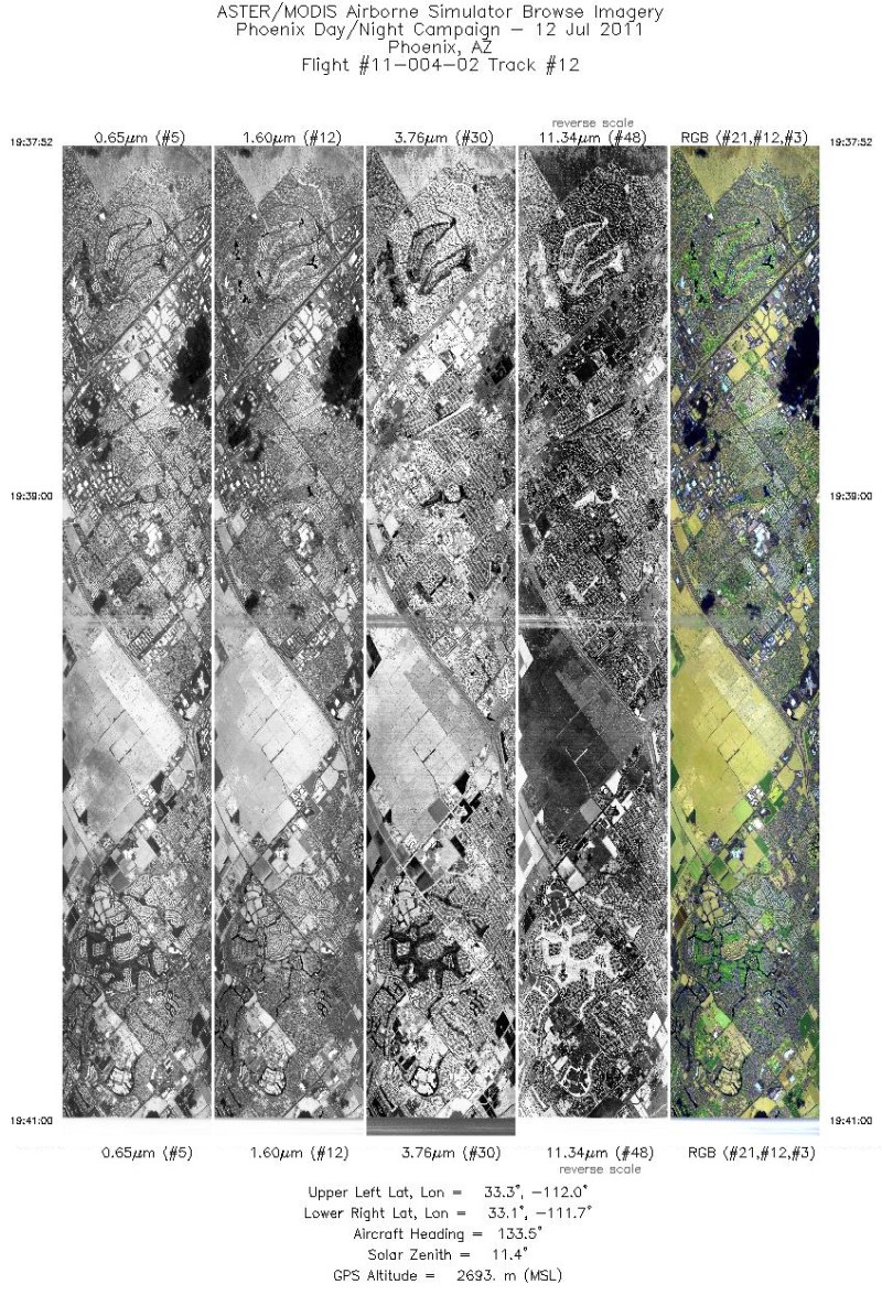
Federal
MASTER: Heat Island Airborne Study, Phoenix, Arizona, 2011
National Aeronautics and Space Administration —
This dataset includes Level 1B (L1B) data products from the MODIS/ASTER Airborne Simulator (MASTER) instrument. The spectral data were collected during five flights... -
Federal
MASTER: Wildfire and farmland mapping, California, July, 2004
National Aeronautics and Space Administration —
This dataset includes Level 1B (L1B) and Level 2 (L2) data products from the MODIS/ASTER Airborne Simulator (MASTER) instrument. The spectral data were collected... -
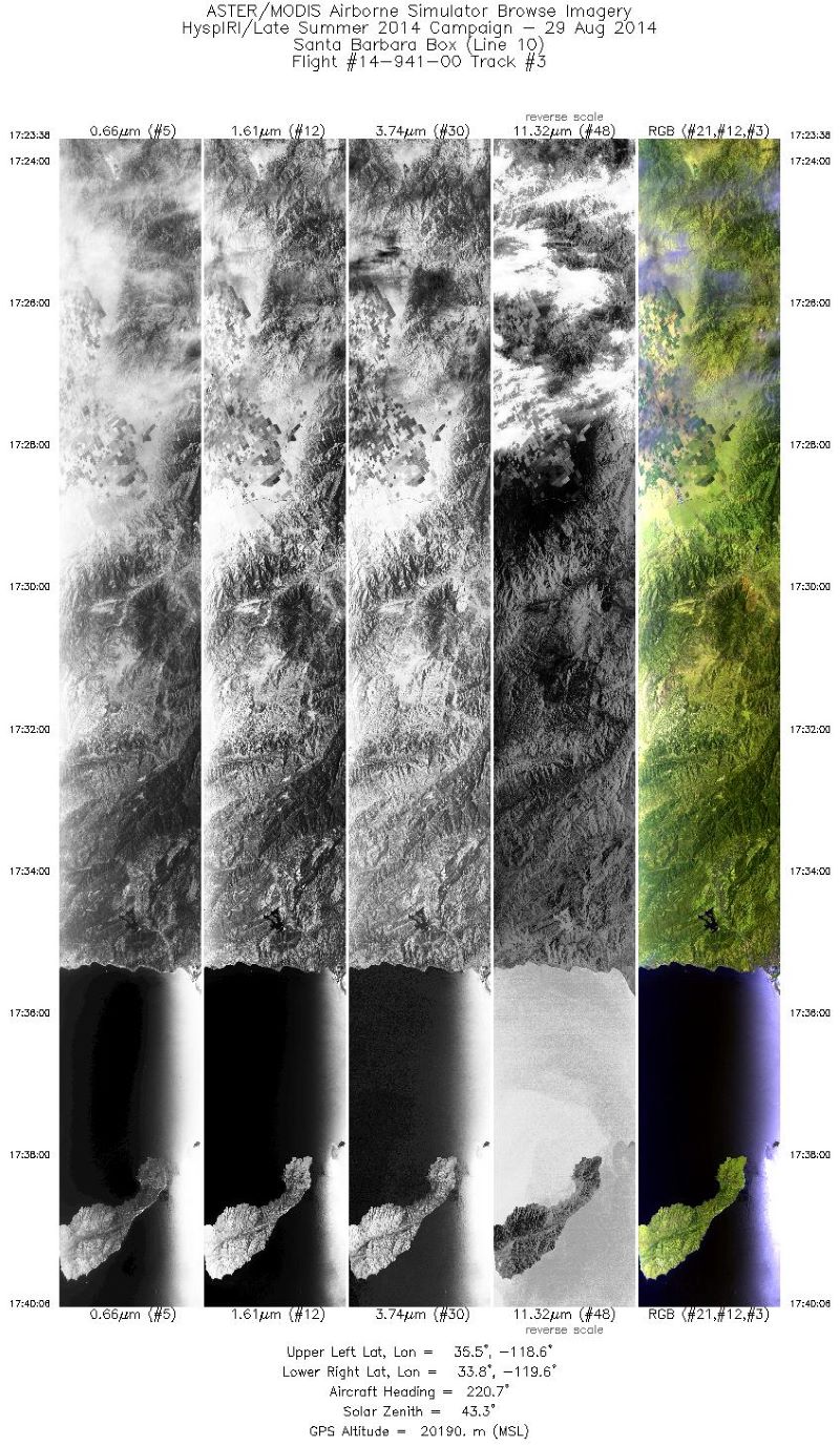
Federal
MASTER: HyspIRI Airborne Campaign, California, Spring 2015
National Aeronautics and Space Administration —
This dataset includes Level 1B (L1B) and Level 2 (L2) data products from the MODIS/ASTER Airborne Simulator (MASTER) instrument. The spectral data were collected as... -
Federal
MASTER: HyspIRI Airborne Campaign, California, Summer 2014
National Aeronautics and Space Administration —
This dataset includes Level 1B (L1B) and Level 2 (L2) data products from the MODIS/ASTER Airborne Simulator (MASTER) instrument. The spectral data were collected as... -
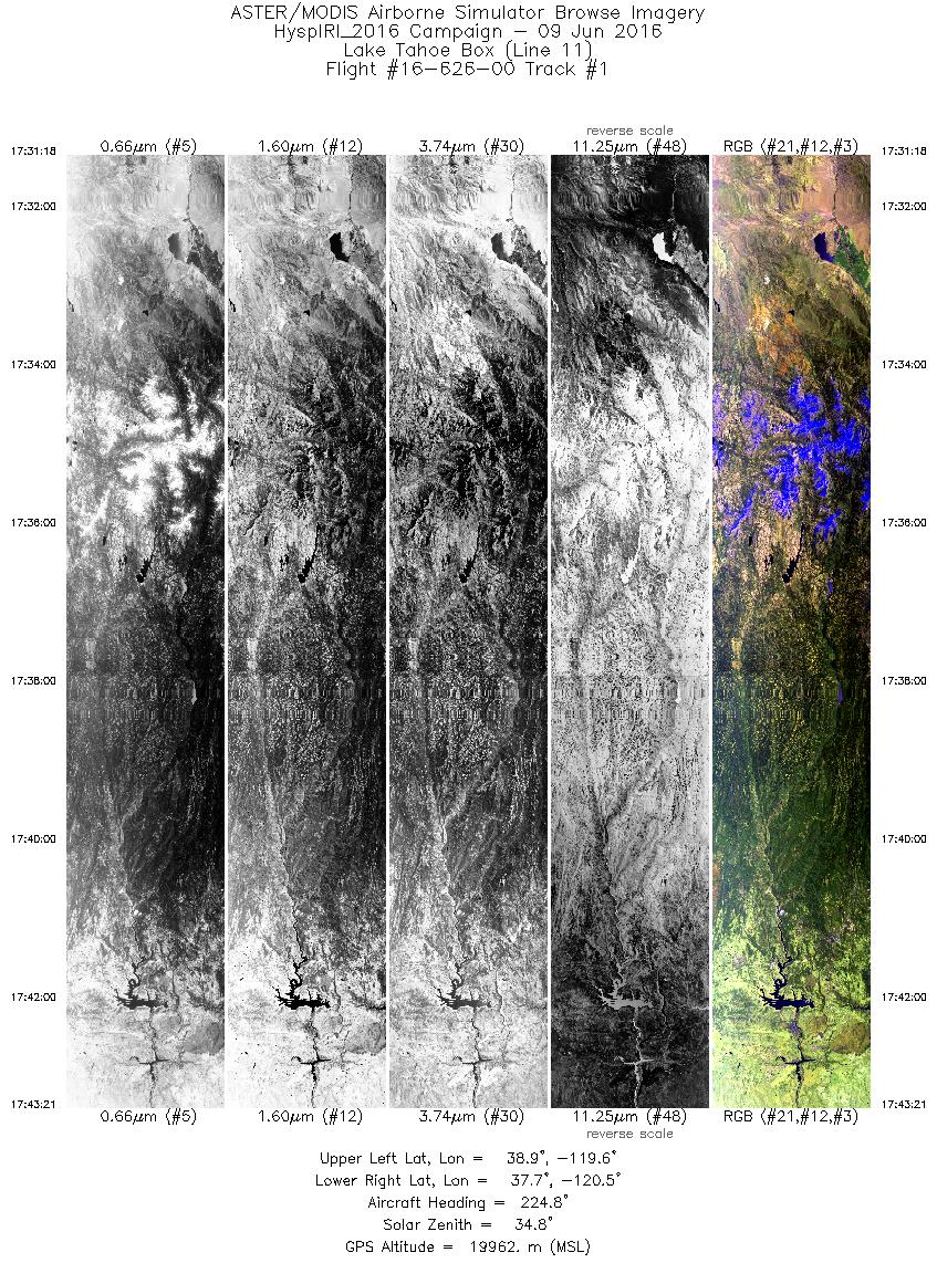
Federal
MASTER: HyspIRI Airborne Campaign, California and Nevada, Summer 2016
National Aeronautics and Space Administration —
This dataset includes Level 1B (L1B) and Level 2 (L2) data products from the MODIS/ASTER Airborne Simulator (MASTER) instrument. The data were collected as part of... -
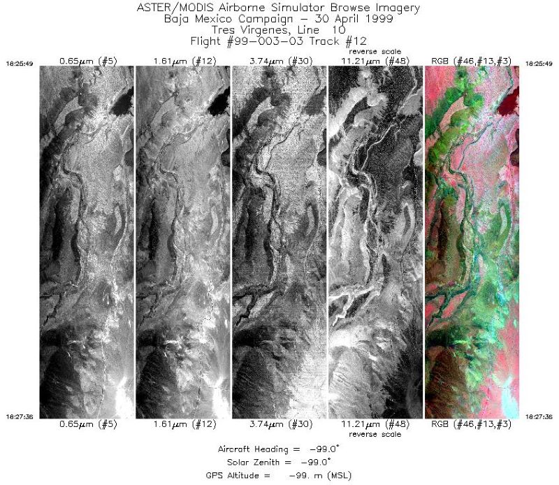
Federal
MASTER: Airborne Science, Baja Mexico-Nevada, April-May, 1999
National Aeronautics and Space Administration —
This dataset includes Level 1B (L1B) data products from the MODIS/ASTER Airborne Simulator (MASTER) instrument. The spectral data were collected during 7 flights... -
Federal
MASTER: Airborne Science, California-Nevada, May-June, 2008
National Aeronautics and Space Administration —
This dataset includes Level 1B (L1B) and Level 2 (L2) data products from the MODIS/ASTER Airborne Simulator (MASTER) instrument. The spectral data were collected as... -
Federal
MASTER: Airborne Science, Nevada, May 2006
National Aeronautics and Space Administration —
This dataset includes Level 1B (L1B) data products from the MODIS/ASTER Airborne Simulator (MASTER) instrument. The spectral data were collected during five flights... -
Federal
PhenoCam Dataset v3.0: Vegetation Phenology from Digital Camera Imagery, 2000-2023
National Aeronautics and Space Administration —
This dataset provides vegetation phenological observations for 738 sites across diverse ecosystems of the world (mostly North America) from 2000 to 2023. The... -
Federal
Aboveground Biomass Density for High Latitude Forests from ICESat-2, 2020
National Aeronautics and Space Administration —
This dataset provides estimates of Aboveground dry woody Biomass Density (AGBD) for high northern latitude forests at a 30-m spatial resolution. It is designed both... -
Federal
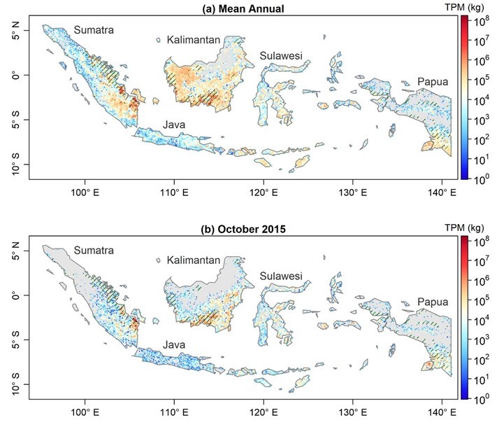
Fire Particulate Emissions from Combined VIIRS and AHI Data for Indonesia, 2015-2020
National Aeronautics and Space Administration —
This dataset provides 10-minute fire emissions within 0.1-degree regularly spaced intervals across Indonesia from July 2015 to December 2020. The dataset was produced... -
Federal
Gridded GEDI Vegetation Structure Metrics and Biomass Density at Multiple Resolutions
National Aeronautics and Space Administration —
This dataset consists of near-global, analysis-ready, multi-resolution gridded vegetation structure metrics derived from NASA Global Ecosystem Dynamics Investigation... -
Federal
Coastal Wetland Elevation and Carbon Flux Inventory with Uncertainty, USA, 2006-2011
National Aeronautics and Space Administration —
This dataset provides maps of coastal wetland carbon and methane fluxes and coastal wetland surface elevation from 2006 to 2011 at 30 m resolution for coastal...

Official websites use .gov
A
.gov website belongs to an official government
organization in the United States.
Secure .gov websites use HTTPS
A
lock (
) or https:// means you’ve safely connected to
the .gov website. Share sensitive information only on official,
secure websites.