

4 datasets found for "jspSSM246的高校毕业生就业满意度调查毕业设计✅项目合作 二开均可 TG:saolei44✅.tKaQcLsxOFw"
-
Federal
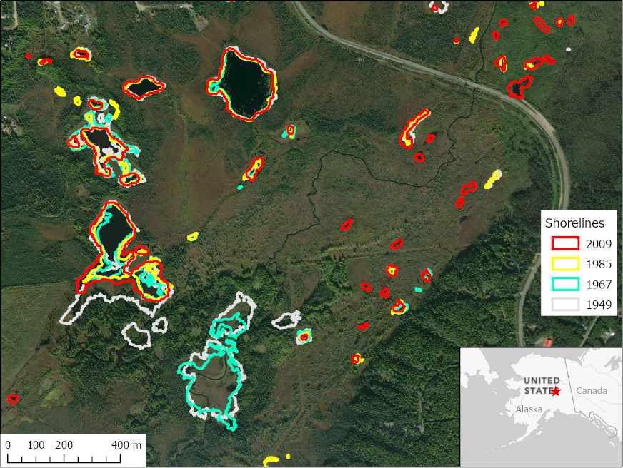
ABoVE: Historical Lake Shorelines and Areas near Fairbanks, Alaska from 1949-2009
National Aeronautics and Space Administration —
This dataset includes maps of historical lake shorelines with derived lake areas in the southern portion of the Goldstream Valley and the surrounding landscape north... -
Federal
NPP Tropical Forest: Barro Colorado, Panama, 1969-1990, R1
National Aeronautics and Space Administration —
This data set contains three ASCII files (.txt format). One file provides net primary productivity (NPP) data for the moist lowland tropical forest on Barro Colorado... -
Federal
CARVE: Daily Thaw State of Boreal and Arctic Alaska from AMSR-E and SSM/I, 2003-2014
National Aeronautics and Space Administration —
This data set provides daily 10 km resolution maps of the Alaskan and Arctic Boreal land surface state as either frozen, melting, or thawed. These data are generated... -
Federal
BOREAS Follow-On HMet-01 Merged SSM/I and Rain Gauge Precipitation Data
National Aeronautics and Space Administration —
A gridded data set has been assembled over the BOREAS hydro-meteorological study region that combines a precipitation data set based on a rain gauge network with...
4 datasets found for "jspSSM246的高校毕业生就业满意度调查毕业设计✅项目合作 二开均可 TG:saolei44✅.tKaQcLsxOFw"