
-
Federal
Stream Flow Daily Data: USGS (FIFE)
National Aeronautics and Space Administration —
The Daily Stream Flow Amounts Data Set contains daily measurements of stream flow for the four LTER stations and for the USGS stream-flow station located on... -
Federal
Global Fire Atlas with Characteristics of Individual Fires, 2003-2016
National Aeronautics and Space Administration —
The Global Fire Atlas is a global dataset that tracks the day-to-day dynamics of individual fires to determine the timing and location of ignitions, fire size,... -
Federal
BOREAS RSS-12 Airborne Tracking Sunphotometer Measurements (C-130)
National Aeronautics and Space Administration —
The BOREAS RSS-12 team collected both ground and airborne sunphotometer measurements for use in characterizing the aerosol optical properties of the atmosphere during... -
Federal
MASTER: Student Airborne Research Program (SARP) campaign, California, USA, 2016
National Aeronautics and Space Administration —
This dataset includes Level 1B (L1B) data products from the MODIS/ASTER Airborne Simulator (MASTER) instrument collected and developed by the Student Airborne... -
Federal
Gridded GEDI Vegetation Structure Metrics and Biomass Density at Multiple Resolutions
National Aeronautics and Space Administration —
This dataset consists of near-global, analysis-ready, multi-resolution gridded vegetation structure metrics derived from NASA Global Ecosystem Dynamics Investigation... -
Federal
MASTER: Student Airborne Research Program (SARP) Campaign, California, 2009
National Aeronautics and Space Administration —
This dataset includes Level 1B (L1B) data products from the MODIS/ASTER Airborne Simulator (MASTER) instrument collected and developed by the Student Airborne... -
Federal
SAFARI 2000 1-Degree Estimates of Burned Biomass, Area, and Emissions, 2000
National Aeronautics and Space Administration —
A new method is used to generate spatial estimates of monthly averaged biomass burned area and spatial and temporal estimates of trace gas and aerosol emissions from... -
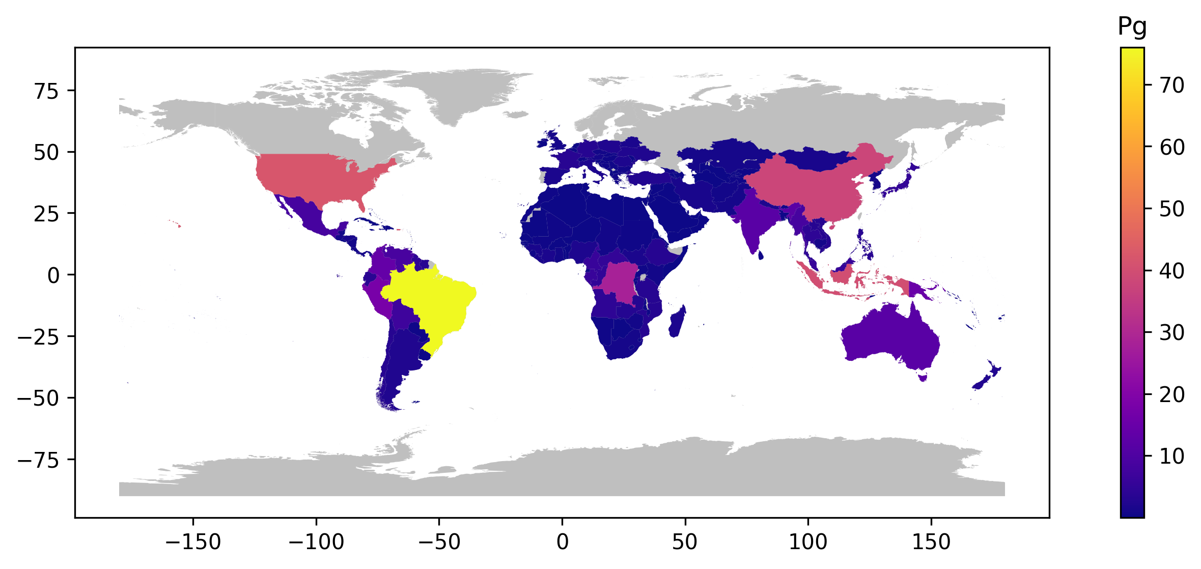
Federal
GEDI L4B Country-level Summaries of Aboveground Biomass
National Aeronautics and Space Administration —
This dataset provides country-level estimates of land surface mean aboveground biomass density (AGBD), total aboveground biomass (AGB) stocks, and the associated... -
Federal
Optical Thickness Data: Staff (FIFE)
National Aeronautics and Space Administration —
Aerosol optical thickness in conjunction with an atmospheric model can provide estimates of atmospheric effects on transmitted and reflected solar radiation. These... -
Federal
LBA-ECO LC-13 GIS Coverages of Logged Areas, Tapajos Forest, Para, Brazil: 1996, 1998
National Aeronautics and Space Administration —
We combined a detailed field study of canopy gap fraction with spectral mixture analysis of Landsat ETM+ satellite imagery to assess landscape and regional dynamics... -
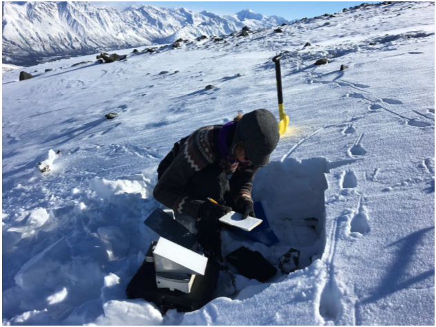
Federal
ABoVE: Dall Sheep Track Sinking Depths, Snow Depth, Hardness, and Density, 2017
National Aeronautics and Space Administration —
This dataset contains Dall sheep (Ovis dalli dalli) hoof sinking depths in snow tracks, and snow depth, hardness, and density measurements in snow pits adjacent to... -
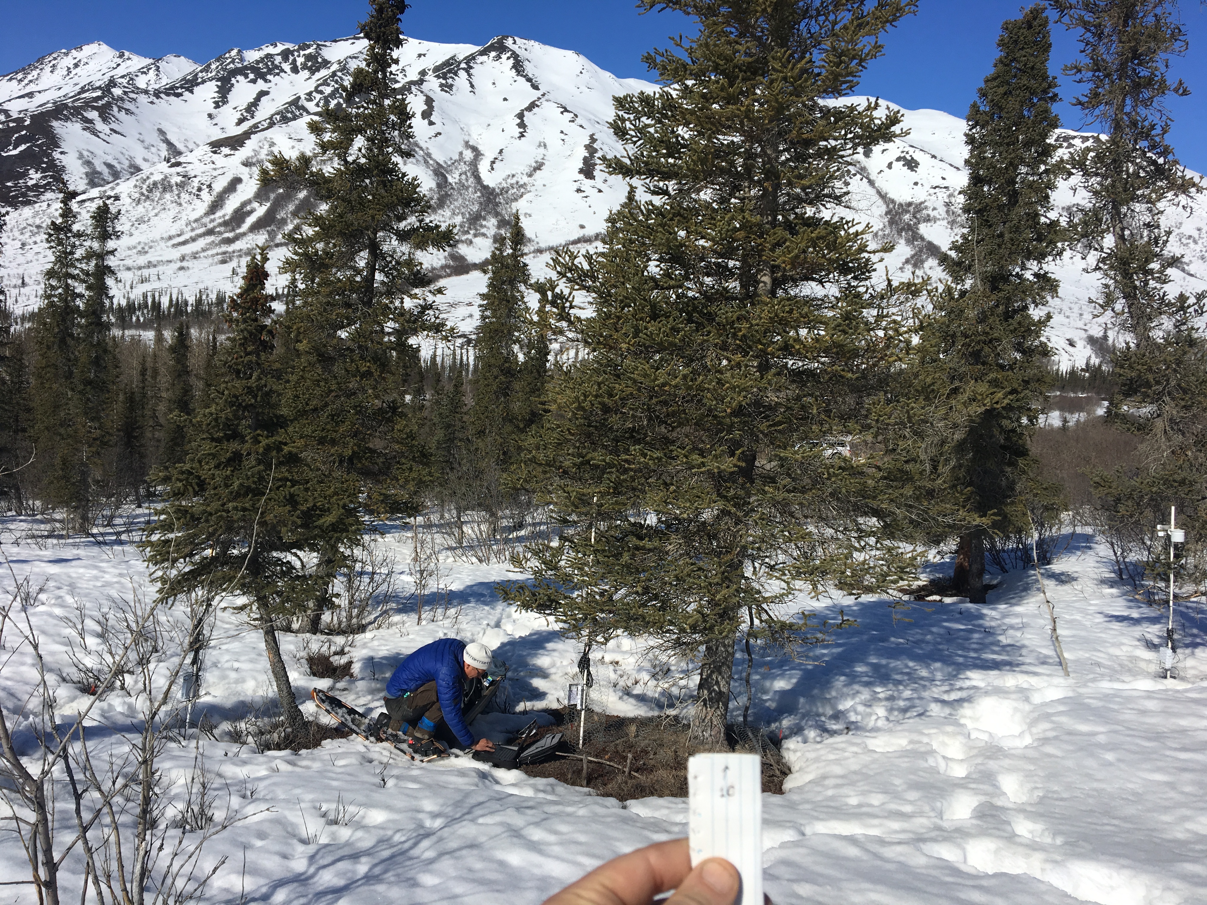
Federal
ABoVE: Photochemical Reflectance and Tree Growth, Brooks Range, Alaska, 2018-2019
National Aeronautics and Space Administration —
This dataset provides simultaneous in-situ measurements of the photochemical reflectance index (PRI) and radial tree growth of selected white spruce trees (Picea... -
Federal
MASTER: BP Oil Spill Mapping, Louisiana-Gulf of Mexico-Wisconsin, Fall, 2010
National Aeronautics and Space Administration —
This dataset includes Level 1B (L1B) and Level 2 (L2) data products from the MODIS/ASTER Airborne Simulator (MASTER) instrument. The raw data were collected during 9... -
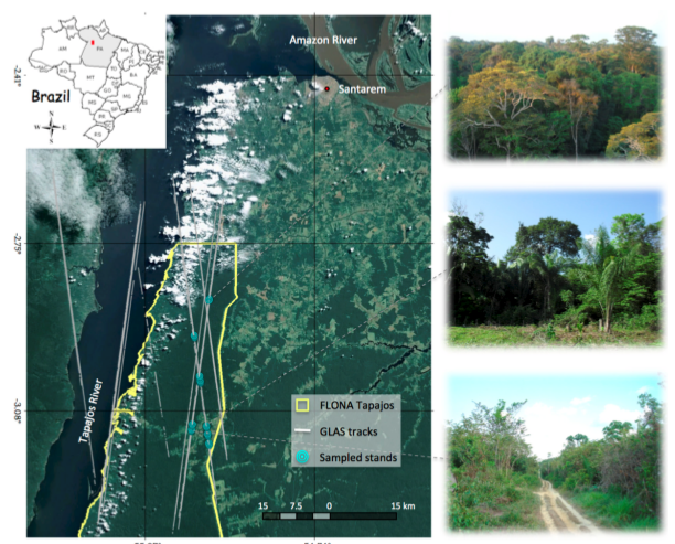
Federal
Tree Inventory and Biometry Measurements, Tapajos National Forest, Para, Brazil, 2010
National Aeronautics and Space Administration —
This dataset provides tree inventory, tree height, diameter at breast height (DBH), and estimated crown measurements from 30 plots located in the Tapajos National... -
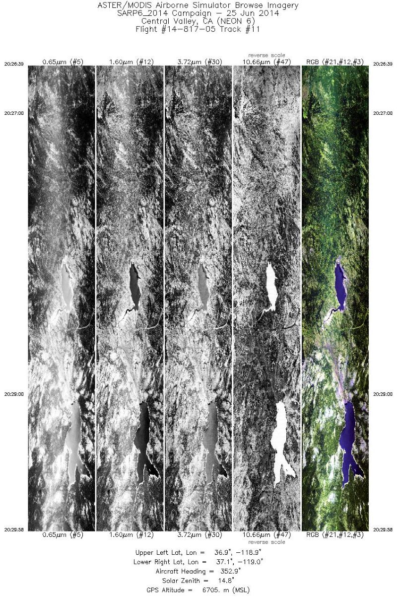
Federal
MASTER: Student Airborne Research Program (SARP) Campaign, California, 2014
National Aeronautics and Space Administration —
This dataset includes Level 1B (L1B) data products from the MODIS/ASTER Airborne Simulator (MASTER) instrument collected and developed by the Student Airborne... -
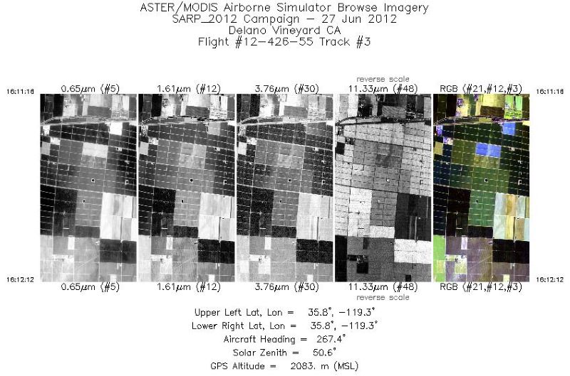
Federal
MASTER: Student Airborne Research Program (SARP) Campaign, California, 2012
National Aeronautics and Space Administration —
This dataset includes Level 1B (L1B) data products from the MODIS/ASTER Airborne Simulator (MASTER) instrument collected and developed by the Student Airborne... -
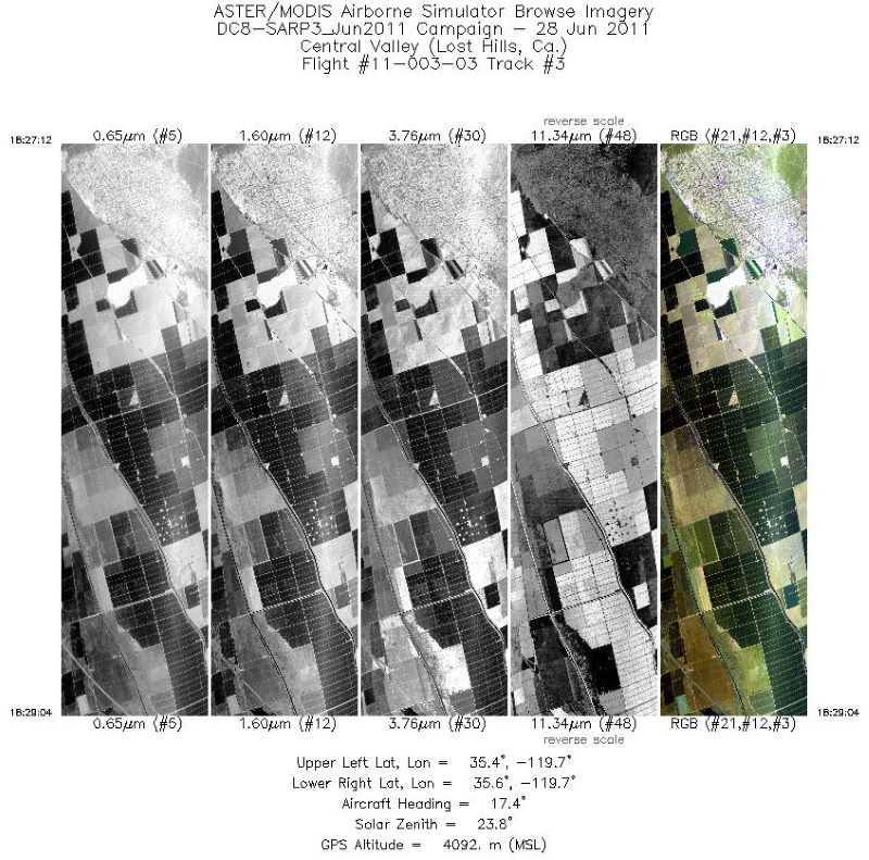
Federal
MASTER: Student Airborne Research Program (SARP) Campaign, California, 2011
National Aeronautics and Space Administration —
This dataset includes Level 1B (L1B) data products from the MODIS/ASTER Airborne Simulator (MASTER) instrument collected and developed by the Student Airborne... -
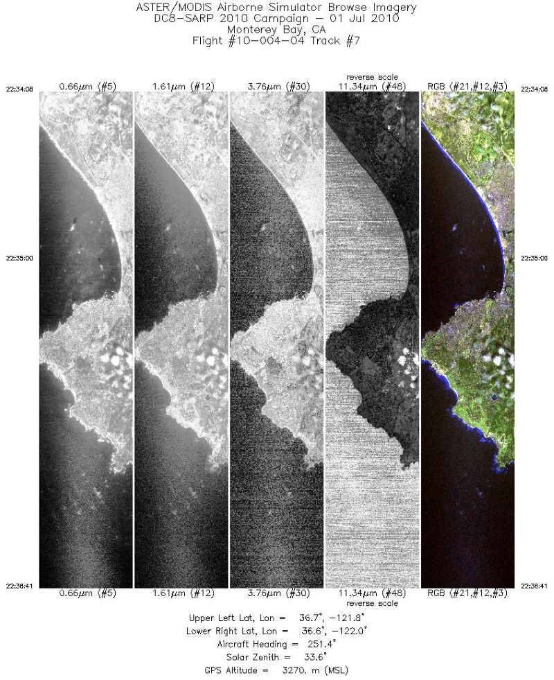
Federal
MASTER: Student Airborne Research Program (SARP) Campaign, California, 2010
National Aeronautics and Space Administration —
This dataset includes Level 1B (L1B) data products from the MODIS/ASTER Airborne Simulator (MASTER) instrument collected and developed by the Student Airborne... -
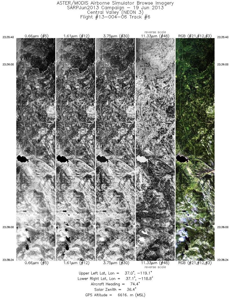
Federal
MASTER: Student Airborne Research Program (SARP) Campaign, California, 2013
National Aeronautics and Space Administration —
This dataset includes Level 1B (L1B) data products from the MODIS/ASTER Airborne Simulator (MASTER) instrument collected and developed by the Student Airborne...

Official websites use .gov
A
.gov website belongs to an official government
organization in the United States.
Secure .gov websites use HTTPS
A
lock (
) or https:// means you’ve safely connected to
the .gov website. Share sensitive information only on official,
secure websites.