
-
Federal
Arctic Boreal Annual Burned Area, Circumpolar Boreal Forest and Tundra, V2, 2002-2022
National Aeronautics and Space Administration —
This dataset provides annual cumulative end-of-season burned area in circumpolar boreal forests and tundra for the years 2002-2022. The data were generated using the... -
Federal
ABoVE: Wetland Vegetation Classification for Peace-Athabasca Delta, Canada, 2019
National Aeronautics and Space Administration —
This dataset contains land cover classification focused on water and wetland vegetation communities over the Peace-Athabasca Delta, Canada. Four classification maps... -
Federal
Gridded GEDI Vegetation Structure Metrics and Biomass Density at Multiple Resolutions
National Aeronautics and Space Administration —
This dataset consists of near-global, analysis-ready, multi-resolution gridded vegetation structure metrics derived from NASA Global Ecosystem Dynamics Investigation... -
Federal
Probabilistic Freeze-Thaw Record for the Northern Hemisphere, 2016-2020
National Aeronautics and Space Administration —
This dataset provides a probabilistic freeze/thaw (FT) data record from 2016 to 2020 for the Northern Hemisphere derived using a deep learning model (U-Net). The... -
Federal
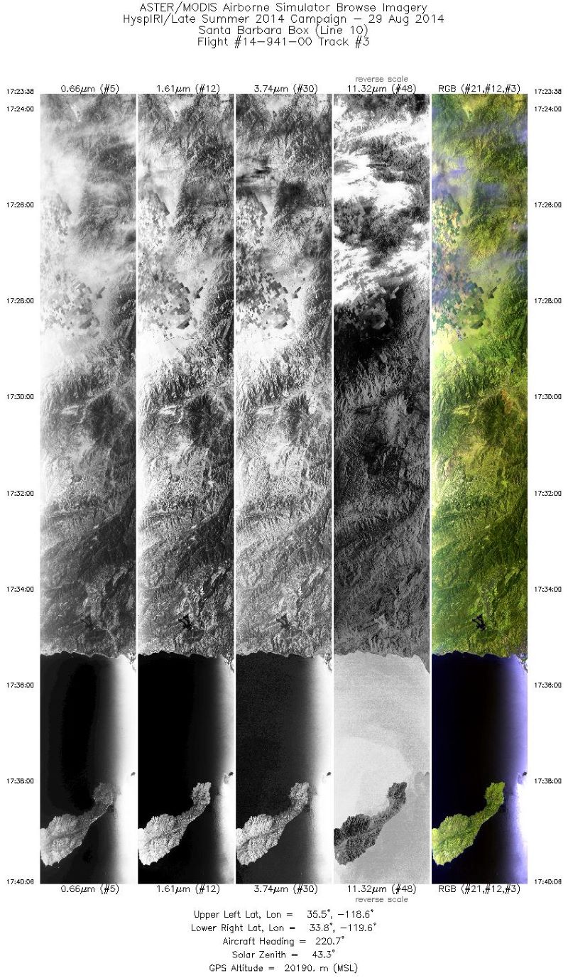
MASTER: HyspIRI Airborne Campaign, California, Summer 2014
National Aeronautics and Space Administration —
This dataset includes Level 1B (L1B) and Level 2 (L2) data products from the MODIS/ASTER Airborne Simulator (MASTER) instrument. The spectral data were collected as... -
Federal
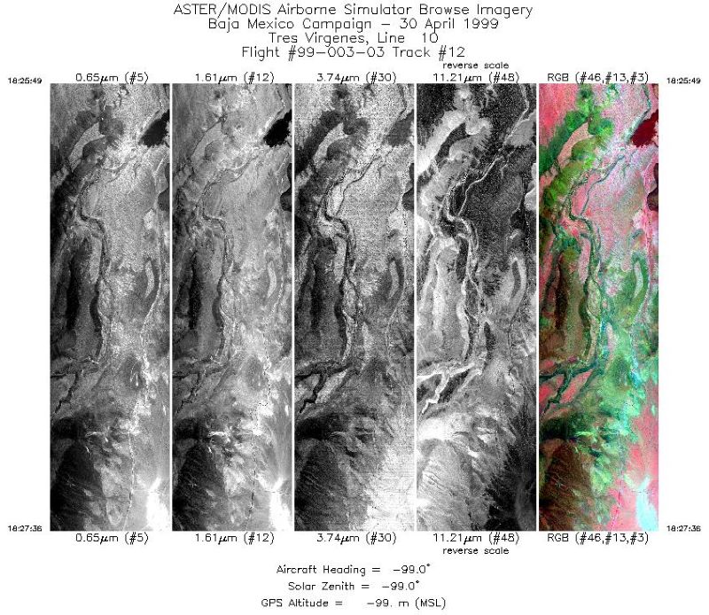
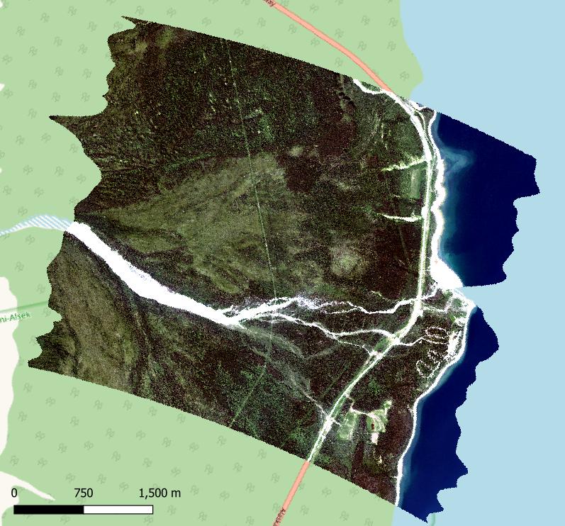
MASTER: Airborne Science, Baja Mexico-Nevada, April-May, 1999
National Aeronautics and Space Administration —
This dataset includes Level 1B (L1B) data products from the MODIS/ASTER Airborne Simulator (MASTER) instrument. The spectral data were collected during 7 flights... -
Federal
Soil Organic Carbon and Wetland Intrinsic Potential, Hoh River Watershed, WA, 2012-13
National Aeronautics and Space Administration —
This dataset contains estimates of soil organic carbon stocks and wetland intrinsic potential (WIP) across the Hoh River Watershed in the Olympic Peninsula, WA, USA... -
Federal
Delta-X: NUMAR Predictive Model for Marsh Accretion Rates and Chemical Properties
National Aeronautics and Space Administration —
This dataset provides input data and model code to run the Marsh Accretion Rates (NUMAR) process model used to predict soil accretion rates and chemical properties... -
Federal
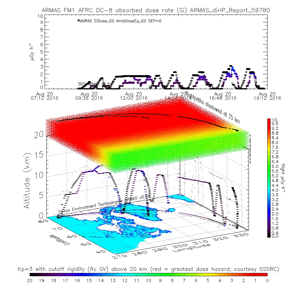
ATom: ARMAS Program Absorbed and Equivalent Radiation Dose Rates for ATom-1 Campaign
National Aeronautics and Space Administration —
This dataset contains Level 2 (L2) absorbed radiation dose rates in silicon from the Automated Radiation Measurements for Aerospace Safety (ARMAS) system along ATom... -
Federal
Characteristics of African Savanna Biomes for Determining Woody Cover
National Aeronautics and Space Administration —
This data set includes the soil and vegetation characteristics, herbivore estimates, and precipitation measurement data for the 854 sites described and analyzed in... -
Federal
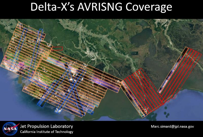
Delta-X: AVIRIS-NG L2 Surface Reflectance, MRD Louisiana, 2021
National Aeronautics and Space Administration —
This dataset provides Level 2 (L2) atmospherically corrected surface reflectance data acquired from NASA's Airborne Visible-Infrared Imaging Spectrometer-Next... -
Federal
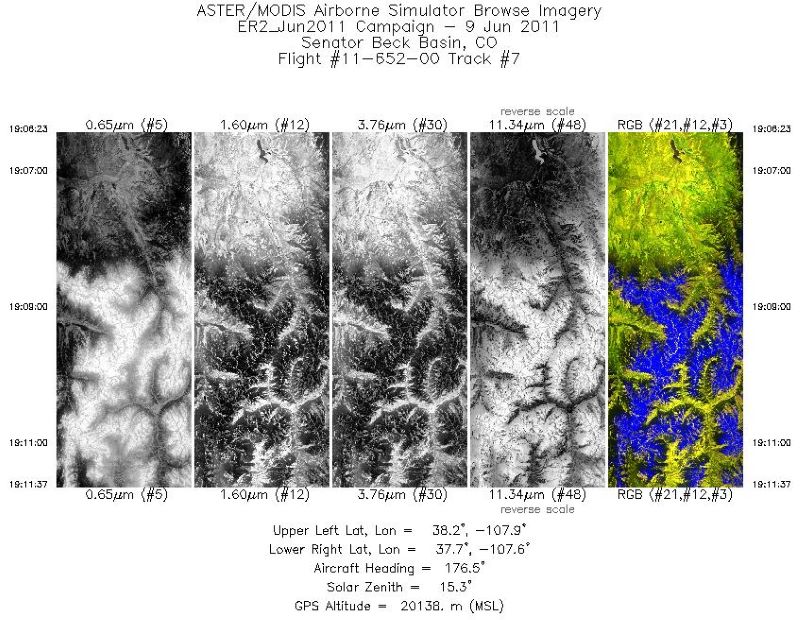
MASTER: Airborne Science, Southwest US, June, 2011
National Aeronautics and Space Administration —
This dataset includes Level 1B (L1B) and Level 2 (L2) data products from the MODIS/ASTER Airborne Simulator (MASTER) instrument. The spectral data were collected... -
Federal
ABoVE: AVIRIS-3 Imaging Spectroscopy for Alaska and Canada, 2023
National Aeronautics and Space Administration —
This dataset includes L1B radiance and L2A surface reflectance imagery acquired by the Airborne Visible / Infrared Imaging Spectrometer-3 (AVIRIS-3) instrument over... -
Federal
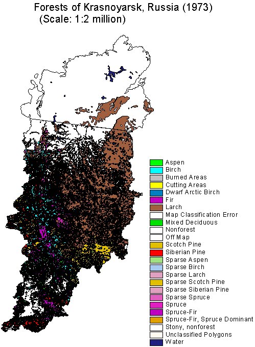
RLC Forest Cover of the Krasnoyarsk Region, Russia, 1973
National Aeronautics and Space Administration —
This dataset is a 1:2 million scale forest cover map for the land area of the Krasnoyarsk Region, Russia. Thirty-two land cover classes are distinguished. These data... -
Federal
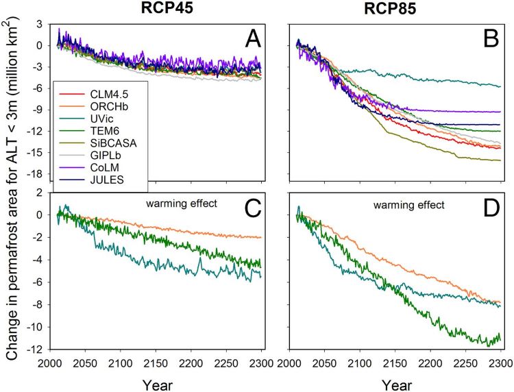
Projections of Permafrost Thaw and Carbon Release for RCP 4.5 and 8.5, 1901-2299
National Aeronautics and Space Administration —
This dataset consists of an ensemble of model projections from 1901 to 2299 for the northern hemisphere permafrost domain. The model projections include monthly... -
Federal
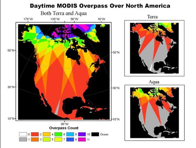
NACP: MODIS Daily Land Incident 4-km PAR Images For North America, 2003-2005
National Aeronautics and Space Administration —
This data set contains daily Moderate Resolution Imaging Spectroradiometer (MODIS) land incident photosynthetically active radiation (PAR) images over North America... -
Federal
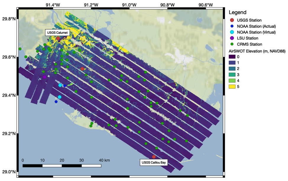
Pre-Delta-X: L2 AirSWOT Water Surface Elevations, Atchafalaya Basin, LA, USA, 2016
National Aeronautics and Space Administration —
This dataset provides water surface elevations over the Wax Lake Delta in the Atchafalaya Basin in coastal Louisiana, USA, in May 2015. These Level 2 (L2) data were... -
Federal
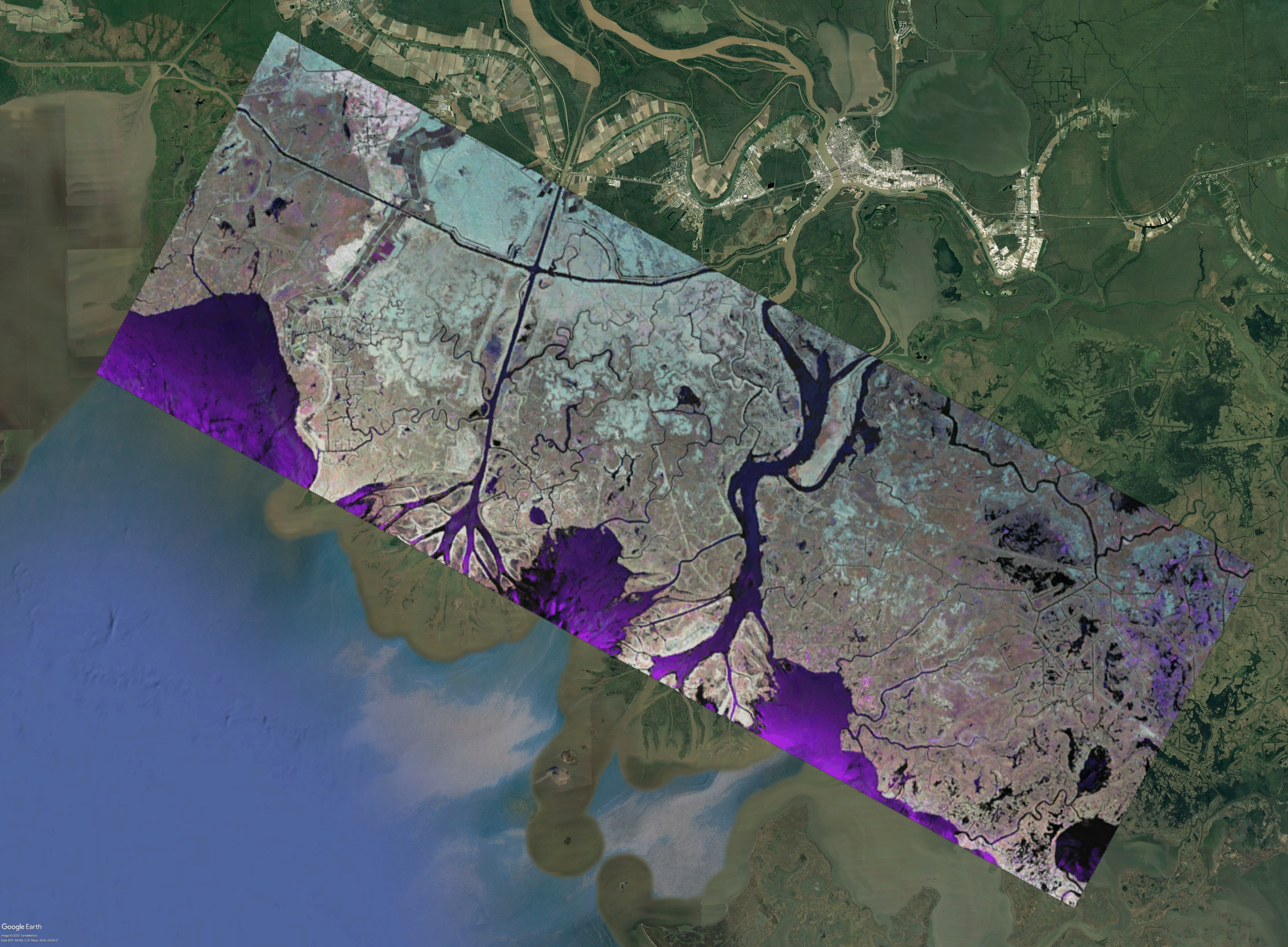
Pre-Delta-X: L1 UAVSAR Single Look Complex and Interferograms, MRD, LA, USA, 2016
National Aeronautics and Space Administration —
This Level 1 (L1) dataset includes single look complex (SLC) stack products and co-registered interferograms in the HH (horizontal transmit and horizontal receive)... -
Federal
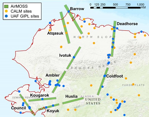
Pre-ABoVE: L1 S-0 Polarimetric Data from AirMOSS P-band SAR, Alaska, 2014-2015
National Aeronautics and Space Administration —
This data set provides level 1 (L1) polarimetric radar backscattering coefficient (sigma-0), multi-look complex, polarimetrically calibrated, and georeferenced data... -
Federal
Delta-X: UAVSAR L2 Interferometric Products, MRD, Louisiana, 2021
National Aeronautics and Space Administration —
This dataset contains georeferenced UAVSAR Level 2 (L2) interferometric products for Delta-X flight lines acquired during the spring (2021-03-27 to 2021-04-18) and...

Official websites use .gov
A
.gov website belongs to an official government
organization in the United States.
Secure .gov websites use HTTPS
A
lock (
) or https:// means you’ve safely connected to
the .gov website. Share sensitive information only on official,
secure websites.