
-
Federal
NACP North American Forest Dynamics Project: Forest Disturbance and Regrowth Data
National Aeronautics and Space Administration —
This data set provides the results of time-series analyses of Landsat imagery for 55 selected forested sites across the conterminous U.S.A. The output is a pair of... -
Federal
ABoVE: Burn Severity of Soil Organic Matter, Northwest Territories, Canada, 2014-2015
National Aeronautics and Space Administration —
This dataset provides maps at 30-m resolution of landscape surface burn severity (surface litter and soil organic layers) from the 2014-2015 fires in the Northwest... -
Federal
Surface Radiance Data: UNL (FIFE)
National Aeronautics and Space Administration —
The Surface Temperatures, Reflected and Emitted Radiation, and PAR from UNL Data Set contains surface temperatures at different view zenith and azimuth angles, net... -
Federal
Stream Flow Daily Data: USGS (FIFE)
National Aeronautics and Space Administration —
The Daily Stream Flow Amounts Data Set contains daily measurements of stream flow for the four LTER stations and for the USGS stream-flow station located on... -
Federal
LBA-ECO LC-01 SRTM 90-Meter Digital Elevation Model, Northern Ecuadorian Amazon
National Aeronautics and Space Administration —
This data set provides 90-meter resolution Digital Elevation Model data used in the University of North Carolina's Carolina Population Center (CPC) Ecuador Projects.... -
Federal
ABoVE: Riverbank Erosion and Vegetation Changes, Yukon River Basin, Alaska, 1984-2017
National Aeronautics and Space Administration —
This dataset provides a time series of riverbank erosion and vegetation colonization along reaches of the Yukon River (3 study areas), Tanana and Nenana Rivers (1... -
Federal
Regridded Harmonized World Soil Database v1.2
National Aeronautics and Space Administration —
This data set describes select global soil parameters from the Harmonized World Soil Database (HWSD) v1.2, including additional calculated parameters such as area... -
Federal
Ground-based Observations of XCO2, XCH4, and XCO, Fairbanks, AK, 2016-2019
National Aeronautics and Space Administration —
This dataset provides ground-based column-averaged dry mole fractions (DMFs) of CO2 (xco2), CO (xco), CH4 (xch4), and N2O (xn2o) to supplement satellite-based... -
Federal
CARVE: Fire-Related Aerosol and Soil Elemental and Isotopic Composition, Alaska, 2013
National Aeronautics and Space Administration —
This data set provides measurements of the isotopic composition of black carbon and organic carbon aerosols collected at two locations in interior Alaska during the... -
Federal
NACP: Urban Greenhouse Gases across the CO2 Urban Synthesis and Analysis Network, V2
National Aeronautics and Space Administration —
This dataset provides hourly urban greenhouse gas measurements for cities in the CO2 Urban Synthesis and Analysis (CO2-USA) Data Synthesis Network for 2000 to 2019.... -
Federal
SAFARI 2000 Land Cover from AVHRR, 1-km, 1992-1993 (Hansen et al.)
National Aeronautics and Space Administration —
The data set consists of a southern African subset of the 1-km Global Land Cover Data Set Derived from AVHRR developed at the Laboratory for Global Remote Sensing... -
Federal
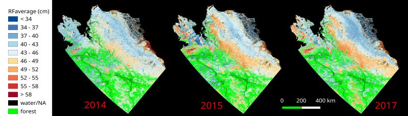
ABoVE: Upscaled Active Layer Thickness in Northern Alaska, 2014-2017
National Aeronautics and Space Administration —
The dataset consists of maps of estimated Active Layer Thickness (ALT) at 30-m resolution throughout the northern half of Alaska for the years 2014, 2015, and 2017.... -
Federal
VEMAP 2: Annual Ecosystem Model Responses to U.S. Climate Change, 1994-2100
National Aeronautics and Space Administration —
The Vegetation-Ecosystem Modeling and Analysis Project (VEMAP) was a large, collaborative, multi-institutional, international effort whose goal was to evaluate the... -
Federal
NPP Multi-Biome: Grassland, Boreal Forest, and Tropical Forest Sites, 1939-1996, R1
National Aeronautics and Space Administration —
This data set contains one data file (.csv format) that provides net primary productivity (NPP) estimates for 34 grasslands, 14 tropical forests, and 5 boreal forest... -
Federal
SAFARI 2000 MODIS 500-m Burned Area Products, Southern Africa, Dry Season 2000
National Aeronautics and Space Administration —
The SAFARI 2000 project was selected as the first regional test for a prototype regional 500 m MODIS burned area product. The MODIS burned area product maps the 500 m... -
Federal
SAFARI 2000 Fire Emission Data, Dry Season 2000
National Aeronautics and Space Administration —
As part of the Southern Africa Regional Science Initiative (SAFARI 2000), the University of Montana participated in both ground-based and airborne campaigns during...

Official websites use .gov
A
.gov website belongs to an official government
organization in the United States.
Secure .gov websites use HTTPS
A
lock (
) or https:// means you’ve safely connected to
the .gov website. Share sensitive information only on official,
secure websites.