
-
Federal
Delta-X: AVIRIS-NG L3 Derived Herbaceous Aboveground Biomass, MRD, Louisiana, USA, V3
National Aeronautics and Space Administration —
This dataset includes high-resolution (~5 m) gridded estimates of aboveground biomass (AGB), aboveground necromass (AGN), and aboveground net primary productivity... -
Federal
GEDI L4B Gridded Aboveground Biomass Density, Version 2
National Aeronautics and Space Administration —
This Global Ecosystem Dynamics Investigation (GEDI) L4B product provides 1 km x 1 km (1 km, hereafter) estimates of mean aboveground biomass density (AGBD) based on... -
Federal
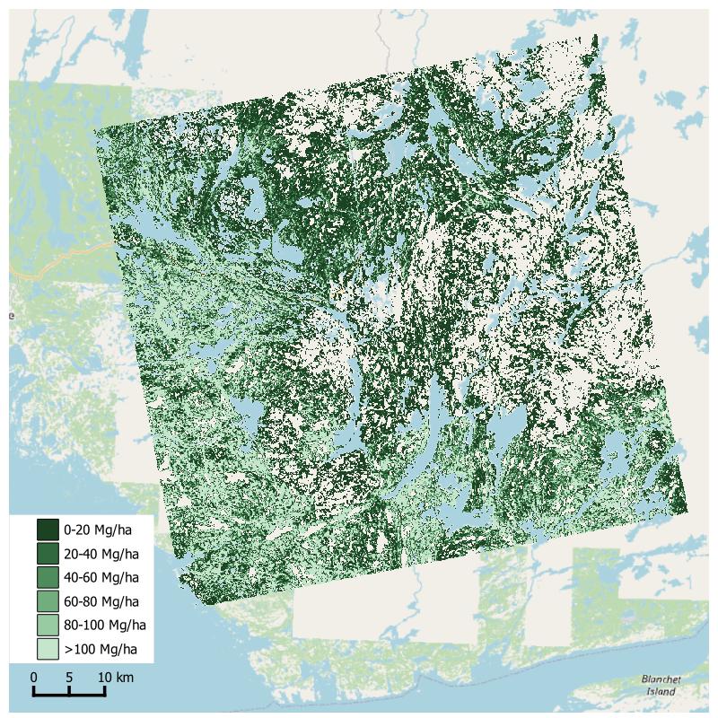
Aboveground Biomass Density for High Latitude Forests from ICESat-2, 2020
National Aeronautics and Space Administration —
This dataset provides estimates of Aboveground dry woody Biomass Density (AGBD) for high northern latitude forests at a 30-m spatial resolution. It is designed both... -
Federal
Delta-X: AVIRIS-NG BRDF-Adjusted Surface Reflectance and Mosaics, MRD, LA, 2021, V3
National Aeronautics and Space Administration —
This data provides AVIRIS-NG Bidirectional Reflectance Distribution Function (BRDF) and sunglint-corrected surface spectral reflectance images over the Atchafalaya... -
Federal
ABoVE: Boreal Forest Resilience Study 2020-2022, Fairbanks AK
National Aeronautics and Space Administration —
This dataset includes five metrics of forest resilience (recruitment, invasives, permafrost change, tree damage, and radial growth) at five recently burned forest... -
Federal
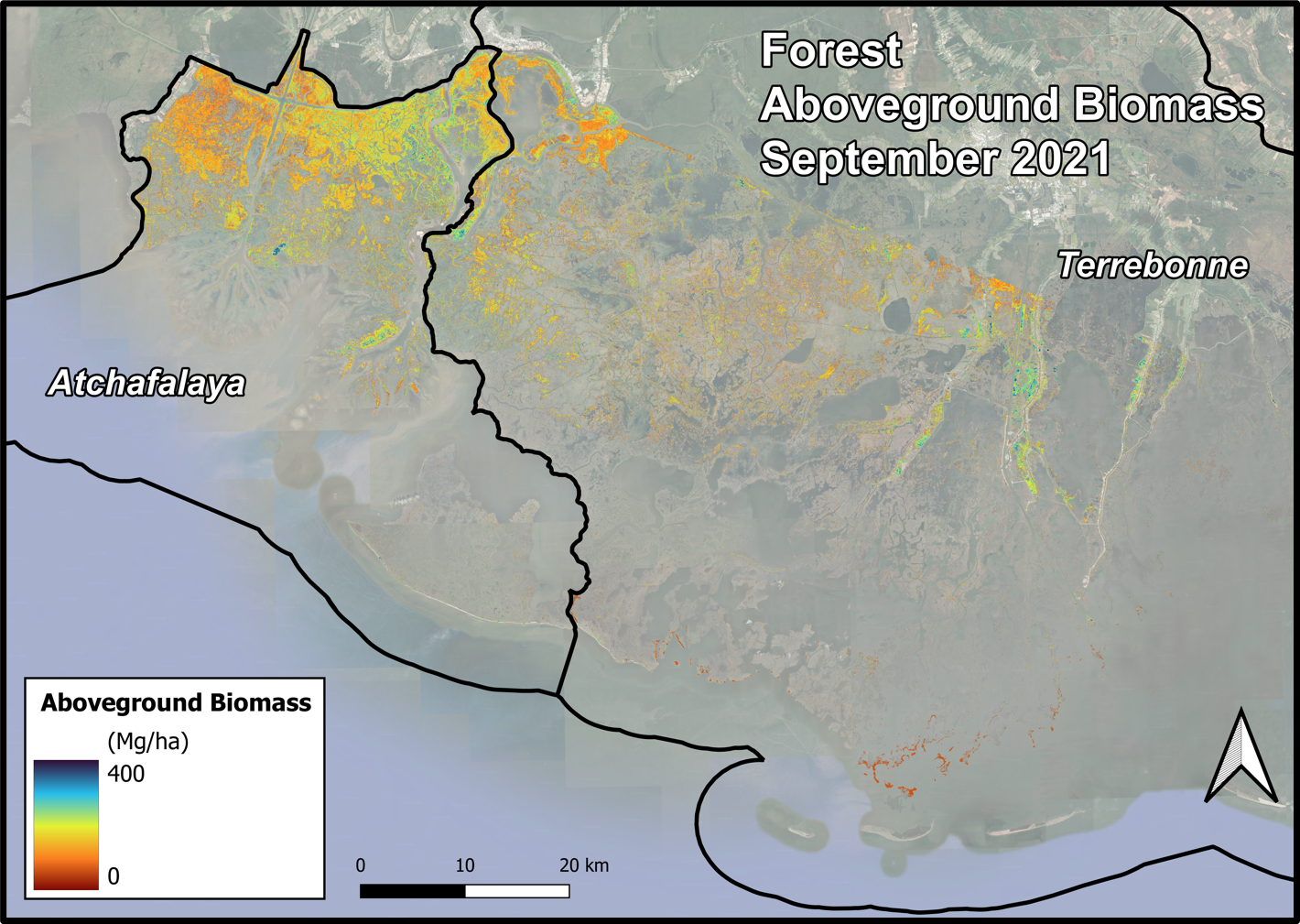
Delta-X AVIRIS-NG and UAVSAR L3 Derived Forest Aboveground Biomass, MRD, LA
National Aeronautics and Space Administration —
This dataset contains estimates of forest aboveground biomass (AGB) across the Atchafalaya and Terrebonne Basins, Louisiana, US. AGB was derived from AVIRIS-NG... -
Federal
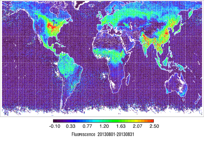
L2 Daily Solar-Induced Fluorescence (SIF) from MetOp-B GOME-2, 2013-2021
National Aeronautics and Space Administration —
This dataset provides Level 2 (L2) Solar-Induced Fluorescence (SIF) of chlorophyll estimates derived from the Global Ozone Monitoring Experiment 2 (GOME-2) instrument... -
Federal
GEDI L4A Footprint Level Aboveground Biomass Density, Version 2
National Aeronautics and Space Administration —
This dataset contains Global Ecosystem Dynamics Investigation (GEDI) Level 4A (L4A) Version 2 predictions of the aboveground biomass density (AGBD; in Mg/ha) and... -
Federal
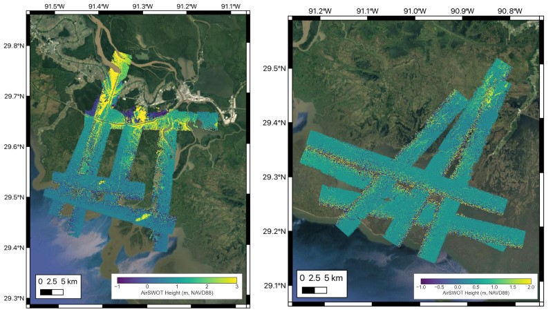
Delta-X: AirSWOT L2 Geocoded Water Surface Elevation, MRD, LA, 2021, V3
National Aeronautics and Space Administration —
This dataset contains Level 2 (L2) AirSWOT geocoded products, including estimated water surface elevation. The AirSWOT instrument is a Ka-band interferometer and for... -
Federal
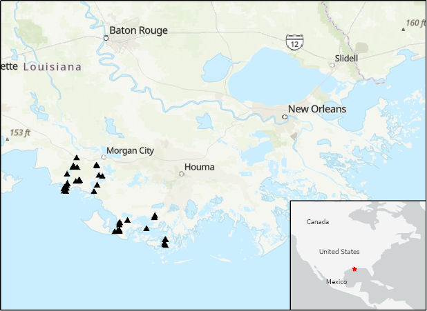
Delta-X: Acoustic Doppler Current Profiler Channel Surveys, MRD, Louisiana, 2021, V2
National Aeronautics and Space Administration —
This dataset provides river discharge measurements collected at selected locations in the Atchafalaya and Terrebonne Basins within the Mississippi River Delta (MRD)... -
Federal
Aboveground Biomass from SAR, Great Slave Lake Region, NWT, 2019
National Aeronautics and Space Administration —
This dataset holds aboveground biomass (ABG) estimates for areas in the Great Slave Lake Region in the Northwest Territories of Canada for 2019. ABG was estimated... -
Federal
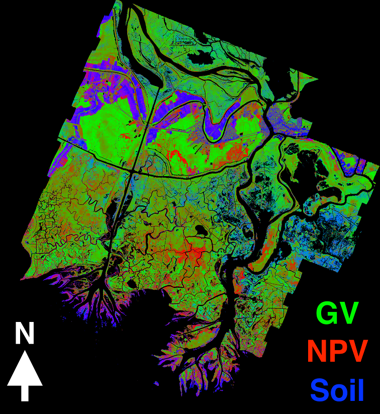
Delta-X: AVIRIS-NG L2B Derived Fractional Cover, MRD, LA, USA, 2021
National Aeronautics and Space Administration —
This dataset provides estimates of fractional vegetation cover across the Atchafalaya and Terrebonne basins. Atmospheric correction was applied to a L2B BRDF-adjusted... -
Federal
ABoVE: Passive Microwave-derived Annual Snowpack Main Melt Onset Date Maps, 1988-2018
National Aeronautics and Space Administration —
This dataset provides the annual date of snowpack seasonal beginning melt (i.e., main melt onset date, MMOD) across northwest Canada; Alaska, U.S.; and parts of far... -
Federal
Delta-X: UAVSAR L1 Single Look Complex (SLC) Stack Products, MRD, Louisiana, 2021
National Aeronautics and Space Administration —
This dataset contains UAVSAR Level 1 (L1) Single Look Complex (SLC) stack products for Delta-X flight lines acquired during 2021-03-27 to 2021-04-18 (spring) and... -
Federal
Land Surface Phenology, Eddy Covariance Tower Sites, North America, 2017-2021
National Aeronautics and Space Administration —
This land surface phenology (LSP) dataset provides spatially explicit data related to the timing of phenological changes such as the start, peak, and end of... -
Federal
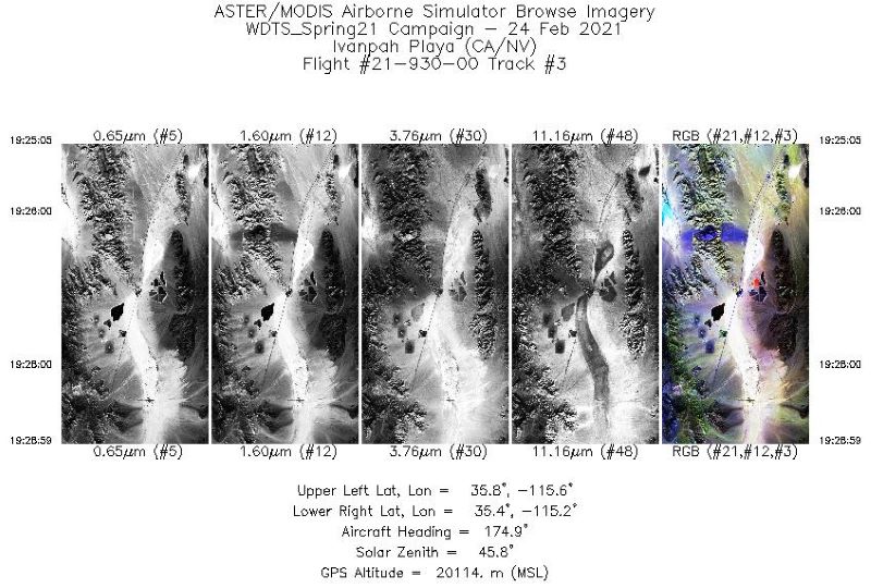
MASTER: Western Diversity Time Series Campaign, WDTS, California, USA, Spring 2021
National Aeronautics and Space Administration —
This dataset includes Level 1B (L1B) and Level 2 (L2) data products from the MODIS/ASTER Airborne Simulator (MASTER) instrument. The spectral data were collected as... -
Federal
MASTER: Tropical Composition, Cloud and Climate Coupling Campaign, 2007
National Aeronautics and Space Administration —
This dataset includes Level 1B (L1B) and Level 2 (L2) data products from the MODIS/ASTER Airborne Simulator (MASTER) instrument. The spectral data were collected... -
Federal
Global Vegetation Height Metrics from GEDI and ICESat2
National Aeronautics and Space Administration —
This dataset provides global rasters of relative height metrics for vegetation from Global Ecosystem Dynamics Investigation (GEDI) L2A data and Ice, Cloud, and Land... -
Federal
Delta-X: AVIRIS-NG L3-derived Water Quality, TSS, and Turbidity, MRD, V3
National Aeronautics and Space Administration —
This dataset includes estimates of total suspended solids (TSS) concentration and turbidity for waters of the Atchafalaya River and Terrebonne Basins of the...

Official websites use .gov
A
.gov website belongs to an official government
organization in the United States.
Secure .gov websites use HTTPS
A
lock (
) or https:// means you’ve safely connected to
the .gov website. Share sensitive information only on official,
secure websites.