
-
Federal
A Global Database of Gas Fluxes from Soils after Rewetting or Thawing, Version 1.0
National Aeronautics and Space Administration —
This database contains information compiled from published studies on gas flux from soil following rewetting or thawing. The resulting database includes 222 field and... -
Federal
Northern and Mid-Latitude Soil Database, Version 1, R1
National Aeronautics and Space Administration —
The U.S. Department of Agriculture, Agriculture and Agri-Food Canada, the Russian Academy of Agricultural Sciences, the University of Copenhagen Institute of... -
Federal
MASTER: FireSense, California and Southern US, Spring 2025
National Aeronautics and Space Administration —
This dataset includes Level 1B (L1B) and Level 2 (L2) data products from the MODIS/ASTER Airborne Simulator (MASTER) instrument. The spectral data were collected as... -
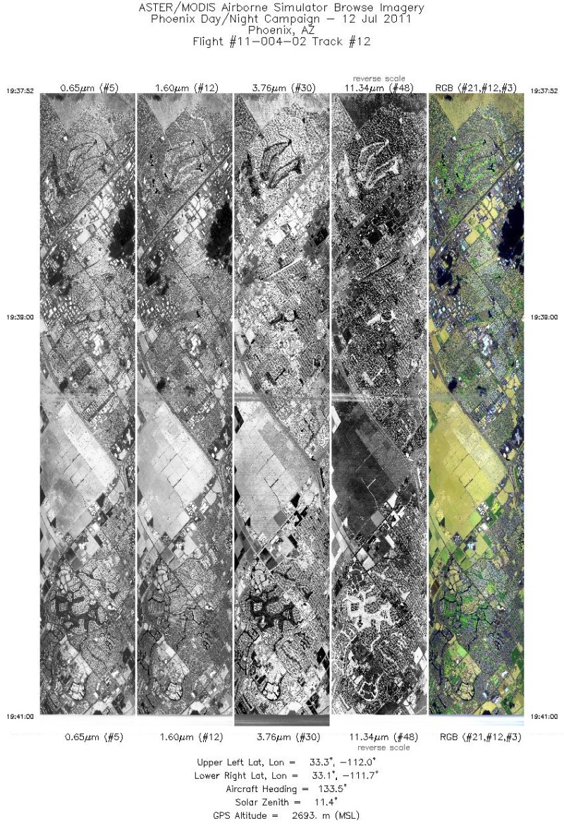
Federal
MASTER: Heat Island Airborne Study, Phoenix, Arizona, 2011
National Aeronautics and Space Administration —
This dataset includes Level 1B (L1B) data products from the MODIS/ASTER Airborne Simulator (MASTER) instrument. The spectral data were collected during five flights... -
Federal
MASTER: Wildfire and farmland mapping, California, July, 2004
National Aeronautics and Space Administration —
This dataset includes Level 1B (L1B) and Level 2 (L2) data products from the MODIS/ASTER Airborne Simulator (MASTER) instrument. The spectral data were collected... -
Federal
MASTER: HyspIRI Airborne Campaign, California, Spring 2015
National Aeronautics and Space Administration —
This dataset includes Level 1B (L1B) and Level 2 (L2) data products from the MODIS/ASTER Airborne Simulator (MASTER) instrument. The spectral data were collected as... -
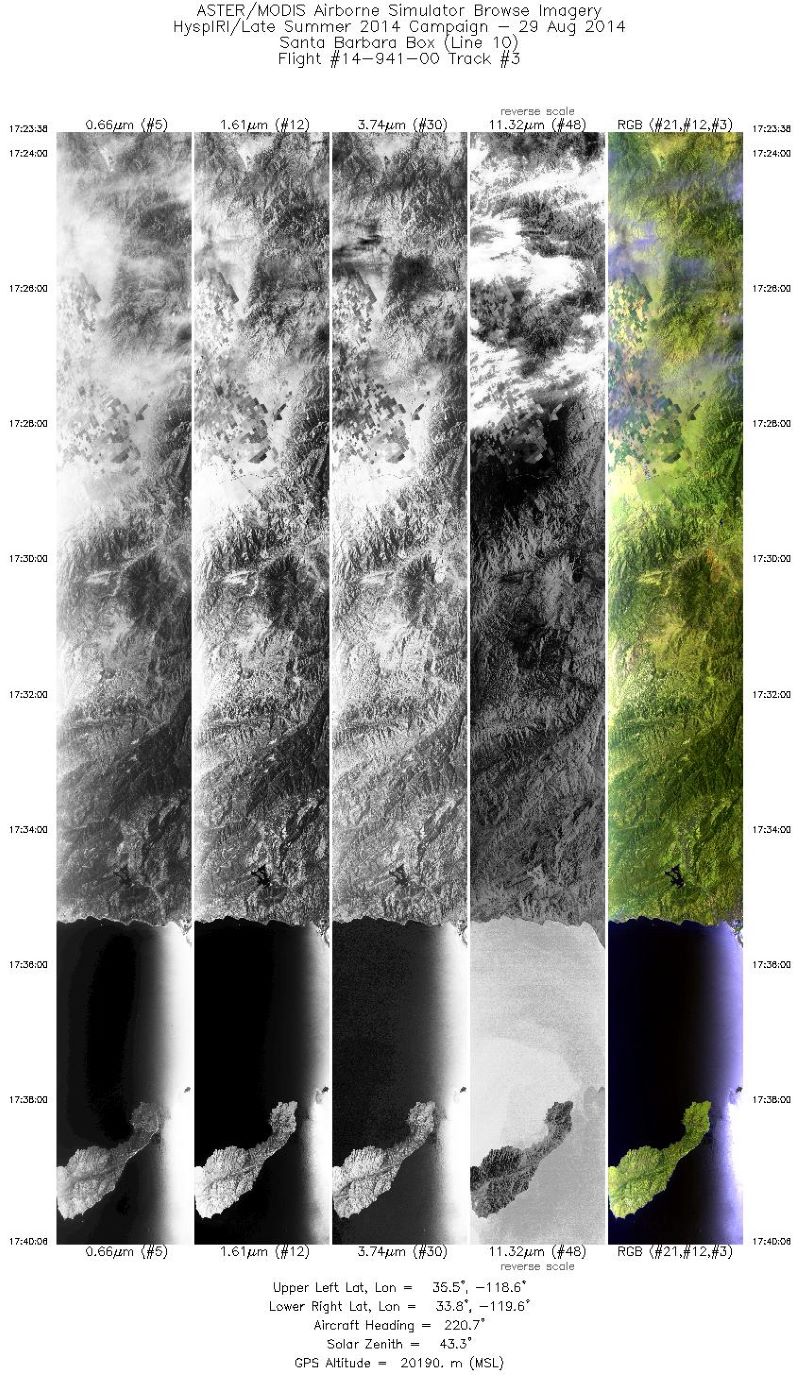
Federal
MASTER: HyspIRI Airborne Campaign, California, Summer 2014
National Aeronautics and Space Administration —
This dataset includes Level 1B (L1B) and Level 2 (L2) data products from the MODIS/ASTER Airborne Simulator (MASTER) instrument. The spectral data were collected as... -
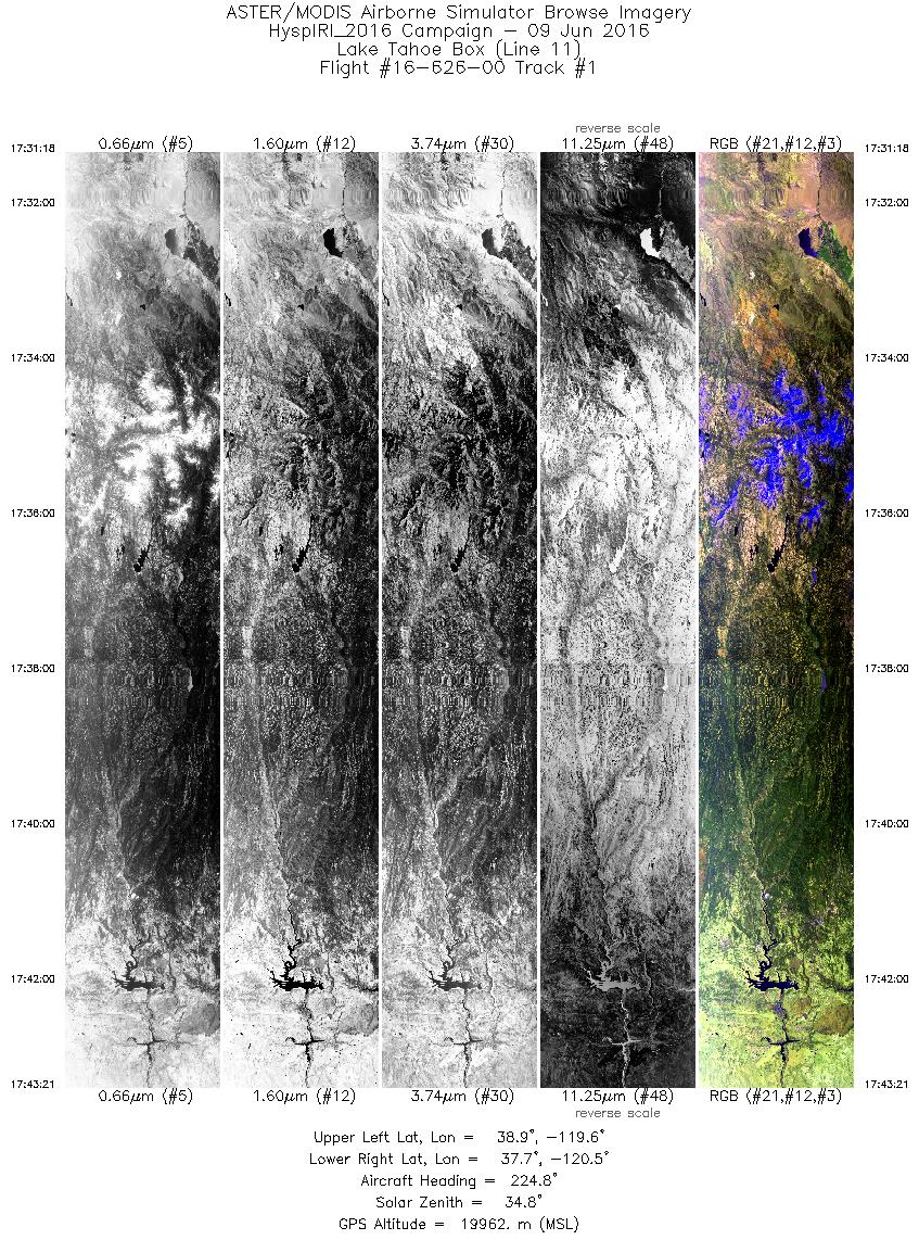
Federal
MASTER: HyspIRI Airborne Campaign, California and Nevada, Summer 2016
National Aeronautics and Space Administration —
This dataset includes Level 1B (L1B) and Level 2 (L2) data products from the MODIS/ASTER Airborne Simulator (MASTER) instrument. The data were collected as part of... -
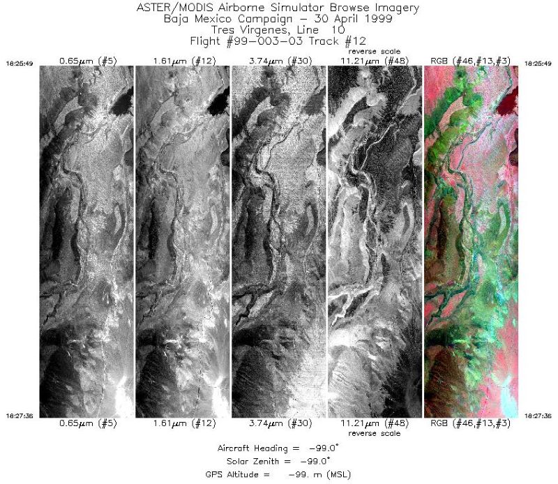
Federal
MASTER: Airborne Science, Baja Mexico-Nevada, April-May, 1999
National Aeronautics and Space Administration —
This dataset includes Level 1B (L1B) data products from the MODIS/ASTER Airborne Simulator (MASTER) instrument. The spectral data were collected during 7 flights... -
Federal
MASTER: Airborne Science, California-Nevada, May-June, 2008
National Aeronautics and Space Administration —
This dataset includes Level 1B (L1B) and Level 2 (L2) data products from the MODIS/ASTER Airborne Simulator (MASTER) instrument. The spectral data were collected as... -
Federal
MASTER: Airborne Science, Nevada, May 2006
National Aeronautics and Space Administration —
This dataset includes Level 1B (L1B) data products from the MODIS/ASTER Airborne Simulator (MASTER) instrument. The spectral data were collected during five flights... -
Federal
Water Quality and Spectral Reflectance, Peace-Athabasca Delta, Canada, 2010-2011
National Aeronautics and Space Administration —
The Peace-Athabasca Delta (PAD) is a hydrologically complex and ecologically diverse freshwater delta formed by the confluence of the Peace, Athabasca, and Birch... -
Federal
PhenoCam Dataset v3.0: Vegetation Phenology from Digital Camera Imagery, 2000-2023
National Aeronautics and Space Administration —
This dataset provides vegetation phenological observations for 738 sites across diverse ecosystems of the world (mostly North America) from 2000 to 2023. The... -
Federal
Pre-LBA ABLE-2A and ABLE-2B Expedition Data
National Aeronautics and Space Administration —
The ABLE 2A and 2B (Atmospheric Boundary Layer Experiments) data consists of estimates of the rate of exchange of a wide variety of aerosols and gases between the... -
Federal
Simulated Fine Particulate Matter (PM2.5) Estimates over Alaska, 2001-2015
National Aeronautics and Space Administration —
The dataset provides simulated PM2.5 concentration estimates over Alaska, U.S. PM2.5 (particulate matter with diameter <= 2.5 microns) concentrations in air... -
Federal
Global Soil Types, 0.5-Degree Grid (Modified Zobler)
National Aeronautics and Space Administration —
A global data set of soil types is available at 0.5-degree latitude by 0.5-degree longitude resolution. There are 106 soil units, based on Zobler?s (1986) assessment... -
Federal
Delta-X: AVIRIS-NG BRDF-Adjusted Surface Reflectance and Mosaics, MRD, LA, 2021, V3
National Aeronautics and Space Administration —
This data provides AVIRIS-NG Bidirectional Reflectance Distribution Function (BRDF) and sunglint-corrected surface spectral reflectance images over the Atchafalaya... -
Federal
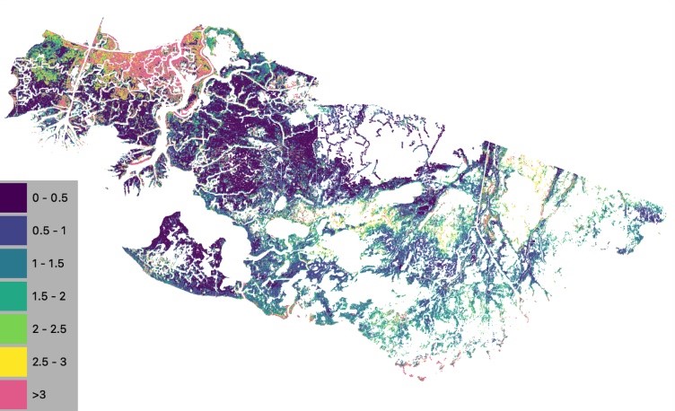
Delta-X: NUMAR Soil Accretion Modeled to 2100, MRD, Louisiana, USA
National Aeronautics and Space Administration —
This dataset holds modeled estimates of soil accretion for the Atchafalaya and Terrebonne basins in the Mississippi River Delta of coastal Louisiana, U.S. Soil... -
Federal
COMEX: Flight Information for AJAX Airborne In Situ CO2 and CH4, 2014-2015, USA
National Aeronautics and Space Administration —
This dataset provides information to access NASA Earthdata published flight data and flight information collected by the Alpha Jet Atmospheric eXperiment (AJAX) and... -
Federal
Annual Land Use and Urban Land Cover: Ethiopia, Nigeria, and South Africa, 2016-2020
National Aeronautics and Space Administration —
This dataset provides a two-tier annual Land Use (LU) and Urban Land Cover (LC) product suite over three African countries, Ethiopia, Nigeria, and South Africa,...

Official websites use .gov
A
.gov website belongs to an official government
organization in the United States.
Secure .gov websites use HTTPS
A
lock (
) or https:// means you’ve safely connected to
the .gov website. Share sensitive information only on official,
secure websites.