
-
Federal
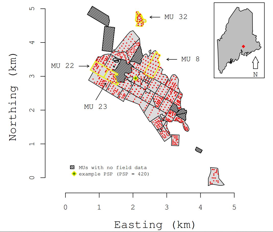
CMS: Aboveground Biomass from Penobscot Experimental Forest, Maine, 2012
National Aeronautics and Space Administration —
This data set includes estimates of aboveground biomass (AGB) in 2012 from the Penobscot Experimental Forest (PEF) in Bradley, Maine. The AGB was modeled using LiDAR... -
Federal
STAQS AVIRIS-NG-derived Methane and Carbon Dioxide Plumes, 2023
National Aeronautics and Space Administration —
This dataset contains enhanced column-integrated methane (CH4) and carbon dioxide (CO2) (concentration lengths) acquired from 211 flight lines across North America... -
Federal
Northern and Mid-Latitude Soil Database, Version 1, R1
National Aeronautics and Space Administration —
The U.S. Department of Agriculture, Agriculture and Agri-Food Canada, the Russian Academy of Agricultural Sciences, the University of Copenhagen Institute of... -
Federal
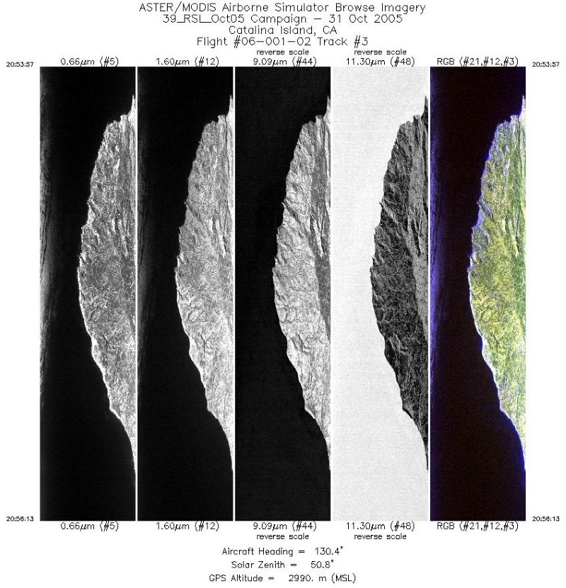
MASTER: Geological Earth Mapping Experiment (GEMx), Spring 2024
National Aeronautics and Space Administration —
This dataset includes Level 1B (L1B) data products from the MODIS/ASTER Airborne Simulator (MASTER) instrument. The spectral data were collected during 26 flights... -
Federal
MASTER: Airborne Science, Catalina Island, California, October 2005
National Aeronautics and Space Administration —
This dataset includes Level 1B (L1B) data products from the MODIS/ASTER Airborne Simulator (MASTER) instrument. The spectral data were collected during one flight... -
Federal
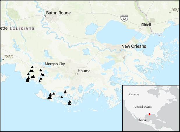
Delta-X: Acoustic Doppler Current Profiler Channel Surveys, MRD, Louisiana, 2021, V2
National Aeronautics and Space Administration —
This dataset provides river discharge measurements collected at selected locations in the Atchafalaya and Terrebonne Basins within the Mississippi River Delta (MRD)... -
Federal
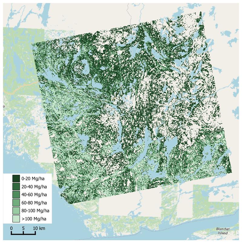
Aboveground Biomass from SAR, Great Slave Lake Region, NWT, 2019
National Aeronautics and Space Administration —
This dataset holds aboveground biomass (ABG) estimates for areas in the Great Slave Lake Region in the Northwest Territories of Canada for 2019. ABG was estimated... -
Federal
ABoVE: Photochemical Reflectance and Tree Growth, Brooks Range, Alaska, 2018-2019
National Aeronautics and Space Administration —
This dataset provides simultaneous in-situ measurements of the photochemical reflectance index (PRI) and radial tree growth of selected white spruce trees (Picea... -
Federal
BOREAS CanSIS Regional Soils Data in Vector Format, V2
National Aeronautics and Space Administration —
This data set contains soils data from the Canada Soil Information System (CanSIS) in ESRI Shapefile format for the provinces of Saskatchewan and Manitoba. They are... -
Federal
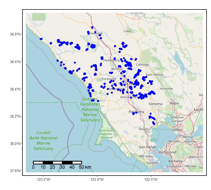
Soundscapes to Landscapes Acoustic Recordings, Sonoma County, CA, 2017-2022
National Aeronautics and Space Administration —
This dataset holds in situ sound recordings from sites in Sonoma County, California, USA as part of the Soundscapes to Landscapes citizen science project. Recordings... -
Federal
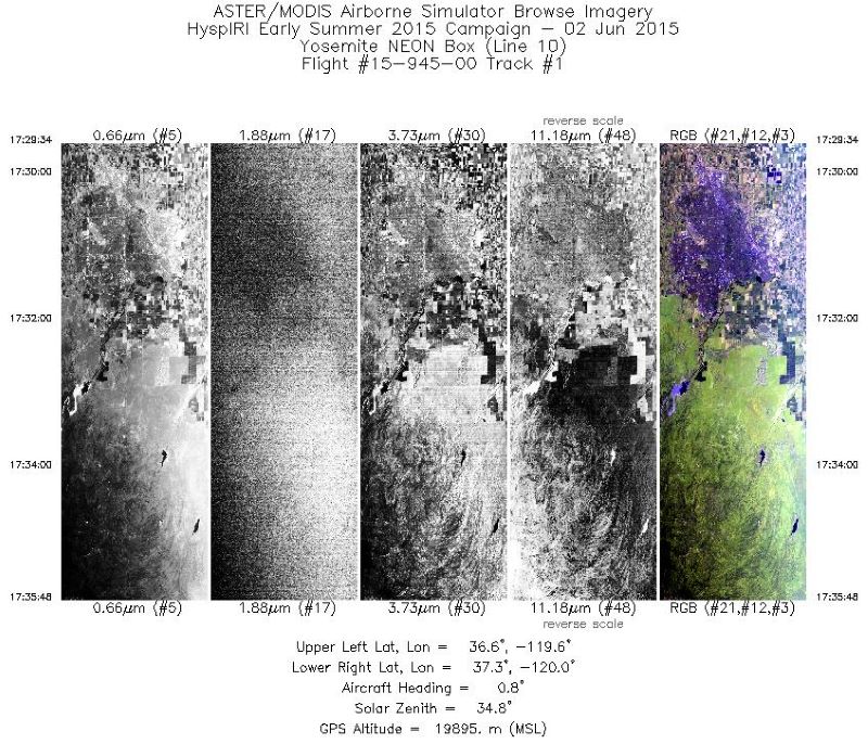
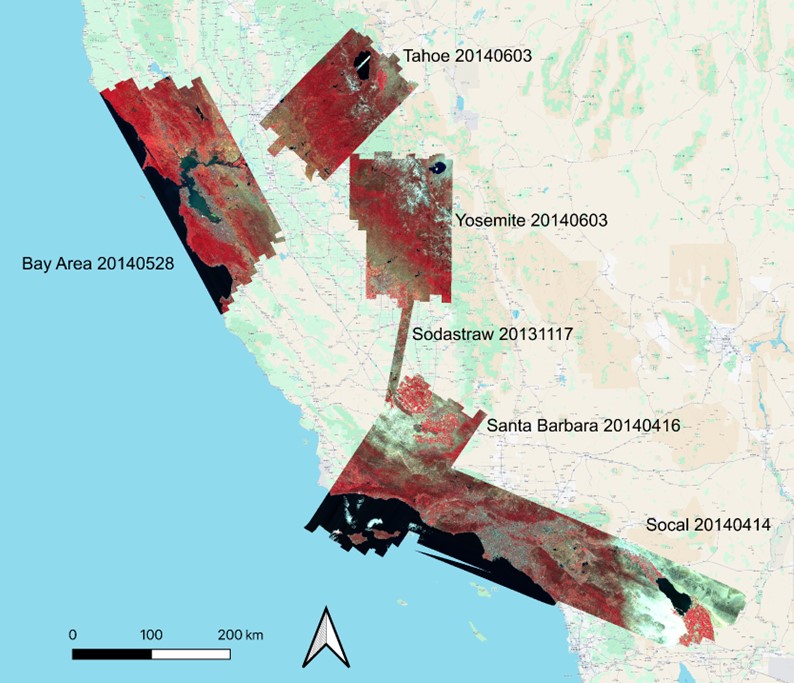
MASTER: HyspIRI Airborne Campaign, California, Summer 2015
National Aeronautics and Space Administration —
This dataset includes Level 1B (L1B) and Level 2 (L2) data products from the MODIS/ASTER Airborne Simulator (MASTER) instrument. The spectral data were collected as... -
Federal
WDTS: AVIRIS-Classic L2B Corrected and Georectified Surface Reflectance, 2013-2018
National Aeronautics and Space Administration —
This dataset includes Level-2 (L2) surface reflectance imagery from the AVIRIS-Classic instrument collected for NASA's Western Diversity Time Series Project over... -
Federal
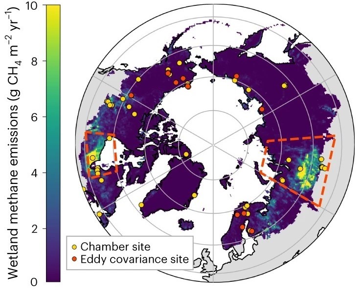
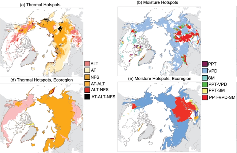
Trends of Thermal, Wetness, and Vegetative Change in the Circumpolar Arctic
National Aeronautics and Space Administration —
This dataset provides estimates of trends in temperature, moisture, and vegetation changes over the circumpolar Arctic. Time series trends were measured by the Theil-... -
Federal
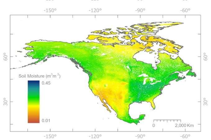
NASMo-TiAM 250m 16-day North America Surface Soil Moisture Dataset
National Aeronautics and Space Administration —
This NASMo-TiAM (North America Soil Moisture Dataset Derived from Time-Specific Adaptable Machine Learning Models) dataset holds gridded estimates of surface soil... -
Federal
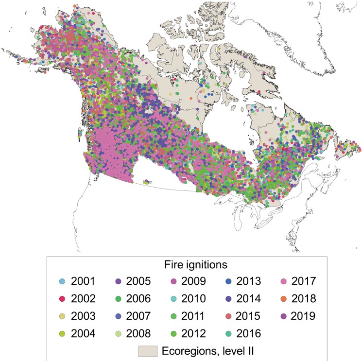
ABoVE: Ignitions of ABoVE-FED Fires in Alaska and Canada
National Aeronautics and Space Administration —
This dataset provides daily fire ignition locations and timing for boreal fires in Alaska, U.S., and Canada between 2001 and 2019. The fire ignition locations and... -
Federal
ABoVE: Distribution Maps of Wildland Fire Fuel Components across Alaskan Tundra, 2015
National Aeronautics and Space Administration —
This dataset provides maps of the distribution of three major wildland fire fuel types at 30 m spatial resolution covering the Alaskan arctic tundra, circa 2015. The... -
Federal
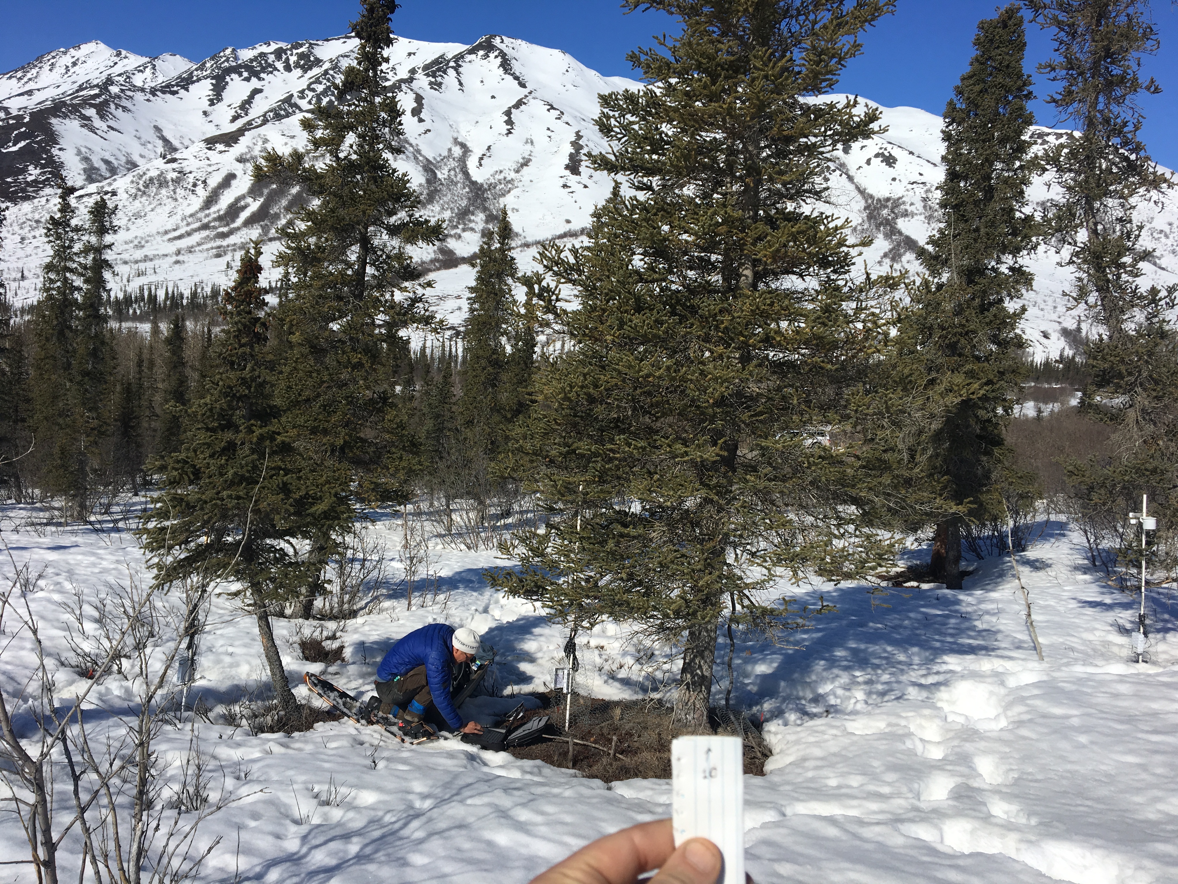
ABoVE: Soil Active Layer Thaw Depths at CRREL sites near Fairbanks, Alaska, 2014-2018
National Aeronautics and Space Administration —
This dataset provides soil active layer thaw depth measurements collected along transects at three sites near Fairbanks, Alaska, USA. Measurements were made during... -
Federal
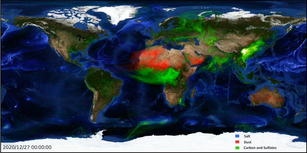
ATom: GEOS-5 Derived Meteorological Conditions and Tagged Tracers Along Flight Tracks
National Aeronautics and Space Administration —
This dataset provides modeled meteorological conditions and tagged-CO tracer concentrations along ATom flight paths derived from the Goddard Earth Observing System...

Official websites use .gov
A
.gov website belongs to an official government
organization in the United States.
Secure .gov websites use HTTPS
A
lock (
) or https:// means you’ve safely connected to
the .gov website. Share sensitive information only on official,
secure websites.