
-
Federal
Northern and Mid-Latitude Soil Database, Version 1, R1
National Aeronautics and Space Administration —
The U.S. Department of Agriculture, Agriculture and Agri-Food Canada, the Russian Academy of Agricultural Sciences, the University of Copenhagen Institute of... -
Federal
ABoVE: Boreal Forest Resilience Study 2020-2022, Fairbanks AK
National Aeronautics and Space Administration —
This dataset includes five metrics of forest resilience (recruitment, invasives, permafrost change, tree damage, and radial growth) at five recently burned forest... -
Federal
STAQS AVIRIS-NG-derived Methane and Carbon Dioxide Plumes, 2023
National Aeronautics and Space Administration —
This dataset contains enhanced column-integrated methane (CH4) and carbon dioxide (CO2) (concentration lengths) acquired from 211 flight lines across North America... -
Federal
MASTER: Geological Earth Mapping Experiment (GEMx), Spring 2024
National Aeronautics and Space Administration —
This dataset includes Level 1B (L1B) data products from the MODIS/ASTER Airborne Simulator (MASTER) instrument. The spectral data were collected during 26 flights... -
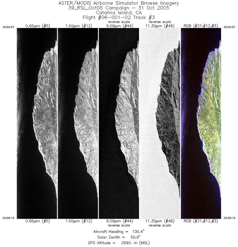
Federal
MASTER: Airborne Science, Catalina Island, California, October 2005
National Aeronautics and Space Administration —
This dataset includes Level 1B (L1B) data products from the MODIS/ASTER Airborne Simulator (MASTER) instrument. The spectral data were collected during one flight... -
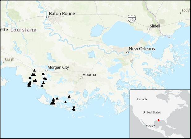
Federal
Delta-X: Acoustic Doppler Current Profiler Channel Surveys, MRD, Louisiana, 2021, V2
National Aeronautics and Space Administration —
This dataset provides river discharge measurements collected at selected locations in the Atchafalaya and Terrebonne Basins within the Mississippi River Delta (MRD)... -
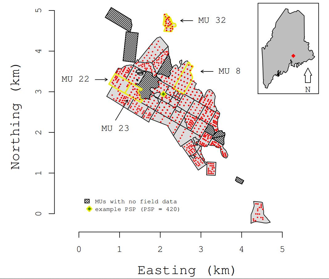
Federal
CMS: Aboveground Biomass from Penobscot Experimental Forest, Maine, 2012
National Aeronautics and Space Administration —
This data set includes estimates of aboveground biomass (AGB) in 2012 from the Penobscot Experimental Forest (PEF) in Bradley, Maine. The AGB was modeled using LiDAR... -
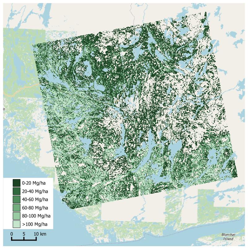
Federal
Aboveground Biomass from SAR, Great Slave Lake Region, NWT, 2019
National Aeronautics and Space Administration —
This dataset holds aboveground biomass (ABG) estimates for areas in the Great Slave Lake Region in the Northwest Territories of Canada for 2019. ABG was estimated... -
Federal
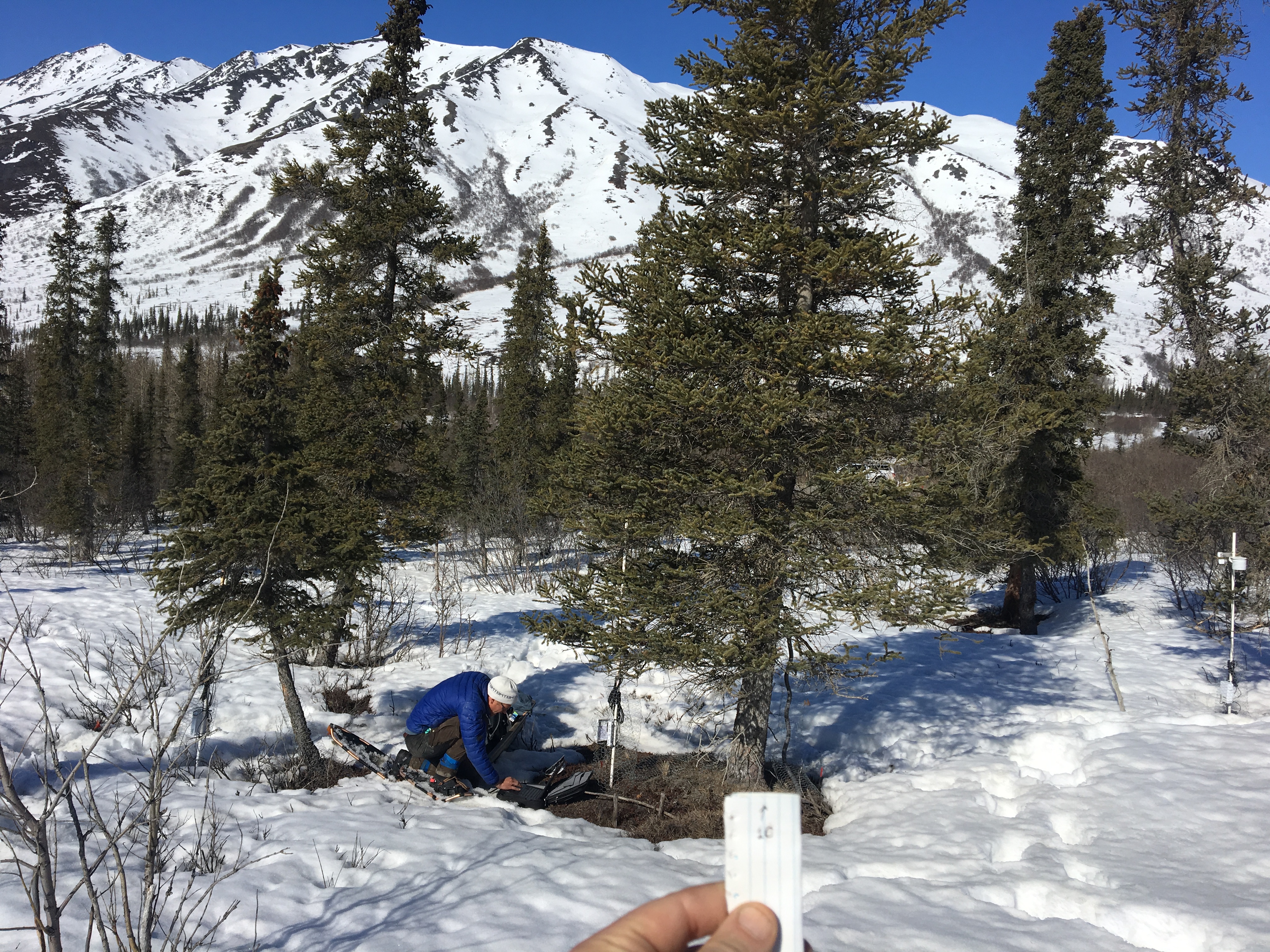
ABoVE: Photochemical Reflectance and Tree Growth, Brooks Range, Alaska, 2018-2019
National Aeronautics and Space Administration —
This dataset provides simultaneous in-situ measurements of the photochemical reflectance index (PRI) and radial tree growth of selected white spruce trees (Picea... -
Federal
ABoVE: Passive Microwave-derived Annual Snowpack Main Melt Onset Date Maps, 1988-2018
National Aeronautics and Space Administration —
This dataset provides the annual date of snowpack seasonal beginning melt (i.e., main melt onset date, MMOD) across northwest Canada; Alaska, U.S.; and parts of far... -
Federal
MASTER: FireSense, western US, October 2023
National Aeronautics and Space Administration —
This dataset includes Level 1B (L1B) data products from the MODIS/ASTER Airborne Simulator (MASTER) instrument. The spectral data were collected as part of the... -
Federal
Land Surface Phenology, Eddy Covariance Tower Sites, North America, 2017-2021
National Aeronautics and Space Administration —
This land surface phenology (LSP) dataset provides spatially explicit data related to the timing of phenological changes such as the start, peak, and end of... -
Federal
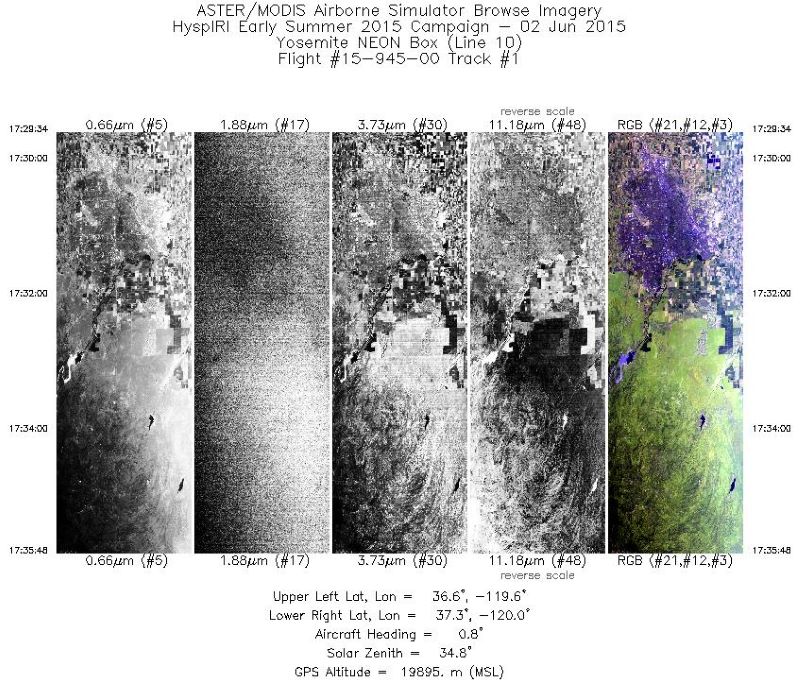
MASTER: HyspIRI Airborne Campaign, California, Summer 2015
National Aeronautics and Space Administration —
This dataset includes Level 1B (L1B) and Level 2 (L2) data products from the MODIS/ASTER Airborne Simulator (MASTER) instrument. The spectral data were collected as... -
Federal
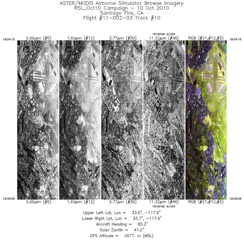
MASTER: Airborne Science, California-Arizona-Jornada, October, 2010
National Aeronautics and Space Administration —
This dataset includes Level 1B (L1B) data products from the MODIS/ASTER Airborne Simulator (MASTER) instrument. The spectral data were collected during six flights... -
Federal
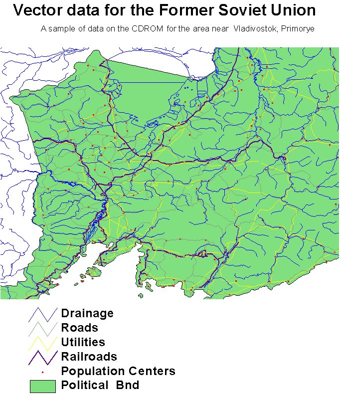
RLC Selected Infrastructure Data for the Former Soviet Union, 1993
National Aeronautics and Space Administration —
This data set consists of roads, drainage, railroads, utilities, and population center information in readily usable vector format for the land area of the Former... -
Federal
WDTS: AVIRIS-Classic L2B Corrected and Georectified Surface Reflectance, 2013-2018
National Aeronautics and Space Administration —
This dataset includes Level-2 (L2) surface reflectance imagery from the AVIRIS-Classic instrument collected for NASA's Western Diversity Time Series Project over... -
Federal
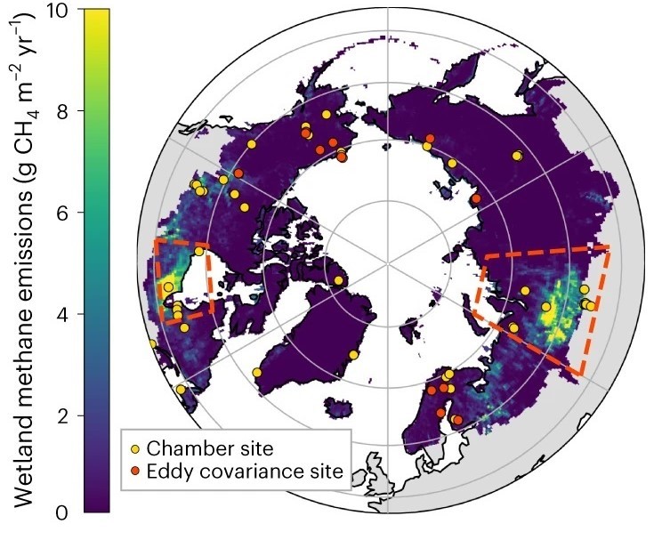
Trends of Thermal, Wetness, and Vegetative Change in the Circumpolar Arctic
National Aeronautics and Space Administration —
This dataset provides estimates of trends in temperature, moisture, and vegetation changes over the circumpolar Arctic. Time series trends were measured by the Theil-... -
Federal
Pre-ABoVE: L1 S-0 Polarimetric Data from AirMOSS P-band SAR, Alaska, 2014-2015
National Aeronautics and Space Administration —
This data set provides level 1 (L1) polarimetric radar backscattering coefficient (sigma-0), multi-look complex, polarimetrically calibrated, and georeferenced data... -
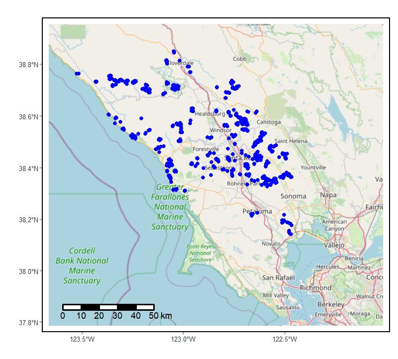
Federal
Soundscapes to Landscapes Acoustic Recordings, Sonoma County, CA, 2017-2022
National Aeronautics and Space Administration —
This dataset holds in situ sound recordings from sites in Sonoma County, California, USA as part of the Soundscapes to Landscapes citizen science project. Recordings...

Official websites use .gov
A
.gov website belongs to an official government
organization in the United States.
Secure .gov websites use HTTPS
A
lock (
) or https:// means you’ve safely connected to
the .gov website. Share sensitive information only on official,
secure websites.