

6 datasets found for "Youth--Statistics"
-
Federal
NASA-SSH ENSO Sea Surface Height Indicator
National Aeronautics and Space Administration —
This file contains an indicator for the El Nino-Southern Oscillation (ENSO), based on satellite observations of sea surface height anomaly, measured by radar... -
Federal
NASA-SSH IOD Sea Surface Height Indicator
National Aeronautics and Space Administration —
This file contains an indicator for the Indian Ocean Dipole (IOD), based on satellite observations of sea surface height anomaly, measured by radar altimeter missions... -
Federal
GHRSST L3C NOAA/ACSPO GOES-18/ABI America Region Sea Surface Temperature v2.90 dataset
National Aeronautics and Space Administration —
The G18-ABI-L3C-ACSPO-v2.90 dataset produced by the NOAA Advanced Clear Sky Processor for Ocean (ACSPO) system is used to derive Sea Surface Skin Temperature (SST)... -
Federal
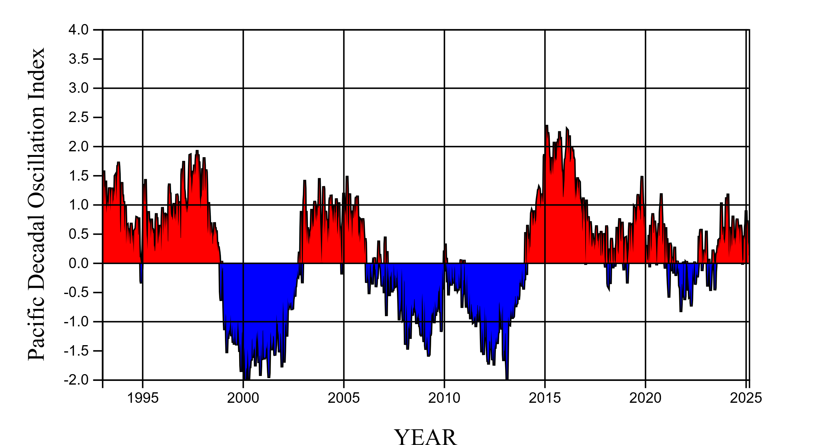
NASA-SSH PDO Sea Surface Height Indicator
National Aeronautics and Space Administration —
This file contains an indicator for the Pacific Decadal Oscillation (PDO), based on satellite observations of sea surface height anomaly, measured by radar altimeter... -
Federal
GHRSST Level 2P Global Sea Surface Skin Temperature from the Moderate Resolution Imaging Spectroradiometer (MODIS) on the NASA Aqua satellite (GDS2)
National Aeronautics and Space Administration —
NASA produces skin sea surface temperature (SST) products from the Infrared (IR) channels of the Moderate-resolution Imaging Spectroradiometer (MODIS) onboard the... -
Federal
GHRSST Level 2P Global Sea Surface Skin Temperature from the Moderate Resolution Imaging Spectroradiometer (MODIS) on the NASA Terra satellite (GDS2)
National Aeronautics and Space Administration —
NASA produces skin sea surface temperature (SST) products from the Infrared (IR) channels of the Moderate-resolution Imaging Spectroradiometer (MODIS) onboard the...
6 datasets found for "Youth--Statistics"