

7 datasets found for "PA真人靠谱吗✅澳门葡京赌场官方网站-网址【079.one】㊙️最火爆PG电子超高爆奖率,注册即送38元.wzrwfsVMtPMi"
-
Federal
NASA-SSH ENSO Sea Surface Height Indicator
National Aeronautics and Space Administration —
This file contains an indicator for the El Nino-Southern Oscillation (ENSO), based on satellite observations of sea surface height anomaly, measured by radar... -
Federal
SWOT Level 2 Nadir Altimeter Operational Geophysical Data Record with Waveforms Version 1.0
National Aeronautics and Space Administration —
The SWOT Level 2 Nadir Altimeter Operational Geophysical Data Record (OGDR) with Waveforms Version 1.0 dataset produced by the Surface Water and Ocean Topography... -
Federal
Hourly Ocean Bottom Pressure at the North Pole from the Arctic Bottom Pressure Recorder Follow On Version 1.0
National Aeronautics and Space Administration —
This dataset provides the first year of hourly ocean bottom pressure measurements at the North Pole from the Arctic Bottom Pressure Recorder - Follow On (ABPR-FO)... -
Federal
NASA-SSH IOD Sea Surface Height Indicator
National Aeronautics and Space Administration —
This file contains an indicator for the Indian Ocean Dipole (IOD), based on satellite observations of sea surface height anomaly, measured by radar altimeter missions... -
Federal
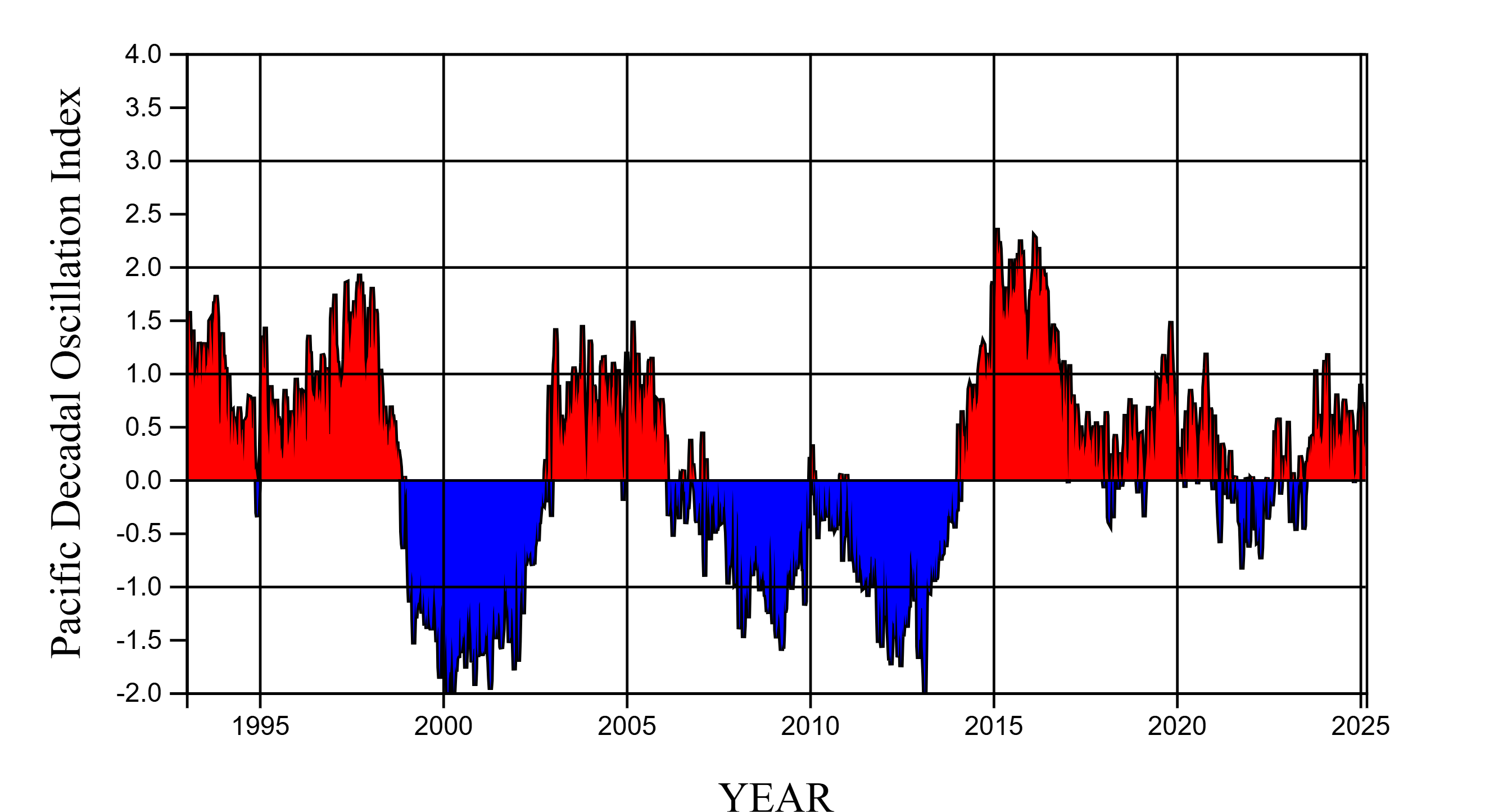
NASA-SSH PDO Sea Surface Height Indicator
National Aeronautics and Space Administration —
This file contains an indicator for the Pacific Decadal Oscillation (PDO), based on satellite observations of sea surface height anomaly, measured by radar altimeter... -
Federal
SWOT Postlaunch Oceanography Field Campaign L2 Moorings
National Aeronautics and Space Administration —
The SWOT Postlaunch Oceanography Field Campaign L2 Moorings collection provides the surface air pressure, GPS, current velocity, and conductivity, temperature and...
7 datasets found for "PA真人靠谱吗✅澳门葡京赌场官方网站-网址【079.one】㊙️最火爆PG电子超高爆奖率,注册即送38元.wzrwfsVMtPMi"