
-
Federal
Sentinel-5P TROPOMI Tropospheric NO2 1-Orbit L2 7km x 3.5km V1 (S5P_L2__NO2___) at GES DISC
National Aeronautics and Space Administration —
Starting from August 6th in 2019, Sentinel-5P TROPOMI along-track high spatial resolution (~5.5km at nadir) has been implemented. For data after August 6th of 2019,... -
Federal
IRIS/Nimbus-4 Level 1 Radiance Data V001 (IRISN4RAD) at GES DISC
National Aeronautics and Space Administration —
The Nimbus-4 Infrared Interferometer Spectrometer (IRIS) Level 1 Radiance Data contain thermal emissions of the Earth's atmosphere at wave numbers between 400 and... -
Federal
AIRS/Aqua L2 Near Real Time (NRT) Cloud-Cleared Infrared Radiances (AIRS-only) V006 (AIRS2CCF_NRT) at GES DISC
National Aeronautics and Space Administration —
The Atmospheric Infrared Sounder (AIRS) Level 2 Near Real Time (NRT) Cloud-Cleared Infrared Radiances (AIRS-only) product (AIRS2CCF_NRT_006) differs from the routine... -
Federal
Sentinel-5P TROPOMI Tropospheric Formaldehyde HCHO 1-Orbit L2 7km x 3.5km V1 (S5P_L2__HCHO__) at GES DISC
National Aeronautics and Space Administration —
Starting from August 6th in 2019, Sentinel-5P TROPOMI along-track high spatial resolution (~5.5km at nadir) has been implemented. Starting from July 13th in 2020,... -
Federal
MODIS/Aqua Temp and Water Vapor Profiles 5km 5-Min L2 Narrow Swath Subset along CloudSat V002 (MAC07S0) at GES DISC NGDA
National Aeronautics and Space Administration —
This is the narrow-swath MODIS/Aqua subset along CloudSat field of view track. The goal of the narrow-swath subset is to select and return MODIS data that are within... -
Federal
Sentinel-5P TROPOMI Methane CH4 1-Orbit L2 7km x 7km V1 (S5P_L2__CH4___) at GES DISC
National Aeronautics and Space Administration —
Starting from August 6th in 2019, Sentinel-5P TROPOMI along-track high spatial resolution (~5.5km at nadir) has been implemented. For data after August 6th of 2019,... -
Federal
Sentinel-5P TROPOMI Total Ozone Column 1-Orbit L2 7km x 3.5km V1 (S5P_L2__O3_TOT) at GES DISC
National Aeronautics and Space Administration —
Starting from August 6th in 2019, Sentinel-5P TROPOMI along-track high spatial resolution (~5.5km at nadir) has been implemented. Starting from July 13th in 2020,... -
Federal
MLS/Aura Near-Real-Time L2 Ozone (O3) Mixing Ratio V005 (ML2O3_NRT) at GES DISC
National Aeronautics and Space Administration —
ML2O3_NRT is the EOS Aura Microwave Limb Sounder (MLS) Near-Real-Time (NRT) product for ozone (O3). This product contains O3 profiles derived from the 240 GHz region.... -
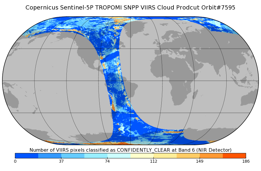
Federal
Sentinel-5P TROPOMI SNPP VIIRS cloud product band 6 (NIR detector) 1-Orbit L2 7km x 3.5km V1 (S5P_L2__NP_BD6) at GES DISC
National Aeronautics and Space Administration —
Starting from August 6th in 2019, Sentinel-5P TROPOMI along-track high spatial resolution (~5.5km at nadir) has been implemented. For data after August 6th of 2019,... -
Federal
MLS/Aura Near-Real-Time L2 Nitric Acid (HNO3) Mixing Ratio V005 (ML2HNO3_NRT) at GES DISC
National Aeronautics and Space Administration —
ML2HNO3_NRT is the EOS Aura Microwave Limb Sounder (MLS) Near-Real-Time (NRT) product for nitric acid (HNO3). This product contains HNO3 profiles derived from the 190... -
Federal
THIR/Nimbus-7 Level 1 Calibrated Located Radiation Data at 6.7 and 11.5 microns V001 (THIRN7L1CLDT) at GES DISC
National Aeronautics and Space Administration —
THIRN7L1CLDT is the Nimbus-7 Temperature-Humidity Infrared Radiometer (THIR) Level 1 Calibrated Located Radiation Data (CLDT) at 6.7 and 11.5 microns product and... -
Federal
OMI/Aura and MODIS/Aqua Merged Cloud Product 1-Orbit L2 Swath 13x24 km V003 (OMMYDCLD) at GES DISC NGDA
National Aeronautics and Space Administration —
The OMI/Aura and MODIS/Aqua Merged Cloud Product 1-Orbit L2 Swath 13x24 km (OMMYDCLD) is a Level-2 orbital product that combines cloud parameters retrieved by the... -
Federal
MODIS/Aqua CLD Mask Spect. Results 250m and 1km 5-Min L2 Wide Swath Subset along CloudSat V002 (MAC35S1) at GES DISC NGDA
National Aeronautics and Space Administration —
This is the wide-swath MODIS/Aqua subset along CloudSat field of view track. The goal of the wide-swath subset is to select and return MODIS data that are within... -
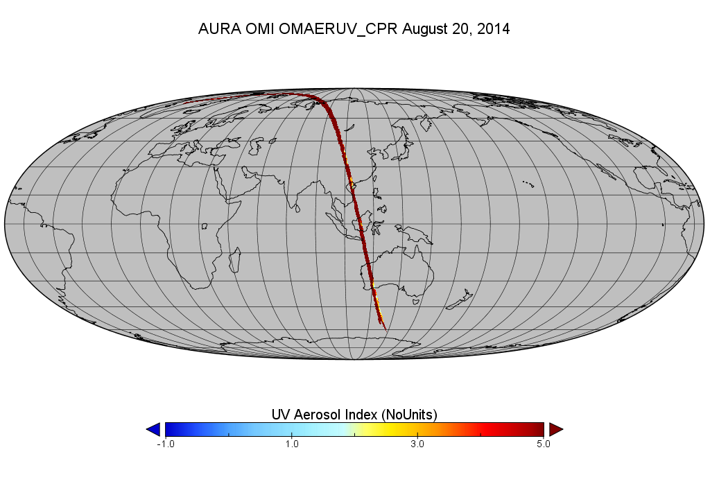
Federal
OMI/Aura Level 2 Near UV Aerosol Optical Depth and Single Scattering Albedo 200-m swath subset along CloudSat track V003 (OMAERUV_CPR) at GES DISC
National Aeronautics and Space Administration —
This is a CloudSat-collocated subset of the original OMI product OMAERUV, for the purposes of the A-Train mission. The goal of the subset is to select and return OMI... -
Federal
MODIS/Aqua Geolocation Fields 1km 5-Min 1A Swath Subset along MLS V002 (MAM03S0) at GES DISC NGDA
National Aeronautics and Space Administration —
This is the MODIS/Aqua subset along the Microwave Limb Sounder (MLS) field of view track. The goal of the subset is to select and return MODIS data that are within... -
Federal
AIRS/Aqua L2 Near Real Time (NRT) Support Retrieval (AIRS-only) V006 (AIRS2SUP_NRT) at GES DISC
National Aeronautics and Space Administration —
The Atmospheric Infrared Sounder (AIRS) Level 2 Near Real Time (NRT) Support Retrieval (AIRS-only) product (AIRS2SUP_NRT_006) differs from the routine product... -
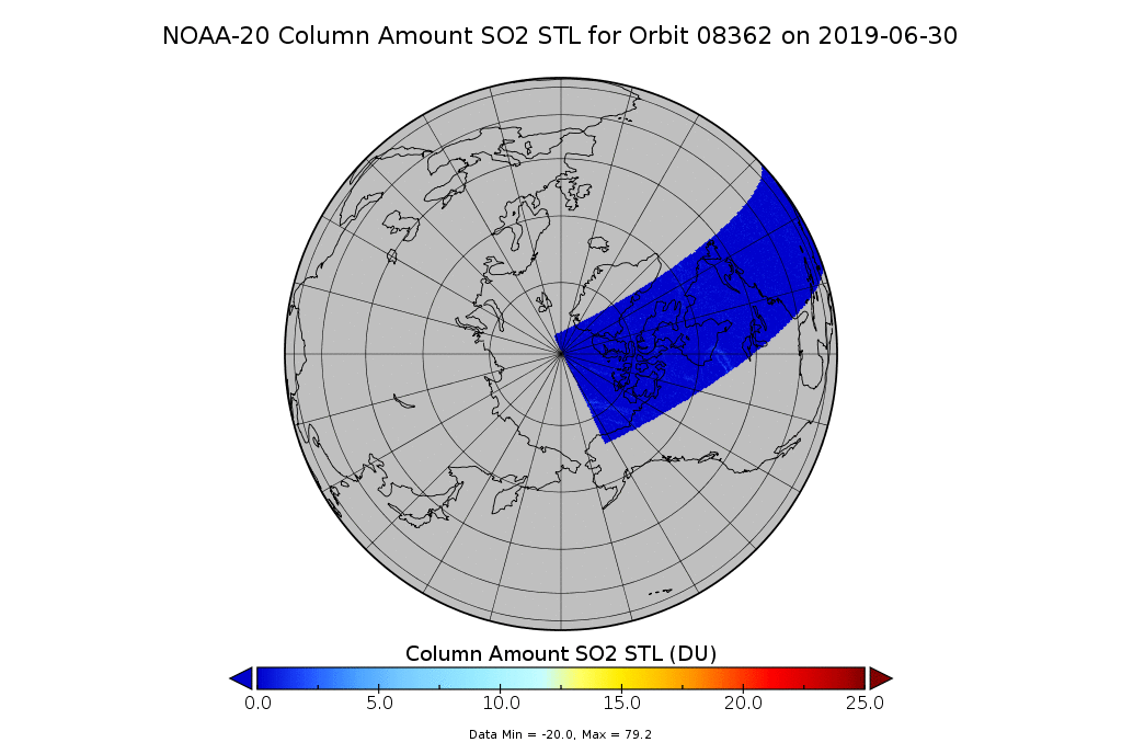
Federal
OMPS-N20 NM PCA SO2 Step 1 Total Column 1-Orbit L2 Swath 17x13km
National Aeronautics and Space Administration —
The OMPS-N20_NM_PCA_SO2 Step1 Total Column 1-Orbit L2 Swath 17x13km collection 1 product contains the retrieved sulfur dioxide (SO2) measured by the Ozone Mapping and... -
Federal
MLS/Aura Near-Real-Time L2 Water Vapor (H2O) Mixing Ratio V005 (ML2H2O_NRT) at GES DISC
National Aeronautics and Space Administration —
ML2H2O_NRT is the EOS Aura Microwave Limb Sounder (MLS) Near-Real-Time (NRT) product for water vapor (H2O). This product contains H2O profiles derived from the 190... -
Federal
Sentinel-5P TROPOMI SNPP VIIRS cloud product band 6 (NIR detector) 1-Orbit L2 5.5km x 3.5km V1 (S5P_L2__NP_BD6_HiR) at GES DISC
National Aeronautics and Space Administration —
Starting from August 6th in 2019, Sentinel-5P TROPOMI along-track high spatial resolution (~5.5km at nadir) has been implemented. For data before August 6th of 2019,... -
Federal
TROPICS05 L2B Tropical Cyclone Intensity Estimate (TCIE) Algorithm V1.0
National Aeronautics and Space Administration —
The "Time-Resolved Observations of Precipitation structure and storm Intensity with a Constellation of Smallsats" (TROPICS) mission has a goal of providing nearly...

Official websites use .gov
A
.gov website belongs to an official government
organization in the United States.
Secure .gov websites use HTTPS
A
lock (
) or https:// means you’ve safely connected to
the .gov website. Share sensitive information only on official,
secure websites.