
-
Federal
SAGE III Meteor-3M L2 Monthly Cloud Presence Data (Native) V004
National Aeronautics and Space Administration —
A monthly data file coincident with solar event granules, that provides information about cloud presence during data capture of the granules -
Federal
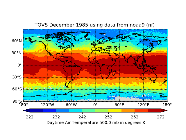
TOVS GLA DAILY GRIDS from NOAA-9 V01 (TOVSADNF) at GES DISC
National Aeronautics and Space Administration —
This dataset (TOVSADNF) contains the TIROS Operational Vertical Sounder (TOVS) level 3 geophysical parameters derived using data from NOAA-9 and the physical... -
Federal
NCDC feed of Global Telecommunication System (GTS) marine observations in International Maritime Meteorological Archive (IMMA) Format
National Oceanic and Atmospheric Administration, Department of Commerce —
The data contained here are surface marine observations from many different sources via the NCDC Global Telecommunication System (GTS) Marine in International... -
Federal
Aeronet Solar Flux
National Aeronautics and Space Administration —
SolRad-Net (Solar Radiation Network) is an established network of ground-based sensors providing high-frequency solar flux measurements in quasi-realtime to the... -
Federal
Sounder SIPS: Suomi NPP CrIMSS Level 2 CLIMCAPS Full Spectral Resolution: Atmosphere cloud and surface geophysical state V2 at GES DISC
National Aeronautics and Space Administration —
The CLIMCAPS (Community Long-term Infrared Microwave Coupled Product System) algorithm is used to analyze data from the Cross-track Infrared Sounder/Advanced... -
Federal
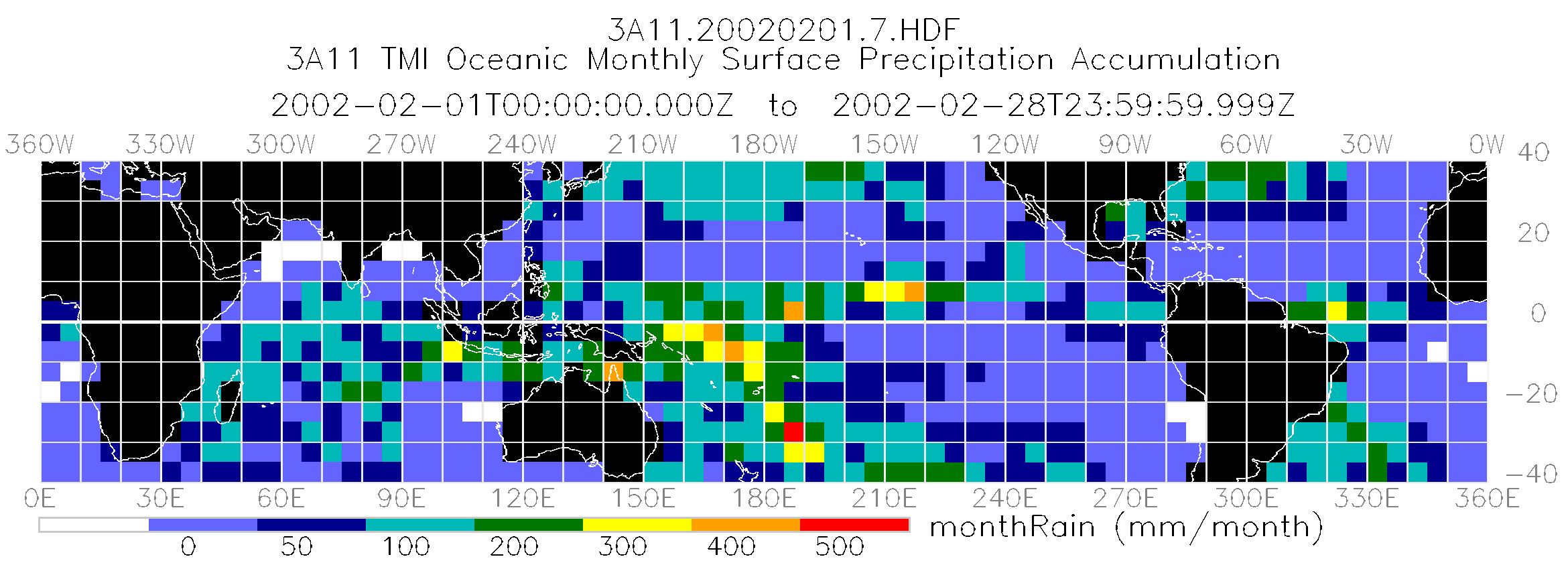
TRMM Microwave Imager Oceanic Rainfall L3 1 month 5 degree x 5 degree V7 (TRMM_3A11) at GES DISC
National Aeronautics and Space Administration —
The new equivalent for this dataset should be searched for as "GPM_3GPROFTRMMTMI_CLIM". The TMI Gridded Oceanic Rainfall Product, also known as TMI Emission, consists... -
Federal
AMSR-E/Aqua Monthly L3 Global Ascending/Descending .25x.25 deg Ocean Grids V002
National Aeronautics and Space Administration —
The Level-3 daily product (AE_DyOcn), weekly product (AE_WkOcn), and monthly product (AE_MoOcn) include SST, near-surface wind speed, columnar water vapor, and... -
Federal
Mirador - Water and Energy Cycles
National Aeronautics and Space Administration —
Earth Science data access made simple. Through water and energy cycle research we can improve hurricane prediction, quantify tropical rainfall and eventually begin to... -
Federal
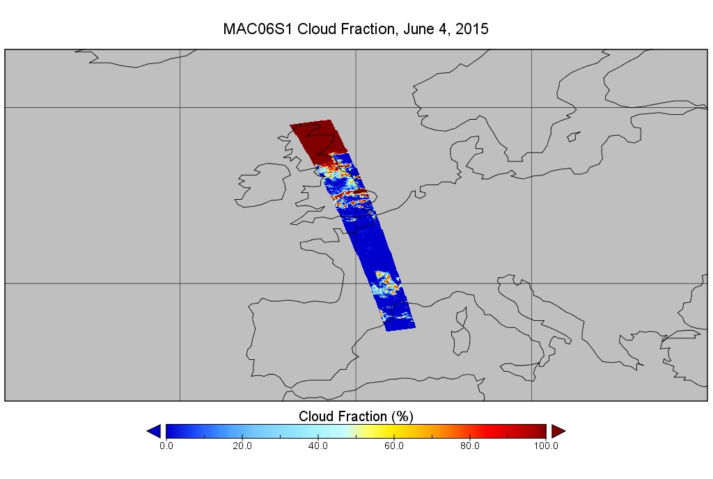
MODIS/Aqua Clouds 1km and 5km 5-Min L2 Swath Subset along MLS V002 (MAM06S0) at GES DISC NGDA
National Aeronautics and Space Administration —
This is the MODIS/Aqua subset along MLS field of view track. The goal of the subset is to select and return MODIS data that are within +-100 km across the MLS track.... -
Federal
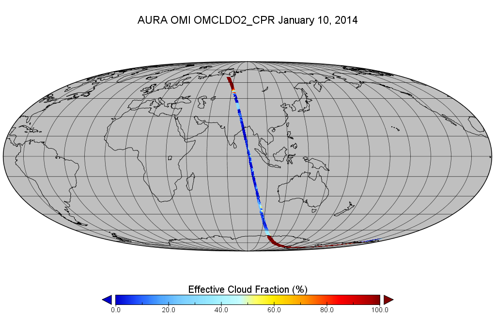
OMI/Aura Cloud Pressure and Fraction (O2-O2 Absorption) 200-km swath subset along CloudSat track V003 (OMCLDO2_CPR) at GES DISC
National Aeronautics and Space Administration —
This the OMI/Aura Cloud Pressure and Fraction (O2-O2 Absorption) subset along CloudSat track, for the purposes of the A-Train mission. The original product uses the... -
Federal
TOVS LMD 5 DAY GRIDS from NOAA-12 V01 (TOVSB5ND) at GES DISC
National Aeronautics and Space Administration —
Level 3 parameters from HIRS/2 and MSU radiances using the Improved Initialization Inversion (3I) classification retrieval scheme by the Laboratoire de Meteorologie... -
Federal
Fast Longwave And SHortwave Fluxes (FLASHflux) Clouds and Radiative Swath (SSF) TERRA-FM1 data in netCDF Version 4B
National Aeronautics and Space Administration —
FLASH_SSF_Terra-FM1-MODIS_Version4B is the Fast Longwave And Shortwave Radiative Fluxes (FLASHFlux) Clouds and Radiative Swath (SSF) TERRA-FM1 data in netCDF Version... -
Federal
CERES MODIS Cloud Retrievals in ISCCP-D2like Format Nighttime Aqua FM4 Edition3A NGDA
National Aeronautics and Space Administration —
CER_ISCCP-D2like-Nit_Aqua-FM4-MODIS_Edition3A is the Clouds and the Earth's Radiant Energy System (CERES) Moderate Resolution Imaging Spectroradiometer (MODIS) Cloud... -
Federal
TOVS GLA MONTHLY GRIDS from NOAA-12 V01 (TOVSAMND) at GES DISC
National Aeronautics and Space Administration —
This dataset (TOVSAMND) contains the TIROS Operational Vertical Sounder (TOVS) level 3 geophysical parameters derived using data from NOAA-12 and the physical... -
Federal
Cloud Regime for CRE Feedback Study
National Aeronautics and Space Administration —
Cloud-only regimes (and 3 sub-regimes of CR15) originally derived from Terra and Aqua observations in 50S-50N, and corresponding "regime numbers on map" files... -
Federal
Level 2.0 Almucantar Inversion Products Phase Functions
National Aeronautics and Space Administration —
AERONET inversion code provides aerosoloptical properties in the total atmospheric column derived from the direct and diffuse radiation measured byAERONETCimel... -
Federal
SAGE III Meteor-3M L2 Monthly Cloud Presence Data (HDF-EOS) V003
National Aeronautics and Space Administration —
A monthly data file coincident with solar event granules, that provides information about cloud presence during data capture of the granules -
Federal
Water Isotope System for Precipitation and Entrainment Research (WISPER) IMPACTS V1
National Aeronautics and Space Administration —
The Water Isotope System for Precipitation and Entrainment Research (WISPER) IMPACTS dataset consists of condensed water contents, water vapor measurements, and... -
Federal
SWOT Level 2 Radiometer Brightness Temperatures and Troposphere Operational Data Product Version 1.0
National Aeronautics and Space Administration —
The SWOT Level 2 Radiometer Brightness Temperatures and Troposphere Operational Geophysical Data Record (OGDR) Version 1.0 dataset produced by the Surface Water and... -
Federal
TOVS GLA MONTHLY GRIDS from NOAA-9 02 (TOVSAMNF) at GES DISC
National Aeronautics and Space Administration —
This dataset (TOVSAMNF) contains the TIROS Operational Vertical Sounder (TOVS) level 3 geophysical parameters derived using data from NOAA-9 and the physical...

Official websites use .gov
A
.gov website belongs to an official government
organization in the United States.
Secure .gov websites use HTTPS
A
lock (
) or https:// means you’ve safely connected to
the .gov website. Share sensitive information only on official,
secure websites.