

1,646 datasets found for "小旋风蜘蛛池模板小说自适应黑色站群模板07新版通用✅项目合作 二开均可 TG:saolei44✅.CcHbVYiODFlukJ"
-
Federal
GPM PR on TRMM Reflectivity, Precipitation Characteristics and Rate, at Surface and Profile L2 1.5 hours V07 (GPM_2APR) at GES DISC
National Aeronautics and Space Administration —
This is the new, GPM-like, format for TRMM Precipitation Radar L2 data that now incorporates what was known as 2A21, 2A23 and 2A25 datasets.The primary purpose of... -
Federal
GHRSST Level 2P Global skin Sea Surface Temperature from the Infrared Atmospheric Sounding Interferometer (IASI) on the Metop-B satellite (GDS V2) produced by OSI SAF
National Aeronautics and Space Administration —
A Group for High Resolution Sea Surface Temperature (GHRSST) Level 2P dataset based on multi-channel sea surface temperature (SST) retrievals generated in real-time... -
Federal
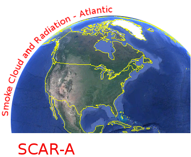
CAR SCAR-A Sulfates, Clouds, and Radiation-Atlantic BRDF Measurements BRDF V2 (CAR_SCARA_BRDF) at GES DISC
National Aeronautics and Space Administration —
The objectives for the SCAR mission are to advance our knowledge of how the physical, chemical and radiative processes in our atmosphere are affected by sulfate... -
Federal
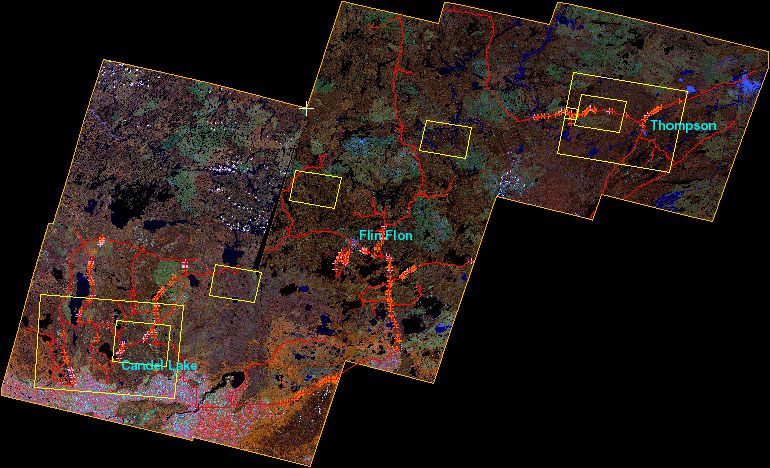
BOREAS Follow-On DSP-01 Landsat TM Land Cover Mosaic of the BOREAS Transect
National Aeronautics and Space Administration —
The objective of this land cover mosaic is to provide a data product that characterises the detailed land cover of a significant portion of the BOREAS Region. Seven... -
Federal
QuikSCAT Level 2B Ocean Wind Vectors in 12.5km Slice Composites Version 3
National Aeronautics and Space Administration —
This dataset contains the latest reprocessed version 3 of the Level 2B science-quality ocean surface wind vector retrievals from the QuikSCAT scatterometer. The... -
Federal
MODIS/Aqua Water Reservoir 8-Day L3 Global V061
National Aeronautics and Space Administration —
The Aqua Moderate Resolution Imaging Spectroradiometer (MODIS) Water Reservoir 8-Day Level 3 (L3) Global (MYD28C2) Version 6.1 product provides current data for 151...
1,646 datasets found for "小旋风蜘蛛池模板小说自适应黑色站群模板07新版通用✅项目合作 二开均可 TG:saolei44✅.CcHbVYiODFlukJ"