

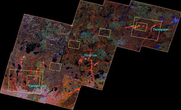
BOREAS Follow-On DSP-01 Landsat TM Land Cover Mosaic of the BOREAS Transect
Access & Use Information
Public: This dataset is intended for public access and use.
License: No license information was provided. If this work was prepared by an officer or employee of the United States government as part of that person's official duties it is considered a U.S. Government Work.
Downloads & Resources
-
Data Information (Unknown Format)BIN
-
Data Information (HTML)HTML
-
Data Information (ZIP)ZIP
BFO_dsp01_ccrs_tm_landcover_588.zip
-
Data Information (PNG)PNG
boreas_logo_square.png
-
Data Information (Unknown Format)BIN
0_readme.txt
-
Data Information (JPEG)JPEG
figure_1.jpg
-
Data Information (JPEG)JPEG
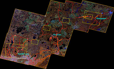
figure_1_sm.jpg
-
Data Information (PDF)PDF
dsp01_tm_landcover_doc.pdf
-
Landing PageLanding Page
Dates
| Metadata Created Date | April 11, 2025 |
|---|---|
| Metadata Updated Date | October 30, 2025 |
Metadata Source
- Data.json Data.json Metadata
Harvested from NASA Data.json
Additional Metadata
| Resource Type | Dataset |
|---|---|
| Metadata Created Date | April 11, 2025 |
| Metadata Updated Date | October 30, 2025 |
| Publisher | ORNL_DAAC |
| Maintainer | |
| Identifier | 10.3334/ORNLDAAC/588 |
| Data Last Modified | 2025-09-10 |
| Category | Earth Science |
| Public Access Level | public |
| Bureau Code | 026:00 |
| Metadata Context | https://project-open-data.cio.gov/v1.1/schema/catalog.jsonld |
| Schema Version | https://project-open-data.cio.gov/v1.1/schema |
| Catalog Describedby | https://project-open-data.cio.gov/v1.1/schema/catalog.json |
| Harvest Object Id | a520e8ee-e085-4caa-a6a5-33166e7699dc |
| Harvest Source Id | 58f92550-7a01-4f00-b1b2-8dc953bd598f |
| Harvest Source Title | NASA Data.json |
| Homepage URL | https://search.earthdata.nasa.gov/search?q=BFO_dsp01_ccrs_tm_landcover_588&ac=true |
| Old Spatial | {"WestBoundingCoordinate":-107.0,"NorthBoundingCoordinate":57.0,"EastBoundingCoordinate":-96.0,"SouthBoundingCoordinate":52.0},"CARTESIAN" |
| Program Code | 026:000 |
| Source Datajson Identifier | True |
| Source Hash | 16532a9e8b13f9dd07b22bd0943a1423effd0e59fd7cc56f7ea7a2f2bfc8fd72 |
| Source Schema Version | 1.1 |
| Spatial | |
| Temporal | 1991-08-09/1991-08-09 |
Didn't find what you're looking for? Suggest a dataset here.