
-
Federal
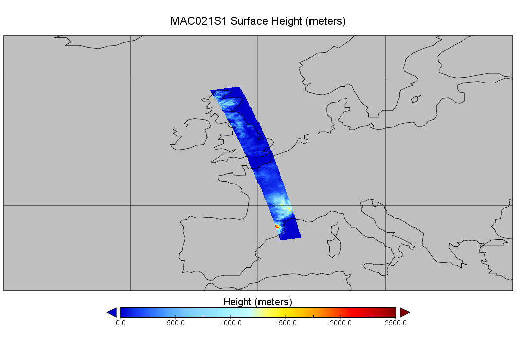
MODIS/Aqua Calibrated Radiances 250m 5-Min L1B Wide Swath Subset along CloudSat V002 (MAC02QS1) at GES DISC NGDA
National Aeronautics and Space Administration —
This is the wide-swath MODIS/Aqua subset along CloudSat field of view track. The goal of the wide-swath subset is to select and return MODIS data that are within... -
Federal
BOREAS/AES READAC 15-minute Surface Meteorological Data
National Aeronautics and Space Administration —
Canadian AES personnel collected and processed data related to surface atmospheric meteorological conditions over the BOREAS region. This data set contains 15 minute... -
Federal
TRMM Attitude and VIRS Packets and Header Record L1A V7 (TRMM_1A01) at GES DISC
National Aeronautics and Space Administration —
The Level-1A Product file, "1A01", is a concatenation of Header record, Spacecraft Attitude packets, VIRS Housekeeping Data packets, VIRS Science Data packets, QACs,... -
Federal
Sentinel-5P TROPOMI SNPP VIIRS cloud product band 6 (NIR detector) 1-Orbit L2 5.5km x 3.5km V2 (S5P_L2__NP_BD6_HiR) at GES DISC
National Aeronautics and Space Administration —
Starting from August 6th in 2019, Sentinel-5P TROPOMI along-track high spatial resolution (~5.5km at nadir) has been implemented. For data before August 6th of 2019,... -
Federal
MODIS/Aqua Cld Mask Spect. Test Results 5-Min L2 Swath Subset along MLS V002 (MAM35S0) at GES DISC NGDA
National Aeronautics and Space Administration —
This is the MODIS/Aqua subset along MLS field of view track. The goal of the subset is to select and return MODIS data that are within +-100 km across the MLS track.... -
Federal
SatCORPS CERES GEO Edition 4 Meteosat-10 Southern Hemisphere Version 1.0
National Aeronautics and Space Administration —
CER_GEO_Ed4_MET10_SH_V01 is the Satellite Cloud and Radiation Property retrieval System (SatCORPS) Clouds and the Earth's Radiant Energy System (CERES) Geostationary... -
Federal
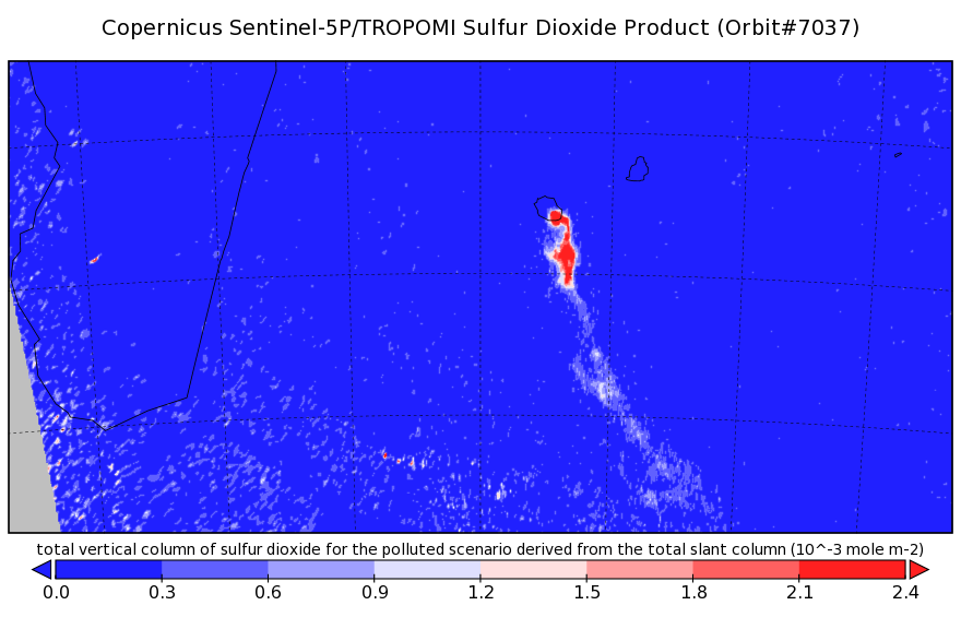
Sentinel-5P TROPOMI Sulphur Dioxide SO2 1-Orbit L2 7km x 3.5km V1 (S5P_L2__SO2___) at GES DISC
National Aeronautics and Space Administration —
Starting from August 6th in 2019, Sentinel-5P TROPOMI along-track high spatial resolution (~5.5km at nadir) has been implemented. Starting from July 13th in 2020,... -
Federal
VISSR/SMS-2 Level 1 Atmospheric and Oceanographic Image Processing System (AOIPS) Data V001 (VISSRSMS2L1AOIPS) at GES DISC
National Aeronautics and Space Administration —
VISSRSMS2L1AOIPS is the Visible Infrared Spin-Scan Radiometer (VISSR) Level 1 Atmospheric and Oceanographic Image Processing System (AOIPS) data product from the... -
Federal
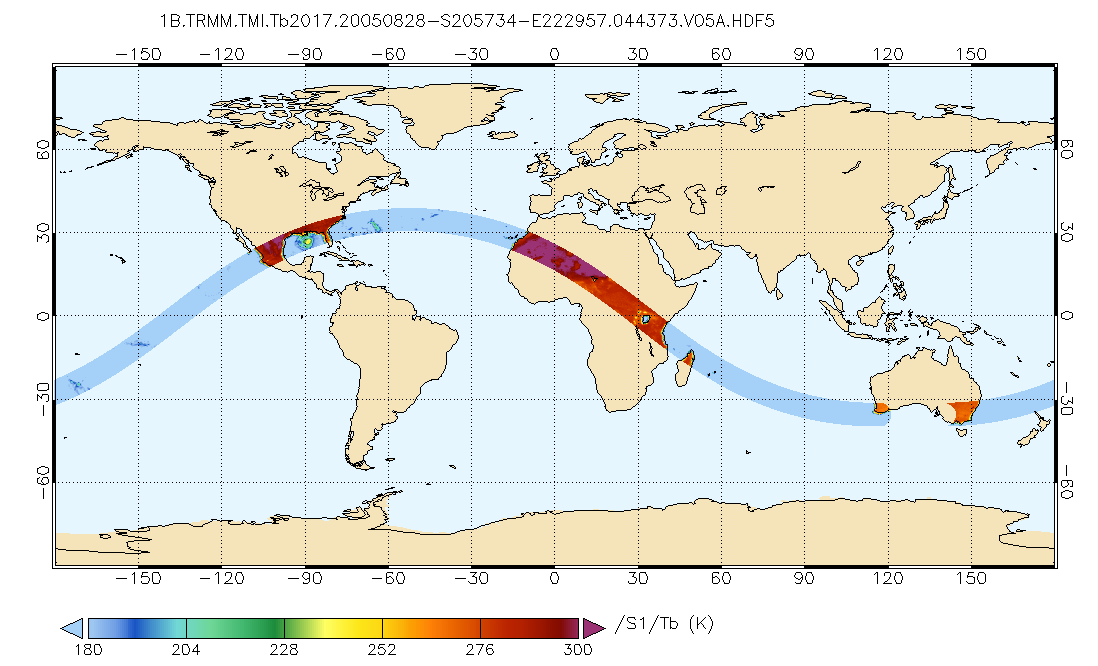
GPM TMI on TRMM Brightness Temperatures L1B 1.5 hours 13 km V07 (GPM_1BTMI) at GES DISC
National Aeronautics and Space Administration —
This is the new (GPM-formated) TRMM product. It replaces the old TRMM_1B11 Version 07 is the current version of the data set. Previous versions have been superseded... -
Federal
CERES Bidirectional Scans NPP FM-5 Edition2
National Aeronautics and Space Administration —
The Edition2 CERES BiDirectional Scans (BDS) for Flight Model 5 (FM5) on the Suomi NPP spacecraft (CER_BDS_NPP-FM5_Edition2) data are CERES geolocated and calibrated... -
Federal
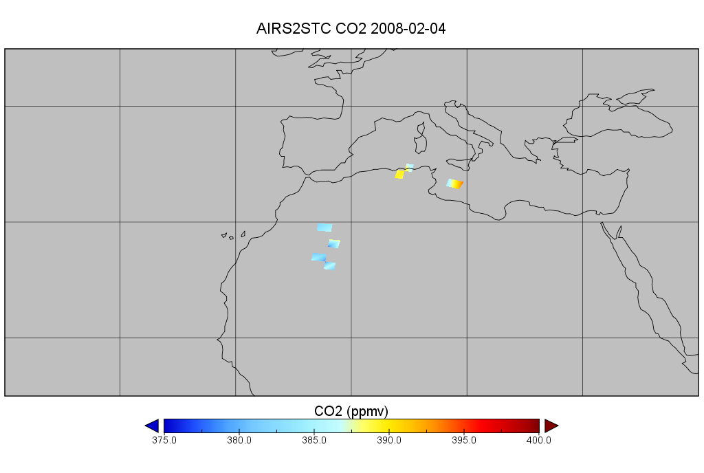
AIRS/Aqua L2 CO2 in the free troposphere (AIRS-only) V005 (AIRS2STC) at GES DISC
National Aeronautics and Space Administration —
The Atmospheric Infrared Sounder (AIRS) is a grating spectrometer (R = 1200) aboard the second Earth Observing System (EOS) polar-orbiting platform, EOS Aqua. In... -
Federal
HIRS/Nimbus-6 Level 1 Calibrated Radiances for the Global Atmospheric Research Program (GARP) V001 (HIRSN6L1GARP) at GES DISC
National Aeronautics and Space Administration —
The Nimbus-6 High Resolution Infrared Radiometer (HIRS) Level 1 Calibrated Radiances for the Global Atmospheric Research Program (GARP) data product contains daily... -
Federal
ECOSTRESS Tiled Ancillary NDVI and Albedo L2 Global 70 m V002
National Aeronautics and Space Administration —
The ECOsystem Spaceborne Thermal Radiometer Experiment on Space Station (ECOSTRESS) mission measures the temperature of plants to better understand how much water... -
Federal
GPM TMI on TRMM unpacked data L1A 1.5 hours 13 km V07 (GPM_1ATMI) at GES DISC
National Aeronautics and Space Administration —
This is the new (GPM-formated) TRMM product. It replaces the old TRMM_1A11 Version 07 is the current version of the data set. Previous versions have been superseded... -
Federal
CERES Single Scanner Footprint (SSF) TOA/Surface Fluxes, Clouds and Aerosols Aqua-FM4 Edition4A
National Aeronautics and Space Administration —
CER_SSF_Aqua-FM4-MODIS_Edition4A is the CERES Single Scanner Footprint (SSF) TOA/Surface Fluxes, Clouds and Aerosols Aqua-Flight Model 4 (FM4) Edition4A data product.... -
Federal
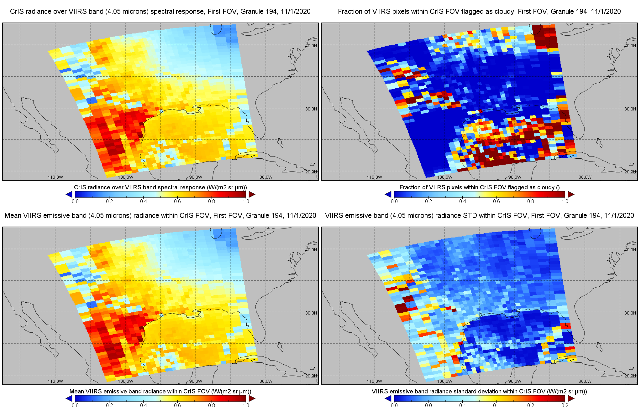
JPSS-1 CrIS IMG: Collocated VIIRS level 1 / cloud mask statistical summary V2 (SNDRJ1CrISL1BIMG) at GES DISC
National Aeronautics and Space Administration —
The Cross-track Infrared Sounder (CrIS) Level 1B Full Spectral Resolution (FSR) data files contain radiance measurements along with ancillary spacecraft, instrument,... -
Federal
CERES Bidirectional Scans Aqua FM3 Edition4
National Aeronautics and Space Administration —
CER_BDS_Aqua-FM3_Edition4 is the Clouds and the Earth's Radiant Energy System (CERES) Bidirectional Scans (BDS) Aqua Flight Model 3 (FM3) Edition 4 data product,... -
Federal
ISLSCP II Monthly Snow-Free Albedo, 1982-1998, and Background Soil Reflectance
National Aeronautics and Space Administration —
This data set contains monthly average snow-free surface shortwave albedo calculated for the period 1982-1998 and estimates of background soil/litter reflectances in... -
Federal
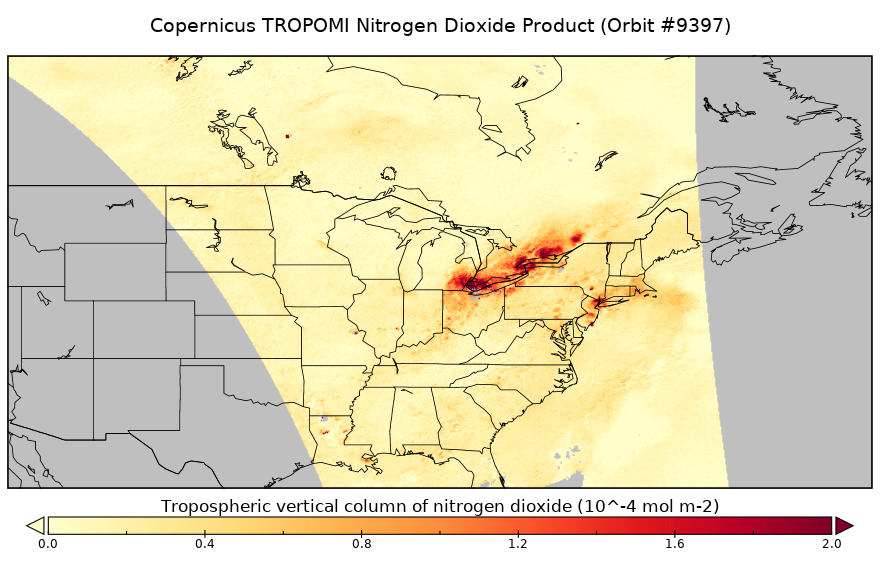
Sentinel-5P TROPOMI Near-Real-Time (NRT) Tropospheric NO2 1-Orbit L2 5.5km x 3.5km V2 (S5P_L2__NO2____HiR_NRT) at GES DISC
National Aeronautics and Space Administration —
The Sentinel-5P TROPOMI Near Real Time (NRT) Tropospheric NO2 1-Orbit L2 5.5km x 3.5km V2 (S5P_L2__NO2_HiRNRT) at GES DISC is the near real time version of the...

Official websites use .gov
A
.gov website belongs to an official government
organization in the United States.
Secure .gov websites use HTTPS
A
lock (
) or https:// means you’ve safely connected to
the .gov website. Share sensitive information only on official,
secure websites.