
-
Federal
TROPESS Chemical Reanalysis Surface NO 2-Hourly 2-dimensional Product V1 (TRPSCRNO2H2D) at GES DISC
National Aeronautics and Space Administration —
The TROPESS Chemical Reanalysis NO 2-Hourly 2-dimensional Product contains surface concentrations of nitric oxide. The data are part of the Tropospheric Chemical... -
Federal
VIIRS/NOAA20 Deep Blue Aerosol L2 6-Min Swath 6 km
National Aeronautics and Space Administration —
The VIIRS/NOAA20 Deep Blue Aerosol L2 6-Min Swath 6 km product from the Visible Infrared Imaging Radiometer Suite (VIIRS) determines atmospheric aerosol loading for... -
Federal
VIIRS/NPP Vegetation Indices Monthly L3 Global 0.05Deg CMG V001
National Aeronautics and Space Administration —
The VNP13C2 VIIRS Version 1 data product was decommissioned on April 8th, 2025. Users are encouraged to use Version 2 data products, which provideFederalVIIRS/NPP Land Surface Temperature and Emissivity 6-Min L2 Swath 750 m
National Aeronautics and Space Administration —
The Near Real Time (NRT) VIIRSLand Surface Temperature and Emissivity 6-Min L2 Swath 750m product (VNP21_NRT) uses a physics-based algorithm to dynamically retrieve...FederalVIIRS/NPP BRDF/Albedo Parameter 3 NIR Daily L3 Global 30 ArcSec CMG V002
National Aeronautics and Space Administration —
The NASA/NOAA Suomi National Polar-orbiting Partnership (Suomi NPP) Visible Infrared Imaging Radiometer Suite (VIIRS) Bidirectional Reflectance Distribution Function...FederalVIIRS/NOAA20 Deep Blue Level 3 monthly aerosol data, 1x1 degree grid
National Aeronautics and Space Administration —
The VIIRS/NOAA20 Deep Blue Level 3 monthly aerosol data, 1x1 degree grid, Short-name AERDB_M3_VIIRS_NOAA20 product is derived from the Version-2.0 (V2.0) daily L3...FederalVIIRS/JPSS1 Atmospherically Corrected Surface Reflectance 6-Min L2 Swath 375m, 750m
National Aeronautics and Space Administration —
The VIIRS/JPSS1 Atmospherically Corrected Surface Reflectance 6-Min L2 Swath 375m, 750m product, with short name VJ109, are estimates of surface reflectance in each...FederalVIIRS/NPP Moderate Resolution Terrain-Corrected Geolocation L1 6-Min Swath 750 m
National Aeronautics and Space Administration —
The VIIRS/NPP Moderate Resolution Terrain-Corrected Geolocation 6-Min L1 Swath 750 m product, short-name VNP03MOD, contains the derived line-of-sight (LOS) vectors...FederalSAFARI 2000 Organic Soil Carbon and Nitrogen Data (Zinke et al.)
National Aeronautics and Space Administration —
The data set contains a subset of the Worldwide Organic Soil Carbon and Nitrogen (Zinke et al. 1986) data set for southern Africa. The data were obtained from soil...FederalSAFARI 2000 Cloud Physics Lidar (CPL) Quicklook Images and Maps
National Aeronautics and Space Administration —
The effect of clouds and aerosols on regional and global climate is of great importance. Two longstanding elements of the NASA climate and radiation science program...FederalSAFARI 2000 LAI and FPAR Measurements at Sua Pan, Botswana, Dry Season 2000
National Aeronautics and Space Administration —
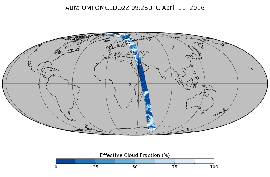
The Multi-angle Imaging SpectroRadiometer (MISR) Validation team was deployed to the Sua Pan salt playa in the Magkadigkadi region of Botswana during the SAFARI 2000...FederalOMI/Aura Cloud Pressure and Fraction (O2-O2 Absorption) Zoomed 1-Orbit L2 Swath 13x12km V003 (OMCLDO2Z) at GES DISC
National Aeronautics and Space Administration —
The reprocessed Aura Ozone Monitoring Instrument (OMI) Level-2 zoomed cloud data product OMCLDO2Z at 13x12 km resolution is now available from the NASA Goddard Earth...FederalOMI/Aura Level 1B Solar Irradiances V003 (OML1BIRR) at GES DISC
National Aeronautics and Space Administration —
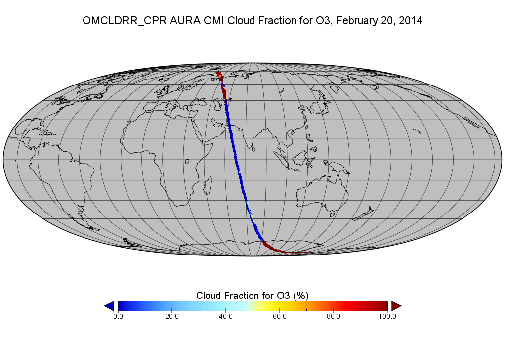
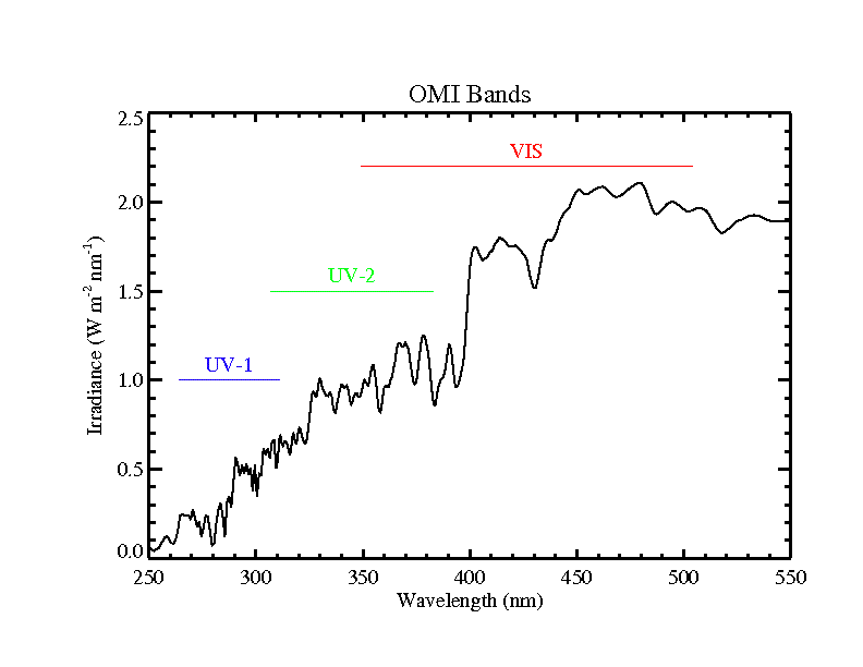
The OMI Level 1B solar irradiance product is the radiometrically calibrated and geolocated measurements of the UV and Visible channels of the spectral solar...FederalOMI/Aura Cloud Pressure and Fraction (Raman Scattering) 200-km swath subset along CloudSat track V003 (OMCLDRR_CPR) at GES DISC
National Aeronautics and Space Administration —
This is the OMI/Aura Cloud Pressure and Fraction (Raman Scattering) subset along CloudSat tracks, for the purposes of the A-Train mission. The original data product...FederalOMPS-NPP L2 NM Nitrogen Dioxide (NO2) Total and Tropospheric Column swath orbital V2 (OMPS_NPP_NMNO2_L2) at GES DISC
National Aeronautics and Space Administration —
The OMPS-NPP L2 NM Nitrogen Dioxide (NO2) Total and Tropospheric Column swath orbital collection 2 version 2.0 product contains the retrieved nitrogen dioxide (NO2)...FederalOMPS-N20 NM PCA SO2 Step 1 Total Column 1-Orbit L2 Swath 17x13km NRT
National Aeronautics and Space Administration —
The OMPS-N20 NM PCA SO2 Step1 Total Column 1-Orbit L2 Swath 17x13km collection 1 product contains the retrieved sulfur dioxide (SO2) measured by the Ozone Mapping and...FederalOMI/Aura Level 1B UV Zoom-in Geolocated Earthshine Radiances V004 (OML1BRUZ) at GES DISC
National Aeronautics and Space Administration —
The Aura Ozone Monitoring Instrument (OMI) Level 1B (L1B) Geolocated Earthshine UV Radiance, Zoom-mode (shortname OML1BRUZ) Version 4 product contains geolocated...FederalSounder SIPS: JPSS-1 CrIS Level 3 Comprehensive Quality Control Gridded Monthly CLIMCAPS V2 (SNDRJ1IML3CMCCP) at GES DISC
National Aeronautics and Space Administration —
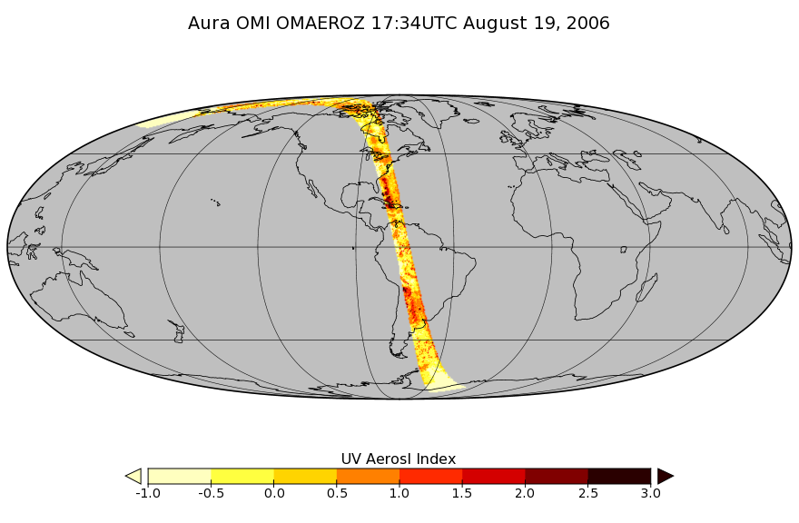
WARNING: To users of the derived product “co_mmr_midtrop” (carbon monoxide mass mixing ratio to dry air [kg/kg] at ~500 hPa). This variable has a significant bias due...FederalOMI/Aura Aerosol product Multi-wavelength Algorithm Zoomed 1-Orbit L2 Swath 13x12km V003 (OMAEROZ) at GES DISC
National Aeronautics and Space Administration —
The reprocessed OMI/Aura Level-2 Zoomed Aerosol data product OMAEROZ at 13x12 km resolution have been made available from the NASA Goddard Earth Sciences Data and...FederalOMI/Aura Chlorine Dioxide (OClO) Total Column 1-orbit L2 Swath 13x24 km V003 (OMOCLO) at GES DISC
National Aeronautics and Space Administration —
The Aura Ozone Monitoring Instrument (OMI) collection-3 Chlorine Dioxide Product OMOCLO is now available from the NASA Goddard Earth Sciences Data and Information...14,469 datasets found for "JSON"

Official websites use .gov
A
.gov website belongs to an official government
organization in the United States.
Secure .gov websites use HTTPS
A
lock (
) or https:// means you’ve safely connected to
the .gov website. Share sensitive information only on official,
secure websites.