
-
Federal
HFradar TAMU GERG
National Oceanic and Atmospheric Administration, Department of Commerce —
High Frequency (HF) radar in Gulf of Mexico. TAMU data from a local source. -
Federal
PDS Cassini Data Release 23
National Aeronautics and Space Administration —
CDA, CIRS, HRD, ISS, MAG, RADAR, RPWS, RSS, SPICE, UVIS, VIMS -
Federal
PDS Cassini Data Release 26
National Aeronautics and Space Administration —
CAPS, HRD, INMS, ISS, MAG, MIMI, RADAR, RPWS, RSS, SPICE, UVIS, VIMS -
Federal
GPM GROUND VALIDATION NOAA S-BAND PROFILER RAW DATA NETCDF FORMAT MC3E V1
National Aeronautics and Space Administration —
The GPM Ground Validation NOAA S-Band Profiler Raw Data NetCDF Format MC3E dataset was gathered during the Midlatitude Continental Convective Clouds Experiment (MC3E)... -
Federal
TRMM Ground Validation Radar Reflectivity Single Level Cartesian Grid 1 hour V7 (TRMM_baseUW) at GES DISC
National Aeronautics and Space Administration —
This dataset is part of the University of Washington TRMM Ground Validation products. Data contains single level, cartesian grids containing output of NCAR SPRINT... -
Federal
Currents, HF Radar, Puerto Rico and the US Virgin Islands, RTV, Near-Real Time, 2012-present, Hourly, 6km
National Oceanic and Atmospheric Administration, Department of Commerce —
Surface ocean velocities estimated from HF-Radar are representative of the upper 2.4 meters of the ocean. The main objective of near-real time processing is to... -
Federal
CAMEX-3 LiDAR Atmospheric Sensing Experiment (LASE) Imagery V1
National Aeronautics and Space Administration —
The CAMEX-3 LiDAR Atmospheric Sensing Experiment (LASE) Imagery dataset is a browse-only dataset that consists of plotted reflectivity data collected by the LiDAR... -
Federal
Active Transportation Demand Management (ATDM) Trajectory Level Validation
Department of Transportation —
The ATDM Trajectory Validation project developed a validation framework and a trajectory computational engine to compare and validate simulated and observed vehicle... -
Federal
SMAP_L1B_SIGMA_NAUGHT_LOW_RES_V003
National Aeronautics and Space Administration —
SMAP Level 1B Sigma Naught Low Res Product Version 3 -
Federal
Rutgers, Realtime Waves 13mhz CMPT
National Oceanic and Atmospheric Administration, Department of Commerce —
Mid-Atlantic Regional Association Coastal Ocean Observing System (MARACOOS) Wave Heights. Ocean Wave Heights. Center for Ocean Observing and Leadership, Department of... -
Federal
SMAP_L1C_SIGMA_NAUGHT_HIGH_RES_V001
National Aeronautics and Space Administration —
SMAP Level 1C Sigma Naught High Res Product -
Federal
Radar - ANL Wind Profiler with RASS, Yakima - Raw Data
Department of Energy —
Overview Winds A radar wind profiler measures the Doppler shift of electromagnetic energy scattered back from atmospheric turbulence and hydrometeors along 3-5... -
Federal
Desert Peak Geodatabase for Geothermal Exploration Artificial Intelligence
Department of Energy —
These files contain the geodatabases related to the Desert Peak Geothermal Field. It includes all input and output files used in the project. The files include data... -
Federal
SMAP/Sentinel-1 L2 Radiometer/Radar 30-Second Scene 3 km EASE-Grid Soil Moisture V003
National Aeronautics and Space Administration —
This Level-2 (L2) soil moisture product provides estimates of land surface conditions retrieved by both the Soil Moisture Active Passive (SMAP) radiometer during 6:00... -
Federal
Radar - 915MHz - Leeds, ND - Raw Data
Department of Energy —
Overview Raw data captured from the NOAA ESRL website: https://www.esrl.noaa.gov/psd/data/obs/data/ Hourly Radar Winds (WwWind) and Temperature (WwTemp) -
Federal
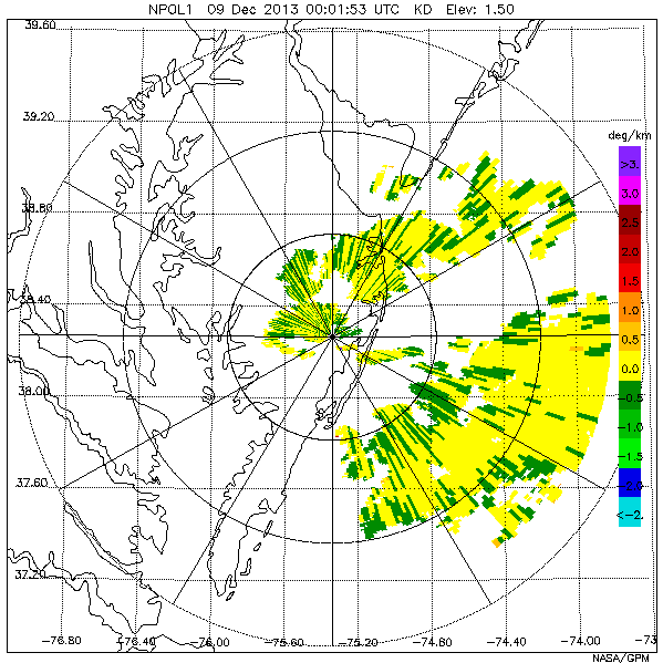
GPM Ground Validation NASA S-Band Dual Polarimetric (NPOL) Doppler Radar Wallops Flight Facility (WFF) V1
National Aeronautics and Space Administration —
The GPM Ground Validation NASA S-Band Dual-Polarimetric (NPOL) Doppler Radar Wallops Flight Facility (WFF) dataset consists of rain rate, reflectivity, Doppler... -
Federal
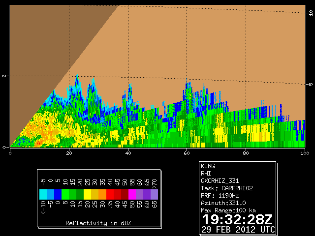
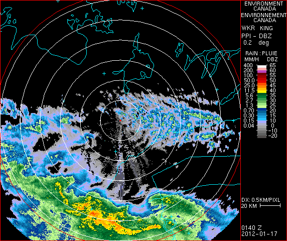
GPM GROUND VALIDATION DUAL POLARIZED C-BAND DOPPLER RADAR KING CITY GCPEX V1
National Aeronautics and Space Administration —
The GPM Ground Validation Dual Polarized C-Band Doppler Radar King City GCPEx dataset has special Range Height Indicator (RHI) and sector scans of several dual... -
Federal
Radar - ESRL Wind Profiler with RASS, Wasco Airport - Raw Data
Department of Energy —
Overview Winds A radar wind profiler measures the Doppler shift of electromagnetic energy scattered back from atmospheric turbulence and hydrometeors along 3-5... -
Federal
Land Ice: Greenland & Antarctic ice mass anomaly
National Aeronautics and Space Administration —
Data from NASA's Grace satellites show that the land ice sheets in both Antarctica and Greenland are losing mass. The continent of Antarctica (left chart) has been... -
Federal
PDS Cassini Data Release 32
National Aeronautics and Space Administration —
CIRS, ISS, RADAR, RPWS, SPICE, UVIS, VIMS

Official websites use .gov
A
.gov website belongs to an official government
organization in the United States.
Secure .gov websites use HTTPS
A
lock (
) or https:// means you’ve safely connected to
the .gov website. Share sensitive information only on official,
secure websites.