
-
Federal
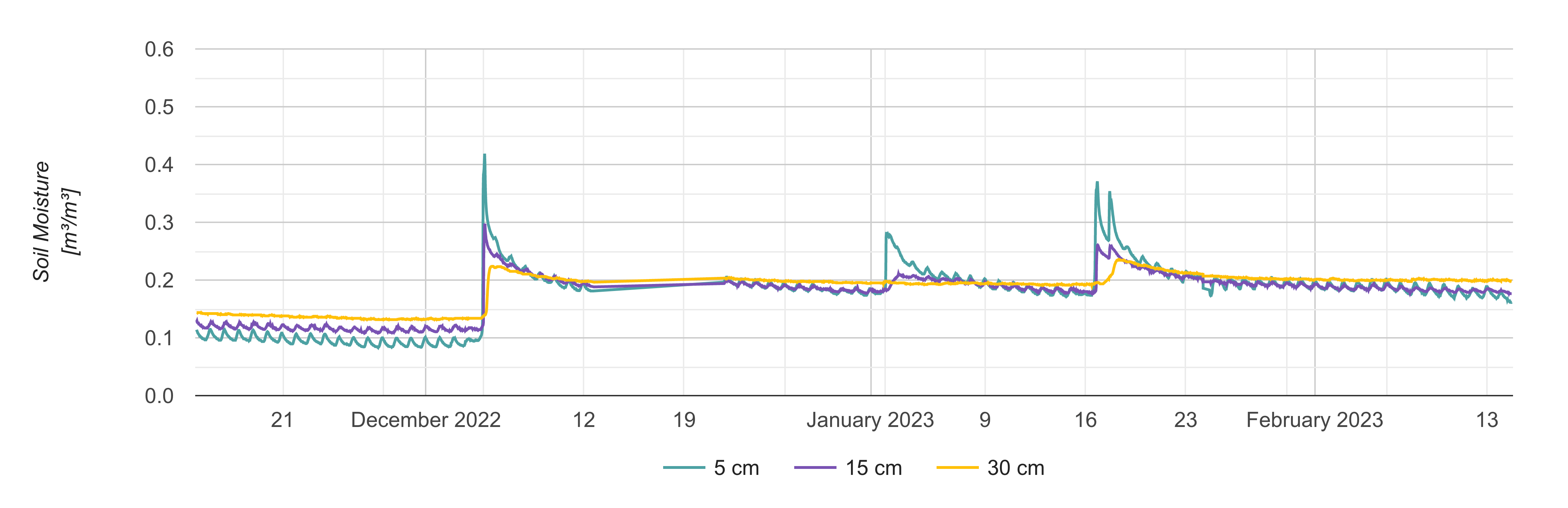
Site Averaged Neutron Soil Moisture: 1987 (Betts)
National Aeronautics and Space Administration —
The Site Averaged Neutron Soil Moisture Data: 1987 (Betts) Data Set contains the site averaged product data of the neutron probe soil moisture collected during the... -
Federal
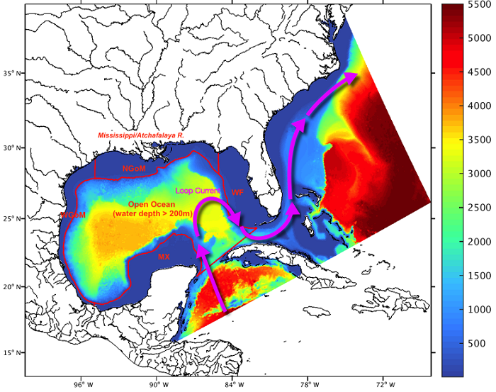
RSS CCMP Monthly 10 Meter Surface Winds Level 4 Version 3.1
National Aeronautics and Space Administration —
This data set contains a monthly-mean, 0.25 degree resolution, near-global gridded analysis of ocean surface winds (wind speed, components, and anomalies) from the... -
Federal
Optical Thickness Data: Staff (FIFE)
National Aeronautics and Space Administration —
Aerosol optical thickness in conjunction with an atmospheric model can provide estimates of atmospheric effects on transmitted and reflected solar radiation. These... -
Federal
AVIRIS-Classic: L2 Calibrated Reflectance, Facility Instrument Collection, V1
National Aeronautics and Space Administration —
This dataset contains Level 2 (L2) orthocorrected reflectance from the Airborne Visible / Infrared Imaging Spectrometer (AVIRIS-Classic) instrument. This is the NASA... -
Federal
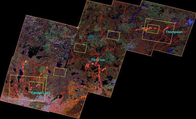
BOREAS Follow-On DSP-01 Landsat TM Land Cover Mosaic of the BOREAS Transect
National Aeronautics and Space Administration —
The objective of this land cover mosaic is to provide a data product that characterises the detailed land cover of a significant portion of the BOREAS Region. Seven... -
Federal
BOREAS Follow-On DSP-10 Regridded Moss Cover Maps for 1994
National Aeronautics and Space Administration —
Existing 1-km moss cover classifications were reprocessed and are now available at multiple resolutions (2 km, 10x5 minutes, and 0.5 degree). These data were... -
Federal
Blue Carbon-based Natural Climate Solutions, Priority Maps for the U.S., 2006-2011
National Aeronautics and Space Administration —
This dataset contains shapefiles showing location of tidal wetland parcels with the potential for net greenhouse gas removal if restored from current mapped condition... -
Federal
HAQES 3-Hourly Ensemble mean surface PM2.5 Organic Carbon concentration at census level, North America V1 (HAQES_NA_PM25_OC_CENSUS) at GES DISC
National Aeronautics and Space Administration —
This product provides HAQES 3-hourly ensemble mean surface PM2.5 Organic Carbon concentration at the census level over the continental United States (CONUS). The... -
Federal
CERES and GEO-Enhanced TOA, Within-Atmosphere and Surface Fluxes, Clouds and Aerosols Daily Terra-NOAA20 Edition4A
National Aeronautics and Space Administration —
CER_SYN1deg-Day_Terra-NOAA20_Edition4A is the Clouds and the Earth's Radiant Energy System (CERES) and geostationary (GEO)-Enhanced Top-of-Atmosphere (TOA), Within-... -
Federal
Combined ASTER and MODIS Emissivity database over Land (CAMEL) Emissivity Climatology Monthly Global 0.05Deg V003
National Aeronautics and Space Administration —
The NASA Making Earth System Data Records for Use in Research Environments (MEaSUREs) Combined Advanced Spaceborne Thermal Emission and Reflection Radiometer (ASTER)... -
Federal
CMS: Soil CO2 Efflux and Properties, Site Vegetation Measurements, Mexico, 2011-2012
National Aeronautics and Space Administration —
This data set provides the results of (1) monthly measurements of soil CO2 efflux, volumetric water content, and temperature, and (2) seasonal measurements of soil... -
Federal
BOREAS TF-03 Automated Chamber CO2 Flux Data from the NSA-OBS
National Aeronautics and Space Administration —
The BOREAS TF-03 and TGB-01 teams collected automated CO2 chamber flux data in their efforts to fully describe the CO2flux at the NSA-OBS site. This data set contains... -
Federal
BOREAS TE-10 Leaf Optical Properties for SSA Species
National Aeronautics and Space Administration —
The BOREAS TE-10 team collected several data sets in support of its efforts to characterize and interpret information on the reflectance, transmittance, gas exchange,... -
Federal
BOREAS TE-18 Landsat TM Physical Classification Image of the NSA
National Aeronautics and Space Administration —
The objective of this classification is to provide the BOREAS investigators with a data product that characterizes the land cover of the NSA. A Landsat-5 TM image... -
Federal
BOREAS TGB-12 Radon-222 Flux Data: NSA
National Aeronautics and Space Administration —
The BOREAS TGB-12 team made measurements of soil carbon inventories, carbon concentration in soil gases, and rates of soil respiration at several sites to estimate... -
Federal
SAFARI 2000 Stem and Canopy Characterization, Kalahari Transect, 1995-2000
National Aeronautics and Space Administration —
This data set provides species distribution, basal area, height, and crown cover of woody stems at 10 sites along the Kalahari Transect where a large gradient in both... -
Federal
Global Forest Aboveground Carbon Stocks and Fluxes from GEDI and ICESat-2, 2018-2021
National Aeronautics and Space Administration —
This dataset provides global gridded estimates of forest aboveground carbon stocks and potential fluxes at a 0.01-degree resolution. It was derived by initializing a...

Official websites use .gov
A
.gov website belongs to an official government
organization in the United States.
Secure .gov websites use HTTPS
A
lock (
) or https:// means you’ve safely connected to
the .gov website. Share sensitive information only on official,
secure websites.