
-
Federal
Global Rural-Urban Mapping Project, Version 1 (GRUMPv1): National Administrative Boundaries
National Aeronautics and Space Administration —
The Global Rural-Urban Mapping Project, Version 1 (GRUMPv1): National Administrative Boundaries are derived from the land area grid to show the outlines of pixels... -
Federal
Global 1-km Downscaled Urban Land Extent Projection and Base Year Grids by SSP Scenarios, 2000-2100
National Aeronautics and Space Administration —
The Global 1-km Downscaled Urban Land Extent Projection and Base Year Grids by SSP Scenarios, 2000-2100 consists of global SSP-consistent spatial urban land fraction... -
Federal
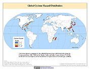
Global Cyclone Hazard Frequency and Distribution
National Aeronautics and Space Administration —
The Global Cyclone Hazard Frequency and Distribution is a 2.5 minute grid based on more than 1,600 storm tracks for the period 1 January 1980 through 31 December 2000... -
Federal
NASA Financial Budget Documents, Strategic Plans and Performance Reports 1999: NASA Budget Graphic
National Aeronautics and Space Administration —
NASA Financial Budget Documents, Strategic Plans and Performance Reports for fiscal year 1999. -
Federal
NASA Earth Observations (NEO)
National Aeronautics and Space Administration —
Our mission is to help you picture climate change and environmental changes happening on our home planet. Here you can search for and retrieve satellite images of... -
Federal
Gridded Species Distribution: Global Amphibian Richness Grids, 2015 Release
National Aeronautics and Space Administration —
The 2015 Release of the Global Amphibian Richness Grids data set of the Gridded Species Distribution collection are aggregations of the presence grids data for the... -
Federal
Global Pesticide Grids (PEST-CHEMGRIDS), Version 1.01
National Aeronautics and Space Administration —
The Global Pesticide Grids (PEST-CHEMGRIDS), Version 1.01 data set contains 20 of the most-used pesticide active ingredients on 6 dominant crops and 4 aggregated crop... -
Federal
African Climate Mobility Initiative (ACMI): Bilateral Migration Projections
National Aeronautics and Space Administration —
The African Climate Mobility Initiative (ACMI): Bilateral Migration Projections consists of projections for bilateral migration flows at 5-year intervals from 2015 to... -
Federal
2023 National Offshore Wind data set (NOW-23)
Department of Energy —
The 2023 National Offshore Wind data set (NOW-23) is the latest wind resource data set for offshore regions in the United States, which supersedes, for its offshore... -
Federal
GHRSST Level 4 SPoRT Global Foundation Sea Surface Temperature Analysis (v1.0)
National Aeronautics and Space Administration —
The GHRSST Level 4 SPoRT Global Foundation Sea Surface Temperature Analysis (v1.0) dataset is produced by the by the NASA Short-term Prediction Research and... -
Federal
HANPP Collection: Human Appropriation of Net Primary Productivity as a Percentage of Net Primary Productivity
National Aeronautics and Space Administration —
The HANPP Collection: Human Appropriation of Net Primary Productivity as a Percentage of Net Primary Productivity represents a map identifying regions in which human... -
Federal
Research Data Framework (RDaF) Database
National Institute of Standards and Technology —
The NIST RDaF is a map of the research data space that uses a lifecycle approach with six high-level lifecycle stages to organize key information concerning research... -
Federal
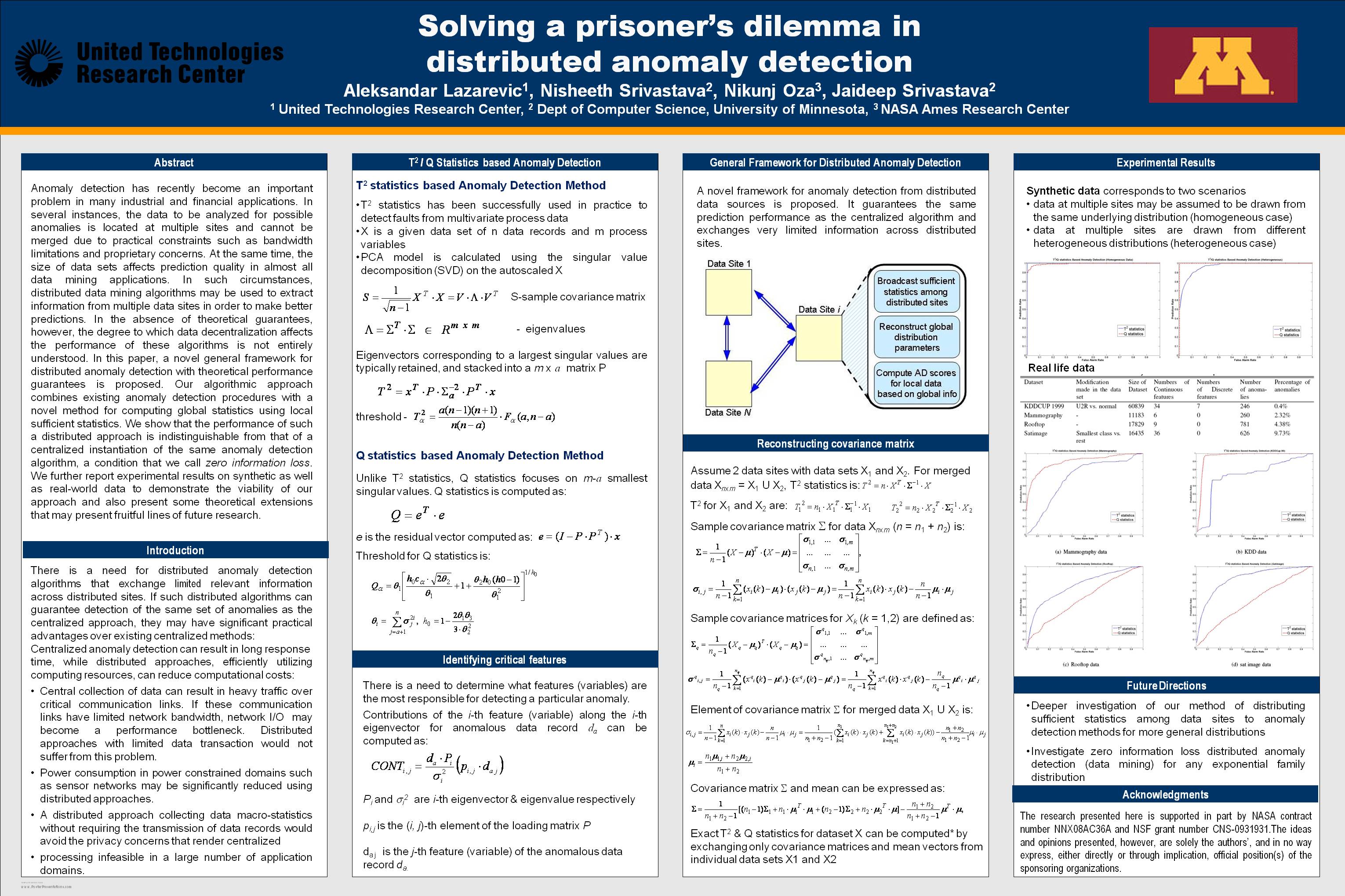
Solving a prisoner's dilemma in distributed anomaly detection
National Aeronautics and Space Administration —
Anomaly detection has recently become an important problem in many industrial and financial applications. In several instances, the data to be analyzed for possible... -
Federal
Vegetation Index and Phenology (VIP) Phenology NDVI Yearly Global 0.05Deg CMG V004
National Aeronautics and Space Administration —
The NASA Making Earth System Data Records for Use in Research Environments (MEaSUREs) Vegetation Index and Phenology (VIP) global datasets were created using surface... -
Federal
TROPICS05 L1B Orbital Geolocated Native-Resolution Brightness Temperatures V0.2
National Aeronautics and Space Administration —
The "Time-Resolved Observations of Precipitation structure and storm Intensity with a Constellation of Smallsats" (TROPICS) mission has a goal of providing nearly... -
Federal
Delta-X: AVIRIS-NG L3 Derived Herbaceous Aboveground Biomass, MRD, Louisiana, USA, V3
National Aeronautics and Space Administration —
This dataset includes high-resolution (~5 m) gridded estimates of aboveground biomass (AGB), aboveground necromass (AGN), and aboveground net primary productivity... -
Federal
Geostationary Earth Orbit Land Surface Temperature Hourly North and South America 4 km V002
National Aeronautics and Space Administration —
The NASA Making Earth System Data Records for Use in Research Environments (MEaSUREs) GEOLST4KHR version 2 swath product provides per-pixel Land Surface Temperature... -
Federal
MODIS/Terra+Aqua Land Aerosol Optical Depth Daily L2G Global 1km SIN Grid V061
National Aeronautics and Space Administration —
The MCD19A2 Version 6.1 data product is a Moderate Resolution Imaging Spectroradiometer (MODIS) Terra and Aqua combined Multi-angle Implementation of Atmospheric... -
Federal
MetOp-C ASCAT Level 2 Ocean Surface Wind Vectors Optimized for Coastal Ocean
National Aeronautics and Space Administration —
This dataset contains operational near-real-time Level 2 coastal ocean surface wind vector retrievals from the Advanced Scatterometer (ASCAT) on MetOp-C at 12.5 km... -
Federal
ASTER L2 Surface Reflectance SWIR and ASTER L2 Surface Reflectance VNIR V003
National Aeronautics and Space Administration —
The Terra Advanced Spaceborne Thermal Emission and Reflection Radiometer (ASTER) Surface Reflectance VNIR and SWIR (AST_07) data product contains measures of the...

Official websites use .gov
A
.gov website belongs to an official government
organization in the United States.
Secure .gov websites use HTTPS
A
lock (
) or https:// means you’ve safely connected to
the .gov website. Share sensitive information only on official,
secure websites.