

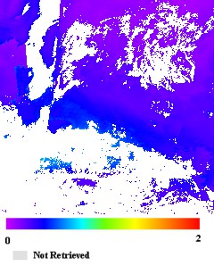
MODIS/Terra+Aqua Land Aerosol Optical Depth Daily L2G Global 1km SIN Grid V061
Access & Use Information
Public: This dataset is intended for public access and use.
License: No license information was provided. If this work was prepared by an officer or employee of the United States government as part of that person's official duties it is considered a U.S. Government Work.
Downloads & Resources
-
Data Information (HTML)HTML
MCD19A2.061
-
Data Information (Unknown Format)BIN
-
Data Information (Unknown Format)BIN
-
Data Information (HTML)HTML
contents.html
-
Data Information (PDF)PDF
MCD19_ATBD.pdf
-
Data Information (PDF)PDF
MCD19_User_Guide_V61.pdf
-
Data Information (Unknown Format)BIN
-
Data Information (Unknown Format)BIN
-
Data Information (HTML)HTML
MODLAND_val.html
-
Data Information (Unknown Format)BIN
-
Data Information (JPEG)JPEG
BROWSE.MCD19A2.A2024202.h21v11.061.2024203154831.1.jpg
-
Data Information (JPEG)JPEG
MODIS_Combined_MAIAC_L2G_AerosolOpticalDepth.jpg
-
Landing PageLanding Page
Dates
| Metadata Created Date | April 11, 2025 |
|---|---|
| Metadata Updated Date | September 19, 2025 |
Metadata Source
- Data.json Data.json Metadata
Harvested from NASA Data.json
Additional Metadata
| Resource Type | Dataset |
|---|---|
| Metadata Created Date | April 11, 2025 |
| Metadata Updated Date | September 19, 2025 |
| Publisher | LP DAAC;NASA/GSFC/SED/ESD/TISL/MODAPS |
| Maintainer | |
| Identifier | 10.5067/MODIS/MCD19A2.061 |
| Data Last Modified | 2025-09-11 |
| Category | Earth Science |
| Public Access Level | public |
| Bureau Code | 026:00 |
| Metadata Context | https://project-open-data.cio.gov/v1.1/schema/catalog.jsonld |
| Schema Version | https://project-open-data.cio.gov/v1.1/schema |
| Catalog Describedby | https://project-open-data.cio.gov/v1.1/schema/catalog.json |
| Harvest Object Id | 54711679-10f4-491c-a354-bfda0d920831 |
| Harvest Source Id | 58f92550-7a01-4f00-b1b2-8dc953bd598f |
| Harvest Source Title | NASA Data.json |
| Homepage URL | https://doi.org/10.5067/MODIS/MCD19A2.061 |
| Old Spatial | {"NorthBoundingCoordinate":90,"WestBoundingCoordinate":-180,"EastBoundingCoordinate":180,"SouthBoundingCoordinate":-90},"CARTESIAN" |
| Program Code | 026:000 |
| Source Datajson Identifier | True |
| Source Hash | 570038cefd472cba640f43fceed87152780e46241f32f914e974018bae360734 |
| Source Schema Version | 1.1 |
| Spatial | |
| Temporal | 2000-02-24/2000-02-24 |
Didn't find what you're looking for? Suggest a dataset here.