
-
Federal
H11801: NOS Hydrographic Survey , Oak Harbor to Saratoga Passage, Washington, 2009-02-18
National Oceanic and Atmospheric Administration, Department of Commerce —
The National Oceanic and Atmospheric Administration (NOAA) has the statutory mandate to collect hydrographic data in support of nautical chart compilation for safe... -
Federal
China Dimensions Data Collection: Fundamental GIS: Digital Chart of China, 1:1M, Version 1
National Aeronautics and Space Administration —
The Fundamental GIS: Digital Chart of China, 1:1M, Version 1 consists of vector maps of China and surrounding areas. The maps include roads, railroads, drainage... -
Federal
Low Elevation Coastal Zone (LECZ) Urban-Rural Population and Land Area Estimates, Version 3
National Aeronautics and Space Administration —
The Low Elevation Coastal Zone (LECZ) Urban-Rural Population and Land Area Estimates, Version 3 data set contains land areas with urban, quasi-urban, rural, and total... -
Federal
H11830: NOS Hydrographic Survey , Gulf of Mexico, 2009-09-30
National Oceanic and Atmospheric Administration, Department of Commerce —
The National Oceanic and Atmospheric Administration (NOAA) has the statutory mandate to collect hydrographic data in support of nautical chart compilation for safe... -
Federal
Global Drought Proportional Economic Loss Risk Deciles
National Aeronautics and Space Administration —
The Global Drought Proportional Economic Loss Risk Deciles is a 2.5 minute grid of drought hazard economic loss as proportions of Gross Domestic Product (GDP) per... -
Federal
Monthly gridded Global Land Data Assimilation System (GLDAS) from Noah-v3.3 land hydrology model for GRACE and GRACE-FO over nominal months
National Aeronautics and Space Administration —
The total land water storage anomalies are aggregated from the Global Land Data Assimilation System (GLDAS) NOAH model. GLDAS outputs land water content by using... -
Federal
Global Fire Emissions Indicators, Country-Level Tabular Data: 1997-2015
National Aeronautics and Space Administration —
The Global Fire Emissions Indicators, Country-Level Tabular Data: 1997-2015 contains country tabulations from 1997 to 2015 for the total area burned (hectares) and... -
Federal
Global Multihazard Mortality Risks and Distribution
National Aeronautics and Space Administration —
The Global Multihazard Mortality Risks and Distribution is a 2.5 minute grid identifying and characterizing the nature of multihazard risk at the global scale. For... -
Federal
Saildrone Baja field campaign surface and ADCP measurements
National Aeronautics and Space Administration —
Saildrone is a wind and solar powered unmanned surface vehicle (USV) capable of long distance deployments lasting up to 12 months and providing high quality, near... -
Federal
Archive of Census Related Products (ACRP): 1990 Census Block Statistics
National Aeronautics and Space Administration —
The 1990 Census Block Statistics portion of the Archive of Census Related Products (ACRP) contains population and housing data from the U.S. Census Bureau's 1990... -
Federal
Burkina Faso Compact - Diversified Agriculture and Water Management
Millennium Challenge Corporation —
Burkina Faso Compact - Diversified Agriculture and Water Management -
Federal
Global 1-km Downscaled Urban Land Extent Projection and Base Year Grids by SSP Scenarios, 2000-2100
National Aeronautics and Space Administration —
The Global 1-km Downscaled Urban Land Extent Projection and Base Year Grids by SSP Scenarios, 2000-2100 consists of global SSP-consistent spatial urban land fraction... -
Federal
Gridded Population of the World, Version 3 (GPWv3): National Administrative Boundaries
National Aeronautics and Space Administration —
The Gridded Population of the World, Version 3 (GPWv3): National Administrative Boundaries are derived from the land area grid to show the outlines of pixels (cells)... -
Federal
HANPP Collection: Global Patterns in Human Appropriation of Net Primary Productivity (HANPP)
National Aeronautics and Space Administration —
The HANPP Collection: Global Patterns in Human Appropriation of Net Primary Productivity (HANPP) represents a digital map of human appropriation of net primary... -
Federal
H13384: NOS Hydrographic Survey , 2021-03-10
National Oceanic and Atmospheric Administration, Department of Commerce —
The National Oceanic and Atmospheric Administration (NOAA) has the statutory mandate to collect hydrographic data in support of nautical chart compilation for safe... -
Federal
The Bronson Files, Dataset 2, Field 17, 2013
Department of Agriculture —
Dr. Kevin Bronson provides this unique nitrogen and water management in cotton agricultural research dataset for compute, including notation of field events and... -
Federal
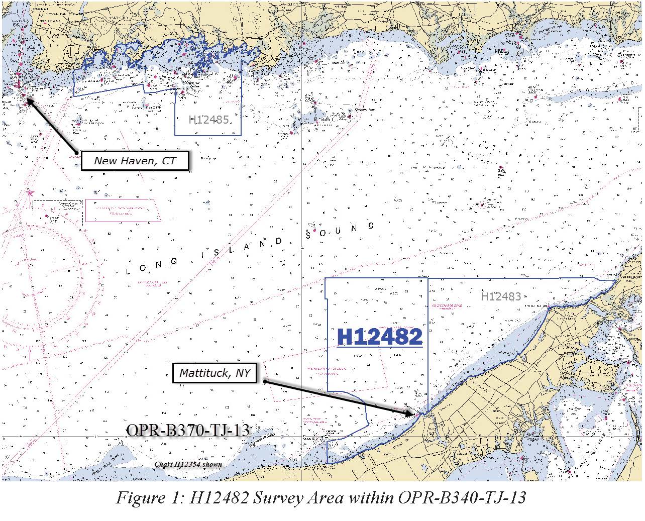
H12482: NOS Hydrographic Survey , Eastern Long Island Sound, 2013-04-20
National Oceanic and Atmospheric Administration, Department of Commerce —
The National Oceanic and Atmospheric Administration (NOAA) has the statutory mandate to collect hydrographic data in support of nautical chart compilation for safe... -
Federal
H12084: NOS Hydrographic Survey , Southern Portion of Cook Inlet, Alaska, 2009-09-08
National Oceanic and Atmospheric Administration, Department of Commerce —
The National Oceanic and Atmospheric Administration (NOAA) has the statutory mandate to collect hydrographic data in support of nautical chart compilation for safe... -
Federal
H12047: NOS Hydrographic Survey , Honolulu Harbor, Hawaii, 2009-05-03
National Oceanic and Atmospheric Administration, Department of Commerce —
The National Oceanic and Atmospheric Administration (NOAA) has the statutory mandate to collect hydrographic data in support of nautical chart compilation for safe...

Official websites use .gov
A
.gov website belongs to an official government
organization in the United States.
Secure .gov websites use HTTPS
A
lock (
) or https:// means you’ve safely connected to
the .gov website. Share sensitive information only on official,
secure websites.
.jpg)
.jpg)