
-
Federal
RSS SSM/I OCEAN PRODUCT GRIDS MONTHLY AVERAGE FROM DMSP F11 NETCDF V7
National Aeronautics and Space Administration —
The RSS SSM/I Ocean Product Grids Monthly Average from DMSP F11 netCDF dataset is part of the collection of Special Sensor Microwave/Imager (SSM/I) and Special Sensor... -
Federal
RSS SSMIS OCEAN PRODUCT GRIDS DAILY FROM DMSP F16 NETCDF V7
National Aeronautics and Space Administration —
The RSS SSMIS Ocean Product Grids Daily from DMSP F16 netCDF dataset is part of the collection of Special Sensor Microwave/Imager (SSM/I) and Special Sensor Microwave... -
Federal
SatCORPS CERES GEO Edition 4 Meteosat-7 Full Disk Version 2
National Aeronautics and Space Administration —
CER_GEO_Ed4_MET07_FD_V02 is the Satellite Cloud and Radiation Property retrieval System (SatCORPS) Clouds and the Earth's Radiant Energy System (CERES) Geostationary... -
Federal
SatCORPS CERES GEO Edition 4 GOES-15 Southern Hemisphere Version 1.2
National Aeronautics and Space Administration —
CER_GEO_Ed4_GOE15_SH_V01.2 is the Satellite Cloud and Radiation Property retrieval System (SatCORPS) Clouds and the Earth's Radiant Energy System (CERES)... -
Federal
RSS SSM/I OCEAN PRODUCT GRIDS DAILY FROM DMSP F8 NETCDF V7
National Aeronautics and Space Administration —
The RSS SSM/I Ocean Product Grids Daily from DMSP F8 netCDF dataset is part of the collection of Special Sensor Microwave/Imager (SSM/I) and Special Sensor Microwave... -
Federal
TROPESS CrIS-SNPP L2 Ammonia for West Coast Fires, Standard Product V1 (TRPSDL2NH3CRSWCF) at GES DISC
National Aeronautics and Space Administration —
The TROPESS CrIS-SNPP L2 Ammonia for West Coast Fires, Standard Product contains the vertical distribution of the retrieved atmospheric state of ammonia (NH3), formal... -
Federal
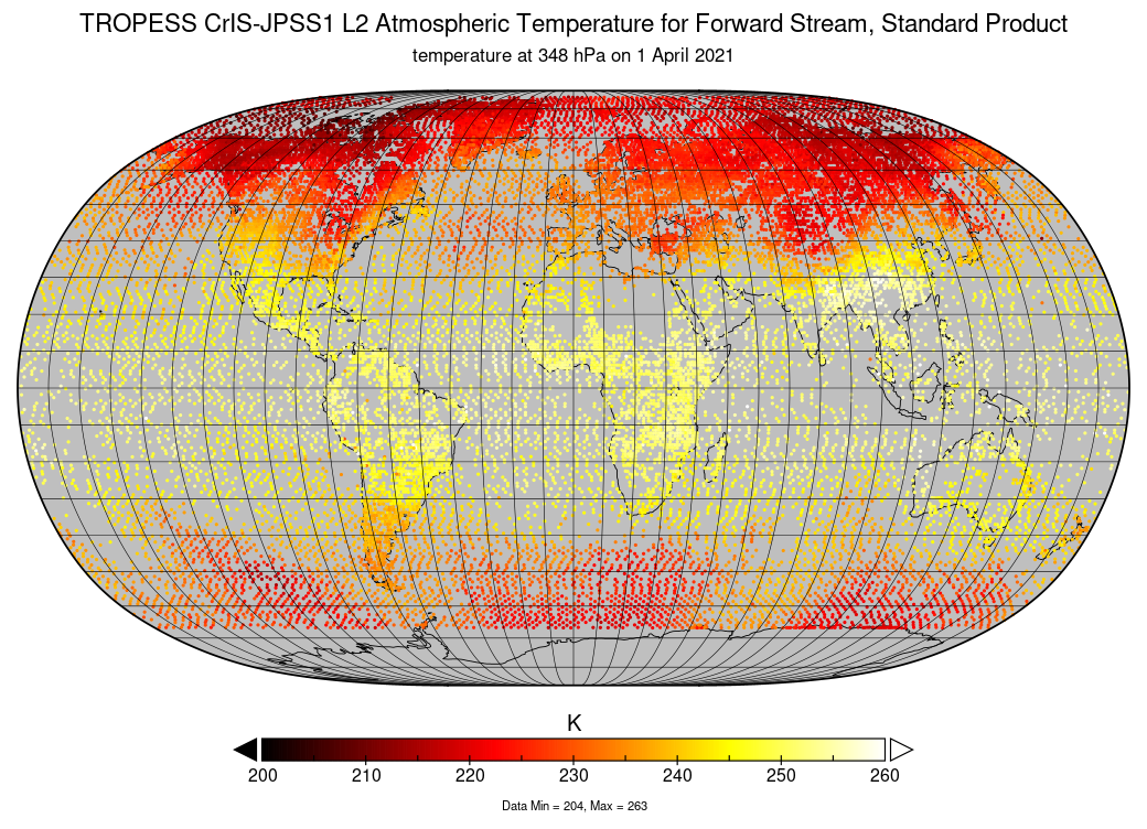
TROPESS CrIS-JPSS1 L2 Atmospheric Temperature for Forward Stream, Standard Product V1 (TRPSDL2TATMCRS1FS) at GES DISC
National Aeronautics and Space Administration —
The TROPESS CrIS-JPSS1 L2 Atmospheric Temperature for Forward Stream, Standard Product contains the vertical distribution of the retrieved atmospheric state of... -
Federal
SOLVE I ER-2 Aircraft In-situ Meteorology and Navigational Data
National Aeronautics and Space Administration —
SOLVE1_MetNav_AircraftInSItu_ER2_Data is the in-situ meteorological and navigational data for the ER-2 aircraft collected during the SAGE III Ozone Loss and... -
Federal
SWOT Level 2 Lake Single-Pass Vector Data Product, Version C
National Aeronautics and Space Administration —
The SWOT Level 2 Lake Single-Pass Vector Data Product from the Surface Water Ocean Topography (SWOT) mission provides water surface elevation, area, storage change... -
Federal
Soil Bulk Density Data (FIFE)
National Aeronautics and Space Administration —
Soil bulk density is defined as the ratio of the mass of dry solids to the bulk volume of the soil occupied by those dry solids. Bulk density of the soil is an... -
Federal
SMEX04 QuikSCAT/SeaWinds Backscatter Data: Sonora, Version 1
National Aeronautics and Space Administration —
This data set includes data collected by the SeaWinds scatterometer on NASA's Quick Scatterometer (QuikSCAT) satellite collected backscatter data. -
Federal
GLDAS Noah Land Surface Model L4 3 hourly 0.25 x 0.25 degree Early Product V2.1 (GLDAS_NOAH025_3H_EP) at GES DISC
National Aeronautics and Space Administration —
NASA Global Land Data Assimilation System Version 2 (GLDAS-2) has three components: GLDAS-2.0, GLDAS-2.1, and GLDAS-2.2. GLDAS-2.0 is forced entirely with the... -
Federal
GHRSST Level 4 CMC0.1deg Global Foundation Sea Surface Temperature Analysis (GDS version 2)
National Aeronautics and Space Administration —
A Group for High Resolution Sea Surface Temperature (GHRSST) Level 4 sea surface temperature (SST) analysis produced daily on an operational basis at the Canadian... -
Federal
GHRSST L2P NOAA/ACSPO GOES-18/ABI West America Region Sea Surface Temperature v2.90 dataset
National Aeronautics and Space Administration —
The G18-ABI-L2P-ACSPO-v2.90 dataset produced by the NOAA ACSPO system is used to derive Subskin and Depth Sea Surface Temperature (SST) from the ABI onboard the G18... -
Federal
GFZ TELLUS GRACE Level-3 Monthly Ocean Bottom Pressure Anomaly Release 6.0 version 04
National Aeronautics and Space Administration —
The monthly ocean bottom pressure anomaly grids are given as equivalent water thickness changes derived from GRACE & GRACE-FO time-variable gravity observations... -
Federal
First ISCCP Regional Experiment (FIRE) Cirrus 2 Volume Imaging Lidar (VIL) Altitude vs. Time (RTI) Data
National Aeronautics and Space Administration —
The First ISCCP Regional Experiments have been designed to improve data products and cloud/radiation parameterizations used in general circulation models (GCMs).... -
Federal
First ISCCP Regional Experiment (FIRE) Cirrus Phase I Langley Research Center (LARC) Eight Inch Lidar
National Aeronautics and Space Administration —
The First ISCCP Regional Experiments have been designed to improve data products and cloud/radiation parameterizations used in general circulation models (GCMs).... -
Federal
First ISCCP Regional Experiment (FIRE) Atlantic Stratocumulus Transition Experiment (ASTEX) Centre Meteorologie Spatiale (CMS) Monthly Solar Irradiance Data
National Aeronautics and Space Administration —
The First ISCCP Regional Experiments have been designed to improve data products and cloud/radiation parameterizations used in general circulation models (GCMs).... -
Federal
First ISCCP Regional Experiment (FIRE) Atlantic Stratocumulus Transition Experiment (ASTEX) Centre Meteorologie Spatiale (CMS) Weekly Solar Irradiance Data
National Aeronautics and Space Administration —
The First ISCCP Regional Experiments have been designed to improve data products and cloud/radiation parameterizations used in general circulation models (GCMs).... -
Federal
ECOSTRESS Swath Geolocation Instantaneous L1B Global 70 m V002
National Aeronautics and Space Administration —
The ECOsystem Spaceborne Thermal Radiometer Experiment on Space Station (ECOSTRESS) mission measures the temperature of plants to better understand how much water...

Official websites use .gov
A
.gov website belongs to an official government
organization in the United States.
Secure .gov websites use HTTPS
A
lock (
) or https:// means you’ve safely connected to
the .gov website. Share sensitive information only on official,
secure websites.