
-
Federal
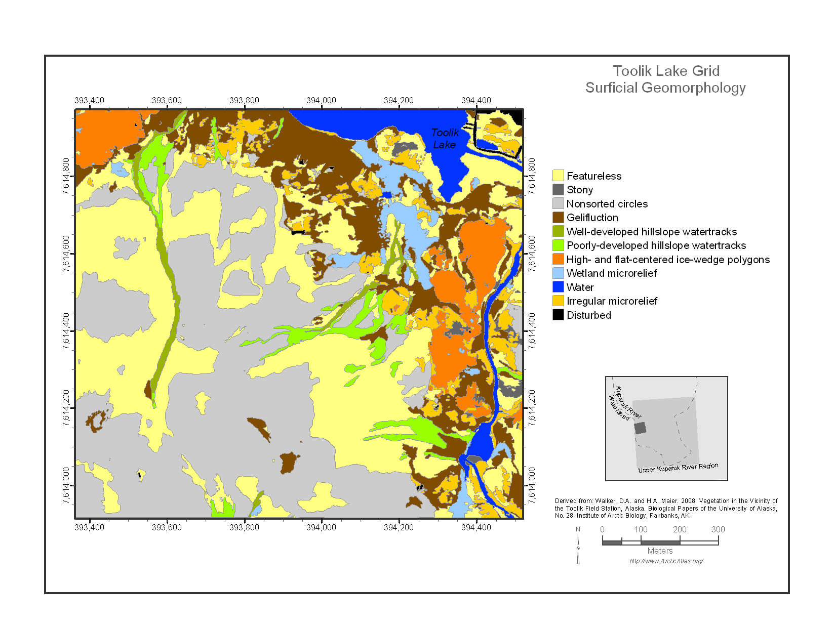
Maps of Vegetation Types and Physiographic Features, Toolik Lake Area, Alaska
National Aeronautics and Space Administration —
This data set provides the spatial distributions of vegetation types, soil carbon, and physiographic features in the Toolik Lake area, Alaska. Specific attributes... -
Federal
Literature-Derived Parameters for the BIOME-BGC Terrestrial Ecosystem Model
National Aeronautics and Space Administration —
Ecosystem simulation models use descriptive input parameters to establish the physiology, biochemistry, structure, and allocation patterns of vegetation functional... -
Federal
LBA-ECO ND-11 Litter Decomposition, Carbon, and Nitrogen Dynamics in Agroforestry
National Aeronautics and Space Administration —
It has been proposed that the C/N ratio, or quality, of litter or mulch mixtures affects N release. Although total N release from these mixtures and the effects on... -
Federal
LBA-ECO ND-11 Forest Soil Structure and Nitrate, NW Mato Grosso, Brazil: 2004-2005
National Aeronautics and Space Administration —
This data set reports the results of the analysis of soil samples for Nitrate (NO3) and physical properties that were collected for one year following reduced impact... -
Federal
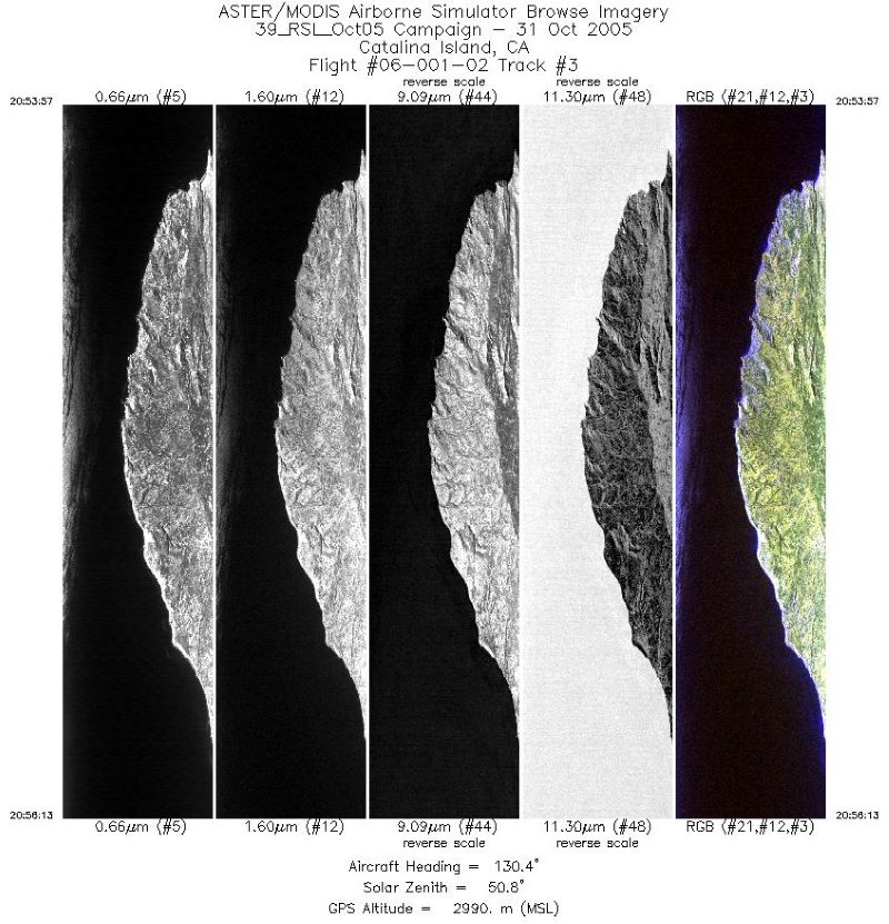
MASTER: Airborne Science, Catalina Island, California, October 2005
National Aeronautics and Space Administration —
This dataset includes Level 1B (L1B) data products from the MODIS/ASTER Airborne Simulator (MASTER) instrument. The spectral data were collected during one flight... -
Federal
Location and Permanency of Water Bodies in the African Sahel Region from 2003-2011
National Aeronautics and Space Administration —
This data set provides an estimate of the spatial and temporal extent of surface water at 250-m resolution over nine years (2003-2011) for the African Sahel region... -
Federal
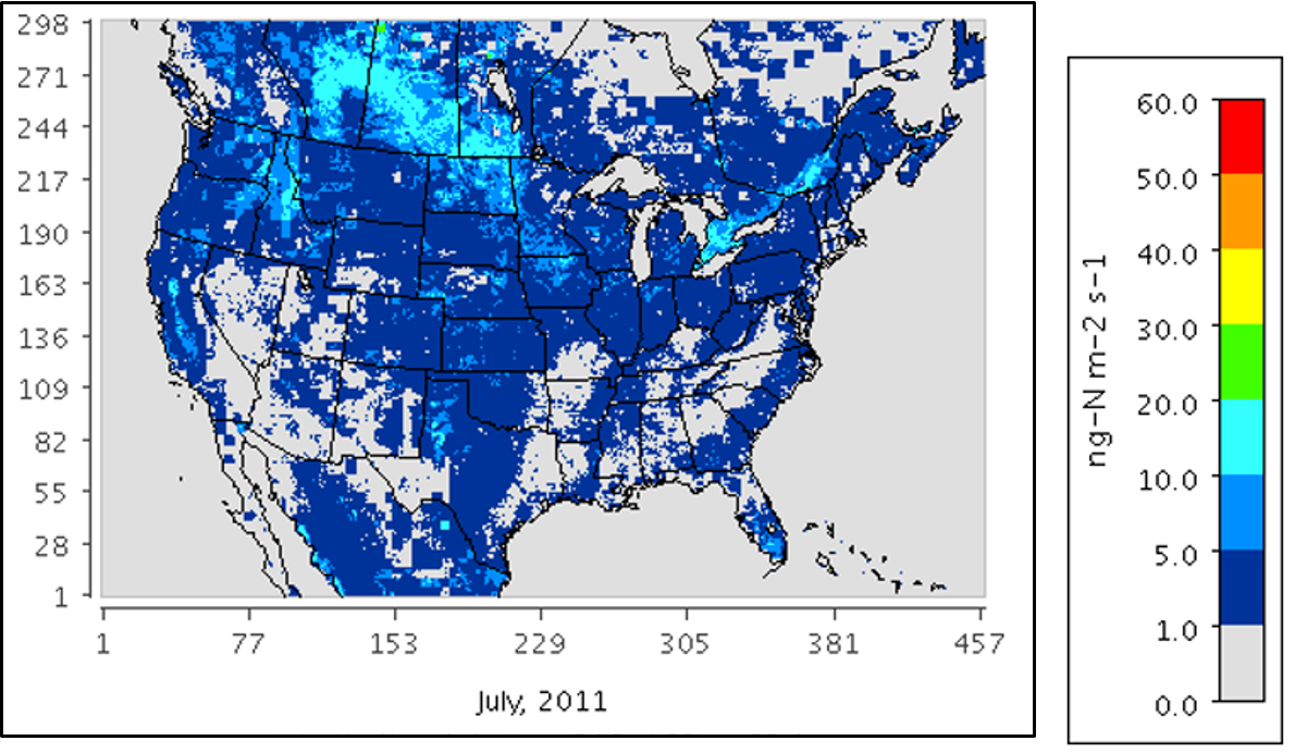
Mechanistic Module for Soil Nitrogen Emissions for CMAQ Model, North America, 2011
National Aeronautics and Space Administration —
This model product provides source code, input data files, and example model outputs for a new mechanistic soil nitrogen (N) module in-line with the Community... -
Federal
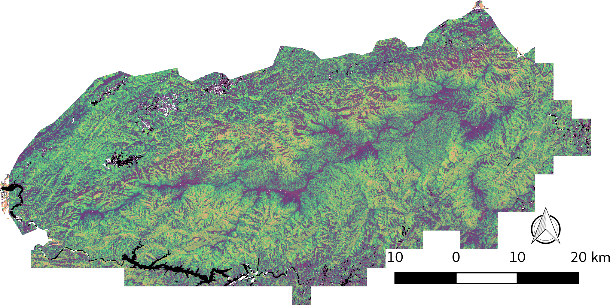
LiDAR-derived Vegetation Canopy Structure, Great Smoky Mountains National Park, 2011
National Aeronautics and Space Administration —
This dataset provides multiple-return LiDAR-derived vegetation canopy structure at 30-meter spatial resolution for the Great Smoky Mountains National Park (GSMNP).... -
Federal
LBA-ECO ND-02 Agricultural and Secondary Forest Soil Trace Gas Flux, Para: 2001-2004
National Aeronautics and Space Administration —
Fires set for slash-and-burn agriculture contribute to the current unsustainable accumulation of atmospheric greenhouse gases, and they also deplete the soil of... -
Federal
LBA-ECO ND-02 Trace Gas Flux from Forest Soil, Para, Brazil : 1999-2001
National Aeronautics and Space Administration —
Understanding secondary successional processes in Amazonian terrestrial ecosystems is becoming increasingly important as continued deforestation expands the area that... -
Federal
NPP Boreal Forest: Superior National Forest, USA, 1983-1984, R1
National Aeronautics and Space Administration —
This data set contains two files (.txt format). One file provides ground-based biophysical measurements and above-ground net primary productivity (ANPP) estimates for... -
Federal
VEMAP 1: U.S. Site Files
National Aeronautics and Space Administration —
The Vegetation/Ecosystem Modeling and Analysis Project (VEMAP) is an ongoing multiinstitutional, international effort addressing the response of biogeography and... -
Federal
VEMAP 1: U.S. Soil
National Aeronautics and Space Administration —
The Vegetation/Ecosystem Modeling and Analysis Project (VEMAP) is an ongoing multiinstitutional, international effort addressing the response of biogeography and... -
Federal
Vegetation Species Data (FIFE)
National Aeronautics and Space Administration —
The Vegetation Species and Cover Abundance Data Set documents the species present at the FIFE staff data measurement sites. Percent cover is estimated for each... -
Federal
VEMAP 2: Monthly Ecosystem Model Responses to U.S. Climate Change, 1994-2100
National Aeronautics and Space Administration —
The Vegetation-Ecosystem Modeling and Analysis Project (VEMAP) was a large, collaborative, multi-institutional, international effort whose goal was to evaluate the... -
Federal
VEMAP 2: U.S. Monthly Climate Change Scenarios, Version 2
National Aeronautics and Space Administration —
The Vegetation/Ecosystem Modeling and Analysis Project (VEMAP) Phase 2 has developed a number of transient climate change scenarios based on coupled atmosphere-ocean... -
Federal
VEMAP 2: U.S. Monthly Climate, 1895-1993, Version 2
National Aeronautics and Space Administration —
The Vegetation/Ecosystem Modeling and Analysis Project (VEMAP) Phase 2 has developed a data set of ~100-year gridded monthly and daily time series of climate for the... -
Federal
SAFARI 2000 Global Historical Climatology Network, V. 1, 1874-1990
National Aeronautics and Space Administration —
This data set consists of a southern African subset of the Global Historical Climatology Network (GHCN) Version 1 database. All stations with the following bounding... -
Federal
SAFARI 2000 MISR Level 2 Data, Southern Africa, Dry Season 2000
National Aeronautics and Space Administration —
MISR (Multi-angle Imaging SpectroRadiometer) views the sunlit Earth simultaneously at nine widely spaced and collects global images with high spatial detail in four... -
Federal
SAFARI 2000 Monthly and Annual CO2 Emissions from Soil, 0.5 Degree Grid
National Aeronautics and Space Administration —
The data set provides estimated monthly and annual soil CO2 emissions for southern Africa (the SAFARI 2000 project region). The calculated emissions are from the...

Official websites use .gov
A
.gov website belongs to an official government
organization in the United States.
Secure .gov websites use HTTPS
A
lock (
) or https:// means you’ve safely connected to
the .gov website. Share sensitive information only on official,
secure websites.