
-
Federal
Reflectance Reference Targets (OTTER)
National Aeronautics and Space Administration —
Spectral reflectance measurements of flat field targets as reference points representative of psuedo-invariant targets as measured by the Spectron SE590... -
Federal
Russian Boreal Forest Disturbance Maps Derived from Landsat Imagery, 1984-2000
National Aeronautics and Space Administration —
This data set provides Boreal forest disturbance maps at 30-m resolution for 55 selected sites across Northern Eurasia within the Russian Federation. Disturbance... -
Federal
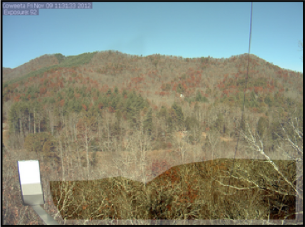
PhenoCam Dataset v2.0: Vegetation Phenology from Digital Camera Imagery, 2000-2018
National Aeronautics and Space Administration —
This data set provides a time series of vegetation phenological observations for 393 sites across diverse ecosystems of the world (mostly North America) from... -
Federal
Pre-ABoVE: Gridded Footprints from WRF-STILT Model, Barrow, Alaska, 1982-2011
National Aeronautics and Space Administration —
This dataset provides Stochastic Time-Inverted Lagrangian Transport model outputs for receptors located at the NOAA Barrow Alaska Observatory for 12 selected years... -
Federal
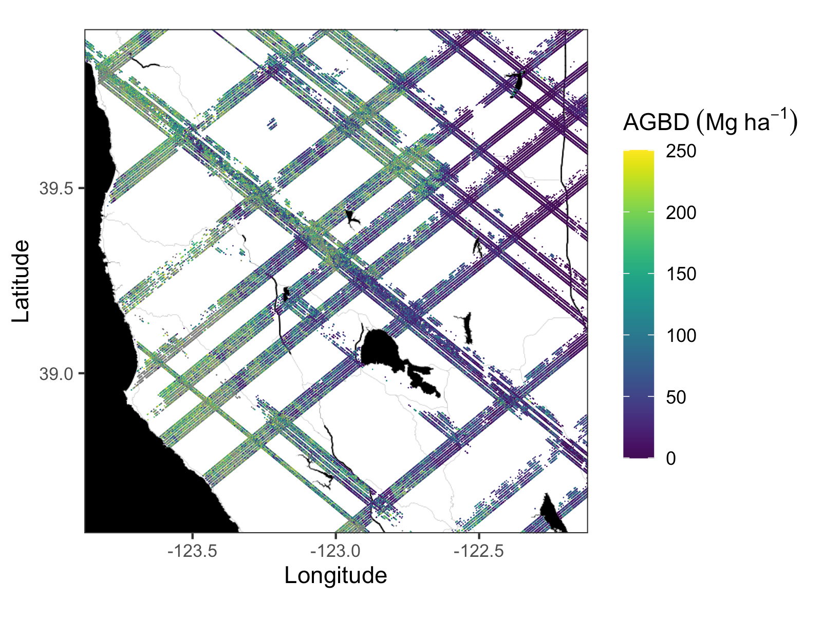
Aboveground Biomass Density for High Latitude Forests from ICESat-2, 2020
National Aeronautics and Space Administration —
This dataset provides estimates of Aboveground dry woody Biomass Density (AGBD) for high northern latitude forests at a 30-m spatial resolution. It is designed both... -
Federal
AirMOSS: L2 Hourly In-Ground Soil Moisture at AirMOSS Sites, 2011-2015
National Aeronautics and Space Administration —
This data set provides level 2 (L2) hourly volumetric (cm3/cm3) soil moisture profiles from in-ground sensors at seven North American sites as part of the Airborne... -
Federal
Forest Inventories at Burned and Unburned Tropical Forest Sites, Acre, Brazil, 2014
National Aeronautics and Space Administration —
This dataset provides measurements for diameter at breast height (DBH) and species identification of trees for inventories taken at five tropical forest sites in Acre... -
Federal
GEDI L4A Footprint Level Aboveground Biomass Density, Golden Weeks, Version 1
National Aeronautics and Space Administration —
This dataset contains Global Ecosystem Dynamics Investigation (GEDI) Level 4A (L4A) predictions of the aboveground biomass density (AGBD; in Mg/ha) and estimates of... -
Federal
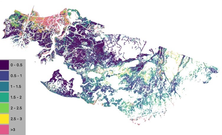
Delta-X: NUMAR Soil Accretion Modeled to 2100, MRD, Louisiana, USA
National Aeronautics and Space Administration —
This dataset holds modeled estimates of soil accretion for the Atchafalaya and Terrebonne basins in the Mississippi River Delta of coastal Louisiana, U.S. Soil... -
Federal
CARVE: L1 Airborne Forward Looking Infrared Radiance Counts, Alaska, 2013-2015
National Aeronautics and Space Administration —
This data set provides earth referenced radiance counts measured by the Forward Looking Infrared (FLIR) camera aboard the CARVE aircraft between April 2013 and... -
Federal
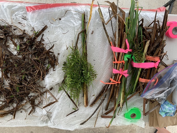
Delta-X: Aboveground Vegetation Structure, Herbaceous Wetlands, MRD, LA, USA, V2
National Aeronautics and Space Administration —
This dataset provides mean stem diameter, mean height, dominant species, hydrogeomorphic zone (HGM), and stem density for vegetation in herbaceous wetlands collected... -
Federal
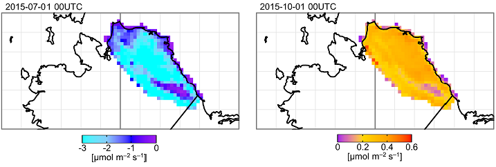
ABoVE: TVPRM Simulated Net Ecosystem Exchange, Alaskan North Slope, 2008-2017
National Aeronautics and Space Administration —
This dataset includes hourly net ecosystem exchange (NEE) simulated by the Tundra Vegetation Photosynthesis and Respiration Model (TVPRM) at 30 km horizontal... -
Federal
ABoVE: Wetland Type, Slave River and Peace-Athabasca Deltas, Canada, 2007 and 2017
National Aeronautics and Space Administration —
This dataset provides ecosystem-types for the Slave River Delta (SRD) and Peace-Athabasca Delta (PAD), Canada, for the time periods circa 2007 and circa 2017. The... -
Federal
BOREAS SERM Forest Cover Data Layers of the SSA in Vector Format
National Aeronautics and Space Administration —
The forest cover data provided by Saskatchewan Environment and Resource Management, Forestry Branch - Inventory Unit (SERM-FBIU) are basically a digital version of... -
Federal
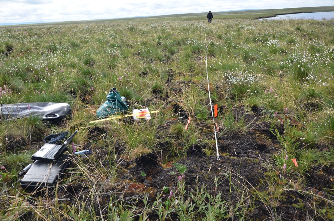
Arctic Vegetation Plots in Burned and Unburned Tundra, Alaska, 2011-2012
National Aeronautics and Space Administration —
This dataset provides environmental and vegetation data collected in late June and July of 2011 and of 2012 from study plots located in tundra fire scars and adjacent... -
Federal
BOREAS TE-18 Landsat TM Maximum Likelihood Classification Image of the SSA
National Aeronautics and Space Administration —
A Landsat-5 TM image from 06-Aug-1990 was used to derive this classification. The objective of this classification is to provide the BOREAS investigators with a data... -
Federal
BOREAS TGB-03 CH4 and CO2 Chamber Flux Data over NSA Upland Sites
National Aeronautics and Space Administration —
The BOREAS TGB-03 team collected methane and carbon dioxide (CH4, CO2) chamber flux measurements at the NSA Fen site, OBS, YJP, and auxiliary sites along Gillam Road... -
Federal
BOREAS TE-06 Predawn Leaf Water Potentials and Foliage Moisture Content Data
National Aeronautics and Space Administration —
The BOREAS TE-06 team collected several data sets to examine the influence of vegetation, climate, and their interactions on the major carbon fluxes for boreal forest... -
Federal
BOREAS AFM-12 1-km AVHRR Seasonal Land Cover Classification
National Aeronautics and Space Administration —
This regional land cover classification is based on the use of multitemporal 1-km Advanced Very High Resolution Radiometer (AVHRR) National Oceanic and Atmospheric... -
Federal
BOREAS/SRC AMS Suite A Surface Meteorological and Radiation Data: 1994
National Aeronautics and Space Administration —
The Saskatchewan Research Council (SRC) collected surface meteorological and radiation data from December, 1993 until Decemb er 1996. The data set is comprised of the...

Official websites use .gov
A
.gov website belongs to an official government
organization in the United States.
Secure .gov websites use HTTPS
A
lock (
) or https:// means you’ve safely connected to
the .gov website. Share sensitive information only on official,
secure websites.