

76 datasets found
-
Federal
EGS Collab: Hydraulic Fracturing Test Measurements on the 4100L of SURF
Department of Energy —
This package includes data from two days of testing at the Sanford Underground Research Facility (SURF) on the 4100 level. The tests were performed in borehole TV4100... -
State
Crane Operator Certificate of Competence
State of New York —
The dataset includes a comprehensive list of crane operator certificates that have been issued to individuals for connection with construction, demolition, and... -
Federal
EGS Collab Experiment 2: Hydraulic Pressure Test Results
Department of Energy —
The EGS Collab experiment 2 was focused on testing shear stimulation techniques. Shear stimulation, in this case, means using hydraulic pressure to cause shear slip... -
Federal
Model archive for the hydraulic modeling for selected streams near Rittman in Wayne and Medina Counties, Ohio
Department of the Interior —
Digital flood-inundation maps were created by the U.S. Geological Survey (USGS) in cooperation with the Muskingum Watershed Conservancy District and the City of... -
Federal
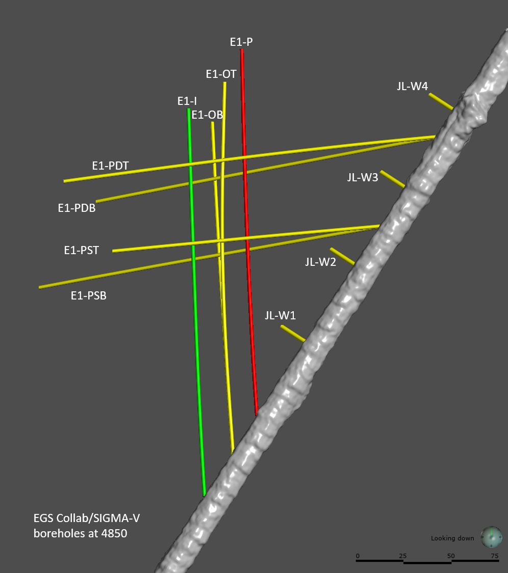
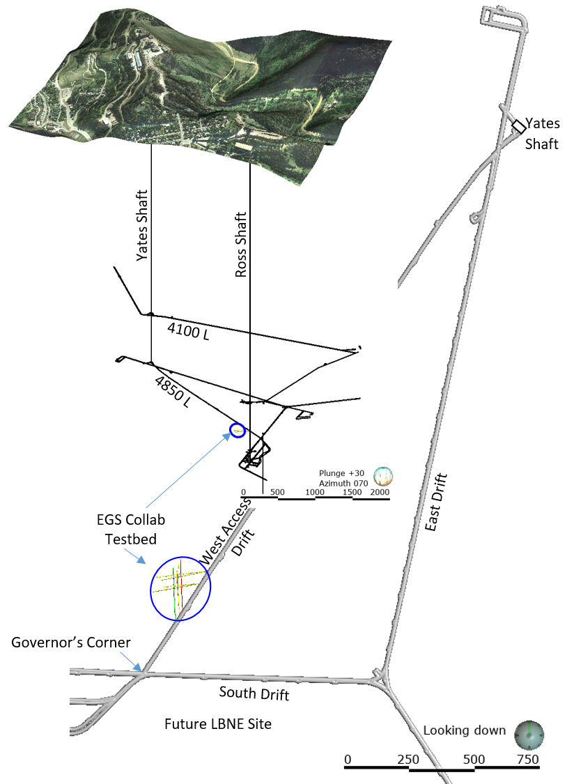
EGS Collab Experiment 1: Well Locations and Orientations.
Department of Energy —
The EGS Collab is conducting experiments in hydraulic fracturing at a depth of 1.5 km in the Sanford Underground Research Facility (SURF) on the 4850 Level. A total... -
Federal
Seismic Analysis of Spatio-Temporal Fracture Generation During EGS Resource Development - Full Moment Tensors and Stress Inversion Catalogs
Department of Energy —
This submission contains 167 full moment tensor (MT) solutions for the seismicity observed two years prior and three years post start of injection activities. Also... -
Federal
Utah FORGE: InSAR Data from 2020
Department of Energy —
Interferometric Synthetic Aperture Radar data from the TerraSAR-X and the TanDEM-X satellite missions operated by the German Space Agency (DLR). Interferometric pairs... -
Federal
EGS Collab Experiment 2: Testbed Well Orientation Data
Department of Energy —
This dataset contains the north seeking gyro data for each of the 11 boreholes drilled at the Experiment 2 testbed on the 4100 foot level of the SURF (Sanford... -
Federal
Geospatial datasets and hydraulic models for the Grand River, Red Cedar River and Sycamore Creek near Lansing, Michigan
Department of the Interior —
Hydrologic and hydraulic analyses were done for selected reaches of the Grand River, Red Cedar River and Sycamore Creek near Lansing, Michigan. To update and expand a... -
Federal
Depth grids for flood-inundation maps in and near Bellville, Ohio.
Department of the Interior —
The depth grids show the depth of flooding on the Clear Fork Mohican River near Bellville, Ohio on local map backgrounds, based on stages of 9.0 ft to 17.0 ft at the... -
Federal
Model archive for the hydraulic modeling for the Grand River, Red Cedar River and Sycamore Creek near Lansing, Michigan
Department of the Interior —
Hydrologic and hydraulic analyses were done for selected reaches of the Grand River, Red Cedar River and Sycamore Creek near Lansing, Michigan. To update and expand a... -
Federal
Input and output shapefiles used in the 2018 hydraulic modeling for the Clear Fork Mohican River and Cedar Fork in Richland County, Ohio.
Department of the Interior —
Digital flood-inundation maps for an 18.6-mile (mi) reach of the Clear Fork Mohican River (that extends approximately from 100 feet upstream from Gass Road near... -
Federal
Hydraulic model for flood-inundation maps for the Cuyahoga River in and near the City of Independence, Ohio
Department of the Interior —
Water-surface elevations along the stream reach were estimated by steady-state hydraulic modeling, assuming unobstructed flow, and using streamflows and hydrologic... -
Federal
Depth grids for flood-inundation maps for the Cuyahoga River in and near the City of Independence, Ohio
Department of the Interior —
The depth grids show the depth of flooding on the Cuyahoga River in and near the City of Independence, Ohio on local map backgrounds, based on stages of 14.0 ft to... -
Federal
Model archive for the hydraulic model for the Cuyahoga River at Jaite, Ohio
Department of the Interior —
Water-surface elevations along the stream reach were estimated by steady-state hydraulic modeling, assuming unobstructed flow, and using streamflows and hydrologic...
76 datasets found