
-
Federal
RapidScat Level 2B Ocean Wind Vectors in 12.5km Slice Composites Version 1.3
National Aeronautics and Space Administration —
This dataset contains the RapidScat Level 2B 12.5km Version 1.3 science-quality ocean surface wind vectors, which are intended as a replacement and continuation of... -
Federal
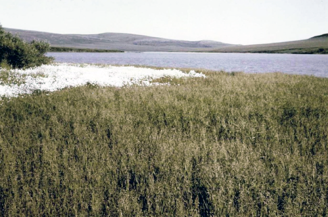
PhenoCam Dataset v3.0: Vegetation Phenology from Digital Camera Imagery, 2000-2023
National Aeronautics and Space Administration —
This dataset provides vegetation phenological observations for 738 sites across diverse ecosystems of the world (mostly North America) from 2000 to 2023. The... -
Federal
BOREAS/SRC AMS Suite A Surface Meteorological and Radiation Data: 1996
National Aeronautics and Space Administration —
The Saskatchewan Research Council (SRC) collected surface meteorological and radiation data from December, 1993 until Decemb er 1996. The data set is comprised of the... -
Federal
OMG Swath Gridded Multibeam Echo Sounding (MBES) Bathymetry
National Aeronautics and Space Administration —
This dataset contains level 2 in situ depth measurements from Multibeam Echo Sounder System (MBES) instruments. These depths were used to map the bathymetry around... -
Federal
SAFARI 2000 Aerosol Fatty Acid and Stable Isotope Data, Mongu, Dry Season 2000
National Aeronautics and Space Administration —
The Southern African Regional Science Initiative (SAFARI 2000) was conducted in part to investigate the impacts of the large-scale transport and deposition of... -
Federal
Aquarius Official Release Level 3 Sea Surface Density Standard Mapped Image Ascending Seasonal Data V5.0
National Aeronautics and Space Administration —
Aquarius Level 3 sea surface density standard mapped image data contains gridded 1 degree spatial resolution density data averaged over daily, 7 day, monthly, and... -
Federal
BOREAS TGB-08 Monoterpene Concentration Data over the SSA-OBS and the SSA-OJP
National Aeronautics and Space Administration —
The TGB-08 team collected data to investigate the controls over non-methane hydrocarbon (NMHC) fluxes from boreal forest tree species. This data set contains... -
Federal
NPP Temperate Forest: OTTER Project Sites, Oregon, USA, 1989-1991, R1
National Aeronautics and Space Administration —
This data set provides net primary productivity (NPP) estimates and associated field measurements for six sites located along the 250-km, west-east transect of the... -
Federal
Aircraft Flux-Filtered: U of Wy. (FIFE)
National Aeronautics and Space Administration —
The University of Wyoming (UW) King Air atmospheric boundary layer measurement missions were flown in 1987 during IFCs 3 and 4. This Boundary Layer Fluxes data set... -
Federal
Arctic Vegetation Plots in Northern NWT and YT, Canada, 1965-1966
National Aeronautics and Space Administration —
This dataset provides vegetation, soil, and plot characteristics for 154 study plots located at three sites across the Richardson Mountains, Northwest Territories... -
Federal
SAFARI 2000 C-130 Aerosol and Meteorological Data, Dry Season 2000
National Aeronautics and Space Administration —
The Met Office C-130 research aircraft was based at Windhoek, Namibia between September 5-16, 2000, where it conducted a series of flights over Namibia as part of the... -
Federal
RSS SSMIS OCEAN PRODUCT GRIDS DAILY FROM DMSP F16 NETCDF V7
National Aeronautics and Space Administration —
The RSS SSMIS Ocean Product Grids Daily from DMSP F16 netCDF dataset is part of the collection of Special Sensor Microwave/Imager (SSM/I) and Special Sensor Microwave... -
Federal
RSS SMAP Level 2C Sea Surface Salinity V6.0 Validated Dataset
National Aeronautics and Space Administration —
The RSS SMAP level 2C sea surface salinity V6.0 dataset produced by the Remote Sensing Systems (RSS) and sponsored by the NASA Ocean Salinity Science Team, is a... -
Federal
Green Catalog of Galactic SNRs (June 2017 Version)
National Aeronautics and Space Administration —
This catalog of known Galactic supernova remnants (SNRs) is an updated version of the catalogs of Galactic SNRs presented in detail in Green (1984, 1988), in summary... -
Federal
MODIS/Aqua Calibrated Radiances 5-Min L1B Swath 250m
National Aeronautics and Space Administration —
The MODIS/Terra Calibrated Radiances 5-Min L1B Swath 250m data set contains calibrated and geolocated at-aperture radiances for 2 discrete bands located in the 0.62... -
Federal
Airborne Precipitation Radar 3rd Generation (APR-3) CPEX
National Aeronautics and Space Administration —
The Airborne Precipitation Radar 3rd Generation (APR-3) CPEX dataset consists of radar reflectivity, Doppler velocity for all bands, linear depolarization ratio Ku-... -
Federal
VIIRS/JPSS1 BRDF/Albedo BSA at Solar Noon Band M4 Daily L3 Global 30ArcSec CMG V002
National Aeronautics and Space Administration —
The NOAA-20 Visible Infrared Imaging Radiometer Suite (VIIRS) Bidirectional Reflectance Distribution Function (BRDF) and Albedo Black-Sky Albedo for Band M4... -
Federal
ABoVE: Permafrost Measurements and Distribution Across the Y-K Delta, Alaska, 2016
National Aeronautics and Space Administration —
This dataset provides field observations of thaw depth and dominant vegetation types, a LiDAR-derived elevation map, and permafrost distribution and probability maps... -
Federal
OCO-3 Level 2 geolocated XCO2 retrievals results, physical model, Retrospective Processing V11r (OCO3_L2_Standard) at GES DISC
National Aeronautics and Space Administration —
Version 11r is the current version of the data set. Older versions will no longer be available and are superseded by Version 11r.The Orbiting Carbon Observatory -3... -
Federal
Sentinel-5P TROPOMI Radiance product band 8 (SWIR detector) L1B 5.5km x 7km V1 (S5P_L1B_RA_BD8_HiR) at GES DISC
National Aeronautics and Space Administration —
Starting from August 6th in 2019, Sentinel-5P TROPOMI along-track high spatial resolution (~5.5km at nadir) has been implemented.For data before August 6th of 2019,...

Official websites use .gov
A
.gov website belongs to an official government
organization in the United States.
Secure .gov websites use HTTPS
A
lock (
) or https:// means you’ve safely connected to
the .gov website. Share sensitive information only on official,
secure websites.