

OMG Swath Gridded Multibeam Echo Sounding (MBES) Bathymetry
Access & Use Information
Public: This dataset is intended for public access and use.
License: No license information was provided. If this work was prepared by an officer or employee of the United States government as part of that person's official duties it is considered a U.S. Government Work.
Downloads & Resources
-
Data Information (Unknown Format)BIN
-
Data Information (PDF)PDF
JPL_OMG_Arctic_Access_2017_Overview.pdf
-
Data Information (PDF)PDF
ORP_OMG_2018_Report.pdf
-
Data Information (PDF)PDF
omg-bathy-mbes-users-guide-v3.pdf
-
Data Information (PDF)PDF
Appendix_A-Daily_Reports.pdf
-
Data Information (PDF)PDF
Appendix_A-Daily_Field_Reports.pdf
-
Data Information (Unknown Format)BIN
README.txt
-
Data Information (Unknown Format)BIN
-
Data Information (Unknown Format)BIN
-
Data Information (Unknown Format)BIN
-
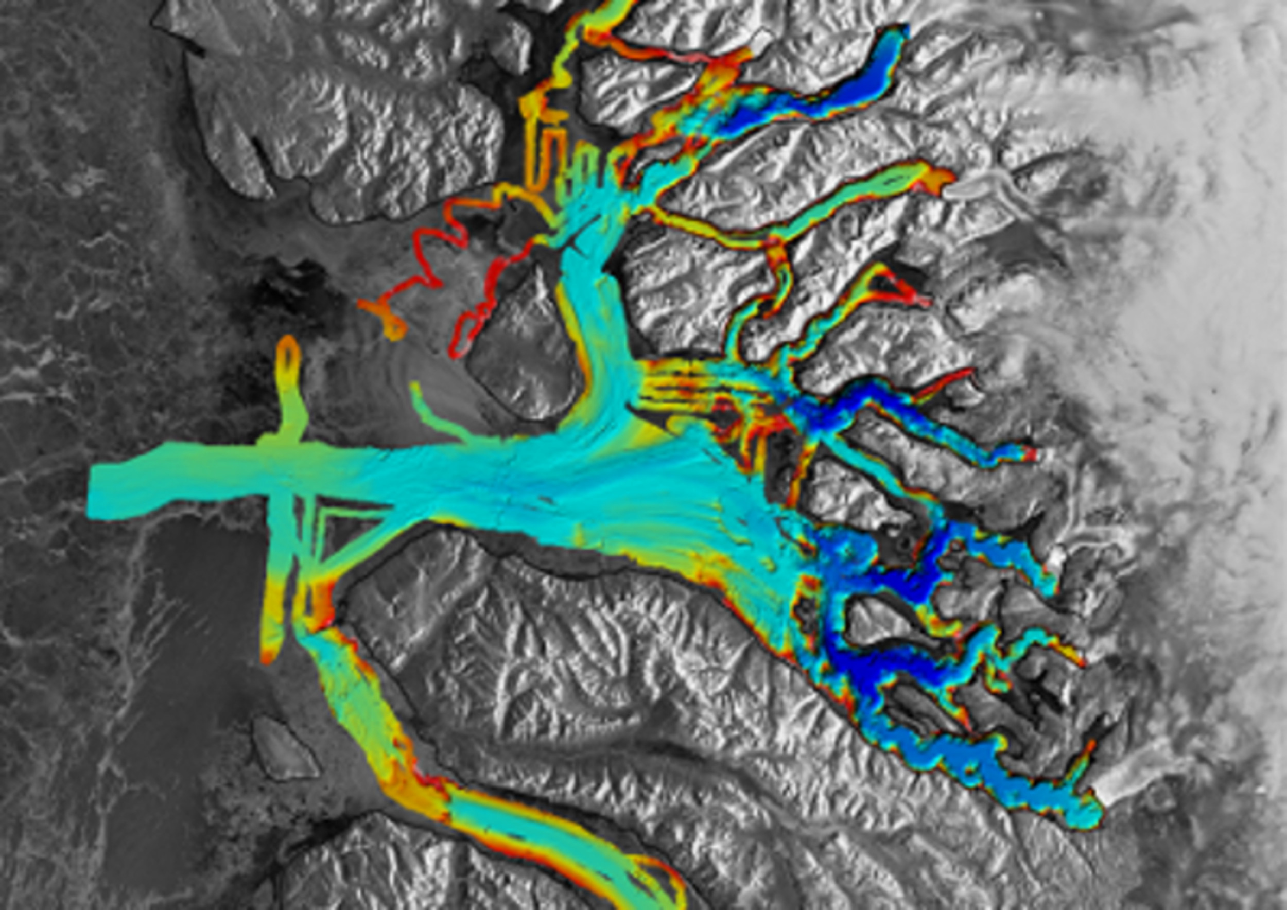
Data Information (JPEG)JPEG
OMG_L2_Bathy_MBES_Gridded.jpg
-
Landing PageLanding Page
Dates
| Metadata Created Date | April 11, 2025 |
|---|---|
| Metadata Updated Date | September 18, 2025 |
Metadata Source
- Data.json Data.json Metadata
Harvested from NASA Data.json
Additional Metadata
| Resource Type | Dataset |
|---|---|
| Metadata Created Date | April 11, 2025 |
| Metadata Updated Date | September 18, 2025 |
| Publisher | NASA/JPL/OMG;NASA/JPL/PODAAC |
| Maintainer | |
| Identifier | 10.5067/OMGEV-MBES1 |
| Data Last Modified | 2025-09-11 |
| Category | Earth Science |
| Public Access Level | public |
| Bureau Code | 026:00 |
| Metadata Context | https://project-open-data.cio.gov/v1.1/schema/catalog.jsonld |
| Schema Version | https://project-open-data.cio.gov/v1.1/schema |
| Catalog Describedby | https://project-open-data.cio.gov/v1.1/schema/catalog.json |
| Harvest Object Id | 46682fac-bca6-4c1d-8ae8-281e28725dca |
| Harvest Source Id | 58f92550-7a01-4f00-b1b2-8dc953bd598f |
| Harvest Source Title | NASA Data.json |
| Homepage URL | https://podaac.jpl.nasa.gov/CitingPODAAC |
| Old Spatial | "CARTESIAN",{"WestBoundingCoordinate":-73.6,"SouthBoundingCoordinate":59.1,"EastBoundingCoordinate":-6.9,"NorthBoundingCoordinate":83.6} |
| Program Code | 026:000 |
| Source Datajson Identifier | True |
| Source Hash | 9b073476fd43e71751401fe2ec7a29c3482070ab019c07adae652c6a1fc417e5 |
| Source Schema Version | 1.1 |
| Spatial | |
| Temporal | 2015-07-25/2015-07-25 |
Didn't find what you're looking for? Suggest a dataset here.