
-
Federal
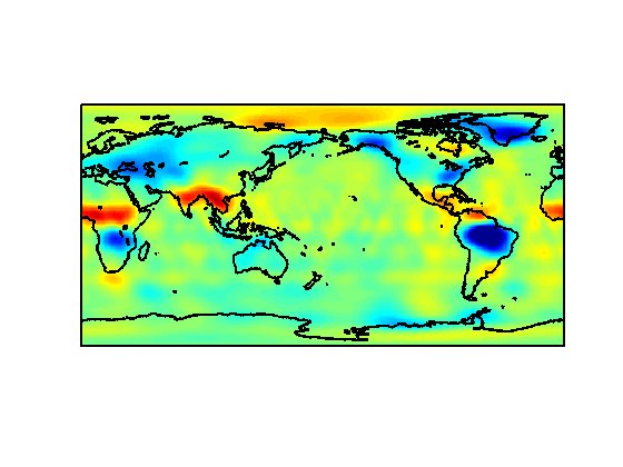
Global Vegetation Greenness (NDVI) from AVHRR GIMMS-3G+, 1981-2022
National Aeronautics and Space Administration —
This dataset holds the Global Inventory Modeling and Mapping Studies-3rd Generation V1.2 (GIMMS-3G+) data for the Normalized Difference Vegetation Index (NDVI). NDVI... -
Federal
Global Hydrologic Soil Groups (HYSOGs250m) for Curve Number-Based Runoff Modeling
National Aeronautics and Space Administration —
This dataset - HYSOGs250m - represents a globally consistent, gridded dataset of hydrologic soil groups (HSGs) with a geographical resolution of 1/480 decimal... -
Federal
Data Files for “The 2030 National Charging Network: Estimating U.S. Light-Duty Demand for Electric Vehicle Charging Infrastructure"
Department of Energy —
This data set includes modeling results from “The 2030 National Charging Network: Estimating U.S. Light-Duty Demand for Electric Vehicle Charging Infrastructure”... -
Federal
ASTER Digital Elevation Model V003
National Aeronautics and Space Administration —
The Terra Advanced Spaceborne Thermal Emission and Reflection Radiometer (ASTER) Digital Elevation Model (AST14DEM) product is generated using bands 3N (nadir-... -
Federal
MODIS/Terra+Aqua Land Cover Type Yearly L3 Global 0.05Deg CMG V061
National Aeronautics and Space Administration —
The Terra and Aqua combined Moderate Resolution Imaging Spectroradiometer (MODIS) Land Cover Climate Modeling Grid (CMG) (MCD12C1) Version 6.1 data product provides a... -
Federal
Operating Geothermal Plants
Department of Energy —
This dataset contains locations of operating geothermal power plants within the United States as of the publication date. Geothermal power plant data was aggregated... -
Federal
Civic Engagement and Volunteering Supplement 2019
AmeriCorps —
This dataset is the most comprehensive look at volunteering and civic life in the 50 states and 51 cities across the country. -
Federal
Public Housing Authorities - National Geospatial Data Asset (NGDA) NGDA
Department of Housing and Urban Development —
Public Housing was established to provide decent and safe rental housing for eligible low-income families, the elderly, and persons with disabilities. Public housing... -
Federal
Records About Japanese Americans Relocated During World War II
National Archives and Records Administration —
This series contains personal descriptive data about Japanese Americans evacuated from the states of Washington, Oregon, and California to ten relocation centers... -
Federal
MODIS/Terra+Aqua Land Cover Dynamics Yearly L3 Global 500m SIN Grid V061
National Aeronautics and Space Administration —
The Terra and Aqua combined Moderate Resolution Imaging Spectroradiometer (MODIS) Land Cover Dynamics (MCD12Q2) Version 6.1 data product provides global land surface... -
Federal
REGIONAL AIR-SEA INTERACTION (RASI) GAP WIND AND COASTAL UPWELLING EVENTS CLIMATOLOGY GULF OF PANAMA, PANAMA V1
National Aeronautics and Space Administration —
The Regional Air-Sea Interactions (RASI) Gap Wind and Coastal Upwelling Events Climatology Gulf of Panama, Panama dataset was created using an automated intelligent... -
Federal
MODIS/Terra+Aqua Land Cover Type Yearly L3 Global 0.05Deg CMG V006
National Aeronautics and Space Administration —
The MCD12C1 Version 6 data product was decommissioned on July 31, 2023. Users are encouraged to use the MCD12C1 Version 6.1 data product.The Terra and Aqua combined... -
Federal
Plant Gravity Perception: Pilot (PGP Pilot)
National Aeronautics and Space Administration —
This study examined tissue-specific early transcriptional responses upon reorientation in wild type and starchless pgm-1 mutant seedlings of Arabidopsis. Seedlings... -
Federal
ALOS PALSAR High Resolution Radiometric Terrain Corrected Product
National Aeronautics and Space Administration —
ASF's SAR Radiometric Terrain Corrected (RTC) dataset gives terrestrial world-wide coverage; excluding Antarctica, Greenland, Iceland, and Asia north of 60 degrees... -
Federal
Ground-Based Global Navigation Satellite System High-rate Mixed Broadcast Ephemeris Data (sub-hourly files) from NASA CDDIS
National Aeronautics and Space Administration —
This dataset consists of ground-based Global Navigation Satellite System (GNSS) Mixed Broadcast Ephemeris Data (sub-hourly files) from the NASA Crustal Dynamics Data... -
Federal
ICON The Far Ultra Violet Imaging Spectrograph Dayside Images
National Aeronautics and Space Administration —
The FUV instrument takes 2D images of the Earth’s horizon in the Far ultraviolet. The imager is pointing approximately 90 degrees to the spacecraft motion, similar to... -
Federal
Chandra Serendipitous Extragalactic X-Ray Source ID (SEXSI) Catalog
National Aeronautics and Space Administration —
The Serendipitous Extragalactic X-Ray Source Identification (SEXSI) program is designed to extend greatly the sample of identified extragalactic hard X-ray (2 - 10... -
Federal
Bright Star Catalog
National Aeronautics and Space Administration —
The BSC5P database table contains data derived from the Bright Star Catalog, 5th Edition, preliminary, which is widely used as a source of basic astronomical and... -
Federal
NASA 3D Models: Kepler
National Aeronautics and Space Administration —
Model of the Kepler spacecraft. Polygons: 372 Vertices: 418

Official websites use .gov
A
.gov website belongs to an official government
organization in the United States.
Secure .gov websites use HTTPS
A
lock (
) or https:// means you’ve safely connected to
the .gov website. Share sensitive information only on official,
secure websites.