

771 datasets found for "新葡京官方网址✅澳门葡京赌场官方网站-网址【079.one】㊙️最火爆PG电子超高爆奖率,注册即送38元.LEFWhEcIGnbGjVp"
-
Federal
AVIRIS-Classic: L1B Calibrated Radiance, Facility Instrument Collection, V1
National Aeronautics and Space Administration —
This dataset contains Level 1B (L1B) orthocorrected, scaled radiance image files as well as files of observational geometry and illumination parameters and supporting... -
Federal
ABoVE: Burn Severity of Soil Organic Matter, Northwest Territories, Canada, 2014-2015
National Aeronautics and Space Administration —
This dataset provides maps at 30-m resolution of landscape surface burn severity (surface litter and soil organic layers) from the 2014-2015 fires in the Northwest... -
Federal
ABoVE: Soil Temperature Profiles, USArray Seismic Stations, AK and Canada, 2016-2019
National Aeronautics and Space Administration —
This dataset includes soil temperature profile measurements taken at 16 monitoring sites in Alaska, USA, and at one site in Yukon, Canada. The six sites are... -
Federal
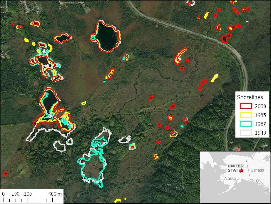
ABoVE: Historical Lake Shorelines and Areas near Fairbanks, Alaska from 1949-2009
National Aeronautics and Space Administration —
This dataset includes maps of historical lake shorelines with derived lake areas in the southern portion of the Goldstream Valley and the surrounding landscape north... -
Federal
FIFE CDROM Vol. 3 Contents: NS001 Thematic Mapper Simulator (TMS) Imagery, 1987-1989
National Aeronautics and Space Administration —
This data set provides aircraft-based NS001 Thematic Mapper Simulator (TMS) images of the study area associated with The First ISLSCP (International Satellite Land... -
Federal
Calculated Leaf Carbon and Nitrogen, 1992 (ACCP)
National Aeronautics and Space Administration —
The purpose of these measurements was to determine plot-level average leaf concentrations of nitrogen, lignin, cellulose, etc. in order to investigate how AVIRIS... -
Federal
MASTER: Airborne Science, California-Nevada, August, 2004
National Aeronautics and Space Administration —
This dataset includes Level 1B (L1B) data products from the MODIS/ASTER Airborne Simulator (MASTER) instrument. The spectral data were collected during one flight... -
Federal
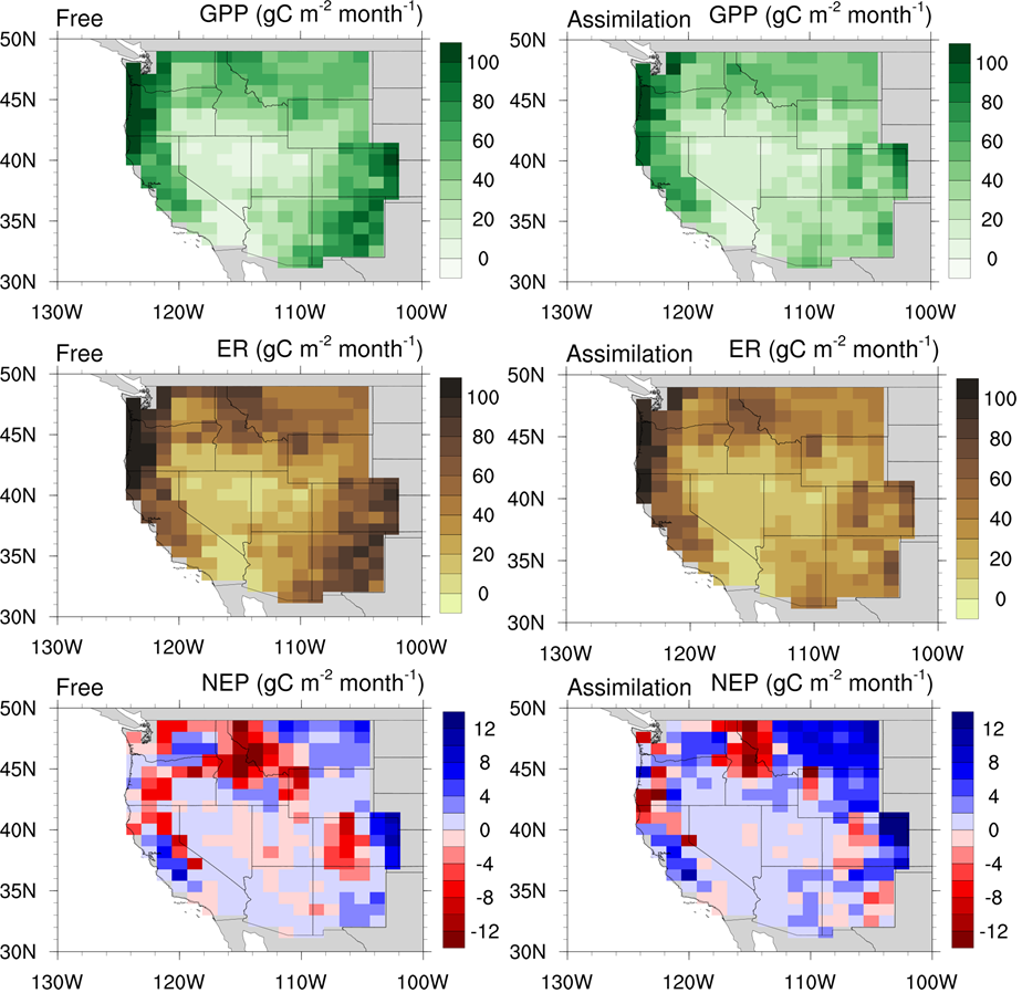
CLM5-DART Regional Carbon Fluxes and Stocks over the Western US, 1998-2010
National Aeronautics and Space Administration —
This dataset provides monthly estimates of biomass stocks and land-atmosphere carbon exchange across the western United States at 0.95 degrees longitude x 1.25... -
Federal
BOREAS TGB-12 Radon-222 Flux Data: NSA
National Aeronautics and Space Administration —
The BOREAS TGB-12 team made measurements of soil carbon inventories, carbon concentration in soil gases, and rates of soil respiration at several sites to estimate... -
Federal
BOREAS TE-18 Landsat TM Physical Classification Image of the NSA
National Aeronautics and Space Administration —
The objective of this classification is to provide the BOREAS investigators with a data product that characterizes the land cover of the NSA. A Landsat-5 TM image... -
Federal
BOREAS TE-10 Leaf Optical Properties for SSA Species
National Aeronautics and Space Administration —
The BOREAS TE-10 team collected several data sets in support of its efforts to characterize and interpret information on the reflectance, transmittance, gas exchange,...
771 datasets found for "新葡京官方网址✅澳门葡京赌场官方网站-网址【079.one】㊙️最火爆PG电子超高爆奖率,注册即送38元.LEFWhEcIGnbGjVp"