
-
Federal
H02260: NOS Hydrographic Survey
National Oceanic and Atmospheric Administration, Department of Commerce —
The National Oceanic and Atmospheric Administration (NOAA) has the statutory mandate to collect hydrographic data in support of nautical chart compilation for safe... -
Federal
H02120: NOS Hydrographic Survey
National Oceanic and Atmospheric Administration, Department of Commerce —
The National Oceanic and Atmospheric Administration (NOAA) has the statutory mandate to collect hydrographic data in support of nautical chart compilation for safe... -
Federal
H03761: NOS Hydrographic Survey
National Oceanic and Atmospheric Administration, Department of Commerce —
The National Oceanic and Atmospheric Administration (NOAA) has the statutory mandate to collect hydrographic data in support of nautical chart compilation for safe... -
Federal
NOAA's Estuarine Living Marine Resources (ELMR) Data Base
National Oceanic and Atmospheric Administration, Department of Commerce —
In 1985, NOAA launched the Estuarine Living Marine Resources (ELMR) Program to develop a consistent data base on the distribution, relative abundance, and life... -
Federal
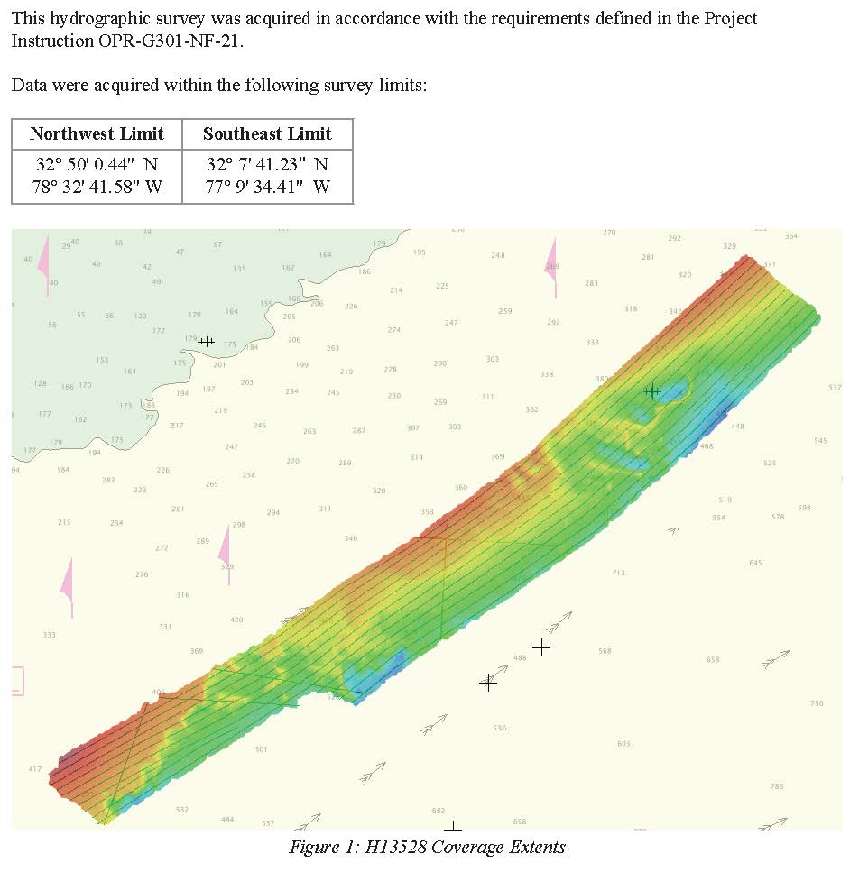
H13528: NOS Hydrographic Survey , 2021-06-12
National Oceanic and Atmospheric Administration, Department of Commerce —
The National Oceanic and Atmospheric Administration (NOAA) has the statutory mandate to collect hydrographic data in support of nautical chart compilation for safe... -
Federal
W00408: NOS Hydrographic Survey , 2015-07-12
National Oceanic and Atmospheric Administration, Department of Commerce —
The National Oceanic and Atmospheric Administration (NOAA) has the statutory mandate to collect hydrographic data in support of nautical chart compilation for safe... -
Federal
NOAA Water Levels for Coastal, Estuaries and Great Lakes regions
National Oceanic and Atmospheric Administration, Department of Commerce —
For over 200 years, NOAA's Center for Operational Oceanographic Products and Services (CO-OPS) and its predecessors have been managing a comprehensive system for... -
Federal
NOAA TIFF Image - 4m Bathymetric Slope of Red Snapper Research Areas in the South Atlantic Bight, 2010
National Oceanic and Atmospheric Administration, Department of Commerce —
This dataset contains unified Bathymetric Slope GeoTiffs with 4x4 meter cell resolution describing the topography of 15 areas along the shelf edge off the South... -
Federal
Shoreline Data Rescue Project of North Carolina and South Carolina, CS275 NGDA
National Oceanic and Atmospheric Administration, Department of Commerce —
These data were automated to provide an accurate high-resolution historical shoreline of North Carolina and South Carolina suitable as a geographic information system... -
Federal
Shoreline Data Rescue Project of Ashley River and Charleston Bay, SC, SC1928A NGDA
National Oceanic and Atmospheric Administration, Department of Commerce —
These data were automated to provide an accurate high-resolution historical shoreline of Ashley River and Charleston Bay, SC suitable as a geographic information... -
Federal
Shoreline Data Rescue Project of Stono Inlet, South Carolina, EC15B02 NGDA
National Oceanic and Atmospheric Administration, Department of Commerce —
These data were automated to provide an accurate high-resolution historical shoreline of Stono Inlet, South Carolina suitable as a geographic information system (GIS)... -
Federal
Shoreline Mapping Program of PORT OF GEORGETOWN, SC, SC1501-CS-N NGDA
National Oceanic and Atmospheric Administration, Department of Commerce —
These data provide an accurate high-resolution shoreline compiled from imagery of PORT OF GEORGETOWN, SC . This vector shoreline data is based on an office... -
Federal
Shoreline Data Rescue Project of Wappoo Creek and Part of Stono River, South Carolina, EC15C04 NGDA
National Oceanic and Atmospheric Administration, Department of Commerce —
These data were automated to provide an accurate high-resolution historical shoreline of Wappoo Creek and Part of Stono River, South Carolina suitable as a geographic... -
Federal
Shoreline Data Rescue Project of Little River Inlet to Bulls Bay, SC, SC1984C NGDA
National Oceanic and Atmospheric Administration, Department of Commerce —
These data were automated to provide an accurate high-resolution historical shoreline of Little River Inlet to Bulls Bay, SC suitable as a geographic information... -
Federal
Shoreline Data Rescue Project of Morris and Folly Islands, Charleston Harbor, South Carolina, EC14C02 NGDA
National Oceanic and Atmospheric Administration, Department of Commerce —
These data were automated to provide an accurate high-resolution historical shoreline of Morris and Folly Islands, Charleston Harbor, South Carolina suitable as a... -
Federal
Shoreline Data Rescue Project of Charleston to Stono Inlet, South Carolina, EC15A02 NGDA
National Oceanic and Atmospheric Administration, Department of Commerce —
These data were automated to provide an accurate high-resolution historical shoreline of Charleston to Stono Inlet, South Carolina suitable as a geographic... -
Federal
Shoreline Data Rescue Project of Brunswick/New Hanover Counties - North Carolina, NC1942A NGDA
National Oceanic and Atmospheric Administration, Department of Commerce —
These data were automated to provide an accurate high-resolution historical shoreline of Brunswick/New Hanover Counties - North Carolina suitable as a geographic... -
Federal
2022 NOAA NGS Emergency Response Imagery: Hurricane Ian
National Oceanic and Atmospheric Administration, Department of Commerce —
Oblique and nadir imagery was acquired following Hurricane Ian from September 29 - October 3, 2022. The aerial photography missions were conducted by the NOAA Remote... -
Federal
Shoreline Data Rescue Project of Cape Fear, N.C. to Winyah Bay, S.C., PH6217 NGDA
National Oceanic and Atmospheric Administration, Department of Commerce —
These data were automated to provide an accurate high-resolution historical shoreline of Cape Fear, N.C. to Winyah Bay, S.C. suitable as a geographic information... -
Federal
1998 Fall East Coast NOAA/USGS/NASA Airborne LiDAR Assessment of Coastal Erosion (ALACE) Project for the US Coastline
National Oceanic and Atmospheric Administration, Department of Commerce —
This data set includes data collected in the fall of 1998 and covers the states of South Carolina, North Carolina, and Virginia. Laser beach mapping uses a pulsed...

Official websites use .gov
A
.gov website belongs to an official government
organization in the United States.
Secure .gov websites use HTTPS
A
lock (
) or https:// means you’ve safely connected to
the .gov website. Share sensitive information only on official,
secure websites.