
-
Federal
EMIT L2B Methane Enhancement Data 60 m V002
National Aeronautics and Space Administration —
The Earth Surface Mineral Dust Source Investigation (EMIT) instrument measures surface mineralogy, targeting the Earth’s arid dust source regions. EMIT is installed... -
Federal
Soil Thermal Conductivity Data (FIFE)
National Aeronautics and Space Administration —
The purpose of the 1989 FIFE soil properties investigation was to obtain a description of the thermal properties of the soils within the FIFE study area. Soil thermal... -
Federal
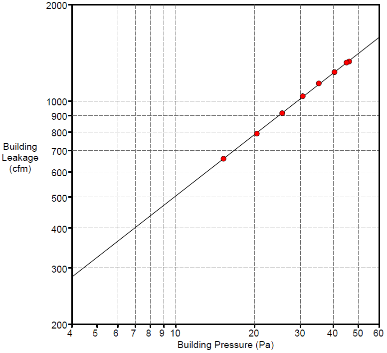
Field Testing of Compartmentalization Methods for Multifamily Construction - Washington DC
Department of Energy —
BSC TO5 Task 2.1 Field Testing of Compartmentalization Methods for Multifamily Construction - Capitol Heights, MD 20743 A building comprising five vertical townhome... -
Federal
NASA MEASURES Precipitation Ensemble based on SSMIS DMSP F18 NASA PPS L1C V05 Tbs 1-orbit L2 Swath 12x12km V1 (PRECIP_SSMIS_F18) at GES DISC
National Aeronautics and Space Administration —
The data presented in this level 2 orbital product are rain rate estimates expressed as mm/hour determined from brightness temperatures (Tbs) obtained from the... -
Federal
SAFARI 2000 Biomass Burning Emissions, Selected Sites, Dry Season 2000
National Aeronautics and Space Administration —
Biomass burning is a major source for gaseous and particulate atmospheric pollution over southern Africa and globally. The purpose of this study was to quantify... -
Federal
GPM MHS on METOP-B (GPROF) Climate-based Radiometer Precipitation Profiling L3 1 day 0.25 degree x 0.25 degree V07 (GPM_3GPROFMETOPBMHS_DAY_CLIM) at GES DISC
National Aeronautics and Space Administration —
Version 07 is the current version of the data set. Older versions are no longer available and have been superseded by Version 07. The "CLIM" products differ from... -
Federal
Delta-X: Bed and Suspended Sediment Grain Size, MRD, LA, USA, 2019-2021, V3
National Aeronautics and Space Administration —
This dataset includes sediment concentration and grain size distribution measurements from suspended and bed sediment samples collected in the Atchafalaya River and... -
Federal
CERES and GEO-Enhanced TOA, Within-Atmosphere and Surface Fluxes, Clouds and Aerosols 1-Hourly Terra-Aqua-NOAA20 Edition4B
National Aeronautics and Space Administration —
CER_SYN1deg-1Hour_Terra-Aqua-NOAA20_Edition4B is the Clouds and the Earth's Radiant Energy System (CERES) and geostationary (GEO) Top-of-Atmosphere (TOA) Within-... -
Federal
BioSCape Vegetation Surveys Berg and Eerste River Catchments, South Africa, 2022-2023
National Aeronautics and Space Administration —
This dataset contains vegetation plot survey data collected at 36 sites across the Berg and Eerste River catchments in the Western Cape, South Africa collected during... -
Federal
BOREAS TE-08 Aspen Bark Spectral Reflectance Data
National Aeronautics and Space Administration —
The BOREAS TE-08 team collected in-lab spectral reflectance data for aspen bark and leaves from three sites within the BOREAS SSA from 24-May-1994 to 16-Jun-1994 (IFC... -
Federal
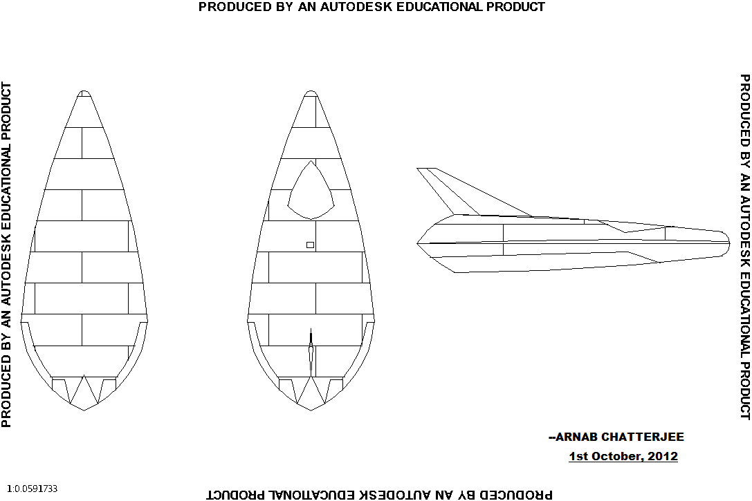
Single reusable spacecraft
National Aeronautics and Space Administration —
Design of a my single person reusable spacecraft. It can carry one person and it has to be dropped from an aircraft at an altitude of 40,000 - 45,000 feet. Can be the... -
Federal
SNPP VIIRS High Resolution Level 3 monthly aerosol data, 0.1x0.1 degree grid Version 001 (AER_DBDT_M10KM_L3_VIIRS_SNPP) at GES DISC
National Aeronautics and Space Administration —
This High-Resolution (0.1 x 0.1 degree) Level 3 monthly Aerosol Optical Depth (AOD) product is generated by combining two Visible Infrared Imaging Radiometer Suite... -
Federal
Pre-ABoVE: Active Layer Thickness and Soil Water Content, Barrow, Alaska, 2013
National Aeronautics and Space Administration —
This data set provides estimates of Active Layer Thickness (ALT) determined with ground-based measurements, and calculated soil volumetric water content (VWC) at four... -
Federal
Snake River Plain Geothermal Play Fairway Analysis Heat, Permeability, and Seal CRS Map Raster Files
Department of Energy —
Snake River Plain Play Fairway Analysis - Phase 1 CRS Raster Files. This dataset contains raster files created in ArcGIS. These raster images depict Common Risk... -
Federal
GPM GROUND VALIDATION DUAL-FREQUENCY DUAL-POLARIZED DOPPLER RADAR (D3R) GCPEX V1
National Aeronautics and Space Administration —
The GPM Ground Validation Dual-frequency Dual-polarized Doppler Radar (D3R) GCPEx and IFloodS data sets contain radar reflectivity and doppler velocity measurements.... -
Federal
BUV/Nimbus-4 Level 2 High-Density Ozone Data V005 (BUVN4L2HDBUV) at GES DISC
National Aeronautics and Space Administration —
The Nimbus-4 BUV Level 2 High-Density Ozone Data collection contains the vertical distribtuion and total column amount of ozone, as well as the full set of ancillary... -
Federal
Calibration Data for Wafer 2 of SRM 3461 - MEMS Cantilever Stiffness
National Institute of Standards and Technology —
SRM 3461 is an AFM sized chip with an array of seven cantilevers on each chip. The uniformity of the chips offered for sale from wafer 2 is excellent and the SRM...

Official websites use .gov
A
.gov website belongs to an official government
organization in the United States.
Secure .gov websites use HTTPS
A
lock (
) or https:// means you’ve safely connected to
the .gov website. Share sensitive information only on official,
secure websites.