
-
Federal
BOREAS Elevation Contours over the NSA and SSA ARC/Info Generate Format
National Aeronautics and Space Administration —
This data set was prepared by BORIS staff by reformatting the original data into the ARC/INFO Generate format. The original data were received in SIF at a scale of... -
Federal
BOREAS DEM Data over the NSA-MSA and SSA-MSA in AEAC Projection
National Aeronautics and Space Administration —
These data were derived from the original DEMs produced by the BOREAS HYD-08 team. The original DEMs were in the UTM projection, while this product is projected in... -
Federal
Oregon Cascades Play Fairway Analysis: Maps
Department of Energy —
The maps in this submission include: heat flow, alkalinity, Cl, Mg, SiO2, Quaternary volcanic rocks, faults, and land ownership. All of the Oregon Cascade region. The... -
Federal
Triton Point Absorber 1:30 Scale Tank Test Data for Extreme Wave Environments
Department of Energy —
This content model summarizes laboratory testing data for the Oscilla Power Triton WEC conducted at 1:30 scale. The WEC was tested in large operational waves and in... -
Federal
Stellwagen Bank bathymetry - Percent slope derived from 5-meter bathymetric contour lines
National Oceanic and Atmospheric Administration, Department of Commerce —
Percent slope of Stellwagen Bank bathymetry. Raster derived from 5-meter bathymetric contour lines (Quads 1-18). Collected on surveys carried out in 4 cruises 1994 -... -
Federal
Project HOTSPOT: Kimberly Well Borehole Geophysics Database
Department of Energy —
The Snake River Plain (SRP), Idaho, hosts potential geothermal resources due to elevated groundwater temperatures associated with the thermal anomaly Yellowstone-... -
Federal
EK80 Water Column Sonar Data Collected During SH1601
National Oceanic and Atmospheric Administration, Department of Commerce —
Scientists from the Fishery Resource Analysis and Monitoring (FRAM) division at the Northwest Fisheries Science Center (NWFSC) led the winter 2016 hake IAT survey... -
Federal
GSS Gulf of Mexico Data Atlas Brown Shrimp Datafile
National Oceanic and Atmospheric Administration, Department of Commerce —
Summarized data set of brown shrimp catch by grouped subarea and grouped depth from 2002 to 2011. -
Federal
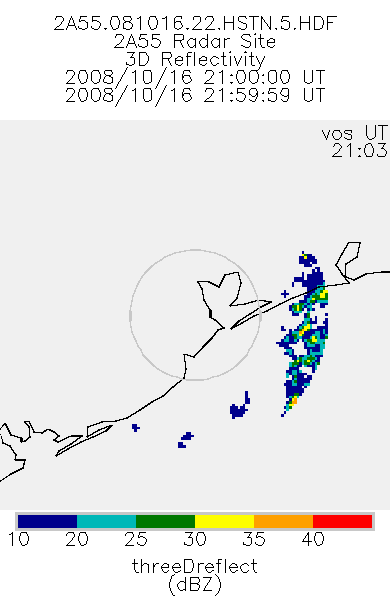
TRMM Ground Validation Radar Site 3D Reflectivity L2 1 hour V7 (TRMM_2A55) at GES DISC
National Aeronautics and Space Administration —
'Radar Site 3-D Reflectivities', is composed of 3 different fields. The first field has an array of 3-D reflectivities in Cartesian coordinates with a 2 km horizontal... -
Federal
Digital Geologic-GIS Map of the Polkville Quadrangle, Kentucky (NPS, GRD, GRI, MACA, POLK digital map) adapted from a U.S. Geological Survey Geologic Quadrangle Map by Gildersleeve (1962)
Department of the Interior —
The Digital Geologic-GIS Map of the Polkville Quadrangle, Kentucky is composed of GIS data layers and GIS tables, and is available in the following GRI-supported GIS... -
Federal
Digital Geologic-GIS Map of the Arkansas Post Quadrangle, Arkansas (NPS, GRD, GRI, ARPO, ARKP digital map) adapted from a Arkansas Geological Survey Digital Geologic Quadrangle Map by Ausbrooks and Prior (2009)
Department of the Interior —
The Digital Geologic-GIS Map of the Arkansas Post Quadrangle, Arkansas is composed of GIS data layers and GIS tables, and is available in the following GRI-supported... -
Federal
Digital Geologic-GIS Map of Buffalo National River and Vicinity, Arkansas (NPS, GRD, GRI, BUFF, BUFF digital map) adapted from Arkansas Geological Survey Digital Geologic Quadrangle Maps by Chandler, Ausbrooks, Braden, Hutto, Smart, Nondorf, Johnson and Traywick (2003, 2003, 2008, 2008, 2011, 2011 and 2012), and U.S. Geological Survey Scientific Investigations Maps by Hudson, Turner, Murray, Pezzutti and Repetski (2001, 2003, 2004, 2006, 2007, 2009, 2010, 2014, 2016 and 2018)
Department of the Interior —
The Digital Geologic-GIS Map of Buffalo National River and Vicinity, Arkansas is composed of GIS data layers and GIS tables, and is available in the following GRI-... -
Federal
Digital Geologic-GIS Map of the Upton Quadrangle, Kentucky (NPS, GRD, GRI, MACA, UPTO digital map) adapted from a U.S. Geological Survey Geologic Quadrangle Map by Moore (1972)
Department of the Interior —
The Digital Geologic-GIS Map of the Upton Quadrangle, Kentucky is composed of GIS data layers and GIS tables, and is available in the following GRI-supported GIS data... -
Federal
Digital Geologic-GIS Map of the Glasgow North Quadrangle, Kentucky (NPS, GRD, GRI, MACA, GLNO digital map) adapted from a U.S. Geological Survey Geologic Quadrangle Map by Haynes (1964), and a Kentucky Geological Survey Digitally Vectorized Geological Quadrangle map by Mullins (2006)
Department of the Interior —
The Digital Geologic-GIS Map of the Glasgow North Quadrangle, Kentucky is composed of GIS data layers and GIS tables, and is available in the following GRI-supported... -
Federal
Digital Geologic-GIS Map of Cumberland Gap National Historical Park and Vicinity, Kentucky, Tennessee and Virginia (NPS, GRD, GRI, CUGA, CUGA digital map) adapted from USGS maps by Harris, et al. (1962), Englund, et al. (1964, 1963), Harris (1965), Maughan, et al. (1973), and Rice, et al. (1978, 1989), Tennessee Division of Geology maps by Brent (1988) and Kohl, et al. (1991), and Kentucky Geological Survey maps by Conley, Sparks, Thompson, Crawford, Johnson and Mullins (2003)
Department of the Interior —
The Digital Geologic-GIS Map of Cumberland Gap National Historical Park and Vicinity, Kentucky, Tennessee and Virginia is composed of GIS data layers and GIS tables,... -
Federal
EK60 Water Column Sonar Data Collected During SH1601
National Oceanic and Atmospheric Administration, Department of Commerce —
Scientists from the Fishery Resource Analysis and Monitoring (FRAM) division at the Northwest Fisheries Science Center (NWFSC) led the winter 2016 hake IAT survey... -
Federal
Stellwagen Bank bathymetry - Degree slope derived from 5-meter bathymetric contour lines
National Oceanic and Atmospheric Administration, Department of Commerce —
Degree slope of Stellwagen Bank bathymetry. Raster derived from 5-meter bathymetric contour lines (Quads 1-18). Collected on surveys carried out in 4 cruises 1994 -... -
State
Figure 4 -- Continuous Abundance Status and Trend By ESU-DPS With Future Status Contours (2022)
State of Washington —
Figure 4 -- Continuous Abundance Status and Trend By ESU-DPS With Future Status Contours (2022). Note: 2020 also attached. -
Federal
2005 Delaware Coastal Program Lidar: Sussex County
National Oceanic and Atmospheric Administration, Department of Commerce —
The data were acquired in March 2005 using the NASA Experimental Advanced Airborne Research Lidar (EAARL) platform in Sussex County, Delaware. Once acquired, the data...

Official websites use .gov
A
.gov website belongs to an official government
organization in the United States.
Secure .gov websites use HTTPS
A
lock (
) or https:// means you’ve safely connected to
the .gov website. Share sensitive information only on official,
secure websites.