
-
Federal
BARREL 4B X-ray Spectrometer (FSPC) Bremsstrahlung X-ray Spectrum Fast Time Resolution, Level 2, 0.05 s Data
National Aeronautics and Space Administration —
FSPC: Six channels of fast time resolution, 50 ms, Bremsstrahlung X-ray spectra detected with a NaI Scintillator. Each channel is separated in its own variable:... -
Federal
VLA Coma Cluster of Galaxies 1.4-GHz Source Catalog
National Aeronautics and Space Administration —
This table contains results from deep 1.4-GHz Very Large Array (VLA) radio continuum observations of two ~0.5 deg2 fields in the Coma cluster of galaxies. The two... -
Federal
SNPP VIIRS High Resolution Level 3 monthly aerosol data, 0.1x0.1 degree grid Version 001 (AER_DBDT_M10KM_L3_VIIRS_SNPP) at GES DISC
National Aeronautics and Space Administration —
This High-Resolution (0.1 x 0.1 degree) Level 3 monthly Aerosol Optical Depth (AOD) product is generated by combining two Visible Infrared Imaging Radiometer Suite... -
Federal
PEM West B Trajectory Data
National Aeronautics and Space Administration —
PEM-West-B_Trajectory_Data is the trajectory data collected during the Pacific Exploratory Mission (PEM) West B suborbital campaign. Data collection for this product... -
Federal
VIIRS/JPSS1 Actual and Potential Evapotranspiration Gap-Filled Yearly L4 Global 500m SIN Grid V002
National Aeronautics and Space Administration —
The NOAA-20 Visible Infrared Imaging Radiometer Suite (VIIRS) Actual and Potential Evapotranspiration product is a gap-filled yearly composite dataset produced at 500... -
Federal
VIIRS/JPSS1 Actual and Potential Evapotranspiration Gap-Filled 8-Day L4 Global 500m SIN Grid V002
National Aeronautics and Space Administration —
The NOAA-20 Visible Infrared Imaging Radiometer Suite (VIIRS) Actual and Potential Evapotranspiration product is a gap-filled 8-day composite dataset produced at 500... -
Federal
MMS 4 Hot Plasma Composition Analyzer (HPCA) Time of Flight, TOF, Counts, Level 2 (L2), Survey Mode, 0.625 s Data
National Aeronautics and Space Administration —
Hot Plasma Composition Analyzer (HPCA) Time of Flight, TOF, Counts, Level 2, Survey 10 s Data. The MMS HPCA instruments measure the energy and composition of... -
Federal
MODIS/Terra Land Surface Temperature/3-Band Emissivity 5-Min L2 1km V006
National Aeronautics and Space Administration —
The MOD21 Version 6 data product was decommissioned on July 31, 2023. Users are encouraged to use the MOD21 Version 6.1 data product.The MOD21 Land Surface... -
Federal
MMS 4 Fast Plasma Investigation, Dual Electron Spectrometer (FPI, DES) Partial Distribution Moments, Level 2 (L2), Fast Mode, 4.5 s Data
National Aeronautics and Space Administration —
FPI usually operates in Fast Survey (FS) Mode in the MMS Region Of Interest (ROI) for the current Mission Phase. Data are taken at Burst (30/150 ms for DES/DIS)... -
Federal
Polar Radiant Energy in the Far InfraRed Experiment (PREFIRE) Spectral Flux from PREFIRE Satellite 2 COG R01
National Aeronautics and Space Administration —
Polar Radiant Energy in the Far InfraRed Experiment (PREFIRE) Spectral Flux from PREFIRE Satellite 2 COG (PREFIRE_SAT2_2B-FLX_COG) is derived from data collected by... -
Federal
Sentinel-6A MF Jason-CS L2 Advanced Microwave Radiometer (AMR-C) STC Geophysical Parameters
National Aeronautics and Space Administration —
Provides L2 short time critical (STC; 36-hour latency) geophysical information from the Advanced Microwave Radiometer on the Sentinel-6A Michael Freilich spacecraft... -
Federal
NuSTAR Master Catalog
National Aeronautics and Space Administration —
The Nuclear Spectroscopic Telescope Array (NuSTAR) mission, launched on 2012 June 13, is the first focusing high-energy X-ray telescope in orbit. NuSTAR operates in... -
Federal
NACP Site: Terrestrial Biosphere Model Output Data in Original Format
National Aeronautics and Space Administration —
This data set contains the original model output data submissions from the 24 terrestrial biosphere models (TBM) that participated in the North American Carbon... -
Federal
HIRENASD Beam FEM
National Aeronautics and Space Administration —
This contains attempts to create BEAM FEM model. I have started a Blog to discuss this... please put your comments there and I will attempt to keep everything... -
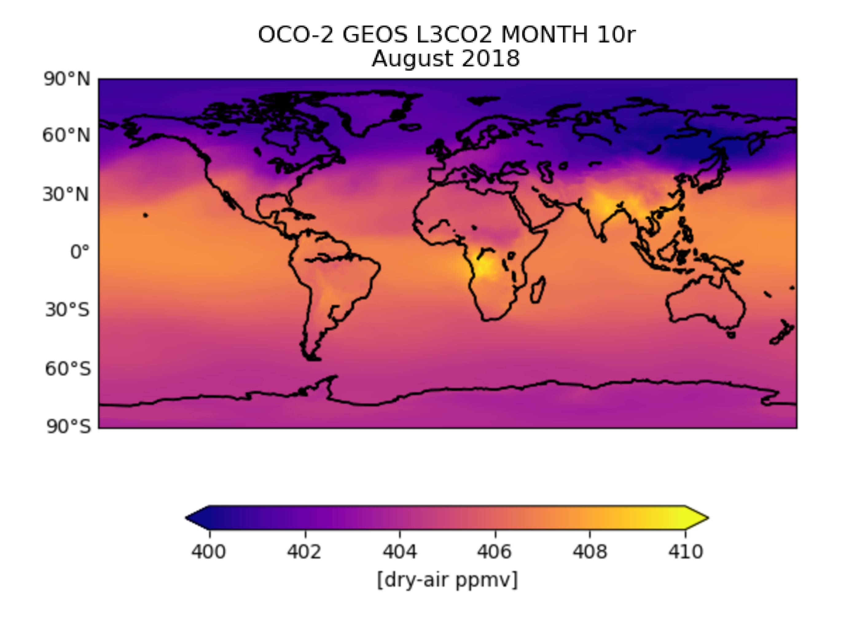
Federal
OCO-2 GEOS Level 3 monthly, 0.5x0.625 assimilated CO2 V10r (OCO2_GEOS_L3CO2_MONTH) at GES DISC
National Aeronautics and Space Administration —
This is the Gridded Monthly OCO-2 Carbon Dioxide assimilated dataset. The OCO-2 mission provides the highest quality space-based XCO2 retrievals to date. However, the... -
Federal
GLDAS Catchment Land Surface Model L4 monthly 1.0 x 1.0 degree V2.0 (GLDAS_CLSM10_M) at GES DISC
National Aeronautics and Space Administration —
NASA Global Land Data Assimilation System Version 2 (GLDAS-2) has three components: GLDAS-2.0, GLDAS-2.1, and GLDAS-2.2. GLDAS-2.0 is forced entirely with the... -
Federal
Bulk RNA sequencing and spatially resolved transcriptional profiling of cerebellums from mice flown on the RR-10 mission
National Aeronautics and Space Administration —
The objective of the Rodent Research-10 mission (RR-10) was to investigate how spaceflight affects the cellular and molecular mechanisms of normal bone tissue... -
Federal
MMS 2 Magnetic Ephemeris and Coordinates (MEC) and Support (Tsyganenko 1989 model, Dynamic conditions), Level 2 (L2), Survey Mode, 30 s Data
National Aeronautics and Space Administration —
Magnetospheric Multiscale 2 (MMS 2) spacecraft position, velocity, attitude, angular momentum vector, and magnetic ephemeris and coordinates (MEC), Level-2 science... -
Federal
GLDAS Noah Land Surface Model L4 3 hourly 0.25 x 0.25 degree V2.0 (GLDAS_NOAH025_3H) at GES DISC
National Aeronautics and Space Administration —
NASA Global Land Data Assimilation System Version 2 (GLDAS-2) has three components: GLDAS-2.0, GLDAS-2.1, and GLDAS-2.2. GLDAS-2.0 is forced entirely with the...

Official websites use .gov
A
.gov website belongs to an official government
organization in the United States.
Secure .gov websites use HTTPS
A
lock (
) or https:// means you’ve safely connected to
the .gov website. Share sensitive information only on official,
secure websites.