
-
Federal
AVIRIS-3 L2A Orthocorrected Surface Reflectance, Facility Instrument Collection
National Aeronautics and Space Administration —
This dataset contains Level 2A (L2A) surface reflectance images from the Airborne Visible / Infrared Imaging Spectrometer-3 (AVIRIS-3) instrument. This is the NASA... -
Federal
LBA-ECO TG-07 Forest Soil P, C, and N Pools, km 83 Site, Tapajos National Forest
National Aeronautics and Space Administration —
This data set reports phosphorus (P), carbon (C), and nitrogen (N) nutrient pool concentrations for forest soils and roots and P pool concentrations for forest floor... -
Federal
LBA-ECO ND-01 Forest and Pasture Soil and Grass Analyses, Rondonia, Brazil: 2003-2004
National Aeronautics and Space Administration —
This data set provides soil physical and chemical properties, and grass nutrient measurements of samples collected from 17 pasture sites located within the state of... -
Federal
LBA-ECO CD-15 LAI and Productivity Data, km 67, Tapajos National Forest: 2003-2004
National Aeronautics and Space Administration —
This data set provides mean leaf area index (LAI), dendrometry band measurements, and litterfall mass from samples collected at the km 67 research site, Topajos... -
Federal
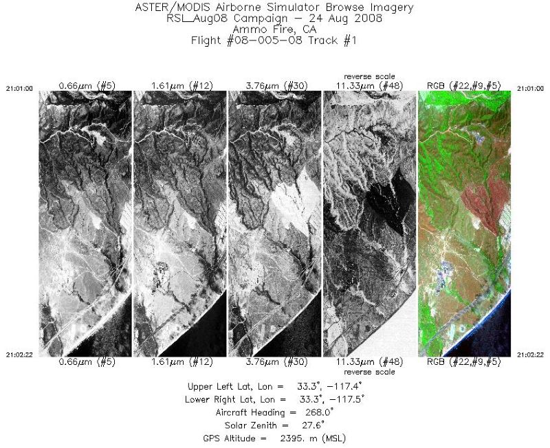
MASTER: California Fire-Burn Area Emergency Response, California, August 2008
National Aeronautics and Space Administration —
This dataset includes Level 1B (L1B) data products from the MODIS/ASTER Airborne Simulator (MASTER) instrument. The spectral data were collected during four flights... -
Federal
MASTER: HyspIRI Airborne Campaign, Hawaii, 2017
National Aeronautics and Space Administration —
This dataset includes Level 1B (L1B) and Level 2 (L2) data products from the MODIS/ASTER Airborne Simulator (MASTER) instrument. The spectral data were collected as... -
Federal
MASTER: California Fire-Burn Area Emergency Response, California, April 2008
National Aeronautics and Space Administration —
This dataset includes Level 1B (L1B) data products from the MODIS/ASTER Airborne Simulator (MASTER) instrument. The spectral data were collected as part of the... -
Federal
BOREAS TE-22 Tree Ring Data
National Aeronautics and Space Administration —
The BOREAS TE-22 team collected complete tree cores at several sites in the SSA and NSA in order to perform historical growth studies and relate the information to... -
Federal
MASTER: California Fires, California, November 2007
National Aeronautics and Space Administration —
This dataset includes Level 1B (L1B) data products from the MODIS/ASTER Airborne Simulator (MASTER) instrument. The spectral data were collected during six flights... -
Federal
BOREAS TE-02 Root Respiration Data
National Aeronautics and Space Administration —
The BOREAS TE-02 team collected several data sets in support of its efforts to characterize and interpret information on the respiration of the foliage, roots, and... -
Federal
NACP Peatland Landcover Type and Wildfire Burn Severity Maps, Alberta, Canada
National Aeronautics and Space Administration —
This data set provides landcover maps of (1) peatland type (bog, fen, marsh, swamp) with levels of biomass (open, forested) and (2) Burn Severity Index (BSI) (Dyrness... -
Federal
Probabilistic Freeze-Thaw Record for the Northern Hemisphere, 2016-2020
National Aeronautics and Space Administration —
This dataset provides a probabilistic freeze/thaw (FT) data record from 2016 to 2020 for the Northern Hemisphere derived using a deep learning model (U-Net). The... -
Federal
BOREAS HYD-08 DEM Data over the NSA-MSA and SSA-MSA in UTM Projection
National Aeronautics and Space Administration —
These DEMs were produced from digitized contours at a cell resolution of 100 meters. Vector contours of the area were used as input to a software package that... -
Federal
MASTER: HyspIRI Airborne Campaign, Hawaii, 2018
National Aeronautics and Space Administration —
This dataset includes Level 1B (L1B) and Level 2 (L2) data products from the MODIS/ASTER Airborne Simulator (MASTER) instrument. The spectral data were collected as... -
Federal
PROVE Surface albedo of Jornada Experimental Range, New Mexico, 1997
National Aeronautics and Space Administration —
The objective of this study was to determine the spatial variations in field measurements of broadband albedo as related to the ground cover and under a range of... -
Federal
BOREAS TE-20 Soils Data over the NSA-MSA and Tower Sites in Vector Format
National Aeronautics and Space Administration —
The BOREAS TE-20 team collected several data sets for use in developing and testing models of forest ecosystem dynamics. This data set contains vector layers of soil... -
Federal
BOREAS Landsat MSS Imagery: Digital Counts
National Aeronautics and Space Administration —
The Earth Resources Technology Satellite (ERTS) Program launched the first of a series of satellites (ERTS-1) in 1972. Part of the NASA Earth Resources Survey... -
Federal
BOREAS RSS-15 SIR-C and TM Biomass and Landcover Maps of the NSA and SSA
National Aeronautics and Space Administration —
As part of BOREAS, the RSS-15 team conducted an investigation using SIR-C , X-SAR and Landsat TM data for estimating total above-ground dry biomass for the SSA and... -
Federal
BOREAS RSS-16 Level-3b DC-8 AIRSAR SY Images
National Aeronautics and Space Administration —
The BOREAS RSS-16 team used satellite and aircraft SAR data in conjunction with various ground measurements to determine the moisture regime of the boreal forest.... -
Federal
Aircraft Flux-Detrended: Univ. Col. (FIFE)
National Aeronautics and Space Administration —
The NCAR King Air participation in FIFE-1987 and FIFE-1989 was part of a coordinated atmospheric boundary layer component which included other aircraft, surface...

Official websites use .gov
A
.gov website belongs to an official government
organization in the United States.
Secure .gov websites use HTTPS
A
lock (
) or https:// means you’ve safely connected to
the .gov website. Share sensitive information only on official,
secure websites.