
-
Federal
BOREAS NS001 TMS Level-0 Images in BIL Format
National Aeronautics and Space Administration —
For BOREAS, the NS001 TMS imagery, along with the other remotely sensed images, was collected in order to provide spatially extensive information over the primary... -
Federal
BOREAS Site and Area Geographic Coordinate Information
National Aeronautics and Space Administration —
In an effort to properly document the sites and areas where data were collected, personnel of the BOReal Ecosystem-Atmosphere Study (BOREAS) Information System... -
Federal
BOREAS TE-05 CO2 Concentration and Stable Isotope Composition
National Aeronautics and Space Administration —
The BOREAS group TE-05 collected measurements in the NSA and SSA on gas exchange, gas composition and tree growth. This data set contains measurements of the... -
Federal
BOREAS HYD-01 Soil Hydraulic Properties
National Aeronautics and Space Administration —
The BOREAS HYD-01 team made several measurements related to soil moisture and soil properties. These soil hydraulic properties were determined at the flux tower sites... -
Federal
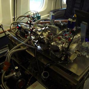
ATom: L2 In Situ Peroxyacetyl Nitrate (PAN) Measurements from Georgia Tech CIMS
National Aeronautics and Space Administration —
This dataset provides measurements of two important components of photochemical smog - peroxyacetyl nitrate (PAN) and peroxyl propionyl nitrate (PPN)- measured by the... -
Federal
Development and Evolution of NASA Satellite Remote Sensing for Ecology
National Aeronautics and Space Administration —
This dataset provides a presentation that highlights the role NASA research and researchers played in developing a wide range of significant, quantitative ecological... -
Federal
NACP Regional: National Greenhouse Gas Inventories and Aggregated Gridded Model Data
National Aeronautics and Space Administration —
This data set provides two products that were derived from the recently published North American Carbon Program (NACP) Regional Synthesis 1-degree terrestrial... -
Federal
A Global Database of Field-observed Leaf Area Index in Woody Plant Species, 1932-2011
National Aeronautics and Space Administration —
This data set provides global leaf area index (LAI) values for woody species. The data are a compilation of field-observed data from 1,216 locations obtained from 554... -
Federal
LBA-ECO LC-24 Land Cover Classes from Landsat TM, Uruara, Para: 1986-1991
National Aeronautics and Space Administration —
This data set provides course land cover classifications derived from Landsat TM images for 1986, 1988, and 1991 for the area surrounding the municipality of Uruara,... -
Federal
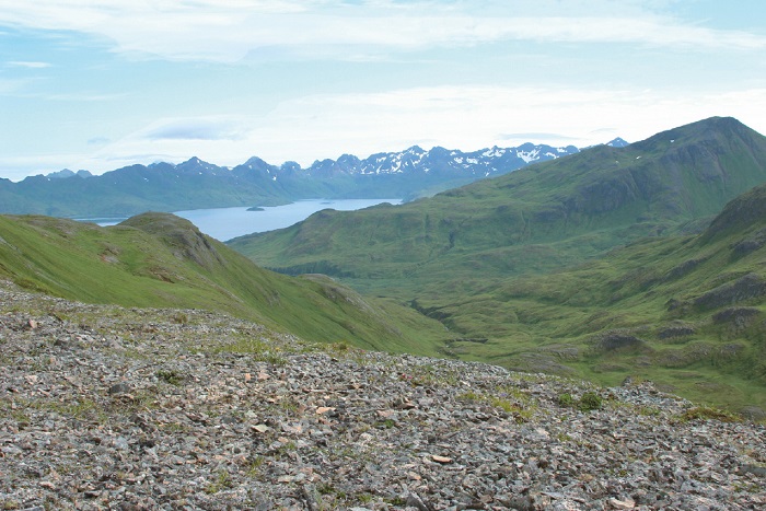
Arctic Vegetation Plots on Unalaska Island, Aleutian Islands, Alaska, 2007
National Aeronautics and Space Administration —
This data set provides environmental, soil, and vegetation data collected during August 2007 from 69 study plots at the Unalaska Island research site, and one plot on... -
Federal
CARVE: Daily Thaw State of Boreal and Arctic Alaska from AMSR-E and SSM/I, 2003-2014
National Aeronautics and Space Administration —
This data set provides daily 10 km resolution maps of the Alaskan and Arctic Boreal land surface state as either frozen, melting, or thawed. These data are generated... -
Federal
Soil Matric Potential, Dielectric, and Physical Properties, Arctic Alaska, 2018
National Aeronautics and Space Administration —
This dataset provides lab-measured soil properties, including soil water matric potential, soil dielectric properties, soil electrical conductivity, corresponding... -
Federal
SAFARI 2000 Derived Soil Properties, 0.5-Deg (ISRIC-WISE)
National Aeronautics and Space Administration —
The data set consists of a southern Africa subset of the ISRIC-WISE global data set of derived soil properties. The World Inventory of Soil Emission Potentials (WISE)... -
Federal
Global Distribution of Root Profiles in Terrestrial Ecosystems
National Aeronautics and Space Administration —
Rooting depths were estimated from a global database of root profiles that was assembled from the primary literature to study relationships of abiotic and biotic... -
Federal
Arctic Boreal Annual Burned Area, Circumpolar Boreal Forest and Tundra, V2, 2002-2022
National Aeronautics and Space Administration —
This dataset provides annual cumulative end-of-season burned area in circumpolar boreal forests and tundra for the years 2002-2022. The data were generated using the... -
Federal
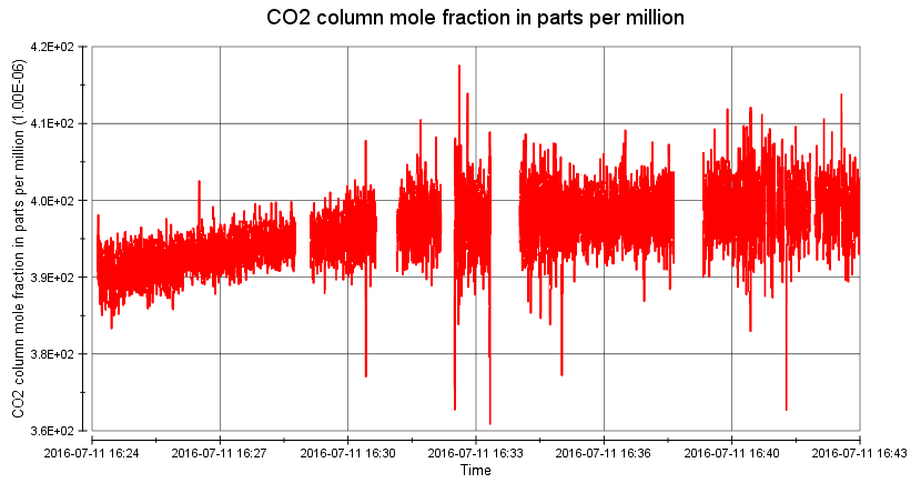
ACT-America: L2 Remotely Sensed Column-average CO2 by Airborne Lidar, Eastern USA
National Aeronautics and Space Administration —
This dataset provides Level 2 (L2) remotely sensed column-average carbon dioxide (CO2) concentrations measured during airborne campaigns in Summer 2016, Winter 2017,...

Official websites use .gov
A
.gov website belongs to an official government
organization in the United States.
Secure .gov websites use HTTPS
A
lock (
) or https:// means you’ve safely connected to
the .gov website. Share sensitive information only on official,
secure websites.