

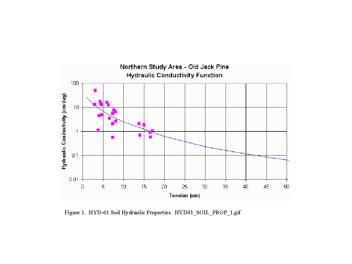
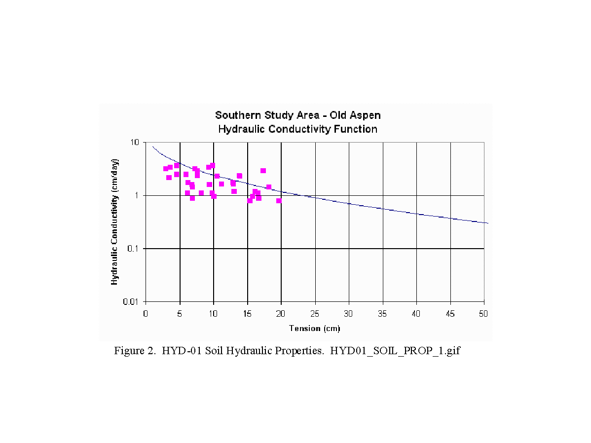
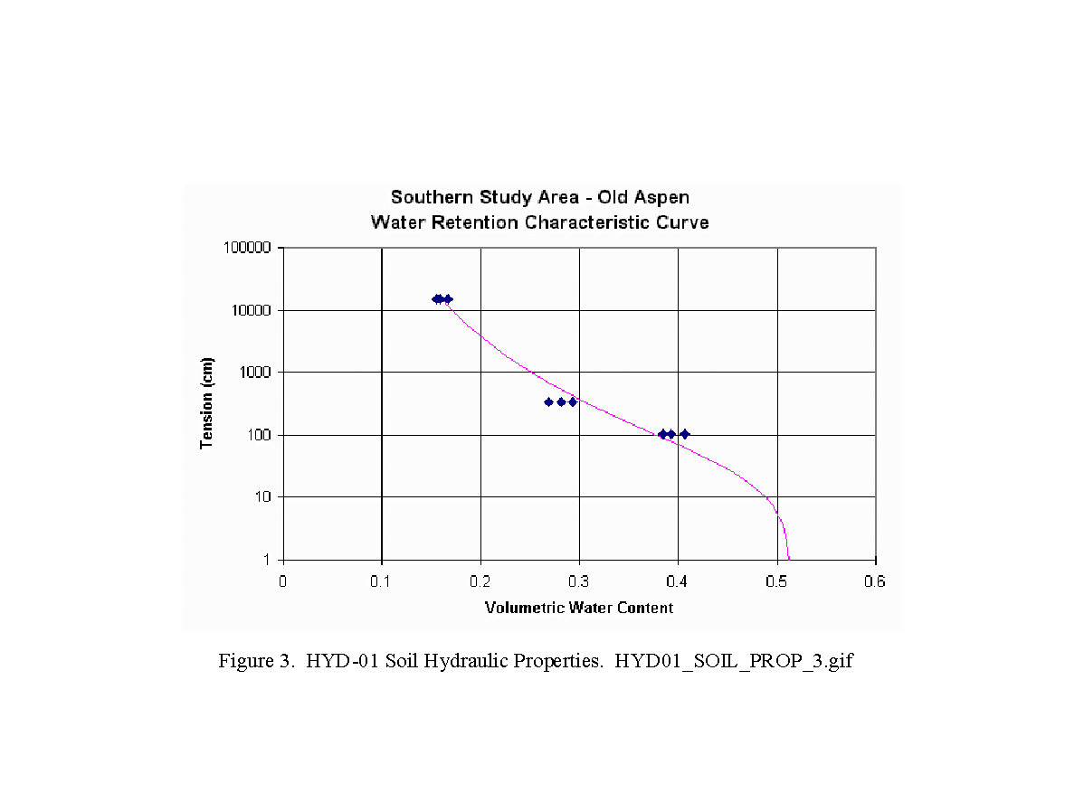
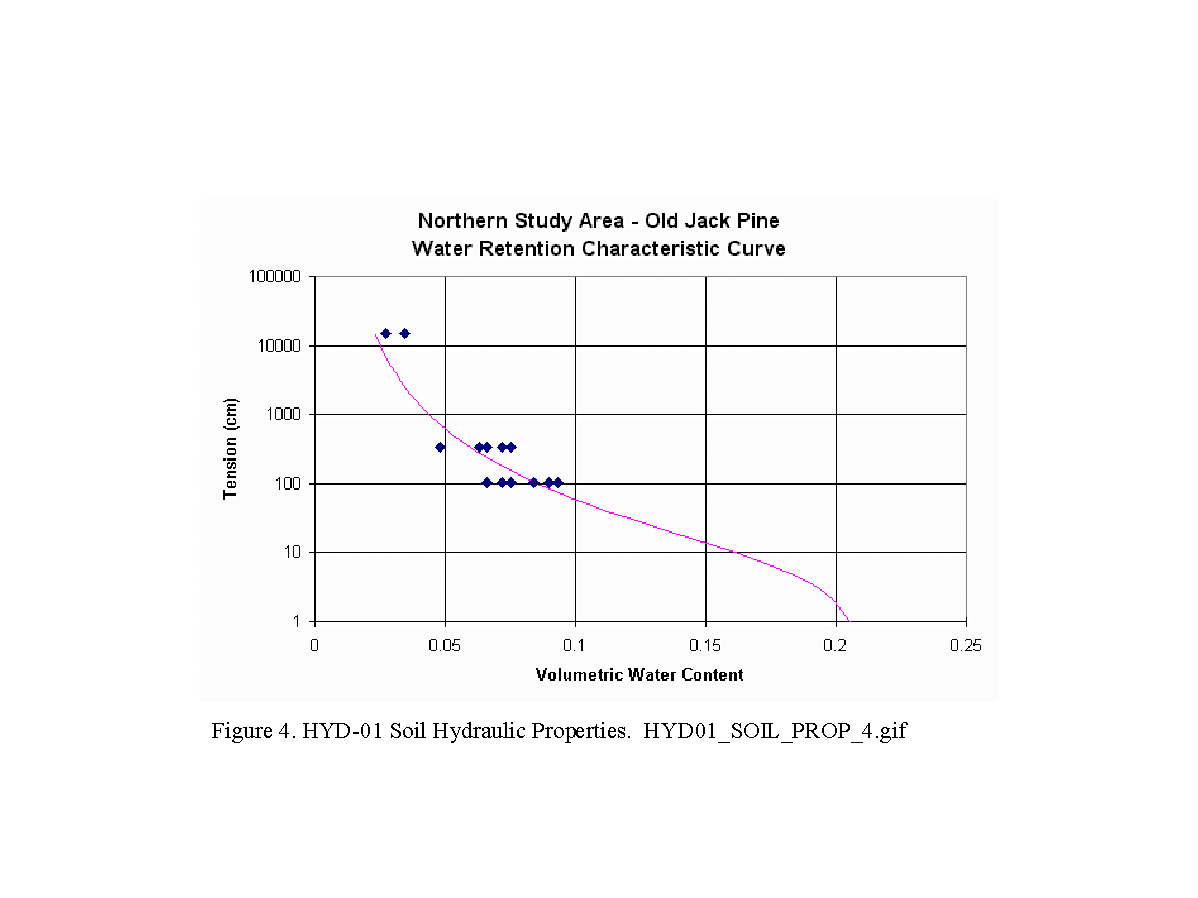
BOREAS HYD-01 Soil Hydraulic Properties
Access & Use Information
Public: This dataset is intended for public access and use.
License: No license information was provided. If this work was prepared by an officer or employee of the United States government as part of that person's official duties it is considered a U.S. Government Work.
Downloads & Resources
-
Data Information (Unknown Format)BIN
-
Data Information (HTML)HTML
-
Data Information (ZIP)ZIP
h01_shd_253.zip
-
Data Information (PNG)PNG
boreas_logo_square.png
-
Data Information (PDF)PDF
HYD01_SOIL_PROP.pdf
-
Data Information (Unknown Format)BIN
HYD01_SOIL_PROP.doc
-
Data Information (Unknown Format)BIN
HYD01_SOIL_PROP.txt
-
Data Information (Unknown Format)BIN
HYD01_SOIL_PROP_1.gif
-
Data Information (Unknown Format)BIN
h01_shd.def
-
Data Information (Unknown Format)BIN
HYD01_SOIL_PROP_2.gif
-
Data Information (Unknown Format)BIN
HYD01_SOIL_PROP_3.gif
-
Data Information (Unknown Format)BIN
HYD01_SOIL_PROP_4.gif
-
Data Information (Unknown Format)BIN
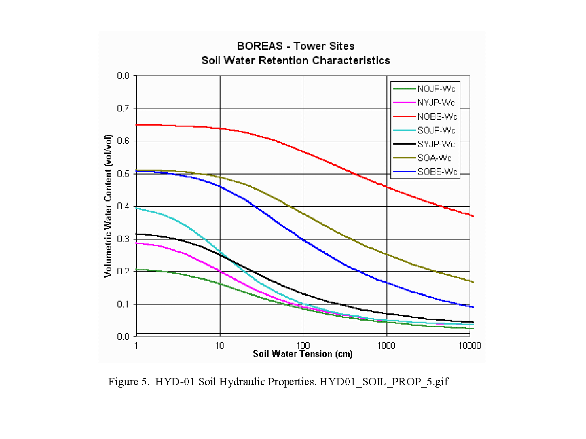
HYD01_SOIL_PROP_5.gif
-
Data Information (Unknown Format)BIN
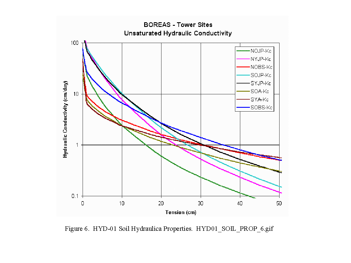
HYD01_SOIL_PROP_6.gif
-
Landing PageLanding Page
Dates
| Metadata Created Date | April 11, 2025 |
|---|---|
| Metadata Updated Date | September 19, 2025 |
Metadata Source
- Data.json Data.json Metadata
Harvested from NASA Data.json
Additional Metadata
| Resource Type | Dataset |
|---|---|
| Metadata Created Date | April 11, 2025 |
| Metadata Updated Date | September 19, 2025 |
| Publisher | ORNL_DAAC |
| Maintainer | |
| Identifier | 10.3334/ORNLDAAC/253 |
| Data Last Modified | 2025-09-10 |
| Category | Earth Science |
| Public Access Level | public |
| Bureau Code | 026:00 |
| Metadata Context | https://project-open-data.cio.gov/v1.1/schema/catalog.jsonld |
| Schema Version | https://project-open-data.cio.gov/v1.1/schema |
| Catalog Describedby | https://project-open-data.cio.gov/v1.1/schema/catalog.json |
| Harvest Object Id | ec37efa5-b3c4-44cd-b4a9-c712f46e105b |
| Harvest Source Id | 58f92550-7a01-4f00-b1b2-8dc953bd598f |
| Harvest Source Title | NASA Data.json |
| Homepage URL | https://search.earthdata.nasa.gov/search?q=h01_shd_253&ac=true |
| Old Spatial | {"WestBoundingCoordinate":-106.2,"NorthBoundingCoordinate":55.93,"EastBoundingCoordinate":-98.29,"SouthBoundingCoordinate":53.63},"CARTESIAN" |
| Program Code | 026:000 |
| Source Datajson Identifier | True |
| Source Hash | f6330576134bb64fe8699137bdef868d055010e8bbe7a0549a488a96ebe2f7bd |
| Source Schema Version | 1.1 |
| Spatial | |
| Temporal | 1994-01-01/1994-01-01 |
Didn't find what you're looking for? Suggest a dataset here.