
-
Federal
ECOSTRESS Attitude Daily L1B Global 70m V001
National Aeronautics and Space Administration —
The ECOsystem Spaceborne Thermal Radiometer Experiment on Space Station (ECOSTRESS) mission measures the temperature of plants to better understand how much water... -
Federal
DC-8 Meteorological and Navigation Data CPEX-AW V1
National Aeronautics and Space Administration —
The DC-8 Meteorological and Navigation Data CPEX-AW dataset is a subset of airborne measurements that include GPS positioning and trajectory data, aircraft... -
Federal
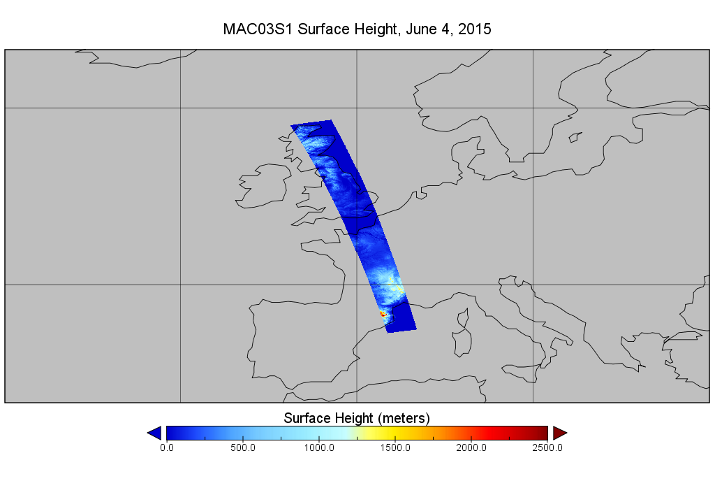
MODIS/Aqua Geolocation Fields 1km 5-Min 1A Wide Swath Subset along CloudSat V002 (MAC03S1) at GES DISC NGDA
National Aeronautics and Space Administration —
This is the wide-swath MODIS/Aqua subset along CloudSat field of view track. The goal of the wide-swath subset is to select and return MODIS data that are within... -
Federal
GPM GROUND VALIDATION NASA ER-2 NAVIGATION DATA MC3E V1
National Aeronautics and Space Administration —
The GPM Ground Validation NASA ER-2 Navigation Data MC3E dataset contains information recorded by an on board navigation recorder (NavRec). In addition to typical... -
Federal
Sentinel-5P TROPOMI Near-Real-Time (NRT) Radiance product band 4 (UVIS detector) L1B 5.5km x 3.5km V2 (S5P_L1B_RA_BD4_HiR_NRT) at GES DISC
National Aeronautics and Space Administration —
The Sentinel-5P TROPOMI Near Real Time (NRT) Radiance product band 4 (UVIS detector) L1B 5.5km x 21km V2 (S5P_L1B_RA_BD4_HiR_NRT) product at GES DISC is the near real... -
Federal
SMAP_L1B_SIGMA_NAUGHT_LOW_RES_V003
National Aeronautics and Space Administration —
SMAP Level 1B Sigma Naught Low Res Product Version 3 -
Federal
OCO-2 Level 0 spacecraft ephemerides, Retrospective Processing V11r (OCO2_Eph) at GES DISC
National Aeronautics and Space Administration —
Version 11r is the current version of the data set. Older versions will no longer be available and are superseded by Version 11r. The Orbiting Carbon Observatory is... -
Federal
SMAP_L1A_RADAR_V001
National Aeronautics and Space Administration —
SMAP Level 1A Radar Product -
Federal
OCO-2 Level 0 spacecraft attitude data V11.2 (OCO2_Att) at GES DISC
National Aeronautics and Space Administration —
Version 11.2 is the current version of the data set. Older versions will no longer be available and are superseded by Version 11.2 The Orbiting Carbon Observatory is... -
Federal
SMAP_L1A_RADAR_RECEIVE_ONLY_V003
National Aeronautics and Space Administration —
SMAP Level 1A Radar Receive Only Product Version 3 -
Federal
SMAP_L1A_RADAR_QA_V001
National Aeronautics and Space Administration —
SMAP Level 1A Radar Data Quality Information -
Federal
SMAP_L1B_SIGMA_NAUGHT_LOW_RES_QA_V003
National Aeronautics and Space Administration —
SMAP Level 1B Sigma Naught Low Res Data Quality Info Version 3 -
Federal
SMAP_L1A_RADAR_RECEIVE_ONLY_METADATA_V001
National Aeronautics and Space Administration —
SMAP Level 1A Radar Receive Only Product Metadata Version 1 -
Federal
GLAS/ICESat L1A Global Laser Pointing Data (HDF5) V033
National Aeronautics and Space Administration —
Level-1A global laser pointing data (GLAH04) contain two orbits of attitude data from the spacecraft star tracker, instrument star tracker, gyro, and laser reference... -
Federal
SMAP_L1A_RADAR_METADATA_V002
National Aeronautics and Space Administration —
SMAP Level 1A Radar Product Metadata Version 2 -
Federal
OLCI/Sentinel-3B L1 Reduced Resolution Top of Atmosphere Reflectance
National Aeronautics and Space Administration —
The OLCI/Sentinel-3B L1 Reduced Resolution Top of Atmosphere Reflectance product, S3B_OL_1_ERR is generated from the data acquired by the Ocean and Land Colour... -
Federal
OCO-2 Level 0 spacecraft ephemerides V11.2 (OCO2_Eph) at GES DISC
National Aeronautics and Space Administration —
Version 11.2 is the current version of the data set. Older versions will no longer be available and are superseded by Version 11.2. The Orbiting Carbon Observatory is... -
Federal
OLCI/Sentinel-3A L1 Reduced Resolution Top of Atmosphere Reflectance
National Aeronautics and Space Administration —
The OLCI/Sentinel-3A L1 Reduced Resolution Top of Atmosphere Reflectance, S3A_OL_1_ERR is generated from the data aquired by the Ocean and Land Colour Instrument... -
Federal
GOES-R PLT ER-2 Flight Navigation Data V1
National Aeronautics and Space Administration —
The GOES-R PLT ER-2 Flight Navigation Data dataset consists of multiple altitude, pressure, temperature parameters, airspeed, and ground speed measurements collected... -
Federal
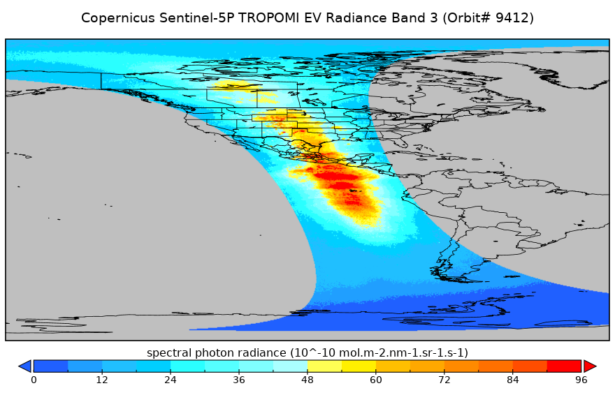
Sentinel-5P TROPOMI Radiance product band 3 (UVIS detector) L1B 5.5km x 3.5km V2 (S5P_L1B_RA_BD3_HiR) at GES DISC
National Aeronautics and Space Administration —
Starting from August 6th in 2019, Sentinel-5P TROPOMI along-track high spatial resolution (~5.5km at nadir) has been implemented. For data before August 6th of 2019,...

Official websites use .gov
A
.gov website belongs to an official government
organization in the United States.
Secure .gov websites use HTTPS
A
lock (
) or https:// means you’ve safely connected to
the .gov website. Share sensitive information only on official,
secure websites.