

97 datasets found for "Map References"
-
Federal
Wind Turbine Structure Setbacks: Ordinances (2022) and Extrapolated Trends, 115 Hub Height 170 Rotor Diameter
Department of Energy —
This dataset represents wind energy setback requirements from structures based on existing county ordinances as of April 2022. A setback requirement is a minimum... -
County
Allegheny County 2000/2010 Census Tract Relationships
Allegheny County / City of Pittsburgh / Western PA Regional Data Center —
The Allegheny County 2000-2010 Census Tract Relationship File shows how 2010 Census tracts in Allegheny County, Pennsylvania relate to the 2000 Census tracts. Each... -
Federal
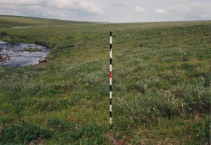
Arctic Vegetation Plots at Happy Valley, Alaska, 1994
National Aeronautics and Space Administration —
This dataset provides environmental, soil, and vegetation data collected in July 1994 from 56 study plots at the Happy Valley research site, located along the... -
Federal
Utah FORGE: Seismic Velocity Models, February 2021
Department of Energy —
This dataset contains a map, showing the Utah FORGE seismic stations, and seismic velocity model data. There are 61 1-D velocity models which are in a compressed TAR... -
Federal
Next Generation Weather Radar (NEXRAD) Setback (4-km)
Department of Energy —
The Next Generation Weather Radar (NEXRAD) system is a network of doppler radar operated jointly by the National Weather Service (NWS), the Federal Aviation... -
Federal
Wind Turbine Sound Setbacks and Supply Curves: Ordinances and Extrapolated Trends, 110 Hub Height, 130 Rotor Diameter
Department of Energy —
This dataset provides a comprehensive set of wind turbine sound setbacks from every residential structure in the contiguous United States (CONUS). A sound setback is... -
Federal
EMIT L4 Earth System Model Products V001
National Aeronautics and Space Administration —
The Earth Surface Mineral Dust Source Investigation (EMIT) instrument measures surface mineralogy, targeting the Earth’s arid dust source regions. EMIT is installed... -
Federal
ECOSTRESS Tiled Evaporative Stress Index PT-JPL Instantaneous L4 Global 70 m V002
National Aeronautics and Space Administration —
The ECOsystem Spaceborne Thermal Radiometer Experiment on Space Station (ECOSTRESS) mission measures the temperature of plants to better understand how much water... -
Federal
HRIR/Nimbus-3 Level 1 Meteorological Radiation Data V001 (HRIRN3L1) at GES DISC
National Aeronautics and Space Administration —
HRIRN3L1 is the High Resolution Infrared Radiometer (HRIR) Nimbus-3 Level 1 Meteorological Radiance Data (NMRT) product and contains infrared radiances converted to... -
Federal
EMIT L3 Aggregated Mineral Spectral Abundance and Uncertainty 0.5 Deg V001
National Aeronautics and Space Administration —
The Earth Surface Mineral Dust Source Investigation (EMIT) instrument measures surface mineralogy, targeting the Earth’s arid dust source regions. EMIT is installed... -
City
Austin Tree Canopy Map 2022
City of Austin —
City of Austin Open Data Terms of Use https://data.austintexas.gov/stories/s/ranj-cccq This is a map depicting tree canopy in Austin, Texas summer of 2022. Data and... -
Federal
NACP Aboveground Biomass and Carbon Baseline Data, V.2 (NBCD 2000), U.S.A., 2000
National Aeronautics and Space Administration —
The NBCD 2000 (National Biomass and Carbon Dataset for the Year 2000) data set provides a high-resolution (30 m) map of year-2000 baseline estimates of basal area-... -
Federal
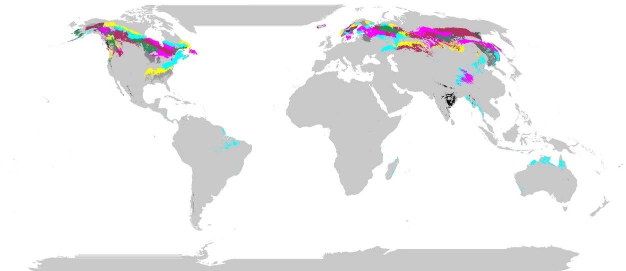
Phenoregions For Monitoring Vegetation Responses to Climate Change
National Aeronautics and Space Administration —
The overall purpose in this research was to identify the regions of the world best suited for long-term monitoring of biospheric responses to climate change, i.e.... -
Federal
EMIT L2B Estimated Mineral Identification and Band Depth and Uncertainty 60 m V001
National Aeronautics and Space Administration —
The Earth Surface Mineral Dust Source Investigation (EMIT) instrument measures surface mineralogy, targeting the Earth’s arid dust source regions. EMIT is installed... -
Federal
Wind Energy: Bans or Moratoriums (2022)
Department of Energy —
This dataset identifies counties and municipalities that had a wind energy ban or moratorium as of April 2022. A TIF data file and a PNG map of the data are provided,... -
Federal
Kilauea Magnetotelluric Dataset
Department of Energy —
In 2002 and 2003 a collaborative effort was undertaken between Lawrence Berkeley National Laboratory, Sandia National Laboratories, the USGS Menlo Park, the USGS... -
Federal
NPP Grassland: Consistent Worldwide Site Estimates, 1954-1990, R1
National Aeronautics and Space Administration —
The NPP Database contains documented field measurements of NPP for global terrestrial sites compiled from published literature and other extant data sources. The NPP... -
Federal
Solar PV Oil and Gas Pipeline Setbacks: Ordinances (2022) and Extrapolated Trends
Department of Energy —
This dataset represents solar energy setback requirements from oil and gas pipelines. A setback requirement is a minimum distance from a pipeline that an energy... -
Federal
Vulcan: High-Resolution Hourly Fossil Fuel CO2 Emissions in USA, 2010-2015, Version 3
National Aeronautics and Space Administration —
The Vulcan version 3.0 hourly dataset quantifies hourly emissions at a 1-km resolution for the 2010-2015 time period. Estimates are provided of hourly carbon dioxide... -
Federal
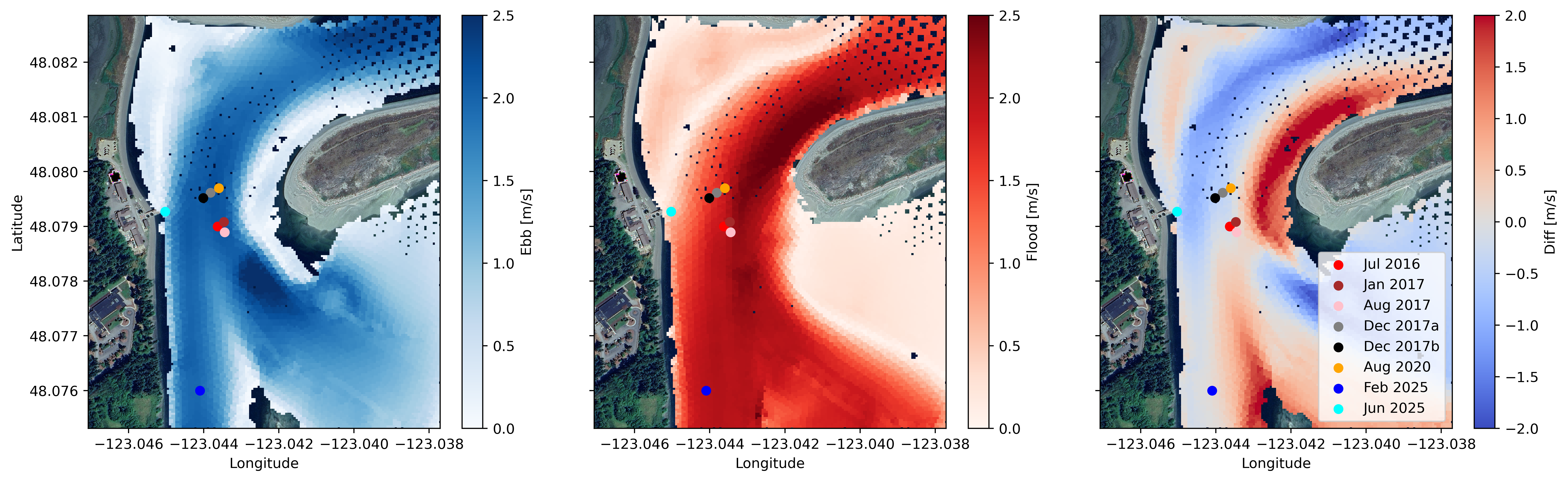
Water Velocity and Turbulence Data from Sequim Bay, WA, 2016 - 2025
Department of Energy —
Collection of publishable datasets from bottom-lander deployments of acoustic Doppler instrumentation in Sequim Bay, WA measured between 2016 and 2025. These data...
97 datasets found for "Map References"