

33 datasets found for "Geologic Maps"
-
Federal
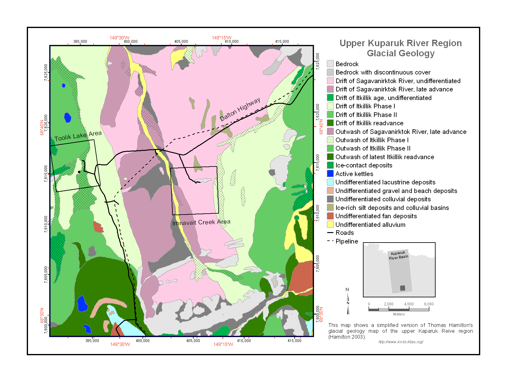
Maps of Vegetation Types and Physiographic Features, Kuparuk River Basin, Alaska
National Aeronautics and Space Administration —
This data set provides a collection of vegetation, landscape, geobotanical, elevation, hydrology, and geologic maps for the Kuparuk River Basin, North Slope, Alaska.... -
Federal
MASTER: Geological Earth Mapping Experiment (GEMx), Spring 2024
National Aeronautics and Space Administration —
This dataset includes Level 1B (L1B) data products from the MODIS/ASTER Airborne Simulator (MASTER) instrument. The spectral data were collected during 26 flights... -
Federal
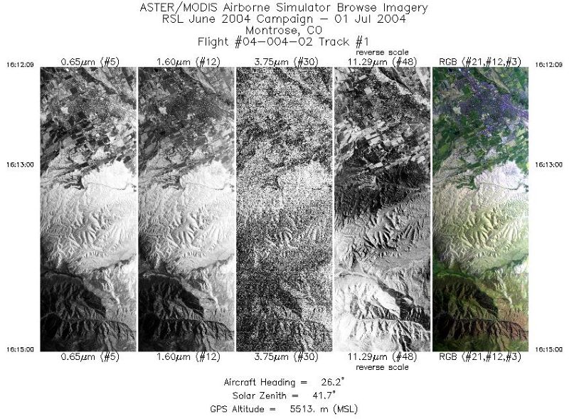
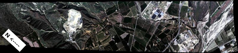
MASTER: Geological substrate mapping, Utah-Colorado, June, 2004
National Aeronautics and Space Administration —
This dataset includes Level 1B (L1B) data products from the MODIS/ASTER Airborne Simulator (MASTER) instrument. The spectral data were collected during two flights... -
Federal
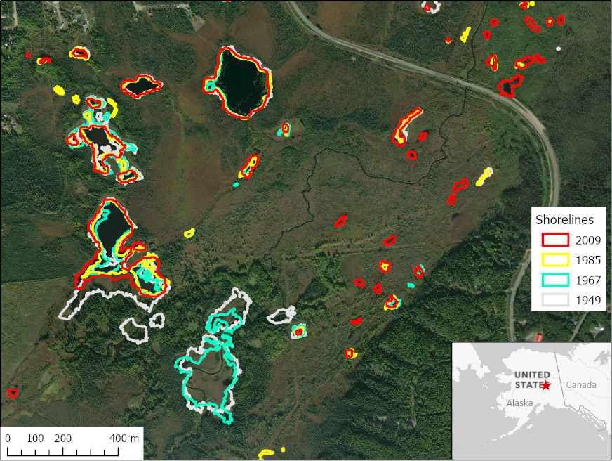
ABoVE: Historical Lake Shorelines and Areas near Fairbanks, Alaska from 1949-2009
National Aeronautics and Space Administration —
This dataset includes maps of historical lake shorelines with derived lake areas in the southern portion of the Goldstream Valley and the surrounding landscape north... -
Federal
SWOT Level 2 Radiometer Brightness Temperatures and Troposphere Interim Data Product
National Aeronautics and Space Administration —
The SWOT Level 2 Radiometer Brightness Temperatures and Troposphere Interim Geophysical Data Record (IGDR) Version 1.0 dataset produced by the Surface Water and Ocean... -
Federal
AVIRIS-NG L1B Calibrated Radiance, Facility Instrument Collection, V1
National Aeronautics and Space Administration —
This dataset contains Level 1B (L1B) orthocorrected, scaled radiance image files as well as files of observational geometry and illumination parameters and supporting... -
Federal
AVIRIS-Classic: L2 Calibrated Reflectance, Facility Instrument Collection, V1
National Aeronautics and Space Administration —
This dataset contains Level 2 (L2) orthocorrected reflectance from the Airborne Visible / Infrared Imaging Spectrometer (AVIRIS-Classic) instrument. This is the NASA... -
Federal
LBA Regional Land Cover from AVHRR, 1-km, Version 1.2 (IGBP)
National Aeronautics and Space Administration —
The data set consists of a LBA study area subset of the IGBP DISCover Data Set. The DISCover data set is one data set contained within the Global Land Cover... -
Federal
HLS Landsat Operational Land Imager Surface Reflectance and TOA Brightness Daily Global 30m v2.0
National Aeronautics and Space Administration —
The Harmonized Landsat Sentinel-2 (HLS) project provides consistent surface reflectance (SR) and top of atmosphere (TOA) brightness data from a virtual constellation... -
Federal
SWOT Level 2 Radiometer Brightness Temperatures and Troposphere Operational Data Product Version D
National Aeronautics and Space Administration —
The SWOT Level 2 Radiometer Brightness Temperatures and Troposphere Operational Geophysical Data Record (OGDR) Version D dataset produced by the Surface Water and... -
Federal
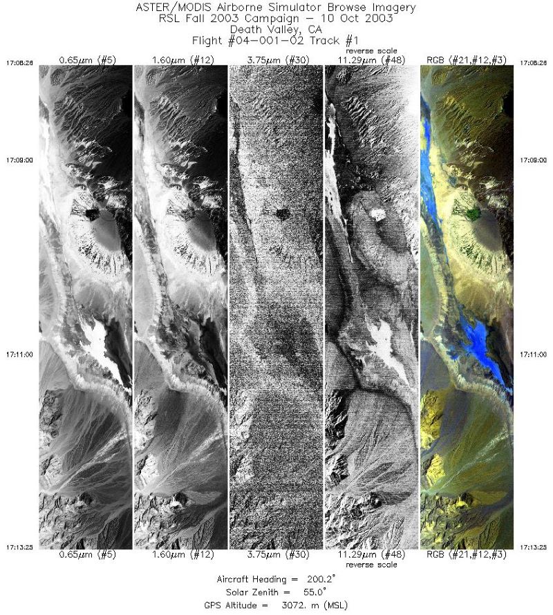
MASTER: Geological fault mapping, California-Nevada, October, 2003
National Aeronautics and Space Administration —
This dataset includes Level 1B (L1B) data products from the MODIS/ASTER Airborne Simulator (MASTER) instrument. The spectral data were collected during six flights... -
Federal
SHIFT: AVIRIS-NG L2A Unrectified Surface Reflectance Version 1
National Aeronautics and Space Administration —
This dataset contains Level 2A (L2A) unrectified surface reflectance images from NASA's Airborne Visible / Infrared Imaging Spectrometer-Next Generation (AVIRIS-NG)...
33 datasets found for "Geologic Maps"