
-
Federal
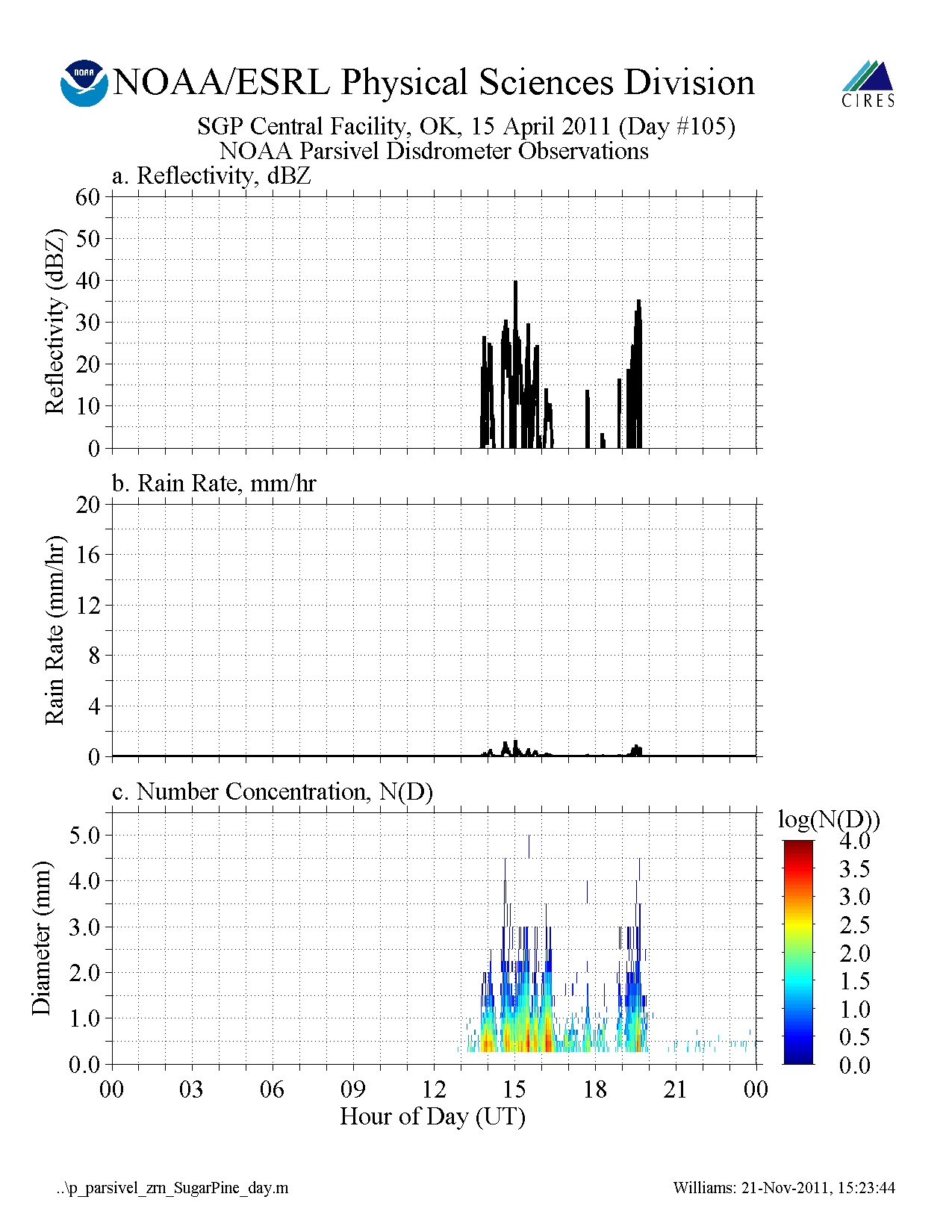
GPM GROUND VALIDATION NOAA PARSIVEL MC3E V1
National Aeronautics and Space Administration —
The GPM Ground Validation NOAA Parsivel MC3E dataset was collected in central Oklahoma during the Midlatitude Continental Convective Clouds Experiment (MC3E) from... -
Federal
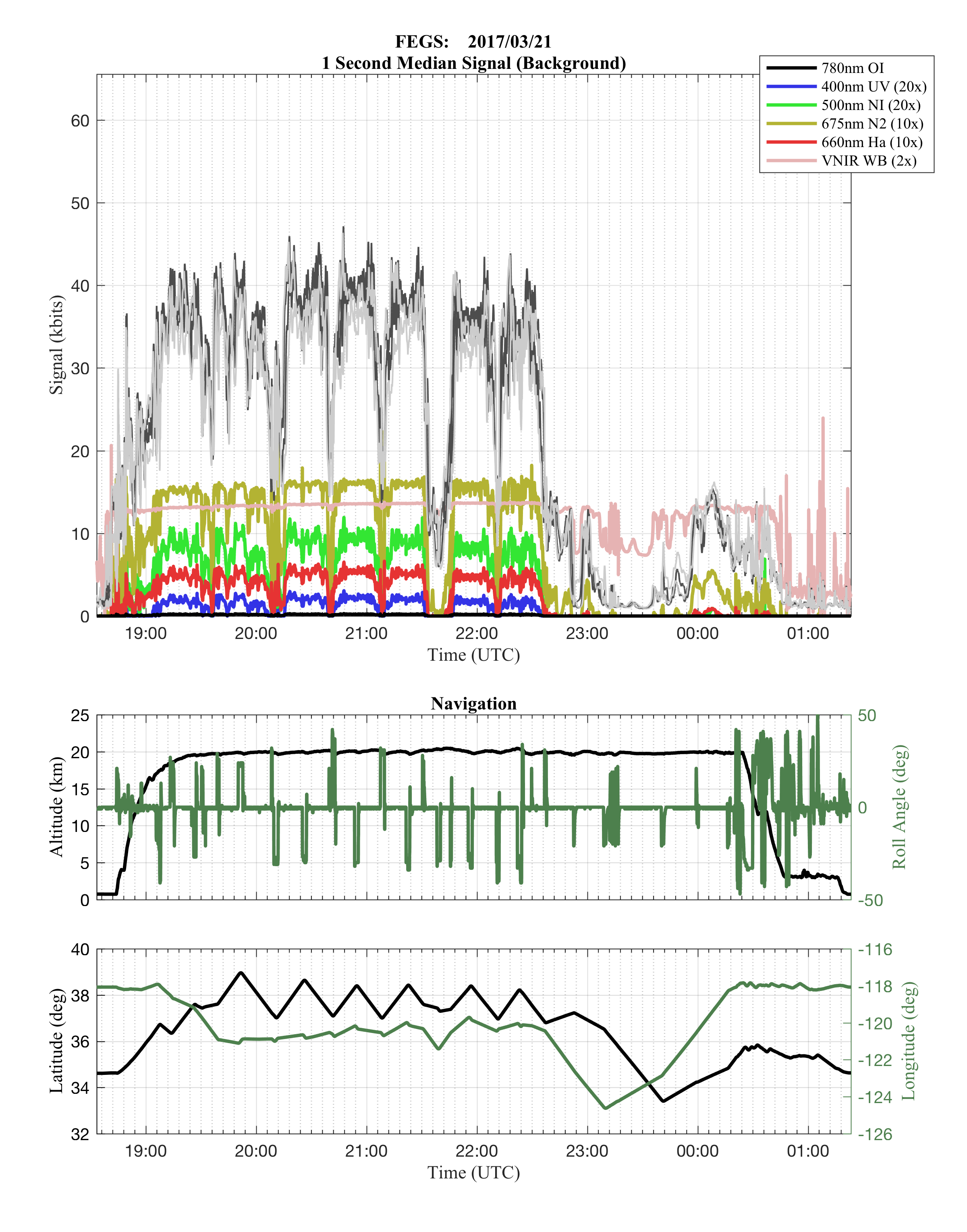
GOES-R PLT Fly's Eye GLM Simulator (FEGS) V1
National Aeronautics and Space Administration —
The GOES-R PLT Fly’s Eye GLM Simulator (FEGS) dataset consists of lightning flash, lightning pulse, and radiance data collected by the FEGS flown aboard a NASA ER-2... -
Federal
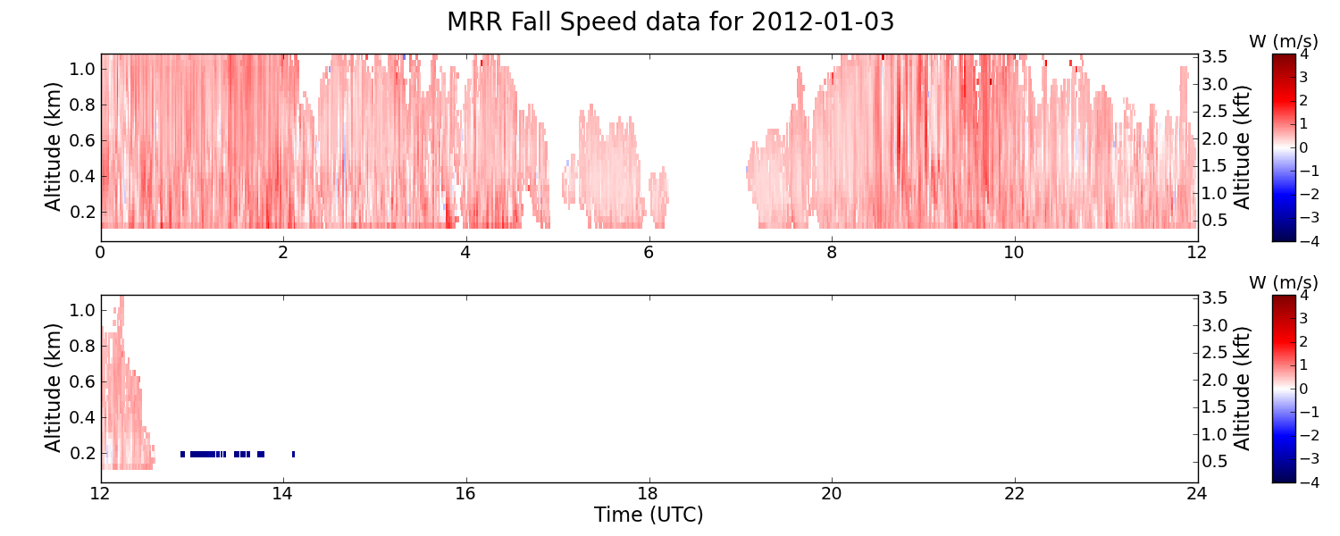
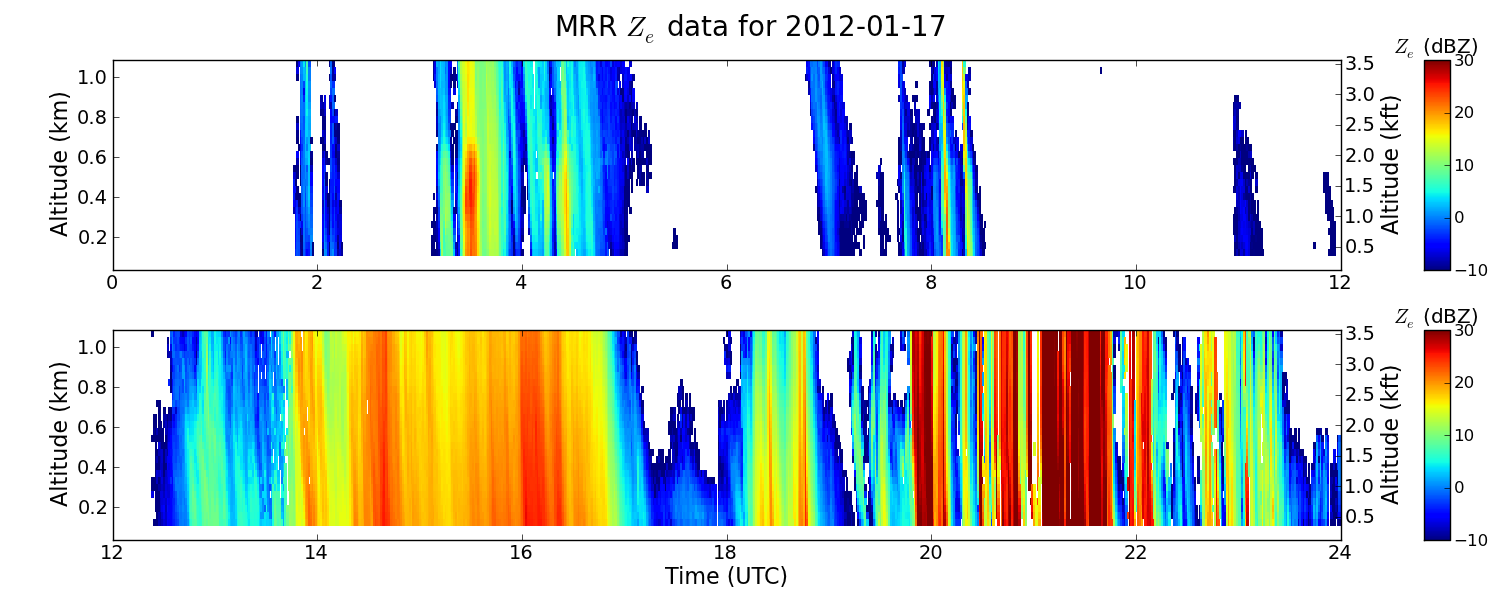
GPM GROUND VALIDATION ENVIRONMENT CANADA (EC) MICRO RAIN RADAR (MRR) GCPEX V2
National Aeronautics and Space Administration —
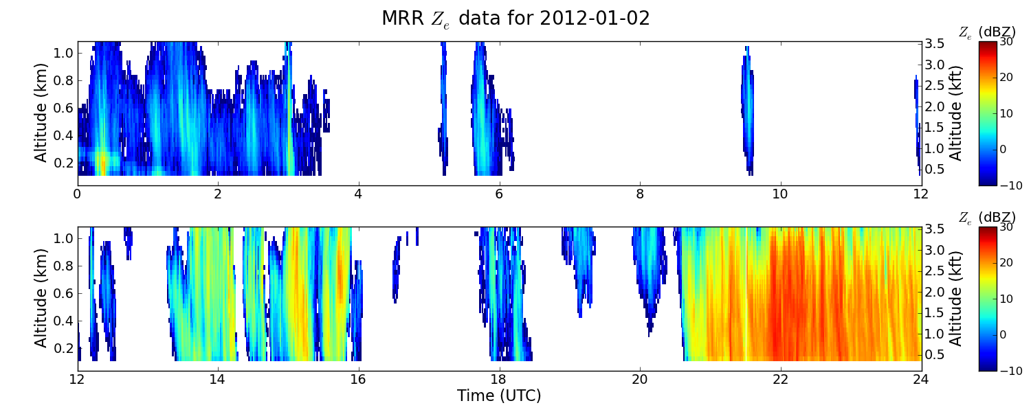
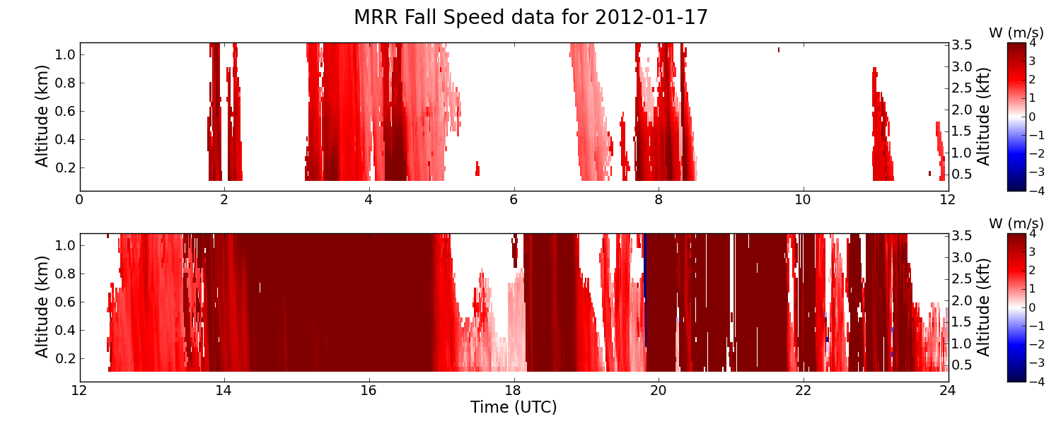
The GPM Ground Validation Environment Canada (EC) Micro Rain Radar (MRR) GCPEx V2 dataset was collected from the Micro Rain Radar (MRR) during the GPM Cold-season... -
Federal
Lightning Imaging Sensor (LIS) on TRMM Science Data V4
National Aeronautics and Space Administration —
The Lightning Imaging Sensor (LIS) Science Data was collected by the LIS instrument on the Tropical Rainfall Measuring Mission (TRMM) satellite used to detect the... -
Federal
Hurricane and Severe Storm Sentinel (HS3) Scanning High-Resolution Interferometer Sounder (S-HIS) V1
National Aeronautics and Space Administration —
The Hurricane and Severe Storm Sentinel (HS3) Scanning High-Resolution Interferometer Sounder (S-HIS) measures emitted thermal radiances that are used to obtain... -
Federal
New York State Mesonet IMPACTS
National Aeronautics and Space Administration —
The New York State Mesonet IMPACTS dataset is browse-only. It consists of temperature, wind, wind direction, mean sea level pressure, precipitation, and snow depth... -
Federal
GPM GROUND VALIDATION SATELLITE SIMULATED ORBITS C3VP V1
National Aeronautics and Space Administration —
The GPM Ground Validation Satellite Simulated Orbits C3VP dataset is available in the Orbital database, which takes account for the atmospheric profiles, the... -
Federal
UAlbany Soundings IMPACTS
National Aeronautics and Space Administration —
The UAlbany Soundings IMPACTS dataset consists of data measured with the iMet-3050A sounding system using 200-g meteorological balloons during the Investigation of... -
Federal
SBU Doppler LiDAR IMPACTS V1
National Aeronautics and Space Administration —
The SBU Doppler LiDAR IMPACTS dataset consists of Doppler velocity and backscatter intensity from the Stony Brook University (SBU) Doppler LiDAR. These data were... -
Federal
P-3 Meteorological and Navigation Data IMPACTS
National Aeronautics and Space Administration —
The P-3 Meteorological and Navigation Data IMPACTS dataset is a subset of airborne measurements that include GPS positioning and trajectory data, aircraft... -
Federal
GRIP GOES 13 OVERSHOOTING TOP V1
National Aeronautics and Space Administration —
The GRIP GOES 13 Overshooting Top dataset was produced during the GRIP Field Experiment for use with the Real Time Mission Monitor (RTMM) tool. The major goal was to... -
Federal
GPM GROUND VALIDATION AUTONOMOUS PARSIVEL UNIT (APU) NSSTC V1
National Aeronautics and Space Administration —
The GPM Ground Validation Autonomous Parsivel Unit (APU) NSSTC dataset was collected by the Autonomous Parsivel Unit (APU), which is an optical disdrometer based on... -
Federal
GOES-R PLT Fly's Eye GLM Simulator (FEGS)
National Aeronautics and Space Administration —
The GOES-R PLT Fly’s Eye GLM Simulator (FEGS) dataset consists of lightning flash, lightning pulse, and radiance data collected by the FEGS flown aboard a NASA ER-2... -
Federal
GPM Ground Validation USGS Stream Flow IFloodS V1
National Aeronautics and Space Administration —
The GPM Ground Validation USGS Stream Flow IFloodS dataset was obtained from USGS during the Iowa Flood Studies (IFloodS) field campaign that extended from March 30,... -
Federal
GPM GROUND VALIDATION PRECIPITATION VIDEO IMAGER (PVI) GCPEX V1
National Aeronautics and Space Administration —
The GPM Ground Validation Precipitation Video Imager (PVI) GCPEx dataset collected precipitation particle images and drop size distribution data from November 2011... -
Federal
GPM GROUND VALIDATION MCGILL W-BAND RADAR GCPEX V1
National Aeronautics and Space Administration —
The GPM Ground Validation McGill W-Band Radar GCPEx dataset was collected from February 1, 2012 to February 29, 2012 at the CARE site in Ontario, Canada as a part of... -
Federal
GPM GROUND VALIDATION NEXRAD LEVEL II KDMX IFLOODS
National Aeronautics and Space Administration —
The GPM Ground Validation Next Generation Weather Radar (NEXRAD) Level II IFloodS datasets were collected from four sites (see Table 1) from March 29, 2013 to June... -
Federal
GPM Ground Validation NEXRAD Level III KMPX IFloodS
National Aeronautics and Space Administration —
The GPM Ground Validation NEXRAD Level III KMPX IFloodS dataset contain precipitation products derived from selected NEXt Generation Weather RADar system (NEXRAD)... -
Federal
GPM Ground Validation KMRX NEXRAD IPHEx V1
National Aeronautics and Space Administration —
The GPM Ground Validation KMRX NEXRAD IPHEx dataset contain data from the KMRX NEXt Generation Weather RADar system (NEXRAD) instrument in operation during the... -
Federal
SBU Parsivel IMPACTS
National Aeronautics and Space Administration —
The SBU Parsivel IMPACTS dataset consists of precipitation data collected by the Parsivel disdrometer in support of the Investigation of Microphysics and...

Official websites use .gov
A
.gov website belongs to an official government
organization in the United States.
Secure .gov websites use HTTPS
A
lock (
) or https:// means you’ve safely connected to
the .gov website. Share sensitive information only on official,
secure websites.