
-
Federal
SatCORPS CERES GEO Edition 4 Meteosat-9 Southern Hemisphere Version 1.0
National Aeronautics and Space Administration —
CER_GEO_Ed4_MET09_SH_V01 is the Satellite Cloud and Radiation Property retrieval System (SatCORPS) Clouds and the Earth's Radiant Energy System (CERES) Geostationary... -
Federal
AERONET Level 2.0 AOD
National Aeronautics and Space Administration —
The aerosol optical depth processing includes the spectral de-convolution algorithm (SDA) described in O'Neill et al. (2003). This algorithm yields fine (sub-micron)... -
Federal
Cloudmask, CLAVR-1, NOAA POES AVHRR, 0.0125 degrees, West US, 2007-present, Nighttime (Single Scan), Lon+/-180
National Oceanic and Atmospheric Administration, Department of Commerce —
The CLAVR-1 cloudmask (Stowe, 1999) is used to cloudmask AVHRR high resolution sea surface temperature products. The cloudmask runs a series of tests on each surface... -
Federal
SBU Micro Rain Radar 2 (MRR2) IMPACTS V1
National Aeronautics and Space Administration —
The SBU Micro Rain Radar 2 (MRR-2) IMPACTS dataset consists of reflectivity, Doppler velocity, signal-to-noise ratio, spectral width, droplet size, Liquid Water... -
Federal
TES/Aura L2 Carbon Monoxide Nadir V007
National Aeronautics and Space Administration —
TL2CON_7 is the Tropospheric Emission Spectrometer (TES)/Aura Level 2 Carbon Monoxide Nadir Version 7 data product. TES was an instrument aboard NASA's Aura satellite... -
Federal
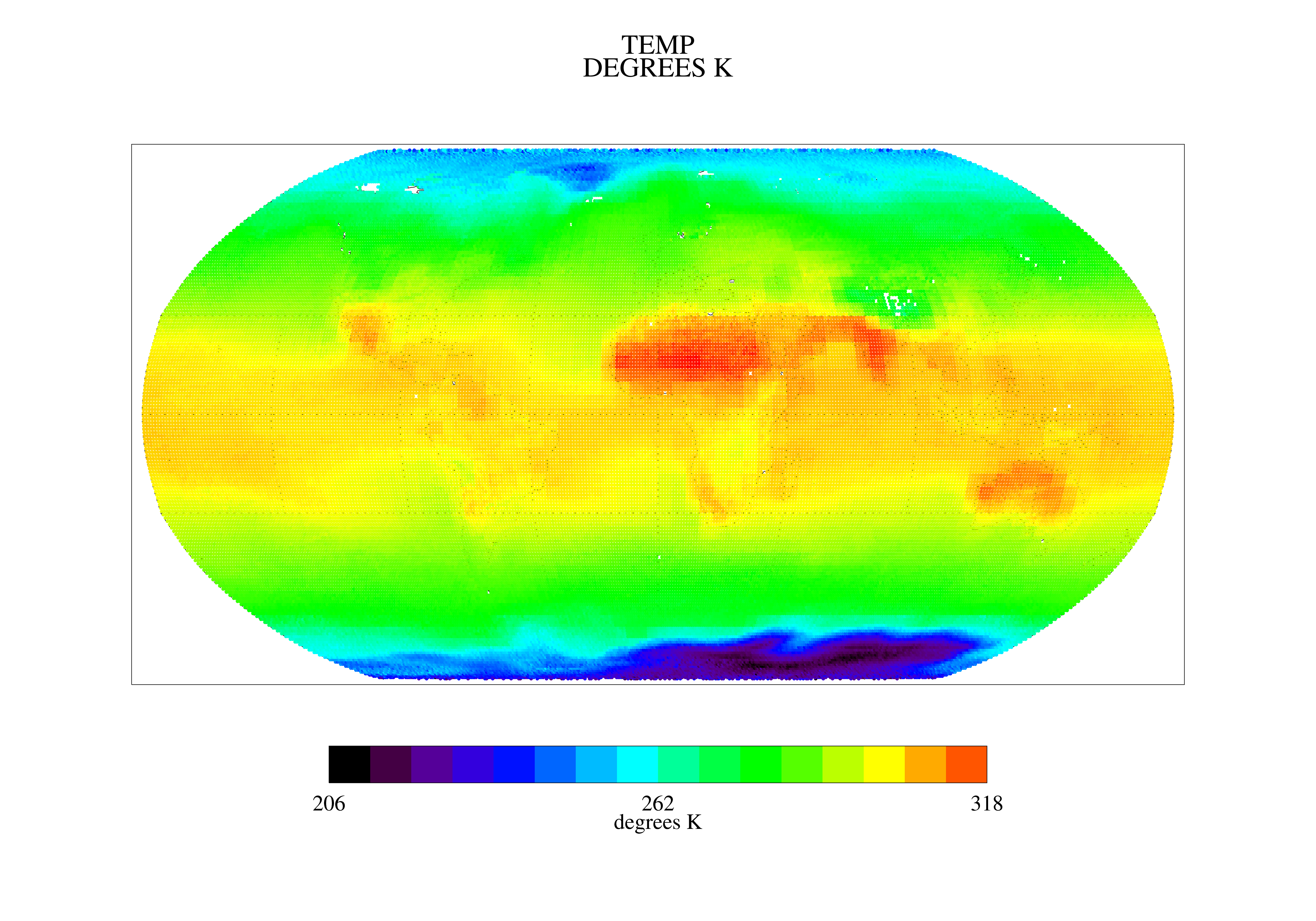
TOVS GLA MONTHLY GRIDS from NOAA-9 V01 (TOVSAMNF) at GES DISC
National Aeronautics and Space Administration —
This dataset (TOVSAMNF) contains the TIROS Operational Vertical Sounder (TOVS) level 3 geophysical parameters derived using data from NOAA-9 and the physical... -
Federal
Hurricane Satellite (HURSAT) Microwave (MW)
National Oceanic and Atmospheric Administration, Department of Commerce —
The Hurricane Satellite (HURSAT) from Microwave (MW) observations of tropical cyclones worldwide data consist of raw satellite observations. The data derive from the... -
Federal
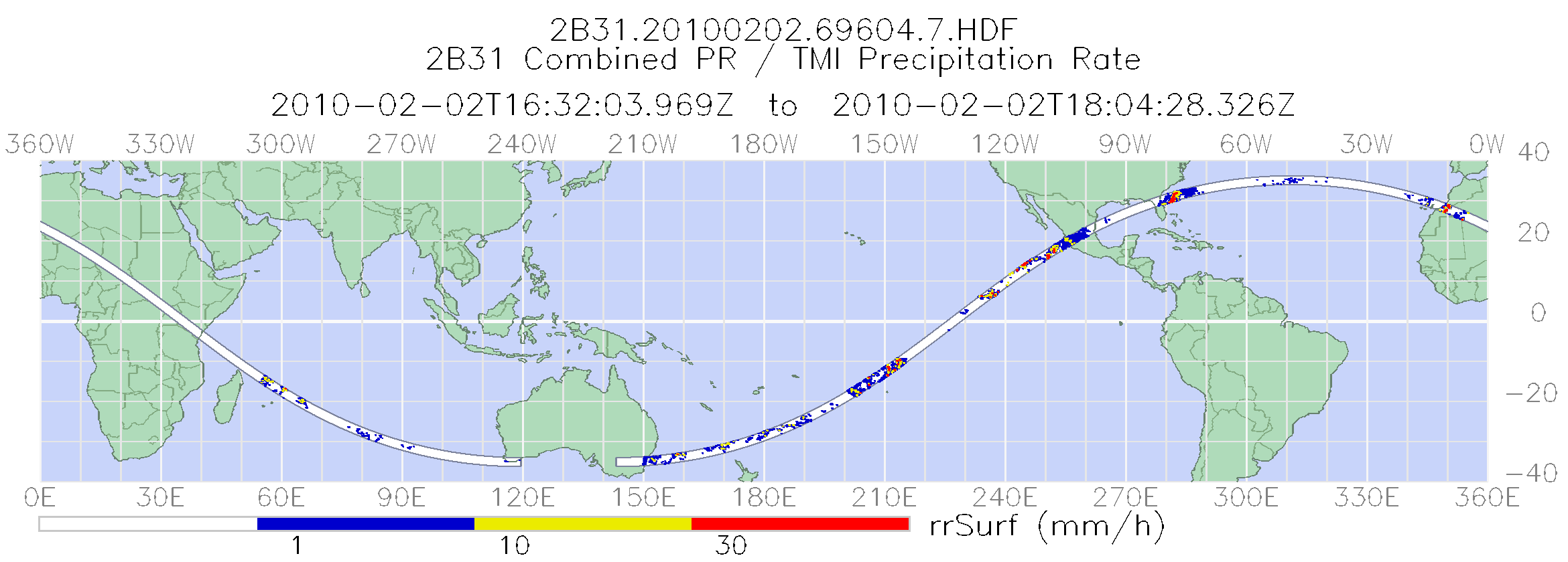
TRMM Combined Precipitation Radar and Microwave Imager Rainfall Profile L2 1.5 hours V7 (TRMM_2B31) at GES DISC
National Aeronautics and Space Administration —
The TRMM combined algorithm (2B31) combines data from the TMI and PR to produce the best rain estimate for TRMM. This combined rainfall product is derived from... -
Federal
AMSR-E/Aqua Daily L3 Global Ascending/Descending .25x.25 deg Ocean Grids V002
National Aeronautics and Space Administration —
The Level-3 daily product (AE_DyOcn), weekly product (AE_WkOcn), and monthly product (AE_MoOcn) include SST, near-surface wind speed, columnar water vapor, and... -
Federal
TRMM Microwave Imager Precipitation Profile L3 1 month 0.5 degree x 0.5 degree V7 (TRMM_3A12) at GES DISC
National Aeronautics and Space Administration —
The new equivalent for this dataset should be searched for as "GPM_3GPROFTRMMTMI_CLIM". This product contains global monthly means of surface precipitation rate, rain... -
Federal
SWOT Level 2 Radiometer Brightness Temperatures and Troposphere Interim Data Product, Version 2.0
National Aeronautics and Space Administration —
The SWOT Level 2 Radiometer Brightness Temperatures and Troposphere Interim Geophysical Data Record (IGDR) Version 1.0 dataset produced by the Surface Water and Ocean... -
Federal
Level 2.0 Almucantar Inversion Products (except phase functions)
National Aeronautics and Space Administration —
AERONET inversion code provides aerosoloptical properties in the total atmospheric column derived from the direct and diffuse radiation measured byAERONETCimel... -
Federal
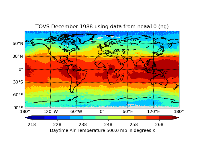
TOVS LMD DAILY GRIDS from NOAA-10 V01 (TOVSBDNG) at GES DISC
National Aeronautics and Space Administration —
Level 3 parameters from HIRS/2 and MSU radiances using the Improved Initialization Inversion (3I) classification retrieval scheme by the Laboratoire de Meteorologie... -
Federal
SatCORPS CERES GEO Edition 4 Meteosat-8 Southern Hemisphere Version 1.0
National Aeronautics and Space Administration —
CER_GEO_Ed4_MET08_SH_V01 is the Satellite Cloud and Radiation Property retrieval System (SatCORPS) Clouds and the Earth's Radiant Energy System (CERES) Geostationary... -
Federal
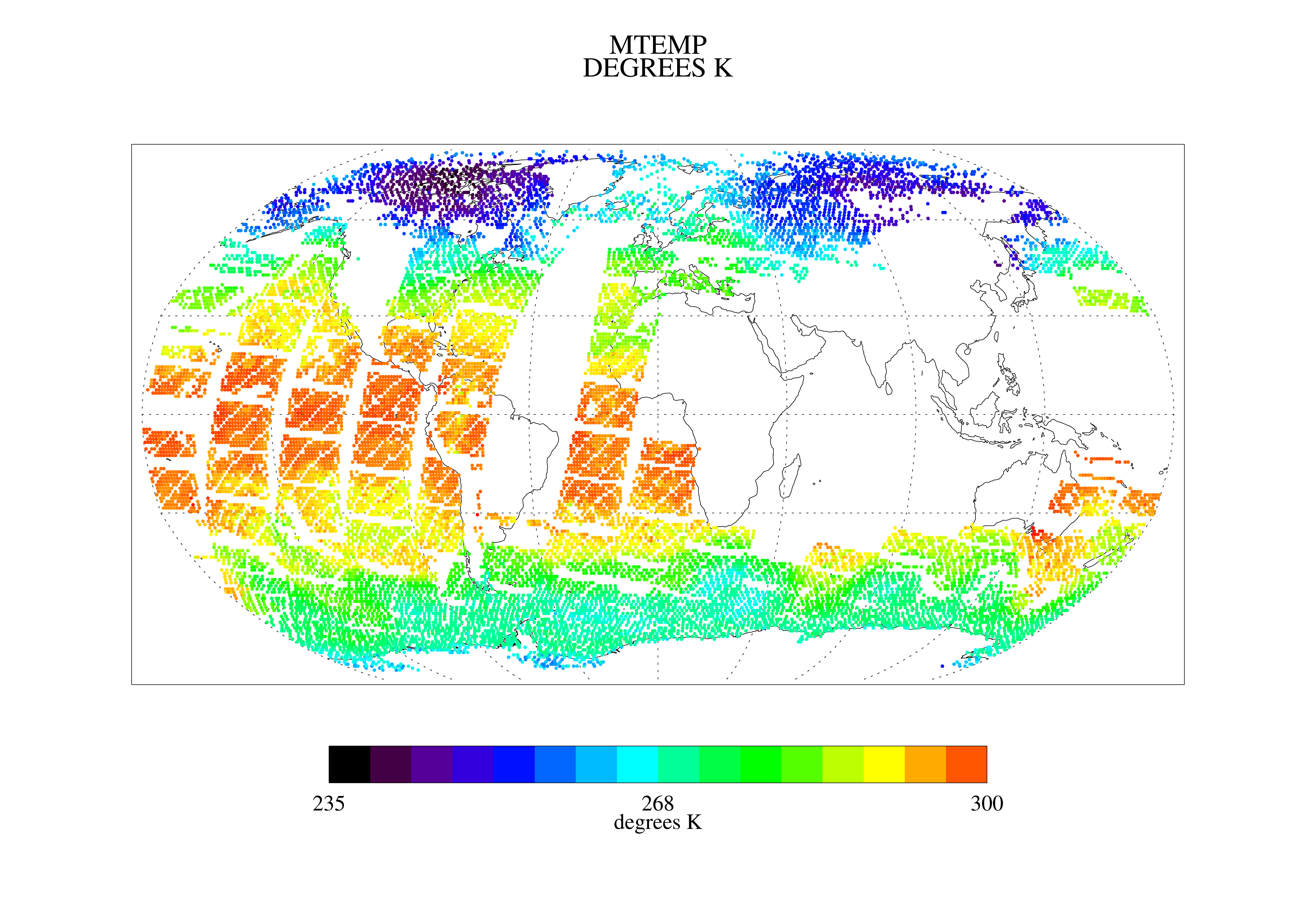
TOVS GLA MONTHLY GRIDS from NOAA-10 02 (TOVSAMNG) at GES DISC
National Aeronautics and Space Administration —
This dataset (TOVSAMNG) contains the TIROS Operational Vertical Sounder (TOVS) level 3 geophysical parameters derived using data from NOAA-10 and the physical... -
Federal
TOVS GLA MONTHLY GRIDS from NOAA-8 02 (TOVSAMNE) at GES DISC
National Aeronautics and Space Administration —
This dataset (TOVSAMNE) contains the TIROS Operational Vertical Sounder (TOVS) level 3 geophysical parameters derived using data from NOAA-8 and the physical... -
Federal
NOAA GOES-R Series Advanced Baseline Imager (ABI) Level 2 Fog/Low Stratus (FLS)
National Oceanic and Atmospheric Administration, Department of Commerce —
The GOES-R Advanced Baseline Imager (ABI) Fog/Low Stratus (FLS) products contain estimates of low cloud/fog thickness and probabilities of reduced aviation visibility... -
Federal
CERES MODIS Cloud Retrievals in ISCCP-D2like Format Day Terra FM2 Edition3A NGDA
National Aeronautics and Space Administration —
CER_ISCCP-D2like-Day_Terra-FM2-MODIS_Edition3A is the Clouds and the Earth's Radiant Energy System (CERES) Moderate Resolution Imaging Spectroradiometer (MODIS) Cloud... -
Federal
Fast Longwave And SHortwave Fluxes (FLASHflux) Clouds and Radiative Swath (SSF) TERRA-FM1 data in netCDF Version 4B
National Aeronautics and Space Administration —
FLASH_SSF_Terra-FM1-MODIS_Version4B is the Fast Longwave And Shortwave Radiative Fluxes (FLASHFlux) Clouds and Radiative Swath (SSF) TERRA-FM1 data in netCDF Version...

Official websites use .gov
A
.gov website belongs to an official government
organization in the United States.
Secure .gov websites use HTTPS
A
lock (
) or https:// means you’ve safely connected to
the .gov website. Share sensitive information only on official,
secure websites.