

5 datasets found for "1 100000"
-
Federal
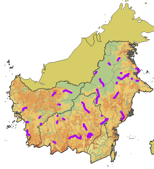
CMS: LiDAR Data for Forested Sites on Borneo Island, Kalimantan, Indonesia, 2014
National Aeronautics and Space Administration —
This dataset provides airborne LiDAR data collected over 90 sites totaling approximately 100,000 hectares of forested land in Kalimantan, Indonesia on the island of... -
Federal
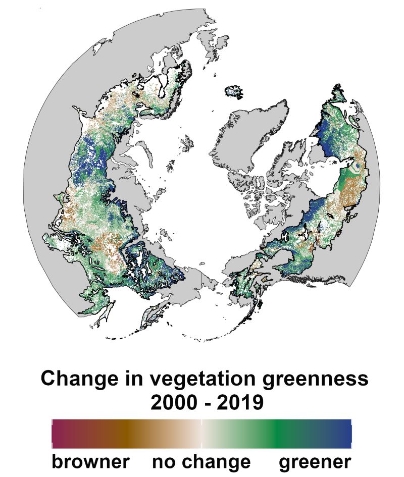
ABoVE: Landsat Vegetation Greenness Trends, Boreal Forest Biome, 1985-2019
National Aeronautics and Space Administration —
This dataset provides information on interannual trends in annual maximum vegetation greenness from 1985 to 2019 for recently undisturbed areas in the boreal forest... -
Federal
Pre-LBA ABLE-2A and ABLE-2B Expedition Data
National Aeronautics and Space Administration —
The ABLE 2A and 2B (Atmospheric Boundary Layer Experiments) data consists of estimates of the rate of exchange of a wide variety of aerosols and gases between the... -
Federal
CMS: LiDAR-derived Canopy Height, Elevation for Sites in Kalimantan, Indonesia, 2014
National Aeronautics and Space Administration —
This dataset provides canopy height and elevation data products derived from airborne LiDAR data collected over 90 sites on the island of Borneo in late 2014. The... -
Federal
Siberian Boreal Forest Aboveground Biomass and Fire Scar Maps, Russia, 1969-2007
National Aeronautics and Space Administration —
This data set provides 30-meter resolution mapped estimates of Cajander larch (Larix cajanderi) aboveground biomass (AGB), circa 2007, and a map of burn perimeters...
5 datasets found for "1 100000"