

10 datasets found for ""Shuttle Radar Topography Mission SRTM""
-
Federal
NACP Aboveground Biomass and Carbon Baseline Data, V.2 (NBCD 2000), U.S.A., 2000
National Aeronautics and Space Administration —
The NBCD 2000 (National Biomass and Carbon Dataset for the Year 2000) data set provides a high-resolution (30 m) map of year-2000 baseline estimates of basal area-... -
Federal
Carbon Pools across CONUS using the MaxEnt Model, 2005, 2010, 2015, 2016, and 2017
National Aeronautics and Space Administration —
This dataset provides annual estimates of six carbon pools, including forest aboveground live biomass, belowground biomass, aboveground dead biomass, belowground dead... -
Federal
LiDAR Derived Forest Aboveground Biomass Maps, Northwestern USA, 2002-2016
National Aeronautics and Space Administration —
This dataset provides maps of aboveground forest biomass (AGB) of living trees and standing dead trees in Mg/ha across portions of Northwestern United States,... -
Federal
LBA-ECO ND-01 Watershed Deforestation from Landsat TM Series, Rondonia, Brazil: 1999
National Aeronautics and Space Administration —
This data set provides estimates of watershed deforestation, as a proportion of the total area of watersheds, in Rondonia, Brazil for 1999. Deforestation maps were... -
Federal
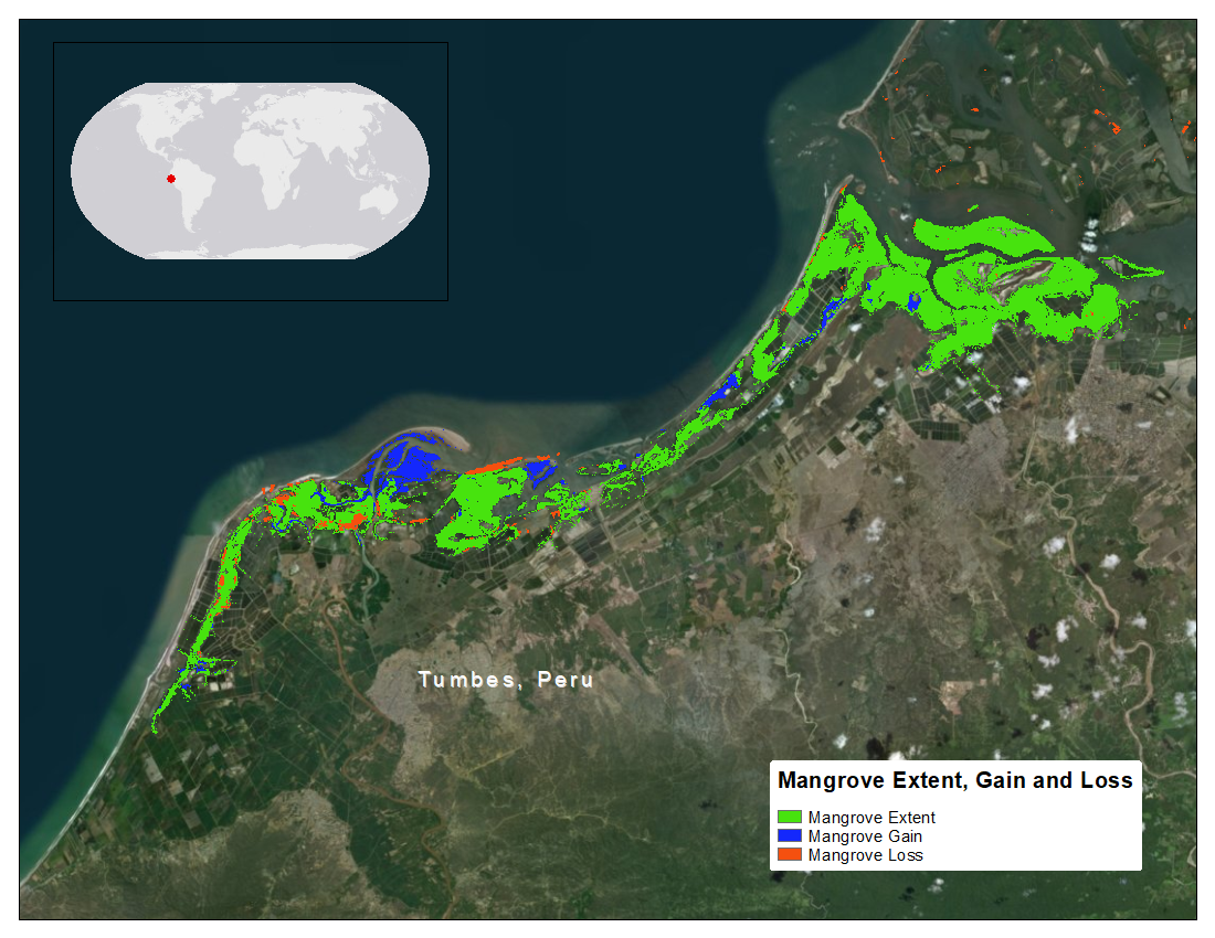
CMS: Mangrove Forest Cover Extent and Change across Major River Deltas, 2000-2016
National Aeronautics and Space Administration —
This dataset provides estimates of mangrove extent for 2016, and mangrove change (gain or loss) from 2000 to 2016, in major river delta regions of eight countries:... -
Federal
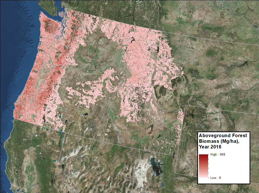
Annual Aboveground Biomass Maps for Forests in the Northwestern USA, 2000-2016
National Aeronautics and Space Administration —
This dataset provides annual maps of aboveground biomass (AGB, Mg/ha) for forests in Washington, Oregon, Idaho, and western Montana, USA, for the years 2000-2016, at... -
Federal
LBA-ECO LC-02 Tributary Coordinates, Acre River, Tri-national River Basin: 2003-2004
National Aeronautics and Space Administration —
This data set provides coordinates for points at the mouth of tributaries of the Acre River in the Tri-national River Basin in South America. Three Global Positioning... -
Federal
LBA-ECO LC-15 Aerodynamic Roughness Maps of Vegetation Canopies, Amazon Basin: 2000
National Aeronautics and Space Administration —
This data set provides physical roughness maps of vegetation canopies in the Amazon Basin. The images are estimates of aerodynamic roughness length (Z0) and zero... -
Federal
LBA-ECO LC-15 SRTM30 Digital Elevation Model Data, Amazon Basin: 2000
National Aeronautics and Space Administration —
This dataset provides a subset of the SRTM30 Digital Elevation Model (DEM) elevation and standard deviation data for the Amazon Basin. SRTM30 is a near-global digital... -
Federal
LBA-ECO LC-01 SRTM 90-Meter Digital Elevation Model, Northern Ecuadorian Amazon
National Aeronautics and Space Administration —
This data set provides 90-meter resolution Digital Elevation Model data used in the University of North Carolina's Carolina Population Center (CPC) Ecuador Projects....
10 datasets found for ""Shuttle Radar Topography Mission SRTM""