

115 datasets found for ""Shuttle Radar Topography Mission SRTM""
-
Federal
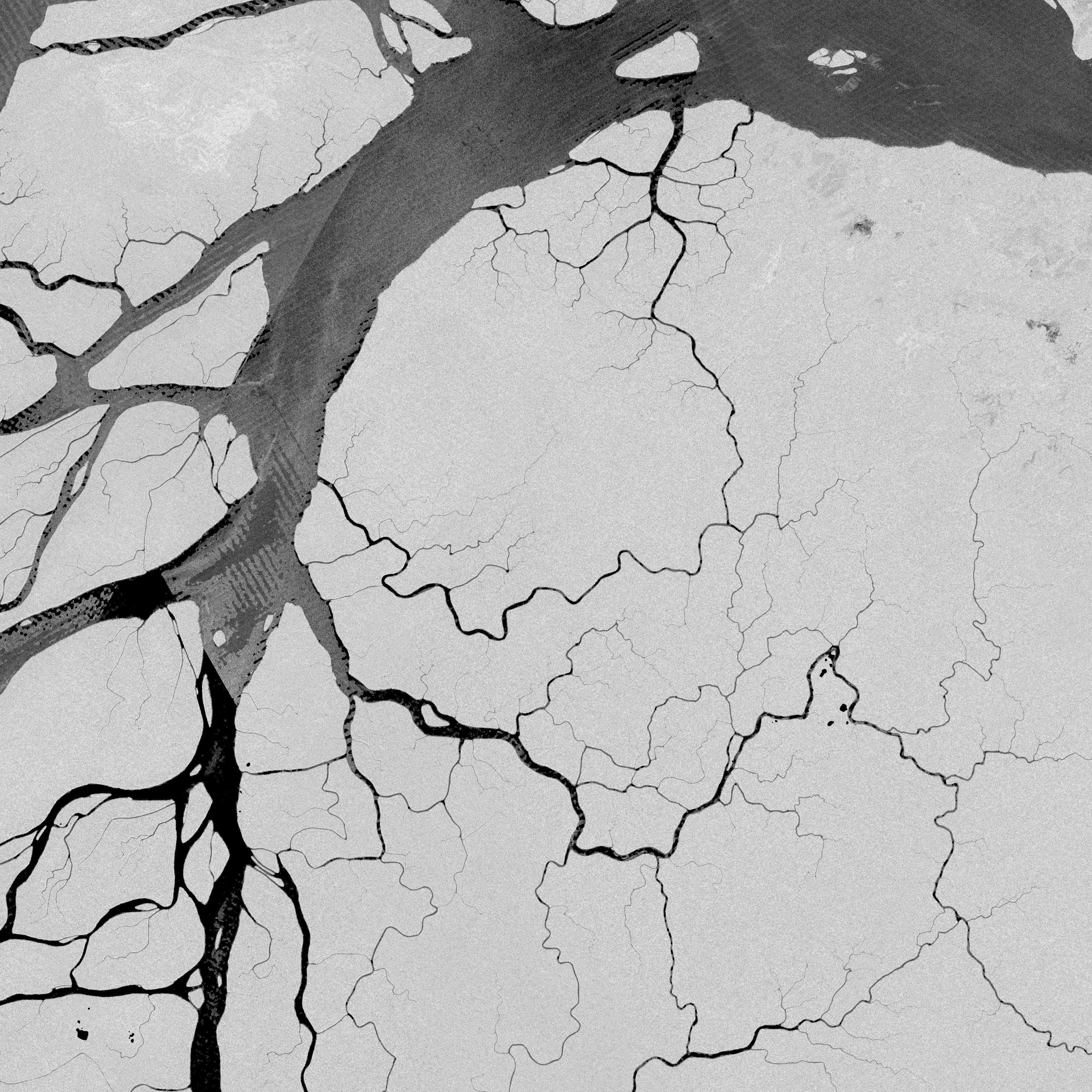
Streams layers from the Hydrologic Derivatives for Modeling and Analysis (HDMA) database -- Australasia
Department of the Interior —
This dataset contains the streams derived from the Digital Elevation Model (DEM) for Australasia from the Hydrological Derivatives for Modeling and Analysis (HDMA)... -
Federal
Catchments layers from the Hydrologic Derivatives for Modeling and Analysis (HDMA) database -- Africa
Department of the Interior —
This dataset contains the catchments derived from the Digital Elevation Model (DEM) for the African continent from the Hydrological Derivatives for Modeling and... -
Federal
Digital elevation model (DEM) from the Hydrologic Derivatives for Modeling and Analysis (HDMA) database -- Greenland
Department of the Interior —
This dataset contains the Digital Elevation Model (DEM) for Greenland from the Hydrologic Derivatives for Modeling and Analysis (HDMA) database. The HDMA database... -
Federal
Slope from the Hydrologic Derivatives for Modeling and Analysis (HDMA) database -- Africa
Department of the Interior —
This dataset contains the slope for Africa from the Hydrologic Derivatives for Modeling and Analysis (HDMA) database. The slope data were developed and distributed by... -
Federal
Slope from the Hydrologic Derivatives for Modeling and Analysis (HDMA) database -- South America
Department of the Interior —
This dataset contains the slope for South America from the Hydrologic Derivatives for Modeling and Analysis (HDMA) database. The data were developed and distributed... -
Federal
Digital Elevation Model (DEM) from the Hydrologic Derivatives for Modeling and Analysis (HDMA) database -- Asia
Department of the Interior —
This dataset contains the Digital Elevation Model (DEM) grid for the Asian continent from the Hydrologic Derivatives for Modeling and Analysis (HDMA) database. The... -
Federal
Compound Topographic Index (CTI) from the Hydrologic Derivatives for Modeling and Analysis (HDMA) database -- South America
Department of the Interior —
This dataset contains the Compound Topographic Index (CTI) for South America from the Hydrologic Derivatives for Modeling and Analysis (HDMA) database. The data were... -
Federal
Digital Elevation Model (DEM) from the Hydrologic Derivatives for Modeling and Analysis (HDMA) database -- Africa
Department of the Interior —
This dataset contains the Digital Elevation Model (DEM) for Africa from the Hydrologic Derivatives for Modeling and Analysis (HDMA) database. The DEM data were... -
Federal
Processing units used in developing the raster layers for the Hydrologic Derivatives for Modeling and Analysis (HDMA) database -- Asia
Department of the Interior —
This dataset contains the processing units for the Asian continent from the Hydrological Derivatives for Modeling and Analysis (HDMA) database. The HDMA database... -
Federal
Slope from the Hydrologic Derivatives for Modeling and Analysis (HDMA) database -- North America
Department of the Interior —
This dataset contains the slope for North America from the Hydrologic Derivatives for Modeling and Analysis (HDMA) database. The slope data were developed and... -
Federal
LBA-ECO LC-15 SRTM30 Digital Elevation Model Data, Amazon Basin: 2000
National Aeronautics and Space Administration —
This dataset provides a subset of the SRTM30 Digital Elevation Model (DEM) elevation and standard deviation data for the Amazon Basin. SRTM30 is a near-global digital... -
Federal
Flow direction from the Hydrologic Derivatives for Modeling and Analysis (HDMA) database -- South America
Department of the Interior —
This dataset contains the Flow Direction (FD) for South America from the Hydrologic Derivatives for Modeling and Analysis (HDMA) database. The data were developed and... -
Federal
Digital Elevation Model (DEM) from the Hydrologic Derivatives for Modeling and Analysis (HDMA) database -- South America
Department of the Interior —
This dataset contains the Digital Elevation Model (DEM) for South America from the Hydrologic Derivatives for Modeling and Analysis (HDMA) database. The data were... -
Federal
Topographic Position Index (TPI) derived from Shuttle Radar Topography Mission (SRTM) elevation interpolated at 1 km resolution across the Appalachian Landscape Conservation Coopertive (LCC) region
Department of the Interior —
The data contained in this file is one of several datasets produced in support of the project entitled “Classification and Mapping of Cave and Karst Resources” for... -
Federal
NASA Shuttle Radar Topography Mission United States 1 arc second
National Aeronautics and Space Administration —
The SRTMUS1 collection was retired on November 20, 2014, when global SRTM data became available at a resolution of 1 arc second. The data for the United States are... -
Federal
NASADEM Merged DEM Global 1 arc second V001
National Aeronautics and Space Administration —
The Land Processes Distributed Active Archive Center (LP DAAC) is responsible for the archive and distribution of the NASA Making Earth System Data Records for Use in... -
Federal
NASADEM SRTM Subswath Global 1 arc second V001
National Aeronautics and Space Administration —
The Land Processes Distributed Active Archive Center (LP DAAC) is responsible for the archive and distribution of NASA Making Earth System Data Records for Use in... -
Federal
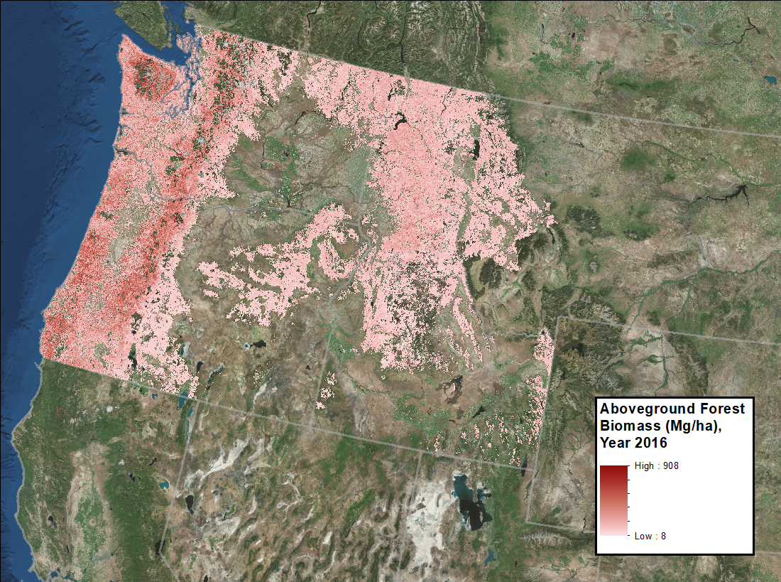
Annual Aboveground Biomass Maps for Forests in the Northwestern USA, 2000-2016
National Aeronautics and Space Administration —
This dataset provides annual maps of aboveground biomass (AGB, Mg/ha) for forests in Washington, Oregon, Idaho, and western Montana, USA, for the years 2000-2016, at... -
Federal
NASADEM Merged DEM Source Global 1 arc second nc V001
National Aeronautics and Space Administration —
The Land Processes Distributed Active Archive Center (LP DAAC) is responsible for the archive and distribution of the NASA Making Earth System Data Records for Use in... -
Federal
NASADEM Slope and Curvation Global 1 arc second V001
National Aeronautics and Space Administration —
The Land Processes Distributed Active Archive Center (LP DAAC) is responsible for the archive and distribution of NASA Making Earth System Data Records for Use in...
115 datasets found for ""Shuttle Radar Topography Mission SRTM""