
-
Federal
NOAA Tidal Currents for Coastal, Estuaries and Great Lakes (non-tidal) regions
National Oceanic and Atmospheric Administration, Department of Commerce —
Since the late-1800s, NOAAâs Center for Operational Oceanographic Products and Services (CO-OPS) and its predecessors have been collecting, analyzing and... -
Federal
Extreme Water Levels from CO-OPS
National Oceanic and Atmospheric Administration, Department of Commerce —
Extremely high or low water levels at coastal locations are an important public concern and a factor in coastal hazard assessment, navigational safety, and ecosystem... -
Federal
Air Gap Data from CO-OPS
National Oceanic and Atmospheric Administration, Department of Commerce —
The Center for Operational Oceanographic Products and Services (CO-OPS) of the National Ocean Service (NOS), an organizational element of NOAA, operates and maintains... -
Federal
F00333: NOS Hydrographic Survey , Offshore New Jersey Coast, New Jersey, 1989-08-24
National Oceanic and Atmospheric Administration, Department of Commerce —
The National Oceanic and Atmospheric Administration (NOAA) has the statutory mandate to collect hydrographic data in support of nautical chart compilation for safe... -
Federal
F00382: NOS Hydrographic Survey , Delaware Bay, New Jersey, 1993-05-07
National Oceanic and Atmospheric Administration, Department of Commerce —
The National Oceanic and Atmospheric Administration (NOAA) has the statutory mandate to collect hydrographic data in support of nautical chart compilation for safe... -
Federal
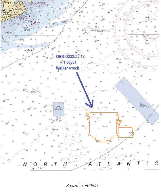
F00631: NOS Hydrographic Survey , Delaware Bay and Approaches, 2013-06-21
National Oceanic and Atmospheric Administration, Department of Commerce —
The National Oceanic and Atmospheric Administration (NOAA) has the statutory mandate to collect hydrographic data in support of nautical chart compilation for safe... -
Federal
F00092: NOS Hydrographic Survey , 1949-10-02
National Oceanic and Atmospheric Administration, Department of Commerce —
The National Oceanic and Atmospheric Administration (NOAA) has the statutory mandate to collect hydrographic data in support of nautical chart compilation for safe... -
Federal
F00101: NOS Hydrographic Survey , 1950-10-11
National Oceanic and Atmospheric Administration, Department of Commerce —
The National Oceanic and Atmospheric Administration (NOAA) has the statutory mandate to collect hydrographic data in support of nautical chart compilation for safe... -
Federal
H13478: NOS Hydrographic Survey , 2021-10-09
National Oceanic and Atmospheric Administration, Department of Commerce —
The National Oceanic and Atmospheric Administration (NOAA) has the statutory mandate to collect hydrographic data in support of nautical chart compilation for safe... -
Federal
H13475: NOS Hydrographic Survey , 2021-10-07
National Oceanic and Atmospheric Administration, Department of Commerce —
The National Oceanic and Atmospheric Administration (NOAA) has the statutory mandate to collect hydrographic data in support of nautical chart compilation for safe... -
Federal
Shoreline Mapping Program of Back Bays, Delaware River, Arnold Point to Dyer Cove, NJ, NJ1404E-TB-C NGDA
National Oceanic and Atmospheric Administration, Department of Commerce —
These data provide an accurate high-resolution shoreline compiled from imagery of Back Bays, Delaware River, Arnold Point to Dyer Cove, NJ . This vector shoreline... -
Federal
H13477: NOS Hydrographic Survey , 2021-10-07
National Oceanic and Atmospheric Administration, Department of Commerce —
The National Oceanic and Atmospheric Administration (NOAA) has the statutory mandate to collect hydrographic data in support of nautical chart compilation for safe...

Official websites use .gov
A
.gov website belongs to an official government
organization in the United States.
Secure .gov websites use HTTPS
A
lock (
) or https:// means you’ve safely connected to
the .gov website. Share sensitive information only on official,
secure websites.
.jpg)
.jpg)