
-
Federal
EMAG2v3: Earth Magnetic Anomaly Grid (2-arc-minute resolution)
National Oceanic and Atmospheric Administration, Department of Commerce —
EMAG2v3 is a global Earth Magnetic Anomaly Grid compiled from satellite, ship, and airborne magnetic measurements. It is a significant update of the previous release... -
Federal
Blue whale at-sea density off California
National Oceanic and Atmospheric Administration, Department of Commerce —
The Office of National Marine Sanctuary (ONMS) updates and revises the management plans for each of its 13 sanctuaries. This process, which is open to the public,... -
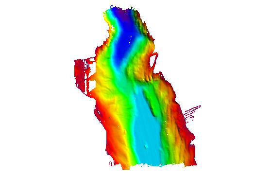
Federal
F00595: NOS Hydrographic Survey , NW Approach to Key West, Florida, 2010-08-23
National Oceanic and Atmospheric Administration, Department of Commerce —
The National Oceanic and Atmospheric Administration (NOAA) has the statutory mandate to collect hydrographic data in support of nautical chart compilation for safe... -
Federal
Kelp distribution off California
National Oceanic and Atmospheric Administration, Department of Commerce —
This data set delineates kelp beds (Nereocystis leutkeana and Macrocystis spp.) along the Pacific Coast of California. Multiple years of kelp mapping data for the... -
Federal
H12110: NOS Hydrographic Survey , San Fransisco Bay, California, 2009-08-03
National Oceanic and Atmospheric Administration, Department of Commerce —
The National Oceanic and Atmospheric Administration (NOAA) has the statutory mandate to collect hydrographic data in support of nautical chart compilation for safe... -
Federal
H13216: NOS Hydrographic Survey , 2019-09-28
National Oceanic and Atmospheric Administration, Department of Commerce —
The National Oceanic and Atmospheric Administration (NOAA) has the statutory mandate to collect hydrographic data in support of nautical chart compilation for safe... -
Federal
Federal and State Waters
National Oceanic and Atmospheric Administration, Department of Commerce —
These data show the geographic representation of Federal and State Waters for the purpose of display in the MarineCadastre.gov OceanReports application. The boundary... -
Federal
H13214: NOS Hydrographic Survey , 2019-09-25
National Oceanic and Atmospheric Administration, Department of Commerce —
The National Oceanic and Atmospheric Administration (NOAA) has the statutory mandate to collect hydrographic data in support of nautical chart compilation for safe... -
Federal
Fall Bottom Trawl Survey
National Oceanic and Atmospheric Administration, Department of Commerce —
The standardized NEFSC Fall Bottom Trawl Survey was initiated in 1963 and covered an area from Hudson Canyon, NY to Nova Scotia, Canada. Throughout the years,... -
Federal
H11517: NOS Hydrographic Survey , Southwestern Alaskan Peninsula, Alaska, 2006-06-15
National Oceanic and Atmospheric Administration, Department of Commerce —
The National Oceanic and Atmospheric Administration (NOAA) has the statutory mandate to collect hydrographic data in support of nautical chart compilation for safe... -
Federal
H11697: NOS Hydrographic Survey , Chatham Strait, Alaska, 2007-09-04
National Oceanic and Atmospheric Administration, Department of Commerce —
The National Oceanic and Atmospheric Administration (NOAA) has the statutory mandate to collect hydrographic data in support of nautical chart compilation for safe... -
Federal
H11873: NOS Hydrographic Survey , Mid-Atlantic Corridor, Maryland, 2008-12-18
National Oceanic and Atmospheric Administration, Department of Commerce —
The National Oceanic and Atmospheric Administration (NOAA) has the statutory mandate to collect hydrographic data in support of nautical chart compilation for safe... -
Federal
H13259: NOS Hydrographic Survey , 2019-08-23
National Oceanic and Atmospheric Administration, Department of Commerce —
The National Oceanic and Atmospheric Administration (NOAA) has the statutory mandate to collect hydrographic data in support of nautical chart compilation for safe... -
Federal
Five-minute grid of marine bird density off central California - Davidson Current seasons, 1980-2001 (CDAS data set Da0_dens.shp)
National Oceanic and Atmospheric Administration, Department of Commerce —
Da0_dens is a polygon shapefile representing 5 minute x 5 minute latitude x longitude cells that contain the overall, combined densities (birds/sq km), of 76 species... -
Federal
H13929: NOS Hydrographic Survey , 2024-09-27
National Oceanic and Atmospheric Administration, Department of Commerce —
The National Oceanic and Atmospheric Administration (NOAA) has the statutory mandate to collect hydrographic data in support of nautical chart compilation for safe... -
Federal
Seagrass distribution off California
National Oceanic and Atmospheric Administration, Department of Commerce —
These data are a compilation of currently available seagrass GIS data sets for the west coast of the United States. These data have been compiled from seventeen... -
Federal
Shallow benthic habitats of San Francisco Bay, California CMECS geoform component
National Oceanic and Atmospheric Administration, Department of Commerce —
This dataset has been developed for the National Oceanic and Atmospheric Administration's (NOAA) Office for Coastal Management (OCM) as a collaborative and... -
Federal
H11494: NOS Hydrographic Survey , Prince William Sound, Alaska, 2005-09-22
National Oceanic and Atmospheric Administration, Department of Commerce —
The National Oceanic and Atmospheric Administration (NOAA) has the statutory mandate to collect hydrographic data in support of nautical chart compilation for safe...

Official websites use .gov
A
.gov website belongs to an official government
organization in the United States.
Secure .gov websites use HTTPS
A
lock (
) or https:// means you’ve safely connected to
the .gov website. Share sensitive information only on official,
secure websites.