
-
Federal
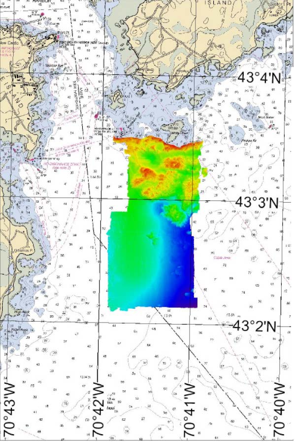
H02361: NOS Hydrographic Survey
National Oceanic and Atmospheric Administration, Department of Commerce —
The National Oceanic and Atmospheric Administration (NOAA) has the statutory mandate to collect hydrographic data in support of nautical chart compilation for safe... -
Federal
H03975: NOS Hydrographic Survey
National Oceanic and Atmospheric Administration, Department of Commerce —
The National Oceanic and Atmospheric Administration (NOAA) has the statutory mandate to collect hydrographic data in support of nautical chart compilation for safe... -
Federal
H03974: NOS Hydrographic Survey
National Oceanic and Atmospheric Administration, Department of Commerce —
The National Oceanic and Atmospheric Administration (NOAA) has the statutory mandate to collect hydrographic data in support of nautical chart compilation for safe... -
Federal
Estuarine Living Marine Resources: North Atlantic Regional Distribution and Abundance (NCEI Accession 0162402)
National Oceanic and Atmospheric Administration, Department of Commerce —
This is the North Atlantic regional component of NOAAâs Estuarine Living Marine Resources (ELMR) Project, a national database of ecologically and economically... -
Federal
Maine and New Hampshire 2016 HYDRO Lines
National Oceanic and Atmospheric Administration, Department of Commerce —
This data set contains vector lines representing coastal hydrography features that are not captured in the HYDROP polygon data layer. The features found in the HYDROL... -
Federal
Maine and New Hampshire 2016 NAV_MARINE_POLY (Navigational/Marine - Recreational/Maritime Polygons)
National Oceanic and Atmospheric Administration, Department of Commerce —
This data set contains vector polygons depicting locations for Anchorage and Shipping Lane for Maine and New Hampshire. Location-specific type and source information... -
Federal
Assessment of Existing Information for Atlantic Coastal Fish Habitat Partnership (ACFHP)
National Oceanic and Atmospheric Administration, Department of Commerce —
The ACFHP database consist of three primary data tables, joined within SQL Server, a relational DBMS: 1. The Bibliographic table provides information on over 500... -
Federal
Coastal Change Analysis Program (C-CAP) Regional Land Cover Data and Change Data NGDA
National Oceanic and Atmospheric Administration, Department of Commerce —
The NOAA Coastal Change Analysis Program (C-CAP) produces national standardized land cover and change products for the coastal regions of the U.S. C-CAP products... -
Federal
Extreme Water Levels from CO-OPS
National Oceanic and Atmospheric Administration, Department of Commerce —
Extremely high or low water levels at coastal locations are an important public concern and a factor in coastal hazard assessment, navigational safety, and ecosystem... -
Federal
IVR EFP Database
National Oceanic and Atmospheric Administration, Department of Commerce —
This database contains trip-level reports submitted by vessels participating in Exempted Fishery projects with IVR reporting requirements. -
Federal
IVR RSA Database
National Oceanic and Atmospheric Administration, Department of Commerce —
This database contains trip-level reports submitted by vessels participating in Research Set-Aside projects with IVR reporting requirements. -
Federal
Estuarine Salinity Zones in US East Coast, Gulf of Mexico, and US West Coast from 1999-01-01 to 1999-12-31 (NCEI Accession 0127396)
National Oceanic and Atmospheric Administration, Department of Commerce —
These unprojected (geographic coordinates) 3-Zone Average Annual Salinity Digital Geographies are based on analysis of long-term salinity data for 147 estuaries of... -
Federal
Maine and New Hampshire 2016 BIRDS Polygons
National Oceanic and Atmospheric Administration, Department of Commerce —
This data set contains sensitive biological resource data for wading birds, shorebirds, waterfowl, raptors, diving birds, seabirds, passerine birds, and gulls and... -
Federal
W00277: NOS Hydrographic Survey , 2007-06-15
National Oceanic and Atmospheric Administration, Department of Commerce —
The National Oceanic and Atmospheric Administration (NOAA) has the statutory mandate to collect hydrographic data in support of nautical chart compilation for safe... -
Federal
H12698: NOS Hydrographic Survey , Approaches to Portsmouth, NH, 2014-05-30
National Oceanic and Atmospheric Administration, Department of Commerce —
The National Oceanic and Atmospheric Administration (NOAA) has the statutory mandate to collect hydrographic data in support of nautical chart compilation for safe... -
Federal
H08094: NOS Hydrographic Survey , Merrimack River and Outer Coast, Massachusetts, 1954-09-02
National Oceanic and Atmospheric Administration, Department of Commerce —
The National Oceanic and Atmospheric Administration (NOAA) has the statutory mandate to collect hydrographic data in support of nautical chart compilation for safe... -
Federal
H00741B: NOS Hydrographic Survey , 1902-12-31
National Oceanic and Atmospheric Administration, Department of Commerce —
The National Oceanic and Atmospheric Administration (NOAA) has the statutory mandate to collect hydrographic data in support of nautical chart compilation for safe... -
Federal
H00741A: NOS Hydrographic Survey , 1902-12-31
National Oceanic and Atmospheric Administration, Department of Commerce —
The National Oceanic and Atmospheric Administration (NOAA) has the statutory mandate to collect hydrographic data in support of nautical chart compilation for safe... -
Federal
NCCOS Assessment: Modeling At-Sea Density of Marine Birds to Support Atlantic Marine Renewable Energy Planning from 1978-2016 (NCEI Accession 0176682)
National Oceanic and Atmospheric Administration, Department of Commerce —
This dataset provides seasonal spatial rasters of median predicted long-term (1978-2016) relative density of 47 marine bird species throughout the US Atlantic Outer... -
Federal
F00129: NOS Hydrographic Survey
National Oceanic and Atmospheric Administration, Department of Commerce —
The National Oceanic and Atmospheric Administration (NOAA) has the statutory mandate to collect hydrographic data in support of nautical chart compilation for safe...

Official websites use .gov
A
.gov website belongs to an official government
organization in the United States.
Secure .gov websites use HTTPS
A
lock (
) or https:// means you’ve safely connected to
the .gov website. Share sensitive information only on official,
secure websites.