
-
Federal
CORONA Satellite Photography recent views
National Aeronautics and Space Administration —
On February 24, 1995, President Clinton signed an Executive Order, directing the declassification of intelligence imagery acquired by the first generation of United... -
Federal
Shuttle Radar Topography Mission DTED Level 1 (3-arc second) Data (DTED-1) recent views
National Aeronautics and Space Administration —
The Shuttle Radar Topography Mission (SRTM) successfully collected Interferometric Synthetic Aperture Radar (IFSAR) data over 80 percent of the landmass of the Earth... -
Federal
Landsat 8 recent views
National Aeronautics and Space Administration —
The Operational Land Imager (OLI) and Thermal Infrared Sensor (TIRS) are onboard the Landsat 8 satellite, have acquired images of the Earth since February 2013. The... -
Federal
CYGNSS Level 1 Science Data Record Version 3.2 recent views
National Aeronautics and Space Administration —
This CYGNSS Level 1 (L1) science data record dataset contains the version 3.2 geo-located Delay Doppler Maps (DDMs) calibrated into Power Received (Watts) and... -
Federal
CALIPSO Lidar Level 2 Cloud Profile, V4-20 recent views
National Aeronautics and Space Administration —
CAL_LID_L2_05kmCPro-Standard-V4-20 is the Cloud-Aerosol Lidar and Infrared Pathfinder Satellite Observations (CALIPSO) Lidar Level 2 Cloud Profile, Version 4-20 data... -
Federal
Shuttle Radar Topography Mission (SRTM) Version 2 recent views
National Aeronautics and Space Administration —
NASA has released version 2 of the Shuttle Radar Topography Mission digital topographic data (also known as the "finished" version). Version 2 is the result of a... -
Federal
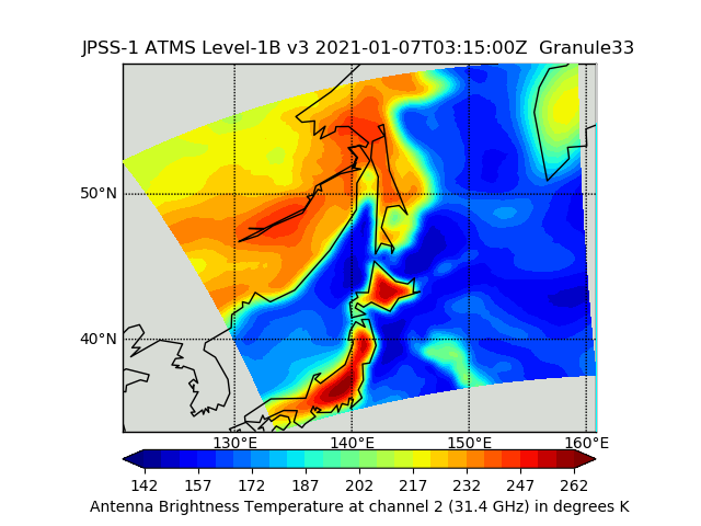
JPSS-1 ATMS Level 1B Brightness Temperature V3 (SNDRJ1ATMSL1B) at GES DISC recent views
National Aeronautics and Space Administration —
The Advanced Technology Microwave Sounder (ATMS) Level 1B data files contain brightness temperature measurements along with ancillary spacecraft, instrument, and... -
Federal
USGS Digital Orthophoto Quadrangles recent views
National Aeronautics and Space Administration —
A Digital Orthophoto Quadrangle (DOQ) is a computer-generated image of an aerial photograph in which the image displacement caused by terrain relief and camera tilt... -
Federal
Shuttle Radar Topography Mission 1-arc second Global recent views
National Aeronautics and Space Administration —
The Shuttle Radar Topography Mission (SRTM) was flown aboard the space shuttle Endeavour February 11-22, 2000. The National Aeronautics and Space Administration... -
Federal
IRIS/Nimbus-4 Level 1 Radiance Data V001 (IRISN4RAD) at GES DISC recent views
National Aeronautics and Space Administration —
The Nimbus-4 Infrared Interferometer Spectrometer (IRIS) Level 1 Radiance Data contain thermal emissions of the Earth's atmosphere at wave numbers between 400 and... -
Federal
NCEP/CPC L3 Half Hourly 4km Global (60S - 60N) Merged IR V1 (GPM_MERGIR) at GES DISC recent views
National Aeronautics and Space Administration —
These data originate from NOAA/NCEP. The NOAA Climate Prediction Center/NCEP/NWS is making the data available originally in binary format, in a weekly rotating... -
Federal
TROPICS07 L2A Unified Resolution Brightness Temperatures V0.2 recent views
National Aeronautics and Space Administration —
The "Time-Resolved Observations of Precipitation structure and storm Intensity with a Constellation of Smallsats" (TROPICS) mission has a goal of providing nearly... -
Federal
MISR Geometric Parameters V003 recent views
National Aeronautics and Space Administration —
MIB2GEOP_003 is the Multi-angle Imaging SpectroRadiometer (MISR) Geometric Parameters Version 3 product. It contains the Geometric Parameters which measure the sun... -
Federal
Annual Summary of Artificial Light At Night from VIIRS/S-NPP at CONUS County and Census Tract V1 (ALAN_VIIRS_CONUS) at GES DISC recent views
National Aeronautics and Space Administration —
This product provides detailed information about the satellite-based data on artificial light at night (ALAN). The Suomi National Polar-orbiting Partnership (S-NPP)... -
Federal
Airborne Multi-angle Imaging SpectroRadiometer (AirMISR) Data from the Lunar Lake 2001 Campaign recent views
National Aeronautics and Space Administration —
The AIRMISR_LUNAR_LAKE_2001 data were acquired during a flight over Lunar Lake, Nevada on June 30, 2001. The Jet Propulsion Laboratory (JPL) in Pasadena, California... -
Federal
MISR Level 1B2 Local Mode Terrain Radiance Data V002 recent views
National Aeronautics and Space Administration —
MB2LMT_2 is the Multi-angle Imaging SpectroRadiometer (MISR) Level 1B2 Local Mode Terrain Radiance Data Version 2 product. It contains the terrain-projected Top-of-... -
Federal
Airborne Multi-angle Imaging SpectroRadiometer (AirMISR) Data from the BARC 2001 Campaign recent views
National Aeronautics and Space Administration —
The AirMISR BARC 2001 data were acquired during a flight over the Beltsville Agricultural Research Center (BARC) on July 21, 2001. The Jet Propulsion Laboratory (JPL)... -
Federal
CALIPSO Lidar Level 1B profile data, V4-10 recent views
National Aeronautics and Space Administration —
CAL_LID_L1-Standard-V4-10 is the Cloud-Aerosol Lidar and Infrared Pathfinder Satellite Observation (CALIPSO) Lidar Level 1B profile data, Version 4-10 data product.... -
Federal
IceBridge GPS/IMU L1B Primary Position and Attitude Solution, Version 1 recent views
National Aeronautics and Space Administration —
This data set contains elevation, roll, pitch, heading, north-south acceleration, east-west acceleration, and vertical acceleration measurements over Antarctica using... -
Federal
MISR Level 3 Component Global Radiance Regional public Product covering a day V002 recent views
National Aeronautics and Space Administration —
MI3DRDR_2 is the Multi-angle Imaging SpectroRadiometer (MISR) Level 3 Component Global Radiance Regional public Product covering a day version 2. It contains a global...

Official websites use .gov
A
.gov website belongs to an official government
organization in the United States.
Secure .gov websites use HTTPS
A
lock (
) or https:// means you’ve safely connected to
the .gov website. Share sensitive information only on official,
secure websites.